Search results
Query: free map
Links: 54 | Categories: 0
-
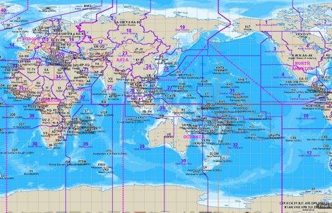 The website provides a free to download large Jpeg DXCC map with amateur radio prefixes and CQ zones. It is a valuable resource for radio amateurs looking to identify DX entities and zones for their operations.
 -
 Select your favorite satellite and watch its trajectory on Google Maps in real time! Includes ISS tracking, Weather, Geostationary, GPS Military, and of course Amateur radio satellites. N2YO provides comprehensive real-time satellite tracking with particular emphasis on amateur radio satellites. The service offers precise pass predictions calculated for user-specific locations, displaying upcoming passes with azimuth, elevation, and duration data essential for ham operators planning satellite contacts. N2YO features dedicated tracking for amateur radio satellites including FM, linear transponder, and digital satellites, with frequency information and downlink/uplink details. The platform delivers live tracking visualizations on interactive maps, Doppler shift calculations, and automated email notifications for upcoming passes. This free resource integrates weather satellite tracking alongside NOAA imagery, making it invaluable for radio enthusiasts pursuing satellite communications.
 -
 HamCalc is a free collection of calculators for radio amateurs include Antenna ERP calculations, Attenuators, Audio Filter design, Coil Winding, Decibels, Great Circles map and calculator, HF Filters, HF Traps, Metric conversions OP Amps QRA Locator to Latitude/Longitude, Radio Horizon calculator, Resonance Satellite orbit calculator Timer calculations (555 timer)Zener Diode calculations Download zip By G4VWL
 -
 A free application that displays location information determined from a callsign, displays translations of common "QSO words and phrases" in the languages used in the callsign's DXCC entity, displays beam headings and SpotCollector DX Spots on a world map, displays country maps, and provides point-and-click control of antenna rotators from AlfaSpid, ARSWIN, Heath, Hygain, M2, Prosistel, SARTek, TIC, Trackbox, and Yaesu
 -
 GCM is a freeware great circle map plotting software for windows, you can choose colours, scale, meridians, fields and or squares from the maidenhead locator system.
 -
 Swisslog, a robust freeware logging program, integrates seamlessly with various external devices and online services, making it a central hub for station operations. My field experience with similar logging software confirms the critical importance of features like real-time logging to services such as eQSL, QRZ, and Club Log, which Swisslog supports with both upload and download synchronization. The program also offers comprehensive award tracking for approximately 150 built-in awards, with the flexibility to add more, alongside detailed statistical reports. Beyond basic logging, Swisslog provides advanced functionalities like direct interfacing with popular digital mode software including WSJT-X, JTDX, and FLDIGI, ensuring accurate and rapid QSO entry for FT8 and other modes. It also supports multiple transceiver control (up to 8) from major manufacturers like Yaesu, Kenwood, and ICOM, and integrates with rotor control systems such as ARS-USB and Hy-Gain DCU. The _DX-Cluster_ integration is particularly useful, displaying spots with real-time award status and automatic detection for SOTA, POTA, and WFF from spot comments, which can significantly improve DXing efficiency. The software's world map feature includes various projections and layers for DXCC, IOTA, and WAZ, with a **double-clicking** function to turn the rotor, and provides accurate propagation predictions. It also supports multiple callbook and QSL manager databases, including QRZ and HamCall, and offers _multilanguage_ support in English, French, German, Italian, Portuguese, and Spanish.
 -
 Radiomobile is an excellent and very detailed radio path mapping software, vhf uhf propagation predictor. This windows free software is a tool used to predict the performance of a radio system.
 -
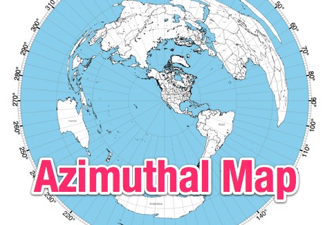 This site provides free azimuthal maps for almost anywhere on the globe. Create your own azimuthal map for your location. You can customize the map in a variety of ways by changing the options in the web form
 -
 Demonstrates BBLogger, a **freeware** logging application designed for both amateur radio operators and Short Wave Listeners (SWLs). Developed by IK2VIW, IZ2BKT, and IK2UVR, this software provides comprehensive station management capabilities, including **CAT control** for various transceivers, integration with digital mode software like WSJT-X, JTDX, and MSHV, and robust QSL management features. The application supports a wide array of functions such as DX cluster interfacing, mapping, awards tracking (including custom awards), and direct integration with services like LoTW, eQSL.cc, and ClubLog for QSL confirmations and OQRS requests. It also includes utilities for ADIF to CSV conversion and vice-versa, catering to diverse logging and data management needs. Recent updates, such as version 13.1, introduce a web server for log management from any device, allowing remote access and control. The software has improved ADIF import capabilities, including time settings for duplicate QSO detection, and enhanced filtering options for log searches. Performance improvements include faster automatic updates and manager database synchronization, along with optimized log checking at startup. Earlier versions added support for FT8 and FT4 modes, refined OQRS integration with ClubLog, and expanded QSL/label printing functionalities, enabling users to select specific callsign types (OM, SWL) for printing. The developers emphasize compatibility with Windows 10/11 for full functionality, noting limitations when running on older operating systems like Windows 7 due to modern security protocol requirements.
 -
 Freeware Win98/NT/XP contest logging program, supports over 270 contests, Grid Square distance/heading routines, plus Grid maps by Dave Mascaro W3KM
 -
 QSO Map Deactivated Due to a new pricing structure for Google Maps APIs (since March 1, 2025), the map function is no longer free to use. For this reason, the QSO Map has been deactivated.
 -
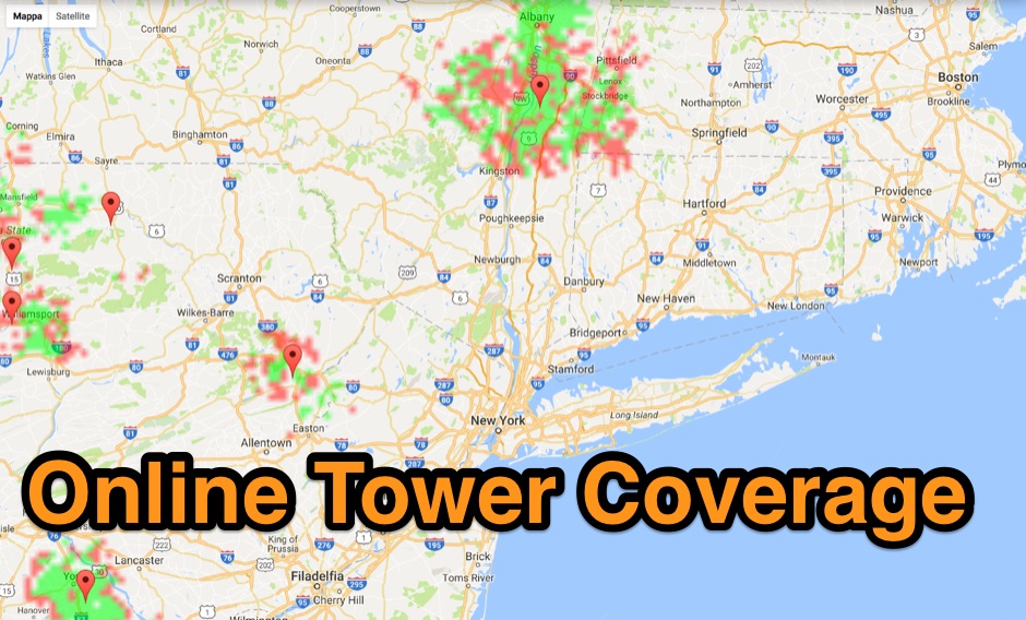 Allow you to create Tower Coverage Maps for any geographical area in the entire world. Maps are based on region and topography, taking into account for hills, mountains and trees. Commercial software allowing a free map trial
 -
 adsbScope is a freeware Windows application designed for processing _ADS-B_ (Automatic Dependent Surveillance-Broadcast) frames received from a compatible decoder. It identifies aircraft, calculates their real-time positions, and presents flight parameters in both alphanumeric tables and a graphical display. The software interfaces via a virtual COM port, receiving raw frames to provide detailed situational awareness, including a global coordinate grid, continental coastlines, over 4,000 **airport** locations, and major cities. Users can overlay OpenStreetMap tiles and view world state boundaries, with each tracked aircraft rendered with labels showing altitude, speed, heading, squawk code, and flight identifiers. When paired with the adsbPIC-decoder, adsbScope enables advanced hardware control, allowing users to toggle data filters for specific frames like DF17/18/19, adjust analog signal thresholds for reception fine-tuning, and manage system resets or bootloader activation directly from the PC. This functionality provides a customizable toolkit for hobbyist radar listeners, offering a robust alternative to commercial tools for processing aircraft data. The software displays up to **1090 MHz** transponder data and can track aircraft up to 250 nautical miles.
 -
 Over 70 international contests are supported by YPlog, a Windows-based logging and radio control program designed for amateur radio operators. This software integrates with various digital mode applications like _WinPSK_, _HamScope_, and _MMTTY_, facilitating partially automated log entry for modes such as PSK31, CW, and RTTY. It provides comprehensive logging capabilities including QSL label printing, beam headings, and dup-checking, alongside award tracking for DXCC, ITU/CQ zones, IOTA, Grid Locators, and Counties. The program offers advanced contesting features, including multi-multi or multi-2 networked operations with automatic log data sharing, multiple Cabrillo submission formats, and configurable CW keyboard layouts. Device support extends to TR-compatible CW keying, SO2R control with Top-Ten devices like the DX-DOUBLER, and internal W9XT digital voice keyer integration. YPlog is notable for its support of the _OK1RR DXCC_ country resolution files, providing a robust historical DX compendium. Beyond logging, YPlog includes two freeware utilities: one for computing design parameters for coaxial traps and another for displaying and printing azimuth and Mercator maps from the operator's QTH. The software runs on Windows 95/98/ME/NT/2K, with a recommended screen resolution of 1024x768. Registration costs **$50.00 US** to unlock all features, including full contesting capabilities and rotator control.
 -
 This free PDF file contains two Worldwide grid square maps. The first map displays the fields (first two letters of a maidenhead locator) while the second includes also squares (third and fourth digit) and it can be useful to determine what is your ham radio grid square. PDF file can be enlarged and scaled to A3 and higher dimensions.
 -
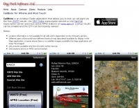 CallBook is an Amateur Radio application that allows you to look up call signs via the free WM7D server, the QRZ Online subscription service or the HamCall subscription server and track active APRS stations on www.aprs.fi. Lookup results can be emailed and the QTH can be instantly viewed in the Maps application
 -
 Operating amateur radio satellites effectively requires precise knowledge of their orbital mechanics and pass times. Gpredict, a real-time satellite tracking and orbit prediction application, addresses this need by allowing operators to monitor numerous satellites simultaneously. It displays critical data such as position and pass details through various visualizations, including lists, tables, maps, and _polar plots_. Unlike many other satellite tracking programs, Gpredict introduces the concept of visualization modules. These modules enable users to group satellites and configure each group independently, offering unparalleled flexibility in how orbital data is presented. This modular approach supports tracking satellites from multiple observer locations concurrently, which is particularly useful for stations with diverse antenna setups or remote operations. Originally a GUI client for John Magliacane's _Predict_ program, Gpredict evolved to integrate its own tracking code for improved performance. The software is distributed under the GNU General Public License, ensuring it remains free and modifiable for the amateur radio community.
 -
 PocketPC freeware that track satellites, and display their position on a map of the world. It also has a display that shows other relevant information useful to Ham Radio operators to allow them to work them.
 -
 The image is a all in one map of ITU Zones displaying worldwide regions and zones. It provides information on ITU Regions at IARU website, aimed at radio amateurs and technical users. Image size is in hight resolution and jpeg format, free to download.
 -
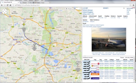 Virtual Radar Server is a free windows decoder of ADS-B signals received by several radio receivers and support even networked data feed. The Server publish a Google Maps-based display of aircraft positions and flight list
 -
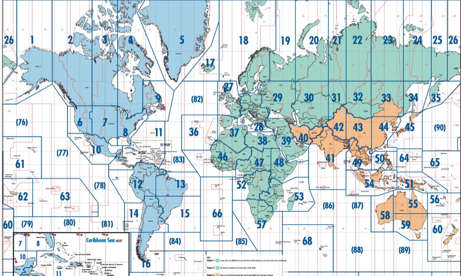 Free Donwload of the PDF file of ITU and CQ zones of the world, made available by Icom America
 -
 WSJT-X and MAP65, open-source amateur radio programs, facilitate weak-signal digital communication. WSJT-X covers VHF/UHF to HF, decoding subthreshold signals. MAP65 optimizes for VHF/UHF EME with JT65. Free and GNU GPL licensed, WSJT-X is on Windows, Linux, and OS X, while MAP65 is Windows-only, supporting SDR hardware.
 -
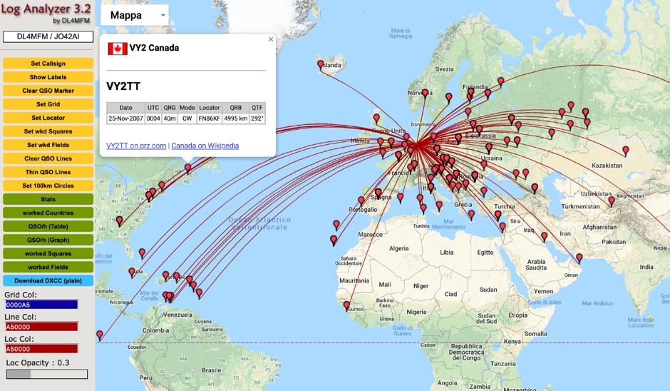
 LogView is a free post-contest log-visualisation tool, for analysing contest performance. It plots the QSOs in a Cabrillo-format contest-log on to one of 8 different maps by finding the position of each QSO from an online database of about 970,000 W/VE callsigns.
 -
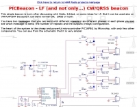 This resource details the construction of a versatile CW/QRSS beacon, designed around a Microchip _PIC16F84_ microcontroller. The project provides a flexible platform for transmitting either standard CW or very slow QRSS signals, making it suitable for LF, VHF, UHF, and SHF applications. It supports two distinct messages, each configurable for speed (from 0 to **127** WPM for CW, or up to **127** seconds per dot for QRSS) and repetition within a six-phase sequence. The core functionality relies on the PIC's EEPROM, which stores all operational parameters, including message content, transmission speeds, phase configurations, and relay control settings. This design allows for parameter modification directly via programming software like _ICProg_ without altering the main program code. The project includes a detailed schematic, a component list, and an explanation of the EEPROM memory mapping for messages, speeds, phase settings, and inter-phase delays. General-purpose outputs (OUT1, OUT2, OUT3) provide dry relay contacts for external control, enabling functions such as power switching, antenna selection, or frequency changes. A 'TRIGGER' input facilitates controlled starts or continuous free-run operation. Sample EEPROM configurations illustrate how to program specific beacon sequences, including message content and relay states.
 -
 VOAProp shows you typical propagation for a given hour of the day during a given month. The propagation is shown as expected signal strengths to be received from different parts of the world, plotted on a world map. Windows freeware by G4ILO
 -
 This program is a generator of coloured azimuth world maps centered on any terrestrial position. Windows Freeware
 -
 This free program displays the location of any locator on a map. It calaculates between two Maidenhead locators the distance (km and miles) azimuth longitude latitude Show the location, direction and distance as you move your mouse on a map! Graphical Locator Program, By ON6MU
 -
 TAHO.EXE, an open-source software, facilitates the creation of APRS maps for _UI-View_ by converting free data from _OpenStreetMap_ into the required *.JPG and *.INF file formats. This utility, developed by Dimitri Junker with specific UI-View format support added at the request of HB9DTX, streamlines the process of integrating detailed geographical information into the _UI-View_ platform. It operates on Windows, generating map files with border coordinates in just a few clicks, eliminating the tedious manual creation of *.INF files for custom maps. This converter allows UI-View users to leverage the continuously updated and community-contributed data of OpenStreetMap, which often surpasses commercial map quality in specific regions. The process is straightforward, with a detailed step-by-step guide available on the OpenStreetMap wiki, translated into French and German. TAHO.EXE significantly enhances the utility of UI-View by providing a readily accessible and continuously improving source of detailed, current geographical maps for displaying APRS station positions and objects.
 -
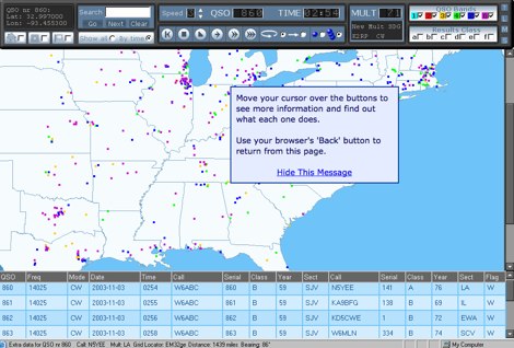
 Over 47 full-screen maps are available within _NAOMI_ (North American Overlay Mapper), a free Windows program designed for US and Canadian amateur radio enthusiasts. This mapping suite includes 9 backgrounds such as CQ Zones, ITU Zones, and ARRL Sections, along with 16 foreground layers like Counties, Areacodes, and Grid Locators. Users can calculate distances and bearings, track real-time mouse positions with continuous Grid-Locator data, and integrate with APRS for live station tracking via the FindU database. For a global perspective, the _Global Overlay Mapper_ (GOM) provides a world map, 8 continental maps, and 29 sub-continental maps, all with 12 active layers including Country Outlines, CQ/ITU Zones, and Prefix information. Both NAOMI and GOM offer feature-locate systems to jump to positions based on prefixes, capital cities, or Grid Locators, and provide customized beam headings and distance displays. The site also features _LogView_, a post-contest log visualization tool that analyzes Cabrillo-format logs by plotting QSOs on maps, supporting over 30 major contests like CQWW and ARRL DX, and allowing comparison with published results.
 -
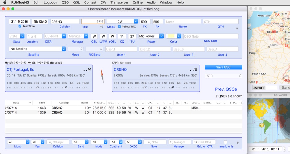 For macOS users engaged in amateur radio operations, a robust logging solution is essential for tracking QSOs, managing contest entries, and handling QSLs. RUMLog addresses these needs by providing a fully featured logbook program designed specifically for the Apple ecosystem. It integrates capabilities such as transceiver control for popular Icom, Elecraft, Yaesu, and Kenwood rigs, CW keyer interfacing, and real-time DX cluster monitoring. The software also includes mapping functions, callsign checking, and extensive import/export options for various log data formats. RUMLog's design supports both general logging and specialized contest operations, offering tools for efficient entry and submission. Its QSL handling and printing utilities streamline the confirmation process, a critical aspect for award pursuits like _DXCC_. The program's ability to interface with a wide array of transceivers via _Hamlib_ or proprietary protocols ensures broad compatibility, allowing operators to leverage its features across different station configurations. The free availability of RUMLog makes it an accessible option for macOS-based hams seeking a powerful logging utility.
 -
 Free Windows APRS Client with capability of downloading free aerial photo and topo map data.
 -
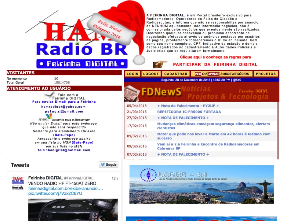 Presents a Brazilian online portal dedicated to **amateur radio**, **CB radio**, and shortwave listening (SWL) communities. The platform facilitates free classified advertisements for radio equipment, including HF, VHF, and UHF transceivers, antennas, and accessories. It also aggregates a substantial collection of technical articles from Brazilian amateur radio operators (e.g., PY2DJW, PY1LJ, PY1LL/4LC), covering topics such as CW training with RufzXP, balun importance, and radio wave characteristics. Furthermore, the resource provides extensive links to Brazilian ham radio sites, clubs, international organizations, and official ANATEL (Brazilian National Telecommunications Agency) documents regarding licensing, equipment homologation, and regulations. The portal features sections for user evaluations of transactions, a "Top Ten" list of most visited pages, and a calendar of past and upcoming ham radio events across Brazil, including "Feirinhas" (local swap meets) and "Encontros de Radioamadores" (hamfests). It also includes a directory of ham radio related businesses and services in Brazil, such as antenna manufacturers (Diex), QSL card printers (Arte Final), and repair technicians (PY2MOK). The site also offers propagation maps, DX cluster links (e.g., DX-SUMMIT), and satellite tracking tools, making it a central hub for Brazilian radio amateurs seeking to buy, sell, learn, or connect with the community.
 -
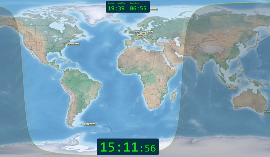 Free windows world map application display current time, sunrise and sunset, greyline map, dx stations, requires windows 7 or higher. The program includes three resized Natural Earth maps which have been resized to 4k or slightly less. By Simon Brown G4ELI better known as the inventor of Ham Radio Deluxe.
 -
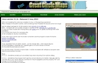 Great Circle Map for Linux, available for Debian, freeware by SM3GSJ
 -
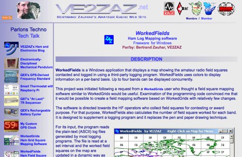 WorkedFields is a windows free software to displays a map showing the amateur radio field squares contacted and logged in using a third-party logging program.
 -
 APRS-Webserver, that presents aprs-data and maps for free using Google Maps api. The position data is imported from aprs.org, winlink.org and echolink.org. The map data are partially commercial and free. This server is for amateur radio purposes only.
 -
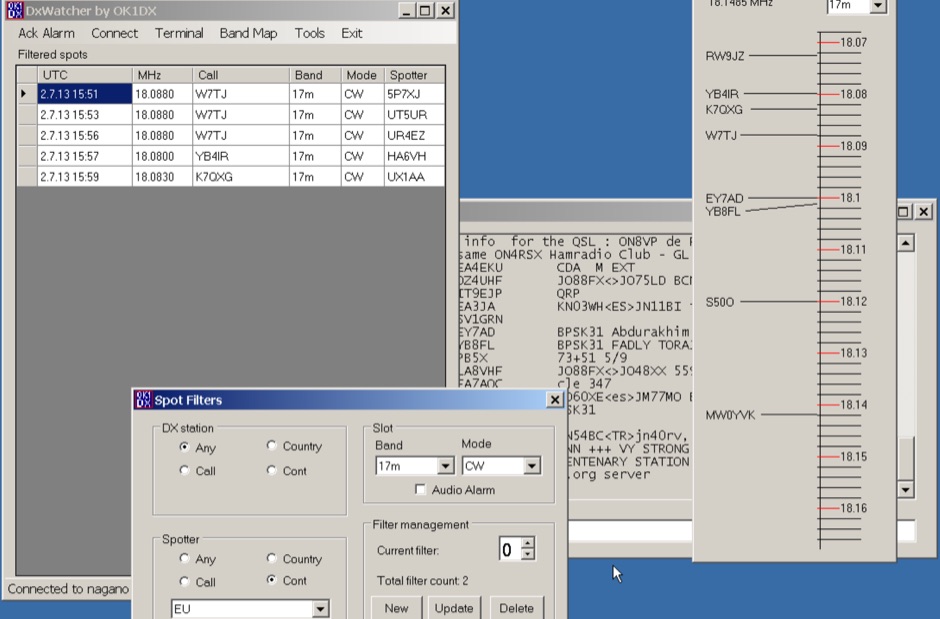 Demonstrates a specialized DX cluster monitoring application, _DxWatcher_, designed for Windows environments. It processes DX spots received via Telnet/Internet, presenting them in a filtered table and a dynamic bandmap. The software integrates with transceivers, specifically the FT-2000, to read VFO frequency and enable one-click tuning to spotted stations. _DxWatcher_ version 1.0.3.0, released on 13 June 2020, includes minor bugfixes and improvements such as enhanced recovery from suspend mode. Key features include configurable bandmap position and size, automatic opening, and bolding of spots received within the last **10 minutes**. The application utilizes the standard _ctry.dat_ file for DXCC country analysis, allowing users to update it for current DXCC status. Source code, developed in C# with MS Visual Studio 2008, is freely available, encouraging modification and sharing while requesting retention of the original author's callsign.
 -
 Sw tool to design point-to-point multi-hop microwave links and networks, 400MHz to 58 GHz. Site/Hop Configuration; Customized Antenna & Radio Equipment Libraries; Link Budget; Path Profile Analysis ,clearance, reflections; import path profiles from SRTM maps, free download.
 -
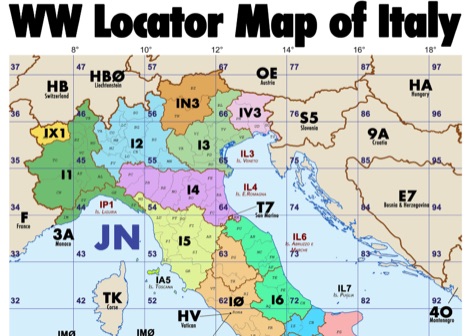 Amateur radio map of Italy with WW locators, provinces abbreviations and Call sign Prefixes, in a A3 size PDF file free to download, made available by IU3KJL Davide
 -
 Over 150 pages of content are dedicated to maximizing activity on the 6-meter band, often referred to as the _Magic Band_. The resource details various propagation modes, including sporadic E, F2, and tropospheric ducting, providing insights into their characteristics and how to leverage them for DX contacts. It also covers essential equipment considerations, from transceivers and transverters to specific antenna designs optimized for 50 MHz operation, such as Yagis and Moxon antennas. The eBook presents strategies for participating in 6-meter contests and pursuing awards like _VUCC_, offering practical advice on logging software and operating techniques. It includes discussions on software tools useful for predicting propagation and managing contacts, alongside guidance on finding and utilizing DX maps to identify openings. The author, K5ND, shares his extensive experience to help operators achieve successful 6-meter DXing. Specific sections address the code of practice for 50 MHz operations and provide assistance in locating rare DX opportunities. The content is structured to guide both new and experienced operators through the nuances of the band, from initial setup to advanced operating strategies.
 -
 This freeware application for Linux and windows, allows you to convert an ADIF file to a KML file so you can map your QSOs easily and open it with google maps, or google earth or any application supporting the KML format
 -
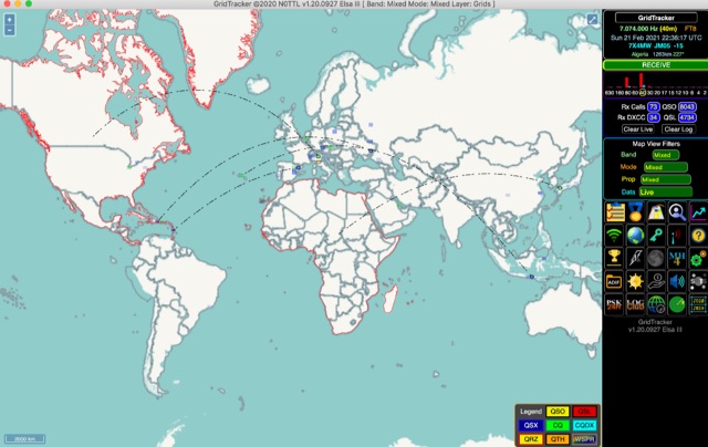 GridTracker listens to live traffic from WSJT-X or JTDX and displays it on a map. It can also load ADIF log files, load clublog, lotw, hrdlog.net and other sources to diplay your logbook statistics and map your QSOs. GridTracker is a free application for windows Linux and MacOS.
 -
 DXLook is a free, web-based propagation platform that delivers comprehensive, real-time insight into HF and VHF conditions directly from any modern browser. It aggregates live spots from PSK Reporter, WSPRnet, RBN, and DX Cluster, complemented by NOAA space-weather metrics such as SFI, K/A indices, and geomagnetic alerts. Integrated VOACAP predictions allow practical "theory versus reality" comparisons, while the interactive world map with filters, gray line, and grid overlays enhances situational awareness. With no installation or maintenance required, DXLook provides a convenient, accurate, and accessible solution for everyday operating and propagation analysis.
 -
 Time Mapper UHD is a versatile mapping and time visualization program offering multi-satellite viewing with frequency display and unique country-pairs for PskReporter data. It features live feeds from logging programs and can plot ADIF files. Ideal for schools, offices, or amateur radio stations, it provides customizable 4K or HD world clock displays with over 60 map layers, including ham radio zones and natural features. The program supports various time functions and can import logs for detailed analysis. It runs on Windows 10 or 11 and offers a 30-day free trial.
 -
 MLog 0.8d is a freeware logging software designed for Windows operating systems (NT, 98, ME, 2000, XP) that facilitates the logging, management, and analysis of amateur radio QSOs. It features a customizable input mask for rapid contest logging, a robust search function for existing contacts, and immediate data storage in CSV format to prevent data loss. The software also includes a double-check mechanism against reference logs during callsign entry, integrated DXCC information, and a "magic field" for streamlined data input, all within a single-window interface. Key functionalities include graphical QSL card management via _QSL-Collection_, CW output through soundcard or PC speaker, and direct access to _Radio Amateur Callbook_ data. MLog supports transceiver control via _Ham Radio Deluxe_ URLs, offers a detailed world map with locator conversions, and can launch _VOACAP_ through _HamCap_. It provides extensive data analysis options for QSLs, _Locator_ large fields, _DOKs_, _DXCCs_, QSO counts, and user-defined contest evaluations, alongside flexible import/export capabilities for various log formats.
 -
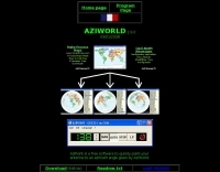
 AZIWORLD is a user-friendly tool for generating azimuthal maps of the Earth centered on any location. Compatible with Windows XP and later, it supports English and French. Maps can be saved in .bmp format for easy customization. AZIWORLD computes azimuths, distances, and geographical positions, integrating seamlessly with AZIPOINT for automatic antenna pointing. Linux/Ubuntu/Android users can run AZIWORLD via WINE or CROSSOVER. For optimal functionality, installing AZIPOINT alongside AZIWORLD is recommended.
 -
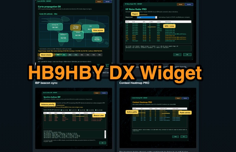 Demonstrates the _Widget DX HB9HBY_ software, a compact desktop application for amateur radio operators, providing essential real-time information. The widget displays UTC time, current HF propagation conditions, local weather, and thunderstorm risk. It also integrates radio-related links and offers advanced PRO functions, such as a DX map, HF noise radar, IBP beacon synchronization, contest heatmap, aurora radar, and a rare DX radar. The software is available for Windows 10/11 and Linux, with a macOS version planned for future release, and supports both French and English interfaces. Author HB9HBY highlights the widget's simple installation process and automatic update capabilities, which can be silent for minor fixes or include notifications for significant changes. The free version provides core functionalities, while a 15-day free trial unlocks the PRO features. A lifetime PRO license is available for a one-time payment of CHF 10, activating advanced tools that help operators make quicker decisions at the station by correlating propagation, UTC, DX activity, and local conditions, though results remain indicative and require confirmation via listening or tools like _RBN_ or _PSKReporter_.
 -
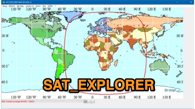 SAT_EXPLORER is a versatile software for tracking the Moon, Sun, and artificial satellites while controlling various antenna interfaces. Compatible with Windows XP and later (32/64-bit) and multilingual (English, French, German, Italian, Spanish), it integrates seamlessly with TRX-Manager for transceiver control. SAT_EXPLORER computes satellite and Moon positions with high precision, calculates EME Doppler shifts, and uploads real-time satellite positions and coverage maps to your personal web pages. Linux/Ubuntu users can run it using WINE or CROSSOVER.
 -
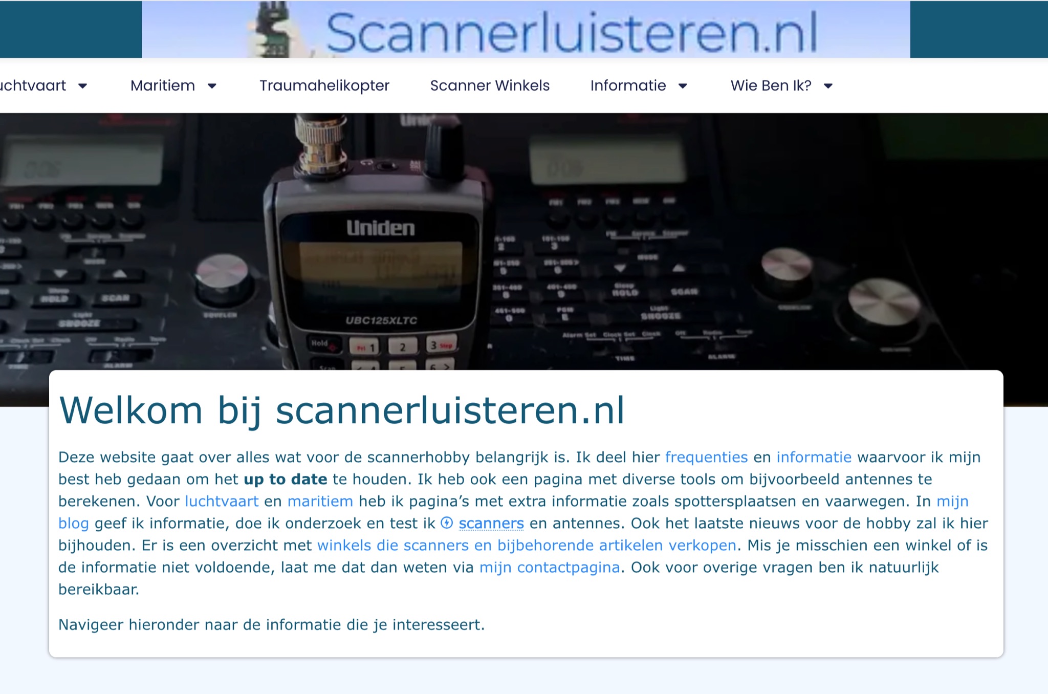 A Dutch website, with a translation option, about scanner radios, maritime, and aviation communication. With maps,a blog, free tools and calculators, and a large collection of Dutch frequencies.
 -
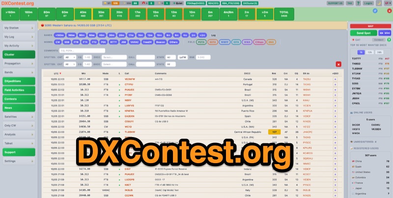 DXContest.org provides a real-time DX cluster, integrating advanced spotting capabilities with features like _propagation maps_, _PSKReporter_, and the _Reverse Beacon Network_. This platform enables radio amateurs to monitor DX activity, apply sophisticated filters to spot data, and even utilize CAT control for their transceivers directly through the web interface. The service is designed for immediate utility, offering free access without requiring user registration. Users can send DX spots, control their radio via CAT, and consult a contest calendar. The platform also provides traditional Telnet access for those preferring client-based cluster interaction. Developed by Pascual R. Salas Vidal, EA5WU, the service aims to be a comprehensive tool for real-time DX operations and contest participation, offering a blend of modern web features and classic cluster functionality.