Search results
Query: marker
Links: 14 | Categories: 0
-
 Footprint Satellite Tracker is a satellite tracking software that provides real-time monitoring of satellite movements worldwide. It features a global map with celestial markers and allows users to adjust time settings to predict satellite paths. Customizable options include location coordinates and time zones. Users can analyze satellite ephemeris and print reports, though file-saving requires a virtual printer. Despite its research utility, the software supports a limited satellite list and lacks options for manual data source connections. Current version has been tested running on Windows 10.
 -
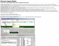 Windows remote control for Yaesu or Icom. Displays the current transceiver settings frequency, mode, and others on the PC in an old-fashioned way that corresponds to the look of receivers in 70's. DX-Cluster Watch (DCW) is an application that automatically refreshes a web page with the dx-cluster content, parses spot lines from it, keeps a consolidated list and inserts the spots to VLR as frequency markers by OK1FIG
 -
 Chinese manufacturer of Software Defined Radio for commercial, public and amateur radio market. Markers of H1 H1Plus H2 Q900 SDR transceivers
 -
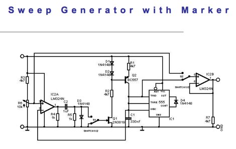 A simple simple sweep generator circuit design where the sawtooth is generated by the PNP transistor and a 555
 -
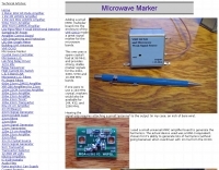
 Homebew a frequency marker by 7N3WVM
 -
 The resource provides an interactive map interface for locating amateur radio license holders across the United States. Users can input a _callsign_, _gridsquare_, zip code, or street address to center the map, which then dynamically populates with station markers. This functionality allows for precise geographical searches, revealing the distribution of hams within specific areas. Upon initial search, the map renders with adjustable zoom and pan capabilities. A key feature is its automatic reload mechanism: after two seconds of inactivity, the map updates to display stations within the newly viewed area. This ensures that the displayed data remains relevant to the user's current focus, whether exploring a densely populated urban center or a more remote region. Further interactive elements include clickable gridsquare labels, which re-center the map, and a "Show gridsquares" checkbox for toggling grid line visibility. Clicking on individual station markers reveals a popup containing the licensee's name and address information, making it a practical tool for geographical station identification.
 -
 PilotMORSE is a great home solution for private pilots or aspiring professionals who want to hone their Morse code skills used to identify VORTACs, localizers, and marker beacons. PilotMORSE takes you through the alphabet with an advanced neural network algorithm that adjusts the pace of presentation based on your responses.
 -
-
 This resource presents a placeholder page for the _Tobacco Valley Amateur Radio Club_ (TVARC), signaling the future establishment of an online presence for this amateur radio organization. The page currently displays a "Coming Soon" message, indicating that the club's official website is in development. It serves as a preliminary marker for the club's digital footprint, suggesting an upcoming platform for members and prospective hams. The current state of the page offers no technical details, operational information, or specific club activities. It functions solely as a temporary landing page, prompting site owners to log in for launch and visitors to check back later. The resource does not provide any data on club repeaters, meeting schedules, or special events, nor does it detail any past achievements like **DX contacts** or **contest scores**.
 -
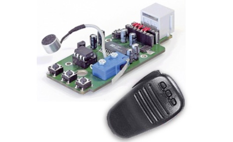 A voice keyer kit available on the marker in two models, BX-184 is the replacement PCB for those who already own an MH-31 microphone. Kit BX-184M includes an MH-31 besides the PCB for those not owning one yet.
 -
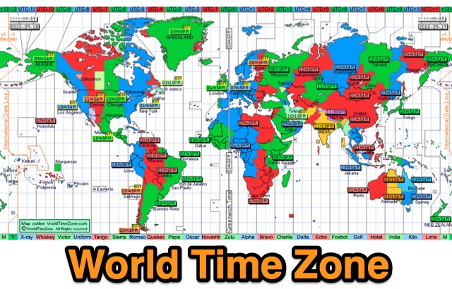 World Time Zone is an online quick reference chart that displays the world time zones in detail. DST is also indicated by yellow markers on the map. UTC difference is marked with different colors, and if you point and click will show up area details
 -
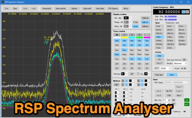 The analyser has been written to support the full range of SDRplay SDR radios including the new RSP1B. The analyser is capable of resolution bandwidths of less than 1Hz with sensitivity better than -145dBm. In addition to being able to run five separate traces, the analyser offers the ability to capture screen shots, export data in a range of formats and includes a versatile marker system. The analyser includes a comprehensive user manual and offers a very useful addition to any workbench.
 -
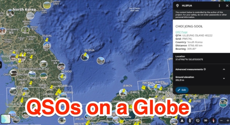 A free web app that converts ADIF files into KML format for viewing on Google Earth or other KML viewers. Users can view QSOs on a 3D globe, click on station markers for details, and navigate the globe. The page provides instructions, features, limitations, and requirements for using the tool.
 -
 Spotty leverages Philip Gladstone’s pskreporter.info data, delivered via an MQTT broker by Tom Fanning (M0LTE), to offer a responsive web application for visualizing propagation. The Map View presents a default visualization (grid AA00 / callsign MY8CALL) and distinguishes signal types: small spots for signals heard by a location, large spots for transmissions from a location, and teardrop markers for transmissions from the monitored callsign. Clicking a spot reveals detailed signal data in an overlay. The application includes a Log View for raw spot data and a Settings tab for customization. Users can filter tracking by specific Callsign or Grid, with preferences saved to the browser. A notable feature is the Time to Live (TTL) setting, adjustable from the default 60 seconds, which controls spot visibility duration to manage map clutter during high-traffic periods. The tool provides a clear, logic-driven interface for real-time signal monitoring.