Search results
Query: win aprs
Links: 26 | Categories: 0
-
 UI-View is an APRS client that runs on Windows. This application differs from most APRS software in that it isn't designed just to be used with TNCs in terminal mode. UI-View also supports TNCs in KISS mode, AGWPE host mode and BPQ host mode. The 32 bit version of UI-View also supports WA8DED/TF host mode, and the variant of it used in the SCS PTC-II and PTC-IIe.
 -
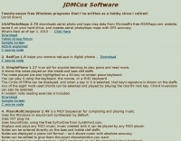
 Automatic Position Reporting System windows program, allow monitoring of real time geographical information such as the position of vehicles, the status of weather, radio direction finding and more.
 -
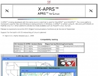 APRS for Linux is a multifaceted system for use with packet radio by Hams, it allows the monitoring of real time geographical information such as the position of vehicles, the status of weather, radio direction finding and much much more. It envolves mapping, GPS tracking, packet radio, etc
 -
 Multimode suite, feature logging, Internet interface to CXCluster, Smart multi-mode controller software, contest, APRS, and PSK31 via Sound card. Free and Commercial version available.
 -
 Macintosh automatic position reporting system, developed by Bob Bruninga, WB4APR, to track boats and vehicles using GPS and packet radio. MacAPRS was written by Keith Sproul, WU2Z and Mark Sproul, KB2ICI
 -
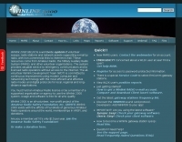 WinLink 2000 employs Stations World-wide to provide an HF/VHF/UHF digital radio Interface into the Internet Email system for the mobile radio operator. Features include binary and graphic file attachments, APRS position reporting and over 340 downloadable WX products. The mode used is Pactor I and Pactor II.
 -
 The purpose of the APRS-Beacon is to provide simple APRS-compatible position beacons for up to three Objects. It is designed to 'stand alone' and does not monitor other traffic on the frequency. It can use a single-port TNC (in 'native' mode), a single- or dual-port TNC in Kiss mode or the AGW Packet Engine in order to transmit on up to four radio ports.(When running with AGWPE, APRS-Beacon will also work with Windows 2000)
 -
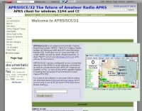 APRSISCE/32 is an Automatic Packet Reporting System (APRS) program, primarily intended for Windows and Windows Mobile (CE), although it will run on Linux and Mac OS under wine. Offer enhanced messaging, announcement support via ANSRVR, and QRU for object query support, can run as a highly configurable Digipeater
 -
 D-PRS converts these position reports from remote D-STAR radios to an APRS format. Windows .net application
 -
 TAHO.EXE, an open-source software, facilitates the creation of APRS maps for _UI-View_ by converting free data from _OpenStreetMap_ into the required *.JPG and *.INF file formats. This utility, developed by Dimitri Junker with specific UI-View format support added at the request of HB9DTX, streamlines the process of integrating detailed geographical information into the _UI-View_ platform. It operates on Windows, generating map files with border coordinates in just a few clicks, eliminating the tedious manual creation of *.INF files for custom maps. This converter allows UI-View users to leverage the continuously updated and community-contributed data of OpenStreetMap, which often surpasses commercial map quality in specific regions. The process is straightforward, with a detailed step-by-step guide available on the OpenStreetMap wiki, translated into French and German. TAHO.EXE significantly enhances the utility of UI-View by providing a readily accessible and continuously improving source of detailed, current geographical maps for displaying APRS station positions and objects.
 -
 Over 47 full-screen maps are available within _NAOMI_ (North American Overlay Mapper), a free Windows program designed for US and Canadian amateur radio enthusiasts. This mapping suite includes 9 backgrounds such as CQ Zones, ITU Zones, and ARRL Sections, along with 16 foreground layers like Counties, Areacodes, and Grid Locators. Users can calculate distances and bearings, track real-time mouse positions with continuous Grid-Locator data, and integrate with APRS for live station tracking via the FindU database. For a global perspective, the _Global Overlay Mapper_ (GOM) provides a world map, 8 continental maps, and 29 sub-continental maps, all with 12 active layers including Country Outlines, CQ/ITU Zones, and Prefix information. Both NAOMI and GOM offer feature-locate systems to jump to positions based on prefixes, capital cities, or Grid Locators, and provide customized beam headings and distance displays. The site also features _LogView_, a post-contest log visualization tool that analyzes Cabrillo-format logs by plotting QSOs on maps, supporting over 30 major contests like CQWW and ARRL DX, and allowing comparison with published results.
 -
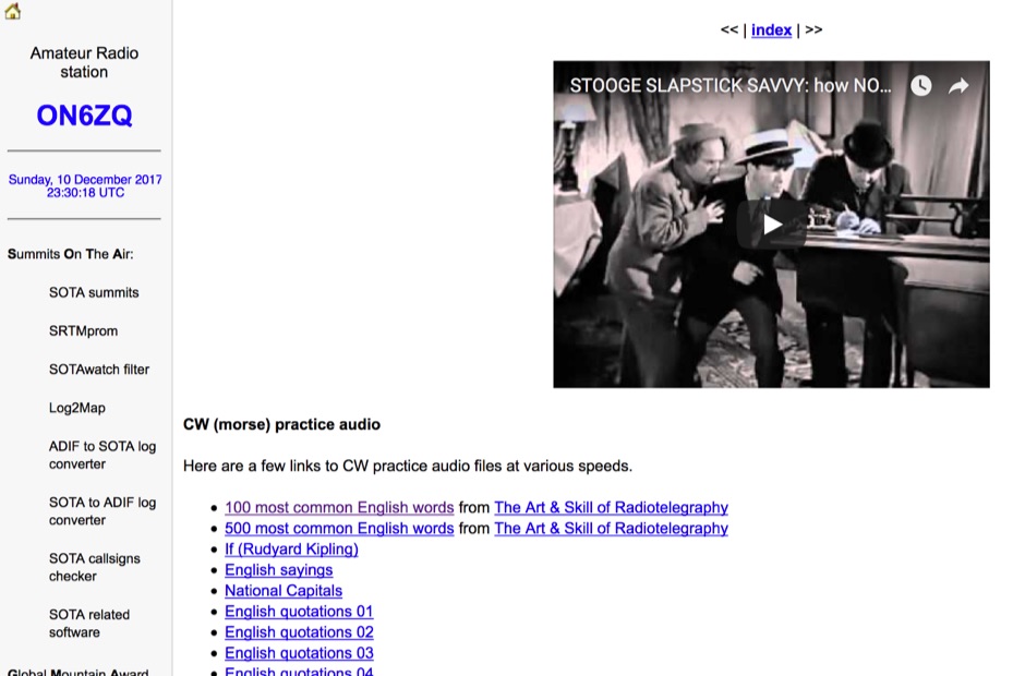 Demonstrates a practical approach to improving Morse code proficiency through a curated selection of audio files. The resource offers downloadable MP3 files designed for CW practice, catering to operators aiming to increase their copying speed and accuracy. Content includes both standard words and specific amateur radio callsign groups, which are crucial for effective on-air communication. The files are organized to facilitate progressive learning, allowing users to select material appropriate for their current skill level. This collection supports the development of essential CW operating skills, particularly for those preparing for contests, DXing, or general ragchewing on HF bands. The _ON6ZQ_ site, maintained by _Christophe David_, also features information on his _Reverse Beacon Network_ skimmer and _SOTA2APRS_ feed, indicating a strong focus on active operating modes and digital integration.
 -
 Free Windows APRS Client with capability of downloading free aerial photo and topo map data.
 -
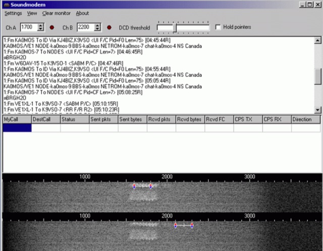 Soundmodem is a free software defined dual-port Packet-Radio TNC that implement a soundcard as a modem and supports AX.25 protocol. Soundmodem has been tested on Windows XP, Vista, 7, 8, 10 and has proved stable in operation. The Soundmodem may be used to build EMCOMM, APRS, BBS, Node station, for satellites
 -
 APRS-Webserver, that presents aprs-data and maps for free using Google Maps api. The position data is imported from aprs.org, winlink.org and echolink.org. The map data are partially commercial and free. This server is for amateur radio purposes only.
 -
 This resource provides a discussion group platform for amateur radio operators interested in APRS within Argentina. It facilitates technical discussions, sharing of operational experiences, and coordination among users of the Automatic Packet Reporting System in the region. The group serves as a central point for exchanging information on local digipeater networks, IGate deployments, and mobile tracking applications, covering both hardware and software aspects relevant to APRS implementation. The forum enables members to post questions, offer solutions, and disseminate news related to APRS activities specific to Argentina, fostering a community-driven approach to problem-solving and knowledge transfer. It supports the collaborative development and maintenance of the APRS infrastructure, allowing for real-time interaction on topics such as frequency usage, network topology, and integration with other amateur radio services.
 -
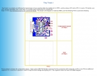 Amateur Packet Reporting System (APRS) operations often require compact, reliable solutions for transmitting position data, particularly for mobile or portable stations. This resource details the construction of the _Tiny Track-I_, a transmit-only APRS tracker designed for straightforward integration with a VHF radio and a Global Positioning System (GPS) receiver. It enables hams to broadcast their location without the complexity of a full-duplex TNC. The project outlines the printed circuit board (PCB) layout and schematic, based on an original design by N6BG, with a personal PCB drawing by SV1BSX. It includes specific component placement and notes an additional 10uF/10V capacitor (C5) for improved IC voltage decoupling, a modification not present in the original N6BG diagram. The unit connects to a computer or GPS via a DB9 female connector. This tracker is ideal for basic position reporting, offering a simple and effective way to participate in APRS networks. Its small footprint makes it suitable for vehicle installations or field deployments where space is limited, providing a **reliable 9600 baud** data stream for location updates.
 -
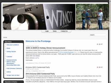 MARCA, Inc. operates approximately 24 repeaters across Arizona mountaintops and Phoenix-area rooftops, supporting modes like D-STAR and Fusion. The club, holding the **W7MOT** callsign, engages in diverse activities including ARRL Field Day events near Forest Lakes, AZ, ARRL FMT contests, and antenna experimentation. Members actively participate in HF operations such as voice, digital, CW, DXing, and various digital HF modes, alongside MESH and EOC operations within the valley. The club's interests span a broad technical spectrum, from SDR radio building to antique radio restoration, and include modern digital modes like WSPR, WSJT, FT8, and FT4. They also explore computer-based operations such as Echolink, fostering a dedicated Single Board Computer (SBC) and Raspberry Pi group. Monthly VE testing sessions for Technician, General, and Extra Class licenses are conducted by Ray Vasquez, K4RMV. Meetings are held on the third Tuesday of each month, typically lasting two hours, with a business segment followed by a technical presentation. These gatherings occur in-person at IHop in Mesa, AZ, and concurrently via Zoom, accommodating both local members and winter visitors. Informal chat groups often form post-meeting to discuss specialized topics like D-STAR, SDR, APRS, MESH, and Fusion.
 -
 Zenith Tracker offers real-time satellite tracking, pass predictions, and radio hardware integration for ham radio operators. The platform includes an interactive world map showing satellite positions, footprints, and ground tracks, as well as a polar radar visualization for detailed pass analysis. Users can view upcoming passes, set filters, and receive notifications. Integration with CSN Technologies S.A.T Hardware and QTRigDoppler allows for automatic radio control, antenna tracking, and transponder management. The platform also offers APRS message interface, grid square-based location input, and API integration for rover activations. Zenith Tracker is recommended for both general users and those needing advanced hardware integration.
 -
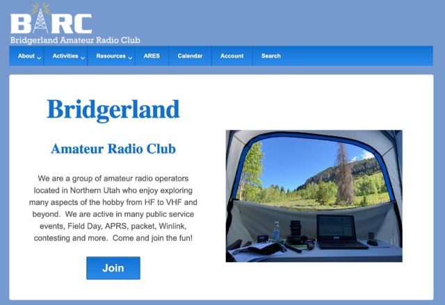 We are a group of amateur radio operators located in Northern Utah who enjoy exploring many aspects of the hobby from HF to VHF and beyond. We are active in many public service events, Field Day, APRS, packet, Winlink, contesting and more
 -
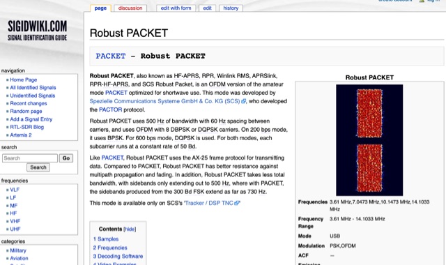 Robust PACKET, developed by Spezielle Communications Systeme GmbH & Co. KG (SCS), is an OFDM variant of the amateur PACKET mode specifically engineered for HF operation. This mode utilizes a 500 Hz bandwidth with 60 Hz carrier spacing, employing OFDM with 8 DBPSK or DQPSK carriers. It supports 200 bps using BPSK and 600 bps with DQPSK, with each subcarrier operating at a constant rate of 50 Bd. Robust PACKET leverages the AX-25 frame protocol for data transmission, similar to standard PACKET. Compared to traditional PACKET, Robust PACKET demonstrates enhanced resilience against multipath propagation and fading effects, critical for reliable HF communications. It also exhibits a more efficient spectral footprint, with sidebands extending only to 500 Hz, whereas 300 Bd FSK PACKET can produce sidebands up to 730 Hz. Operational frequencies for Robust PACKET include 3.61 MHz, 7.0473 MHz, 10.1473 MHz, and 14.1033 MHz, with specific regional frequencies also documented. Decoding software options for Robust PACKET include Wavecom W-Code and Wavecom W-Spectra. The mode is primarily supported by SCS's 'Tracker / DSP TNC' hardware.
 -
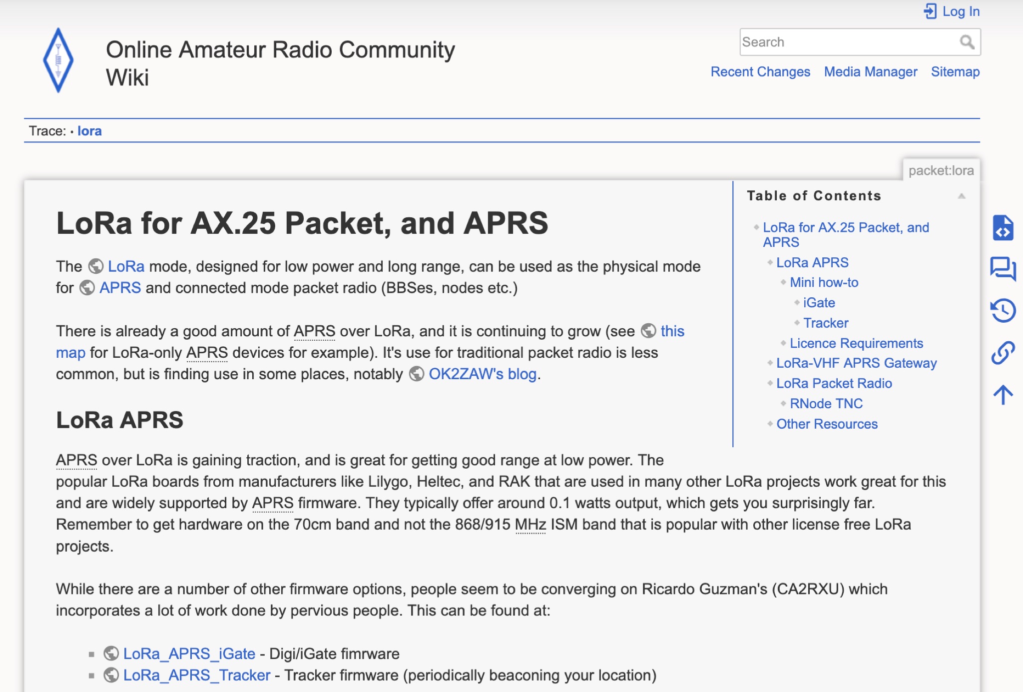 Learn how LoRa mode can be used for APRS and connected mode packet radio, offering low power and long-range communication. Discover the growing popularity of LoRa-only APRS devices and the use of LoRa boards from manufacturers like Lilygo, Heltec, and RAK. Find out about firmware options like Ricardo Guzman's CA2RXU firmware, which incorporates previous work and offers KISS for external APRS clients. Explore LoRa APRS frequency and modulation settings in the UK, and consider adding CA2RXU firmware to lora-aprs.live for more radio-specific information. Dive into the world of LoRa technology for ham radio operators and experiment with different firmware options.
 -
 The article discusses the construction of a UHF band-stop stub filter to protect an APRS receiver from potential damage during a balloon launch. The author, who communicates using a 441 MHz transmitter, needed to ensure that the RTL-SDR dongle receiving at 144 MHz wouldn't be damaged by the transmissions. The solution involved creating a quarter-wavelength open stub filter using coaxial cable, which attenuates the 441 MHz signal while allowing the 144 MHz signal to pass through. The filter's design is based on the principles of constructive and destructive interference, with careful measurement and trimming to achieve the desired frequency response. The final filter provided 34.8 dB of insertion loss at 441 MHz and minimal loss at 144 MHz, effectively protecting the receiver.
 -
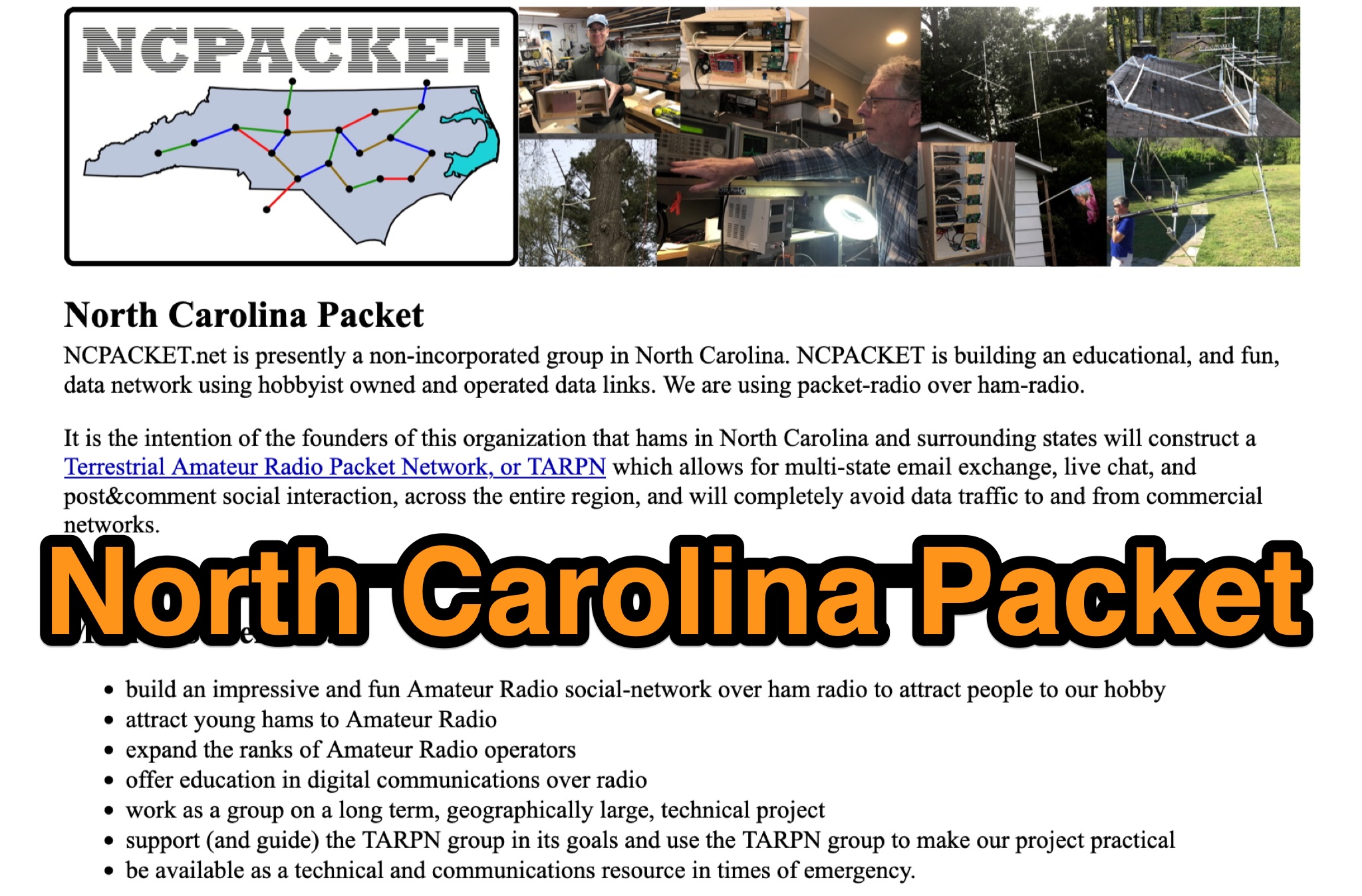 Learn about North Carolina Packet Voice nets and NCPACKET YouTube videos. Get your NCPACKET Callsign Badge to wear at ham club meetings and hamfests. Explore Hamfest Photos and NCPacket news. Discover the North Carolina TARPN Nodes mission statement and the benefits of being off the grid. Find out why TARPN is a great option and compare it with Winlink, APRS, ARES, and MARS. Learn how to build the NCPACKET network, including information on repeater sites and other key components.
 -
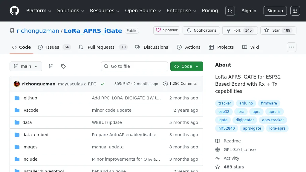 Demonstrates firmware for microcontrollers like the _ESP32_ to implement a LoRa APRS iGate and Digipeater. This project leverages LoRa for packet radio communication, allowing amateur radio operators to bridge the gap between LoRa-enabled APRS stations and the global APRS-IS network via WiFi. It details the setup for both iGate and Digipeater modes, including features like transmitting APRS-IS packets over LoRa to local stations and a 30-second buffer in digipeater mode to prevent packet storms. This firmware offers an Ultra Eco Mode, achieving current consumption between **7mA** and **13mA**, making it suitable for remote, battery-powered deployments. The integrated WebUI simplifies configuration and management, providing an accessible interface for hams to deploy and maintain their LoRa APRS infrastructure. It supports sending weather telemetry packets and adheres to APRS protocols, released under the GPL-3.0 license.
 -
 Demonstrates a LoRa APRS Tracker project featuring a comprehensive menu system for message management, weather requests, and monitoring nearby trackers. The device supports adjustable display eco mode and screen brightness, optimizing power consumption by dynamically changing processor speed from 240MHz to 80MHz. GPS beacons are encoded for efficient RF transmission, and an OLED screen displays altitude, speed, course, _BME280_ weather data, or new message counts, along with recently heard stations. Bluetooth connectivity enables operation as a TNC with Android (APRSdroid) or iPhone (APRS.fi app), providing LED and sound notifications for transmissions and received messages. The integrated BME280 module facilitates weather data display and transmission, with Winlink mail support via _APRSLink_. The tracker can switch between **three major LoRa APRS frequencies** worldwide, offering versatile global operation.