Search results
Query: coverage map
Links: 11 | Categories: 1
Categories
-
 Allow you to create Tower Coverage Maps for any geographical area in the entire world. Maps are based on region and topography, taking into account for hills, mountains and trees. Commercial software allowing a free map trial
 -
 These pages provide general propagation advice for HF communicators. Information available includes inferred global propagation conditions, real time HF fadeout coverage charts, regional ionospheric vertical MUF maps and Hourly Area Prediction charts for Astralia and Asia, Europe and North America
 -
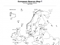 For radio amateurs engaged in propagation studies and DXing on the 6-meter band, understanding the distribution of active beacons is crucial for assessing band openings and signal paths. This resource presents a static map compiled by _Carl-Axel Lindberg, SM6NZV_, illustrating the geographical placement of European beacons operating on the 50 MHz band, which is vital for monitoring sporadic-E, F2-layer, and other propagation modes. The map, last updated in April 2002, serves as a historical reference for beacon locations, allowing operators to correlate observed signal reports with known beacon positions. While not real-time, it provides foundational data for analyzing past propagation events and understanding typical beacon coverage areas across the European continent. Operators can use this information to identify potential receive stations or transmit points for future _DX contacts_ on the _Magic Band_.
 -
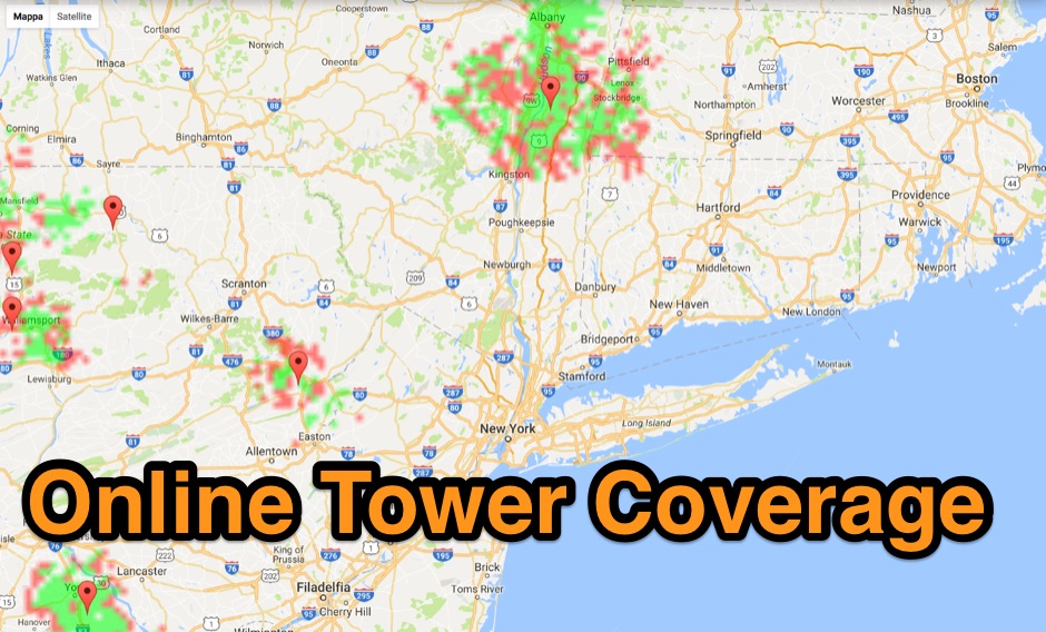
 RF Path design software, tower coverage mapping software to evaluate radio transmitter sites, predict and simulate radio coverage, plan land mobile radio or cellular systems. Commercial RF coverage mapping software by Softwright llc.
 -
 Repeater Information & Coverage maps
 -
 BeaconSpot.uk provides an accurate, real-time picture of microwave and VHF/UHF beacons operating across Europe, alongside a worldwide listing of 6-meter beacons. The platform allows users to retrieve detailed data for individual beacons, facilitating in-depth analysis of signal characteristics and propagation paths. Interactive maps visualize beacon distribution by frequency band and display spot coverage for each station, offering a clear geographical overview of active beacons. The system integrates real-time DXCluster spots, sourced from contributors like Alain, ON4KST, and Pascal, F5LEN, and enables users to submit outgoing spots directly to the DXCluster. Beacon keepers can manage their beacon data, receive email alerts upon being spotted, and track their station's ODX (Outstanding DX) records. For every received spot, the distance to the beacon is automatically calculated and displayed, aiding propagation studies.
 -
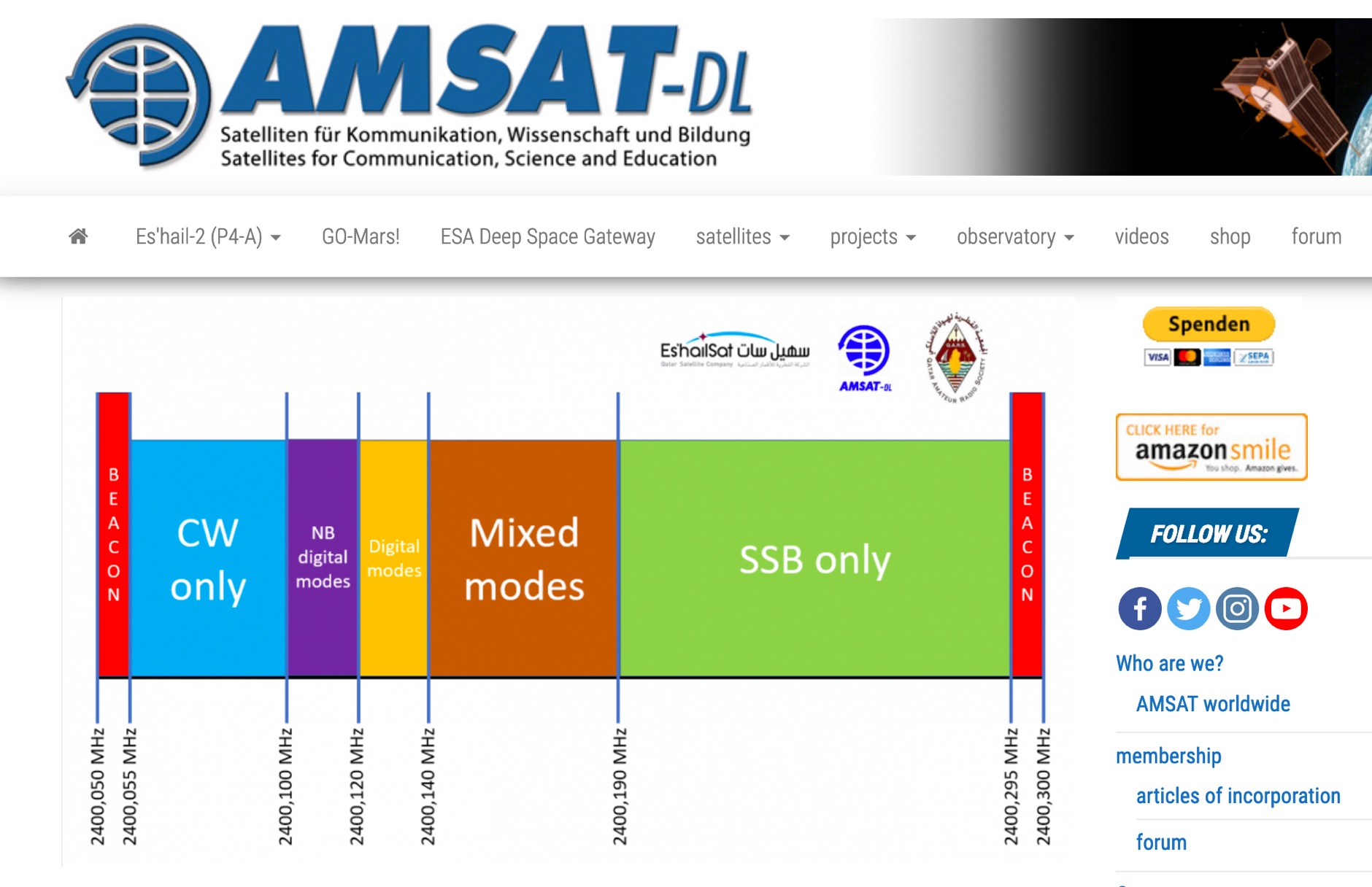 P4-A narrowband transponder Operating Guidelines and Band Plan, coverage map of the QO100 geostationary amateur radio satellite
 -
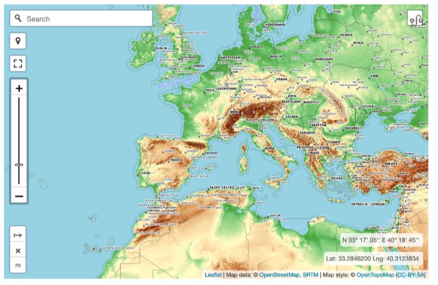 Online interactive elevationmap can help radio amateurs by predicting signal propagation, optimizing antenna placement, planning coverage, ensuring line-of-sight, mitigating interference, and enhancing emergency communication. T
 -
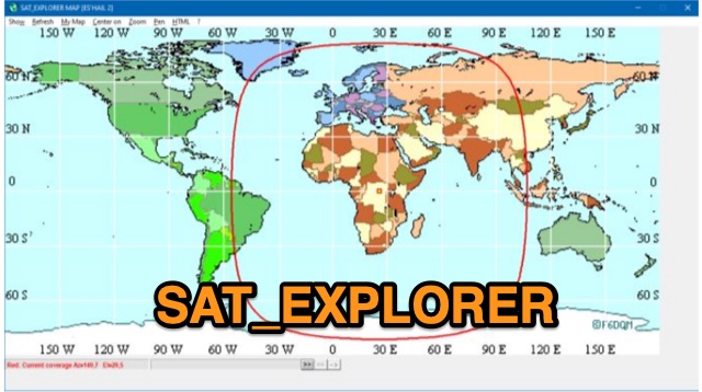 SAT_EXPLORER is a versatile software for tracking the Moon, Sun, and artificial satellites while controlling various antenna interfaces. Compatible with Windows XP and later (32/64-bit) and multilingual (English, French, German, Italian, Spanish), it integrates seamlessly with TRX-Manager for transceiver control. SAT_EXPLORER computes satellite and Moon positions with high precision, calculates EME Doppler shifts, and uploads real-time satellite positions and coverage maps to your personal web pages. Linux/Ubuntu users can run it using WINE or CROSSOVER.
 -
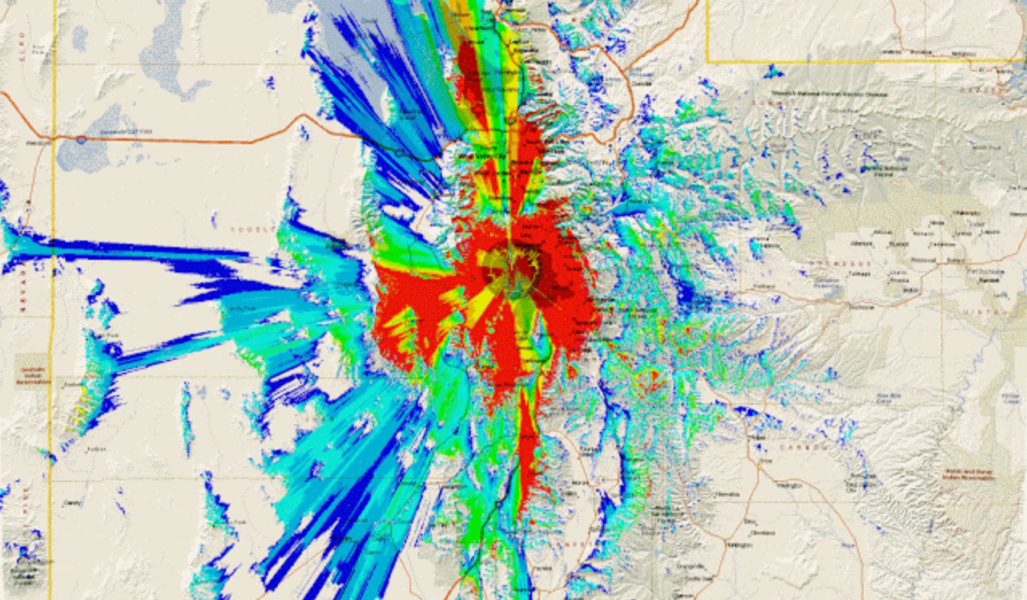 This study analyzes the antenna pattern of the Utah Amateur Radio Club's 146.760 MHz repeater following antenna relocation in 1997. Noting degraded transmission toward the north, a customized signal mapping system using a Yaesu FT-817, GPS, and software was developed to log real-time signal data. Calibration techniques extended the radio's signal range, enabling precise field measurements. The method allowed continuous signal strength monitoring while driving, revealing anomalies in coverage likely due to tower modifications. Findings helped assess and visualize the antenna’s actual radiation pattern and highlighted environmental impact on signal distribution.
 -
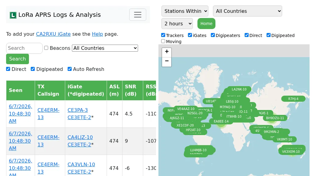 Demonstrates the operational status and reach of the LoRa APRS infrastructure, providing a live mapping and logging service for network participants. Users can verify network coverage, monitor _iGates_, and track mobile stations, observing messages and real-time network activity. The platform offers insights into station locations and data flow within the LoRa APRS system, which is crucial for understanding the performance of LoRa technology in Automatic Packet Reporting System applications. This utility helps amateur radio operators understand where transmissions are being received and processed by iGates, and how mobile units are moving within the network. The site's analysis tools provide RF performance monitoring and metrics, enabling users to assess network efficiency and identify areas for improvement. For example, operators can see how many packets are received by specific iGates, or track the path of a mobile station over a **100 km** range, offering practical insights into signal propagation and network reliability for _packet radio_ enthusiasts.