Search results
Query: aprs qth
Links: 4 | Categories: 0
-
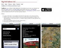 CallBook is an Amateur Radio application that allows you to look up call signs via the free WM7D server, the QRZ Online subscription service or the HamCall subscription server and track active APRS stations on www.aprs.fi. Lookup results can be emailed and the QTH can be instantly viewed in the Maps application
 -
 Accessing this interface provides entry to one of the largest databases for amateur radio voice repeaters, encompassing over 8000 entries from more than 60 countries. The resource supports both desktop and mobile access, with a default display based on browser type, or forced via a "force" parameter (e.g., relais.dl3el.de?force=mobile). Users input a QTH-locator to find local repeater information. The database integrates FM-Funknetz servers and hotspots, potentially creating duplicate entries but ensuring new FM-Funknetz repeaters are immediately displayed. DMR repeater information, including status and talkgroup configurations, is sourced directly from DMR+ / ircDDB and Brandmeister systems, with real-time updates for active and default talkgroups. C4FM/Wires-X installations, particularly MMDVM-based gateways not listed in Yaesu's database, are identified through Brandmeister dashboard descriptions, marked with "W-x" or "W-x#MMDVM" for manual entries. D-Star repeater data from ircddb or QuadNet2 is also incorporated, with entries marked (i), (o), or (d) for manual additions. An APRS interface allows searching by callsign, using Sassan, DL3NCK's database, and offers a mobile-friendly, auto-refreshing display that follows an APRS station. Output data can be generated in GPX format for offline smartphone maps or CSV for spreadsheet applications. The database also attempts to determine valid repeater offsets based on IARU region and frequency, indicated by a "." after the frequency.
 -
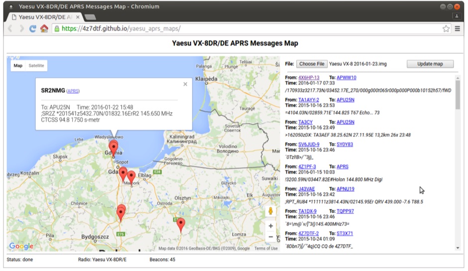 Yaesu VX-8DR/DE received APRS beacons map based on Google Maps. The application parses Chirp's .img files and shows the QTH of the incoming APRS messages.
 -
 Demonstrates the practical application of APRS (Automatic Packet Reporting System) through the lens of HB9PVI's activities in Switzerland. It covers the system's core function of reporting geographical positions and telemetry data from various objects, including mobile stations, aircraft, and the ISS, distributed via packet radio and internet gateways. The resource highlights the routing paradigm shift introduced in April 2005, specifically the recommendation to use _WIDE1-1_ instead of RELAY and WIDE for digipeating to reduce duplicate packets. The page presents real-time maps displaying the positions of amateur radio stations in Switzerland and around Bern, updated every few minutes. It details specific callsigns like _HB9BA-2_ (HB9PVI's home QTH), _HB9BA-8_ (a weather station), and _HB9BA-4_ (a WIDE digipeater on Weissenstein mountain), providing context for their roles within the local APRS network. Links to track HB9PVI's mobile operations (_HB9PVI-9_) and handheld devices (_HB9PVI-15_, _HB9PVI-7_) are also provided. Furthermore, the resource curates a list of APRS software options for various operating systems, including _JavAPRS_ for Europe, _UI-view_, and _X-Astir_ for Linux, alongside digipeater/IGATE software like _DiXPRS_. It also offers downloadable APRS information, including a PDF article by HB9PVI and HE9ZGN, and a PowerPoint presentation in German, making it a repository of practical and historical APRS data.