Search results
Query: iaru zone map
Links: 3 | Categories: 0
-
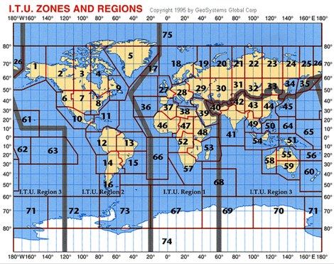 The resource offers a high-resolution JPEG image file depicting worldwide **ITU Zones** and Regions, specifically designed for radio amateurs and technical users. This visual aid clarifies the geographical divisions established by the International Telecommunication Union, which are fundamental for understanding amateur radio operating regulations and DXing awards. Information regarding ITU Regions is referenced from the IARU website, ensuring accuracy for amateur radio operations. The image file is provided in a convenient JPEG format, optimized for clarity and ease of use. Users can freely download this map, which serves as a practical reference for identifying the specific ITU zone of a DX entity or for planning contest strategies based on regional distinctions.
-
-
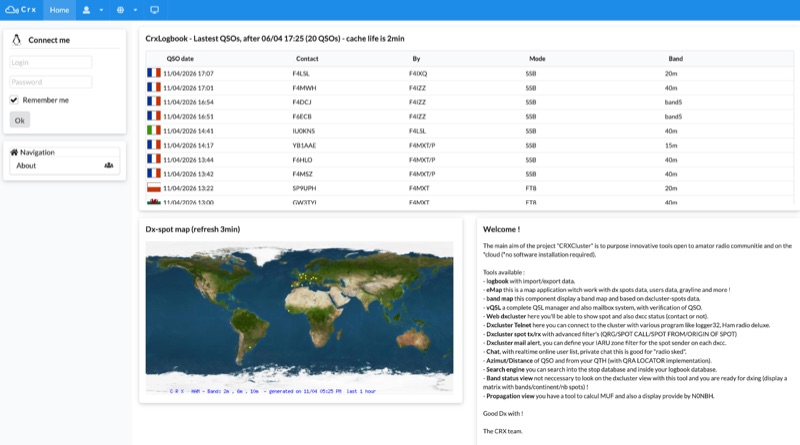 Demonstrates a cloud-based suite of tools for amateur radio operations, eliminating local software installation. The platform integrates a comprehensive logbook with import/export functionality, an _eMap_ application displaying DX spots, user locations, and grayline data, alongside a dynamic band map derived from DX cluster information. It also provides a _vQSL_ system for QSL management and a mailbox with QSO verification. Users can access a Web DX cluster to monitor spots and _DXCC_ status, or connect via Telnet using external programs like _Logger32_ or Ham Radio Deluxe. The cluster supports advanced spot filtering by QRG, spot call, spot from, and origin, with configurable mail alerts based on IARU zone filters. Additional features include a real-time chat for skeds, azimuth/distance calculations from a user's QTH (with QRA locator), a search engine for spot and logbook databases, a band status matrix, and a propagation tool for MUF calculations, leveraging data from N0NBH.