Search results
Query: repeater map
Links: 21 | Categories: 3
-
-
 Australia's largest online database of VK email & URL's. Home of the AAR Netring and VK Classifieds. Repeater lists, maps and more...
 -

-
-
 A google map of the UK amateur radio repeaters with clickable information
 -
 An interactive repeater map that uses google maps to display location of repaeter types available in Italy by Andrea IW0HOG
 -
 Iphone App with list of nearby repeaters in the UK, along with details of input and output frequencies, a map, and a handy bearing arrow for each repeater.
 -
 The only worldwide amateur radio repeater directory. Supports Android, iPhone, web, RT Systems, CHIRP GPS enabled. AvMap, Garmin, TomTom
 -
 Map of VHF UHF repeaters in australia
 -
 Accessing this interface provides entry to one of the largest databases for amateur radio voice repeaters, encompassing over 8000 entries from more than 60 countries. The resource supports both desktop and mobile access, with a default display based on browser type, or forced via a "force" parameter (e.g., relais.dl3el.de?force=mobile). Users input a QTH-locator to find local repeater information. The database integrates FM-Funknetz servers and hotspots, potentially creating duplicate entries but ensuring new FM-Funknetz repeaters are immediately displayed. DMR repeater information, including status and talkgroup configurations, is sourced directly from DMR+ / ircDDB and Brandmeister systems, with real-time updates for active and default talkgroups. C4FM/Wires-X installations, particularly MMDVM-based gateways not listed in Yaesu's database, are identified through Brandmeister dashboard descriptions, marked with "W-x" or "W-x#MMDVM" for manual entries. D-Star repeater data from ircddb or QuadNet2 is also incorporated, with entries marked (i), (o), or (d) for manual additions. An APRS interface allows searching by callsign, using Sassan, DL3NCK's database, and offers a mobile-friendly, auto-refreshing display that follows an APRS station. Output data can be generated in GPX format for offline smartphone maps or CSV for spreadsheet applications. The database also attempts to determine valid repeater offsets based on IARU region and frequency, indicated by a "." after the frequency.
 -
 Repeater Information & Coverage maps
 -
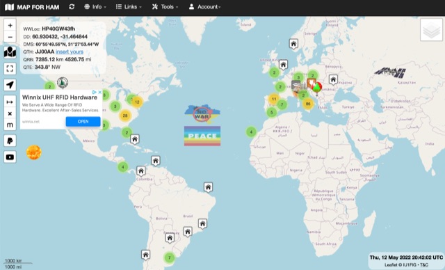 The first interactive map of amateur radio repeaters and more updated in REAL TIME.
 -
 An Google Maps interactive layer showing Australian amateur radio repeaters. You can navigate and zoom as required and click on a repeater-site icon to display frequency, ctcss and other details and notes for that repeater.
 -
 The Milwaukee Repeater Club is the oldest continuously operating repeater in Milwaukee
 -
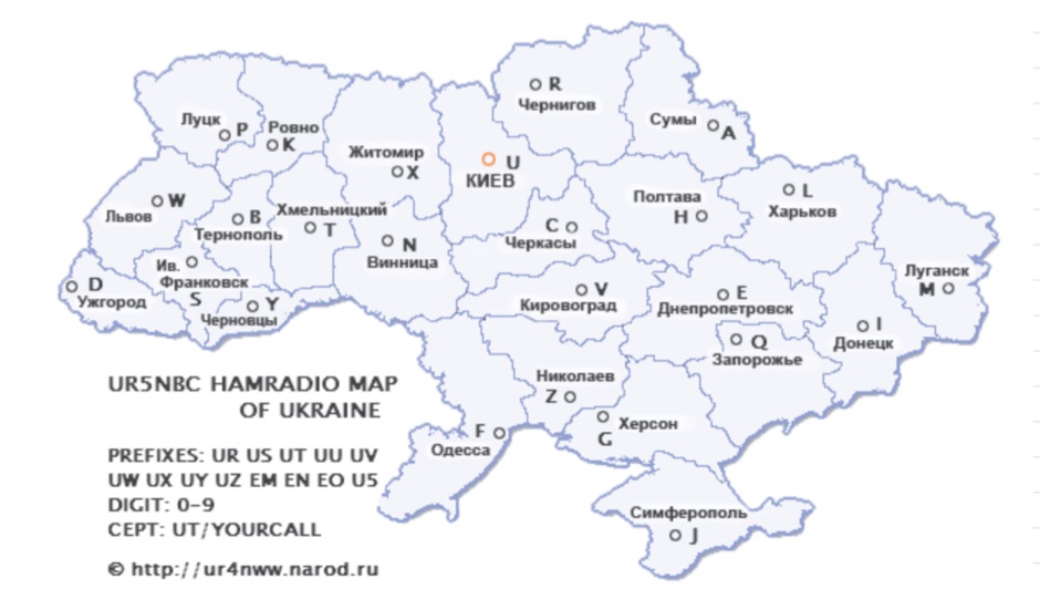 Map and list of amateur radio Repeaters in Ukraine in Russian
 -
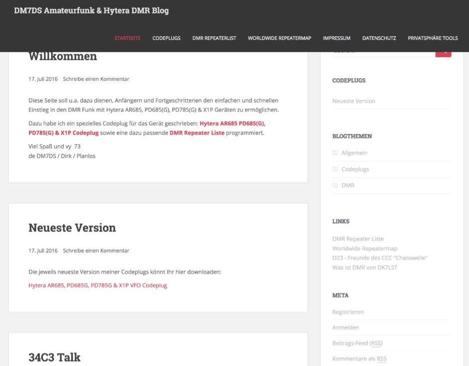 DMR personal web site. Includes download links for Codeplug for Hytera AR685 PD685G, PD785G, PD785 & X1P with DMR Plus and Brandmeister support with VFO like channels. Repeater maps. In German.
 -
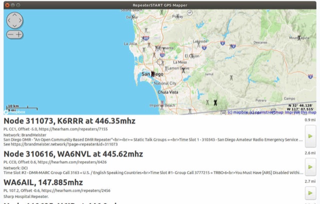 The amateur radio listener for when you're not on the radio. Repeater-START, the offline repeater listing app for Windows, Linux, Raspberry Pi, Ubuntu, Librem Phone is available, Now with grid square display, topographical maps and frequency preferences
 -
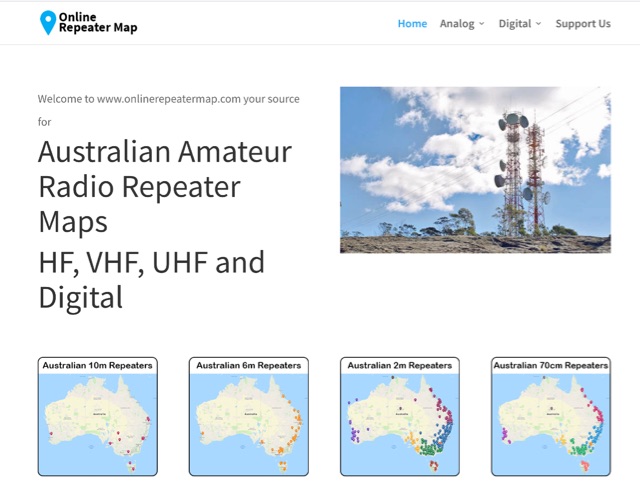 Online Repeater Map aims to help Australian amateur radio operators quickly and easily visualize the location of ham radio repeaters
 -
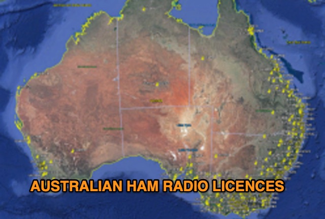 Discover a comprehensive solution for mapping Australian ham radio entities using data from the ACMA Public Register. This tool, developed in Delphi 7, generates KML files for Google Earth, showcasing repeaters, beacons, and operators across different prefixes. While respecting privacy regulations, the files provide valuable insights into the amateur radio landscape.
 -
 Southern California's Premier Repeater System. Intractive map with Analog and Digital mode repeaters in South, Mid and North California
 -
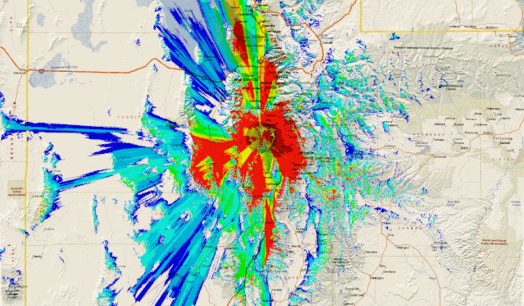 This study analyzes the antenna pattern of the Utah Amateur Radio Club's 146.760 MHz repeater following antenna relocation in 1997. Noting degraded transmission toward the north, a customized signal mapping system using a Yaesu FT-817, GPS, and software was developed to log real-time signal data. Calibration techniques extended the radio's signal range, enabling precise field measurements. The method allowed continuous signal strength monitoring while driving, revealing anomalies in coverage likely due to tower modifications. Findings helped assess and visualize the antenna’s actual radiation pattern and highlighted environmental impact on signal distribution.