Search results
Query: sota maps
Links: 5 | Categories: 0
-
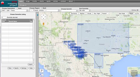 An interactive map for sota operations. SOTA Activators and cheasers will find this summits mapping site very useful resource. Based on Google maps.
 -
 Mircules HAM QuickLog provides a mobile logging solution for amateur radio operators, supporting quick contact entry on iOS and Android platforms. It features multiple log file management, instant callsign information display including Country, ITU zone, CQ Zone, and DXCC number, and robust ADIF and CSV import/export capabilities. The application is designed for efficient logging with optional fields and default values, streamlining the process for both shack and field operations. The software includes dedicated support for POTA, SOTA, and IOTA activations through specific fields like MY_SIG_INFO, SIG_INFO, MY_SOTA_REF, IOTA, and MY_IOTA. A specialized contest mode offers real-time dupe checking and automatic TX exchange updates to enhance contest efficiency. Integration with QRZ.COM and HAMQTH.COM allows for direct operator information lookup and import, while Open Street Maps integration provides geographic context for contacts. The application also features a notes and scratchpad function for each log file.
 -
 A real-time, responsive map view of APRS (Automatic Packet Reporting System) information, CWOP (Citizens Weather Observer Program), and other APRS-IS sources across the world. The N2RWE Real-time APRS Map leverages cutting-edge technologies and custom software to present a dynamic and user-friendly platform for visualizing Automatic Packet Reporting System (APRS) data. This web application aggregates real-time station locations from various public sources, offering a comprehensive view of APRS activity. It caters to both novice and experienced users by providing features like Maidenhead Grid maps, station lists, license plate searches, and advanced tools for geolocation, address lookup, and data analysis. Additionally, the platform integrates with Summits on the Air (SOTA) information, enhancing the experience for SOTA enthusiasts. By actively supporting the #APRSThursday net, the N2RWE Real-time APRS Map fosters a collaborative environment for the APRS community.
 -
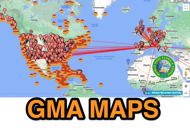 GMA provides an on-line google-map based map with overlays for sota, iota, wwff, lighthouse, mills
 -
 Ham2K PoLo is an android Portable Logger, Support for Parks On The Air (POTA), Summits On The Air (SOTA), Field Day, Winter Field Day, Worldwide Flora and Fauna (WWFF) and more. Fast and efficient yet fully-featured: QRZ.com name lookups, QSO Maps, offline data files, contact rates, duplicate warnings, POTA spots, search parks nearby or by name, etc.