Search results
Query: remote stations
Links: 15 | Categories: 2
-
 Use real audio streams to listen to Hf and VHF stations around the world via remote controlled receivers connected to the web.
 -
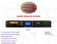 You can listen to a remote controlled ham radio station and if you are a authorized ham you can talk. Originally hosted at lamonica.com this is one of the very first online ham radio stations on the net.
 -
 Merging Internet technology with Amateur Radio holds great promise. This article discusses the authors experiences in putting several Internet Remote Base stations on the air. By Stan Schretter, W4MQ, Brad Wyatt, K6WR, and Keith Lamonica, W7DXX
 -
 Operating amateur radio satellites effectively requires precise knowledge of their orbital mechanics and pass times. Gpredict, a real-time satellite tracking and orbit prediction application, addresses this need by allowing operators to monitor numerous satellites simultaneously. It displays critical data such as position and pass details through various visualizations, including lists, tables, maps, and _polar plots_. Unlike many other satellite tracking programs, Gpredict introduces the concept of visualization modules. These modules enable users to group satellites and configure each group independently, offering unparalleled flexibility in how orbital data is presented. This modular approach supports tracking satellites from multiple observer locations concurrently, which is particularly useful for stations with diverse antenna setups or remote operations. Originally a GUI client for John Magliacane's _Predict_ program, Gpredict evolved to integrate its own tracking code for improved performance. The software is distributed under the GNU General Public License, ensuring it remains free and modifiable for the amateur radio community.
 -
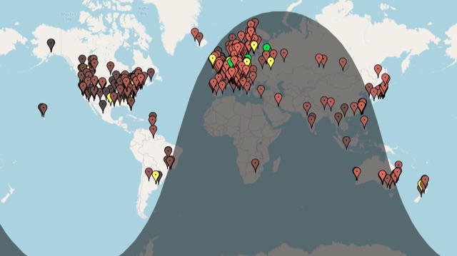 A live map of current KiWiSDR receivers available on the network. It allows users to explore a directory of web-controlled receivers for listening to HF and VHF stations worldwide. The site provides access to remote ham radio stations online, making it a valuable resource for amateur radio operators.
 -
 Presents a dedicated logging solution for amateur radio DXpeditions, addressing the unique operational demands of remote or temporary stations. This freeware Windows application provides essential tools for managing QSO data, ensuring accurate record-keeping during high-volume operations. The software supports efficient entry and retrieval of contact information, crucial for verifying DXCC credit and submitting contest logs. It streamlines the process of logging contacts, which is vital when operating from rare entities or during intense pile-ups, helping operators maintain focus on making contacts rather than complex data management. The application aims to simplify the logistical challenges associated with DXpedition logging.
 -
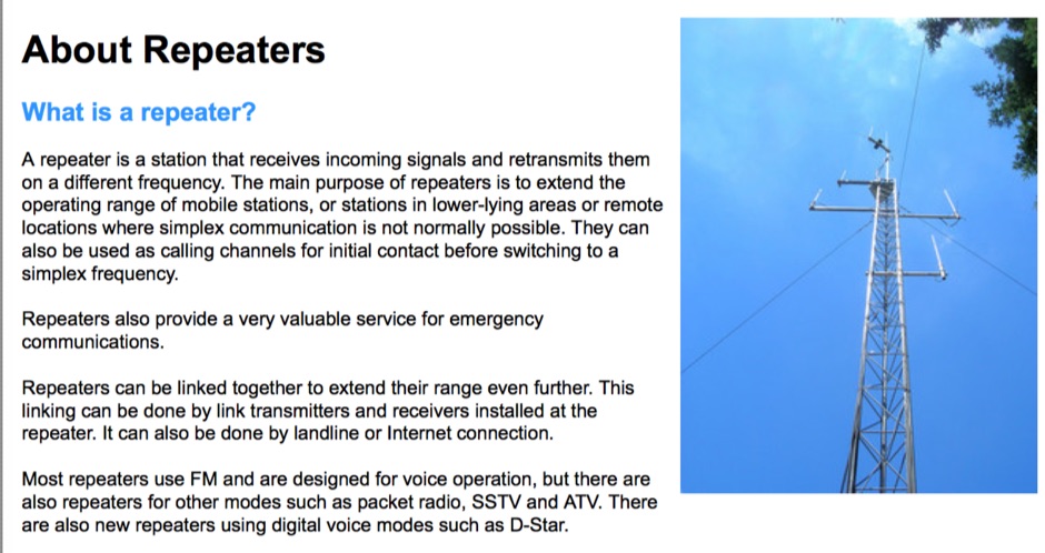 Amateur radio repeaters extend communication range for mobile and remote stations by retransmitting signals on a different frequency, often for emergency communications. The resource details various repeater bands, noting that 2 meters and 70 cm are primary for activity, with 10-meter repeaters offering potential national and overseas coverage. It specifies **18 channels** on 6 meters and **31 channels** on 2 meters, along with a new 70 cm offset of _7 MHz_ adopted in 2015. The content explains how repeaters can be linked via dedicated transmitters/receivers, landlines, or Internet VoIP systems like _IRLP_ and Echolink, enabling global connections. It also describes simplex gateways for multi-band operation and the use of CTCSS subaudible tones for access control and interference mitigation. The document highlights specialized repeaters for modes beyond voice, such as SSTV and ATV, particularly on 70cm and higher bands. Operational guidelines for efficient and courteous repeater use are referenced, along with links to Australian repeater listings and band plans.
 -
 The resource provides an interactive map interface for locating amateur radio license holders across the United States. Users can input a _callsign_, _gridsquare_, zip code, or street address to center the map, which then dynamically populates with station markers. This functionality allows for precise geographical searches, revealing the distribution of hams within specific areas. Upon initial search, the map renders with adjustable zoom and pan capabilities. A key feature is its automatic reload mechanism: after two seconds of inactivity, the map updates to display stations within the newly viewed area. This ensures that the displayed data remains relevant to the user's current focus, whether exploring a densely populated urban center or a more remote region. Further interactive elements include clickable gridsquare labels, which re-center the map, and a "Show gridsquares" checkbox for toggling grid line visibility. Clicking on individual station markers reveals a popup containing the licensee's name and address information, making it a practical tool for geographical station identification.
 -
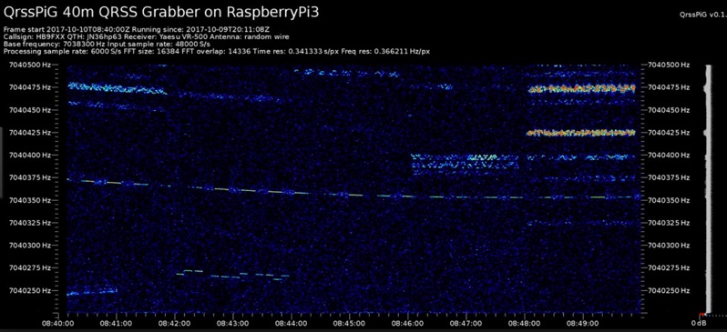 Monitoring extremely weak signals in the QRSS (Very Slow Morse) mode requires specialized receiving and processing capabilities to extract information below the typical noise floor. This project provides a software solution, _QrssPiG_, designed to run on a Raspberry Pi, enabling it to function as a dedicated QRSS grabber. It interfaces with various Software Defined Radio (SDR) devices, including the popular _rtl-sdr_ dongles and _HackRF_ units, to acquire raw I/Q data streams. The software then performs the necessary signal processing to visualize and decode these faint, long-duration CW transmissions, often operating with milliwatts of power. The system leverages the computational power of the Raspberry Pi for real-time signal analysis, allowing hams to participate in QRSS experiments and monitor distant beacons. It supports different SDR hardware, offering flexibility in setup and deployment for home stations or remote monitoring sites. The project includes detailed instructions for installation and configuration, making it accessible for those familiar with Linux environments. This grabber is particularly useful for tracking propagation on the LF and HF bands where QRSS activity is common, providing a visual representation of signal presence over extended periods.
 -
 Accurate meteorological data is crucial for optimizing antenna performance, predicting propagation, and ensuring safe tower work. This resource provides a curated inventory of weather stations, including models like the _AcuRite Atlas_ with lightning detection and the _Ambient Weather WS-2902_ WiFi Smart Weather Station, which offer real-time data on environmental factors. The product listings detail specific features such as direct-to-Wi-Fi connectivity, rainfall tracking, and temperature insights, enabling informed decision-making for various amateur radio operations. The platform categorizes products by application, featuring weather stations tailored for home and backyard use, as well as more robust systems for farm and agriculture, which can be critical for field day operations or remote station monitoring. It also highlights _Made in USA_ options, emphasizing local manufacturing and support. Beyond weather instruments, the site also presents related surveillance technology, such as the _Waggle solar CCTV camera_, designed for outdoor reliability with an IP65 weatherproof rating. This integration allows for comprehensive monitoring of remote ham radio shacks or antenna sites, combining environmental data with visual oversight.
 -
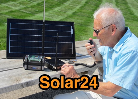 Solar power supplies combine a photovoltaic (PV) solar panel with a Lithium Iron Phosphate (LiFePO4) battery to provide reliable, off-grid power for amateur radio stations, camping, remote equipment, emergency preparedness, and anything else that needs power.
 -
 Documents the XR0ZR DXpedition to Juan Fernandez Island (SA-005) in November 2013, providing insights into activating a highly sought-after DXCC entity. The team's efforts focused on maximizing QSO opportunities across various bands and modes, a critical aspect for stations aiming to complete their DXCC or IOTA awards. Operating from a remote location like Juan Fernandez presents unique logistical and technical challenges, which the expedition successfully navigated to put this entity on the air for thousands of eager DXers worldwide. The resource outlines the operational period, the callsign XR0ZR, and the specific island group activated. Such DXpeditions are vital for the global amateur radio community, enabling hams in less accessible regions to achieve their award goals and fostering international communication. The detailed account serves as a historical record of a significant activation.
 -
 Guide to AllStarLink the world wide network of Amateur Radio repeaters, remote base stations and hot spots accessible to each other via the Internet and/or private IP networks.
 -
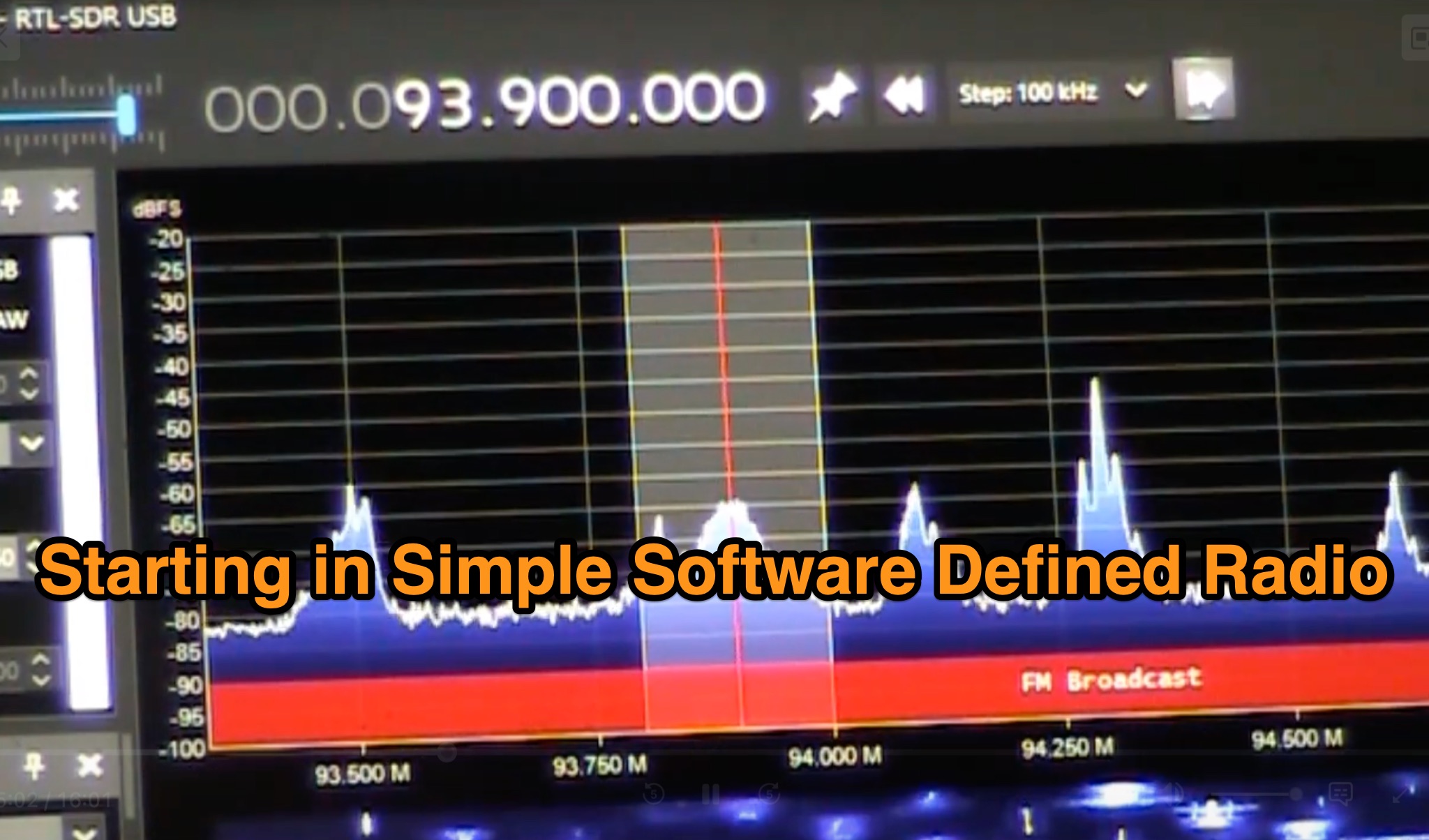 This page explores the world of Software Defined Radios (SDRs) in the context of amateur radio. It discusses how SDRs have revolutionized the hobby by reducing costs and enabling remote operation. The article provides ideas for projects and experiments that hams can undertake with SDR technology, highlighting the educational and experimental opportunities it offers. It also mentions specific examples of SDR projects like the Stoke on Trent SDR and SDR.HU. The content is aimed at amateur radio operators looking to explore and harness the potential of SDRs in their stations.
 -
 TX5EU 2026 DXpedition to Raivavae Island, **OC-114**, within the Austral Islands, providing a detailed account of the German/Dutch team's operations. The resource outlines the participation of operators such as DL2AWG Guenter, PA2KW Evert, and DK2AMM Ernoe, who engaged in CW, SSB, RTTY, and various digital modes. It documents the real-world challenges encountered, including significant equipment failures and antenna damage to 80/60m, 30m, and 10m verticals due to adverse storm conditions. The page offers timely news updates on the expedition's progress, noting repairs to a power amplifier's 10/12m bandpass filter, which enabled three stations to utilize amplification. Earlier reports highlighted power failures and the loss of multiple power amplifiers, necessitating one station to operate barefoot FT-8 with 100W. The team's persistent efforts to repair antennas as weather permits are also detailed, reflecting the dynamic nature of remote island operations.