Distance & Bearing
Distances and beam headings
Sort:
Related Categories
-
 This site provides free azimuthal maps for almost anywhere on the globe. Create your own azimuthal map for your location. You can customize the map in a variety of ways by changing the options in the web form
 -
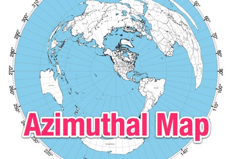
 The page provides a tool to create a customized Ham Radio Az Map on the fly, with various dimensions available. It is a valuable resource for amateur radio operators to visualize and optimize pointing of directional antennas. The content includes maps for different regions, prefix maps, and world maps.
 -
 This online tool will convert any street address into latitude and longitude and vice-versa by executing queries to several online mapping services like googlemap geocoder maporama terraserver and more by Stephen P. Morse
 -
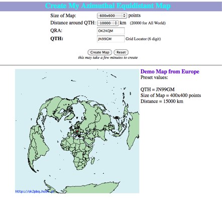 Online generator or Azimuthal equidistand map
 -
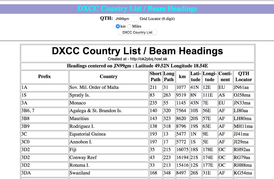 You can have your persolal DXCC country list with correct beam heading calculated on you grid square location
 -
 This online calculator computes the great circle distance between two points on the earth's surface
 -
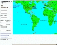 Interactive great circles and QRA Locator map
 -
 An introduction to PSK31, MT63, and Hellschreiber, John DeGood NU3E Trenton Computer Festival in PDF
 -
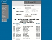 A list of all IOTA reference numbers and IOTA groups for the Islands On The Air award, personalised to your own QTH
 -
 Calculate bearing and distance and Locator online with this Java application, may not work with all browser.
 -
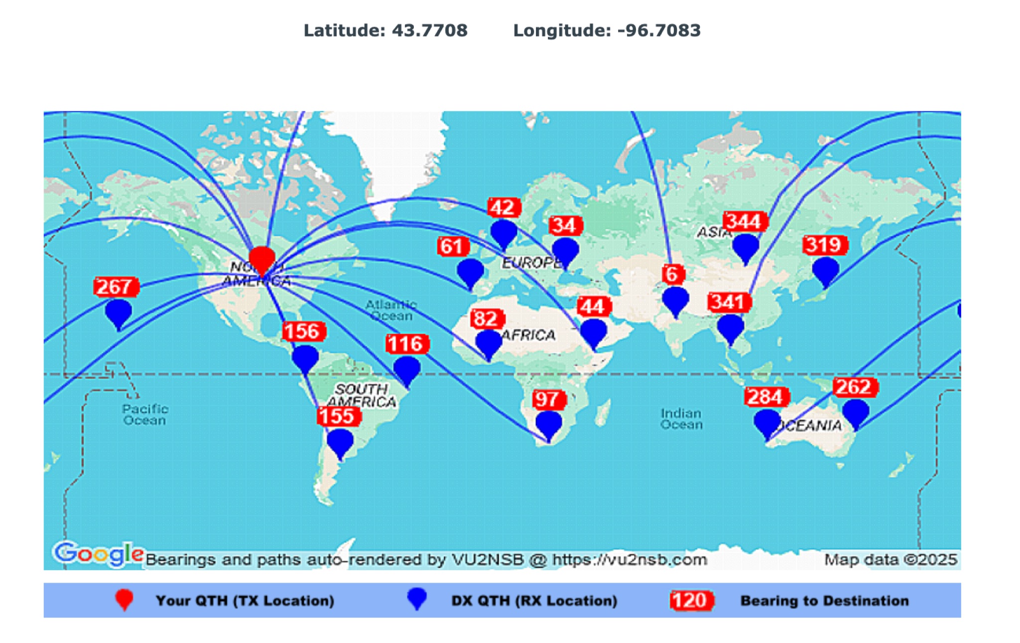 This page by Basu (VU2NSB) presents automatically rendered antenna bearings with geodesic paths projected on a rectangular map. ch geodesic great circle path displayed on the map originates from your location that is derived from your Internet IP address. Therefore the Antenna Bearing Geodesic Map generated below should be accurate and relevant to your physical location (QTH). This map is an alternative to the Great circle Map.
 -
 The page automatically generate a Great Circle Map (GCM) for ham radio operators based on the IP address or by a given QTH locator. The GCM generated, unlike traditional maps of this type, has been rendered in an elliptical shape instead of a circle. This provides an expanded view horizontally thus making it easier to interpret. The map base is colored with each continent colored differently for easier recognition. The color code of the continents is given below the map for easy reference
 -
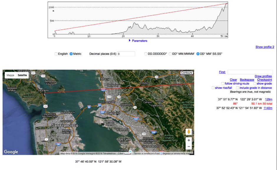 HeyWhatsThat Path Profiler is an online useful tool to do a Line of Sight calculation between yourself and the another station