Search results
Query: KML
Links: 7 | Categories: 0
-
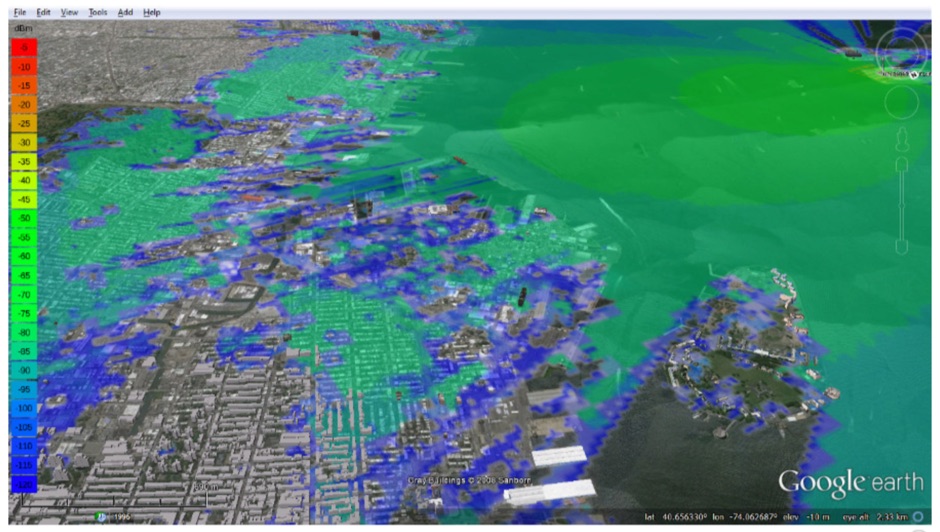 The ultimate Keyhole Markup Language (KML) plugin for Google earth. Keyhole Radio is a unique and powerful RF planning interface, accessed by loading a Keyhole Markup Language (KML) overlay in Google earth.
 -
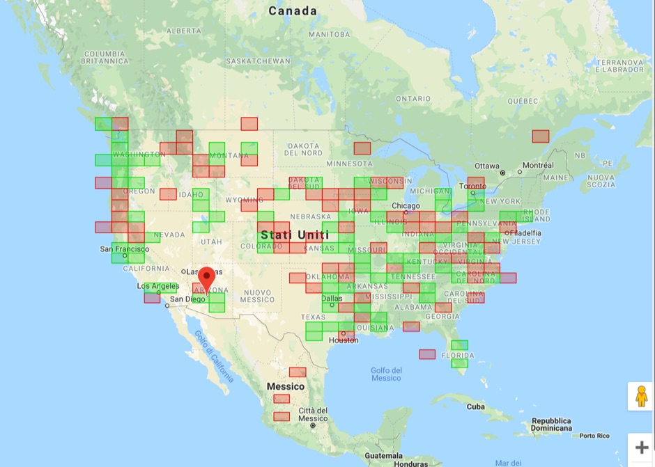 Upload an ADIF fiel and plot all worked grids in an online map. Support filtering by band, year and can export the output directly into a google map, or a google earth KML file
 -
 This freeware application for Linux and windows, allows you to convert an ADIF file to a KML file so you can map your QSOs easily and open it with google maps, or google earth or any application supporting the KML format
 -
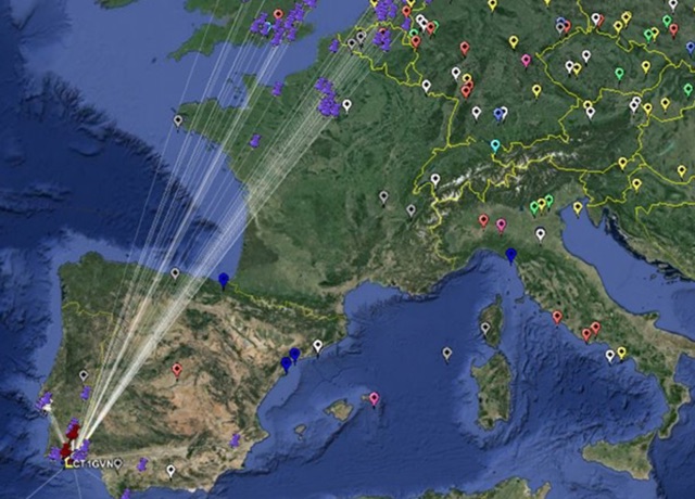
 This project is a python program used to plot the location of QSOs (radio contacts) on Google Earth or other mapping applications. It reads an ADI file of the QSOs and creates a KML file
 -
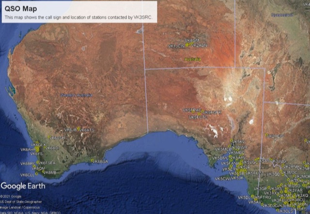
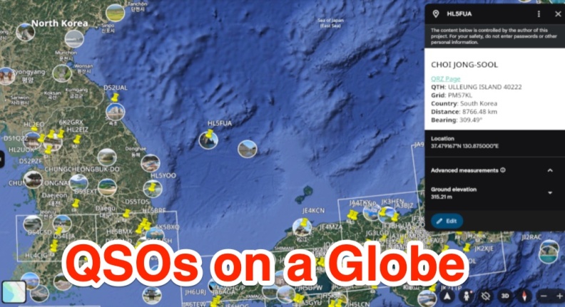 A free web app that converts ADIF files into KML format for viewing on Google Earth or other KML viewers. Users can view QSOs on a 3D globe, click on station markers for details, and navigate the globe. The page provides instructions, features, limitations, and requirements for using the tool.
 -
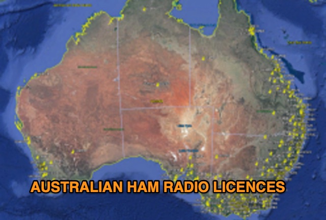 Discover a comprehensive solution for mapping Australian ham radio entities using data from the ACMA Public Register. This tool, developed in Delphi 7, generates KML files for Google Earth, showcasing repeaters, beacons, and operators across different prefixes. While respecting privacy regulations, the files provide valuable insights into the amateur radio landscape.
 -
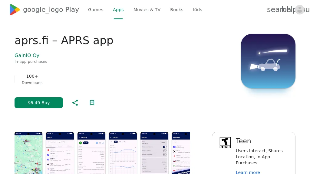 The aprs.fi Android application offers immediate, real-time access to APRS position information, weather reports, and telemetry graphs, allowing users to zoom and browse stations globally without delay. It includes features like callsign and address search with history, multi-station tracking, and map filtering for elements such as weather stations and AIS targets. The app also supports KML and GeoJSON overlay files for enhanced map visualization. Users can beacon their position directly to aprs.fi or connect wirelessly to a Bluetooth, BLE, WiFi, or USB-attached TNC for receiving and transmitting position beacons without an internet connection. The application runs on the robust and fast aprs.fi database, providing _Dark Mode_ support for improved ergonomics in low-light conditions and high-resolution graphics for modern displays, including the full APRS symbol set. While the core application is a one-time purchase, some advanced functionalities, such as APRS text messaging, a high-performance software DSP modem, and _APRS-IS_ beaconing with up to **10 callsign profiles**, require an additional "Extra Features" subscription. This subscription also unlocks RX iGate functionality and extended time ranges for map and graph views, expanding its utility for serious APRS operators.