Search results
Query: UI-View
Links: 9 | Categories: 0
-
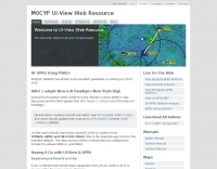 UI-View is an APRS client that runs on Windows. This application differs from most APRS software in that it isn't designed just to be used with TNCs in terminal mode. UI-View also supports TNCs in KISS mode, AGWPE host mode and BPQ host mode. The 32 bit version of UI-View also supports WA8DED/TF host mode, and the variant of it used in the SCS PTC-II and PTC-IIe.
 -
 Amateur radio programs to download, locator , log, etc... for Psion Aprs maps for PC (ui-view)
 -
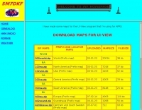 some maps for the UI-View program that SM7DKF is using for APRS
 -
 Dire Wolf is a software soundcard modem and APRS encoder/decoder. It can be used stand-alone to receive APRS messages, as a digipeater, APRStt gateway, or Internet Gateway (IGate). It can also be used as a virtual TNC for other applications such as APRSIS32, UI-View32, Xastir, APRS-TW, YAAC, UISS, Linux AX25, and many others.
 -
 TAHO.EXE, an open-source software, facilitates the creation of APRS maps for _UI-View_ by converting free data from _OpenStreetMap_ into the required *.JPG and *.INF file formats. This utility, developed by Dimitri Junker with specific UI-View format support added at the request of HB9DTX, streamlines the process of integrating detailed geographical information into the _UI-View_ platform. It operates on Windows, generating map files with border coordinates in just a few clicks, eliminating the tedious manual creation of *.INF files for custom maps. This converter allows UI-View users to leverage the continuously updated and community-contributed data of OpenStreetMap, which often surpasses commercial map quality in specific regions. The process is straightforward, with a detailed step-by-step guide available on the OpenStreetMap wiki, translated into French and German. TAHO.EXE significantly enhances the utility of UI-View by providing a readily accessible and continuously improving source of detailed, current geographical maps for displaying APRS station positions and objects.
 -
 Amateur radio links to ui-view/aprs sites plus various other bits
 -
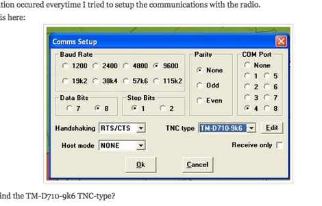 How to establish a APRS local gateway from Internet to Radio with a TM-D710 and UI-View, the well known software from G4IDE
 -
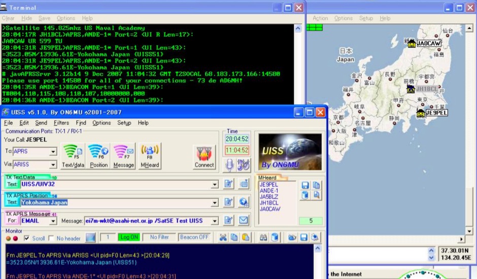 An Easy Guide to UI-View32 and UISS produced by Mineo Wakita, from installing UI-View32, setting up and configuring software and using the UISS
 -
 Demonstrates the practical application of APRS (Automatic Packet Reporting System) through the lens of HB9PVI's activities in Switzerland. It covers the system's core function of reporting geographical positions and telemetry data from various objects, including mobile stations, aircraft, and the ISS, distributed via packet radio and internet gateways. The resource highlights the routing paradigm shift introduced in April 2005, specifically the recommendation to use _WIDE1-1_ instead of RELAY and WIDE for digipeating to reduce duplicate packets. The page presents real-time maps displaying the positions of amateur radio stations in Switzerland and around Bern, updated every few minutes. It details specific callsigns like _HB9BA-2_ (HB9PVI's home QTH), _HB9BA-8_ (a weather station), and _HB9BA-4_ (a WIDE digipeater on Weissenstein mountain), providing context for their roles within the local APRS network. Links to track HB9PVI's mobile operations (_HB9PVI-9_) and handheld devices (_HB9PVI-15_, _HB9PVI-7_) are also provided. Furthermore, the resource curates a list of APRS software options for various operating systems, including _JavAPRS_ for Europe, _UI-view_, and _X-Astir_ for Linux, alongside digipeater/IGATE software like _DiXPRS_. It also offers downloadable APRS information, including a PDF article by HB9PVI and HE9ZGN, and a PowerPoint presentation in German, making it a repository of practical and historical APRS data.