Amateur Radio Maps for Effective Operation
Navigate Your Radio Contacts
Amateur Radio Maps provide essential tools for operators to enhance their communication capabilities. These maps include Grid Square Maps, Azimuthal Maps, and DX Maps, Ham Radio Callsign World Map which help in identifying propagation paths, locating stations, and planning effective contacts. By utilizing these resources, operators can improve their DXing and contesting strategies, making their operations more efficient and enjoyable.
Key resources include the DXCC Interactive World Map, GridTracker, and the HamDXMap, each offering unique features for real-time tracking and analysis. These tools support various formats and integration with logging software, enhancing the overall user experience for amateur radio enthusiasts.
Sort:
Related Categories
-
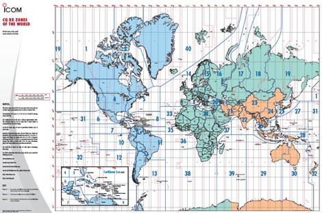 A 6 Mb PDF file of CQ Zones and ITU Zones and prefixes made available to download by Icom America.
 -
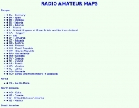
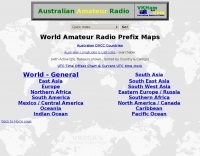
 A large collection of amateur radio maps, including CQ and ITU Zones, a complete set of ham radio Prefix Maps, grid locators and time zones map. An excellent ham radio mapping service.
 -
 A large collection of maps of each dxcc country with general information, banknotes and coins, satellite images, flags and national information where available by SP6NVK
 -
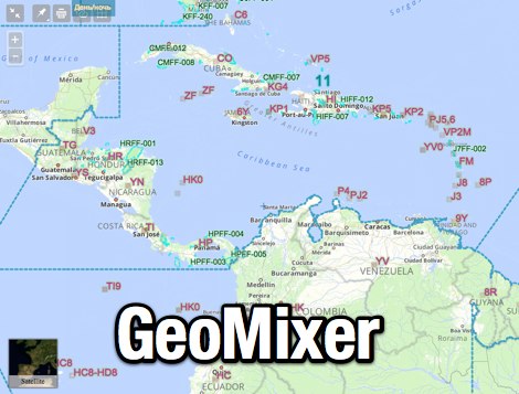 Amateur Radio Maps online mixer of different selectable layers, including DXCC references, IOTA references, ITU and WAZ Zones. Works with most web browsers make heavy javascript usage.
 -
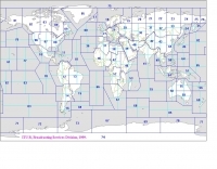
 The ITU and CQ Zones Map is a printable two-page PDF provided by Icom, displaying the world divided into ITU and CQ Zones. The purpose is to assist radio amateurs in identifying and understanding these zones for communication purposes.
 -
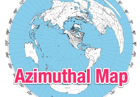 This site provides free azimuthal maps for almost anywhere on the globe. Create your own azimuthal map for your location. You can customize the map in a variety of ways by changing the options in the web form
 -
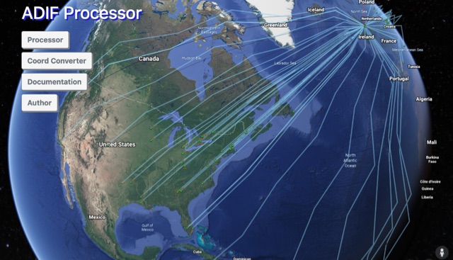 The ADIF Processor is an online application that visualizes amateur radio contacts from an ADIF log file using Google Earth. SOTA CSV log files can also be used. As well as allowing you to view and explore your contacts in Google Earth, you will be able to see a Markdown or text table of contacts, use the output ADIF file which contains QRZ.com data, accurate contact distances and fields populated from comments in the input file. Print QSL labels. One of the benefits of using the ADIF Processor before uploading/storing your ADIF file is detecting errors in callsigns and activity references (e.g. POTA or SOTA references).
 -
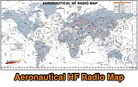 A large worldwide map of aeronautical service Frequencies allocation on HF bands dated 2002
 -
 Interactive map displaying US amateur radio license holders by callsign, gridsquare, zip code, or street address. Features dynamic station loading.
 -
 The page provides a tool to create a customized Ham Radio Az Map on the fly, with various dimensions available. It is a valuable resource for amateur radio operators to visualize and optimize pointing of directional antennas. The content includes maps for different regions, prefix maps, and world maps.
 -
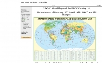
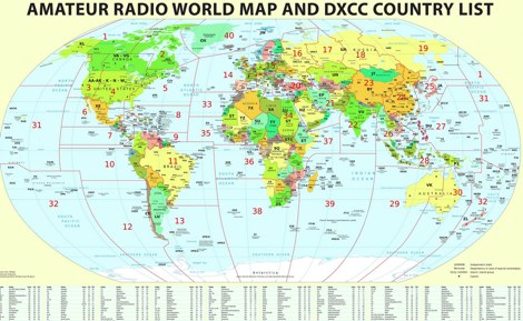 Large picture of a 2011 amateur radio map with DXCC country list
 -
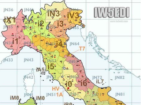 Map of italy with amateur radio prefixes and grid squares
 -
 List and maps of European squares for each call area. You can use the list, to estimate the location, if you hear a station on the band who's locator you do not know.
 -
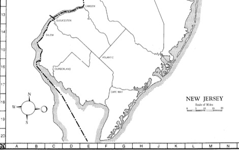
 ARRL WAS Map, Map of USA call districts by ARRL and edited by AA70A
 -
 EU-EW HAM radio regions map by ew2eo
 -
 APRS Central California maps. Here are the APRS maps you should have.
 -
 This page contains a map of Chinese Prefixes.
 -
 This online tool will convert any street address into latitude and longitude and vice-versa by executing queries to several online mapping services like googlemap geocoder maporama terraserver and more by Stephen P. Morse
 -
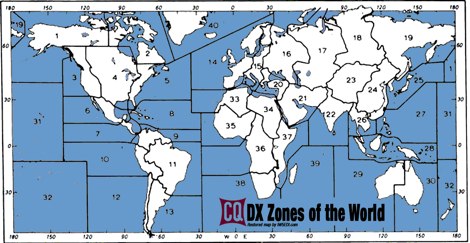 A restored version of the original CQ DX Zones of the world
 -
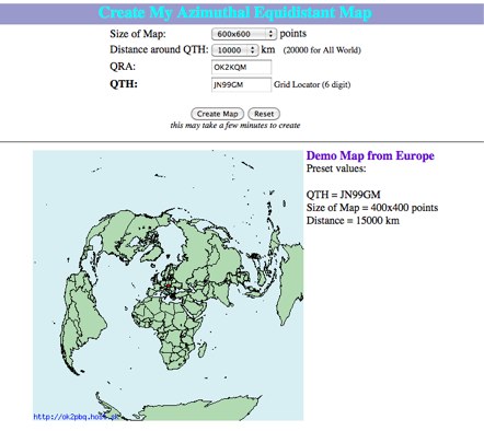 Online generator or Azimuthal equidistand map
 -
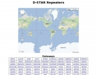 Worldwide jFindU d-star repeaters map
 -
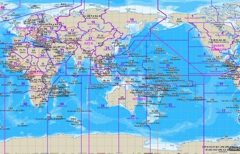
 A large jpeg DX World map that include ITU Zones, grid squares and prefixes. This high-resolution DX World Map is an essential tool for amateur radio operators. It clearly displays ITU zones, CQ zones, grid squares (Maidenhead Locator), and DXCC prefixes, helping you to plan QSOs, track propagation paths, and participate in global contests. Whether you are a seasoned DXer or a beginner, this map provides a clear, detailed view of the radio world, improving your station's efficiency and geographic awareness. Available in JPEG format, it's perfect for display
 -
 The DXCC World Map web application is a modern and interactive mapping tool designed for shortwave radio enthusiasts. It showcases a high-quality world map along with the Sun's position, sunrise and sunset times, the terminator, coordinates, QTH locator, azimuth, azimuth map, current DXCC list, Aurora, and WWV Geophysical Alert Messages. Additionally, it provides the SFI, X-Ray, Kp, and Ap indices.
 -
 The website provides a free to download large Jpeg DXCC map with amateur radio prefixes and CQ zones. It is a valuable resource for radio amateurs looking to identify DX entities and zones for their operations.
 -
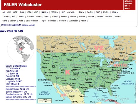 Search for call sign and display maps and dxcc info
 -
 Dynamic Map Progam with 34 maps, 442 overlays, and realtime position/locator info. Online Demo available. 0-59c per map.
 -
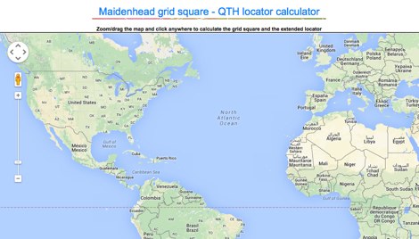
 Ham Radio Maidenhead Grid Square Locator Geocoding with Google Maps by by HA8TKS
 -
 Several grid square maps on the net, including world maps, regional maps and specific country grid square maps, collected by ve2pij
 -
 Amateur Prefix Maps by UT0UM updated with ARRL DXCC and ITU changes, available for download in PDF
 -
 The first interactive map of amateur radio repeaters and more updated in REAL TIME.
 -
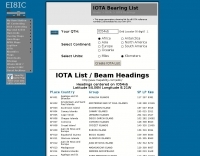 A list of all IOTA reference numbers and IOTA groups for the Islands On The Air award, personalised to your own QTH
 -
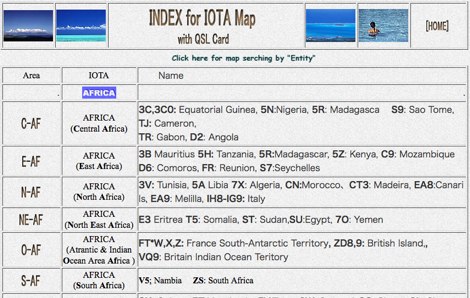 Maps and QSL gallery of IOTA islands all over the world
 -
 iota mapping project - a mapping resource for the IOTA (Islands On The Air) award program
 -
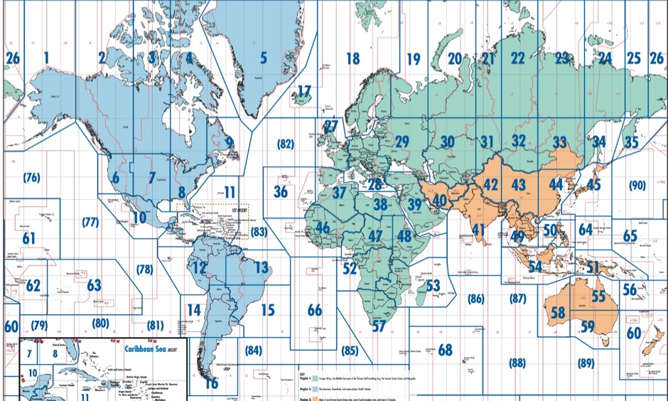
 Explore this high-resolution ITU Zones Map, a critical reference resource for amateur radio operators, international broadcasters, and telecommunications engineers. Originally established by the International Telecommunication Union – Radiocommunication Sector (ITU-R) Broadcasting Services Division (1999), this chart accurately divides the globe into 90 specific CIRAF zones. This authoritative visual guide is indispensable for planning High Frequency (HF) radio propagation, scheduling international broadcasts, and verifying locations for radio contests and awards. Distinct from the 40 CQ Zones, the ITU zoning system provides the official administrative framework used for global frequency management. This digitally enhanced version ensures maximum clarity of zone boundaries and numbering (e.g., Zone 28 for Central Europe), making it an essential tool for technical accuracy in logbooks and station management. It serves as a trustworthy standard for educators, hobbyists, and industry professionals alike.
 -
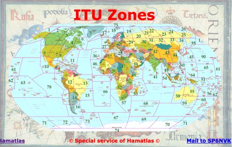
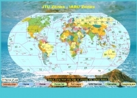 Map of ITU and IARU Zones at hamatlas.eu
 -
 Free Donwload of the PDF file of ITU and CQ zones of the world, made available by Icom America
 -
 LU Argentina Country CALL division Antarctic and South Atlantic prefixes and sufixes
 -
 The image is a all in one map of ITU Zones displaying worldwide regions and zones. It provides information on ITU Regions at IARU website, aimed at radio amateurs and technical users. Image size is in hight resolution and jpeg format, free to download.
 -
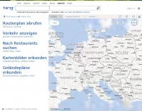 Detailed and searchable maps by mapblast
 -
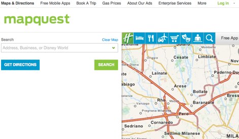 Detailed online and searchable maps, driving directions and city guides
 -
 Lookup callsigns in locator, or locator of a specified callsign and display in google map
 -
 QSO Map Deactivated Due to a new pricing structure for Google Maps APIs (since March 1, 2025), the map function is no longer free to use. For this reason, the QSO Map has been deactivated.
 -
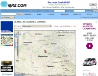 DX Atlas - DX Locations of the World by QRZ.com
 -
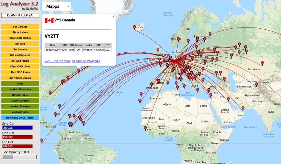
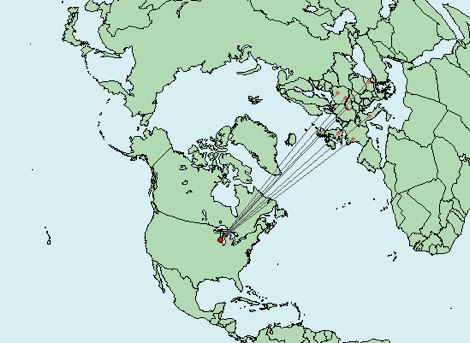 Write down grid squares of your QSOs and this nice online tool will create a World map with all contacts QTH linked to your home QTH. The QSO map picture can be downloaded for resharing.
 -
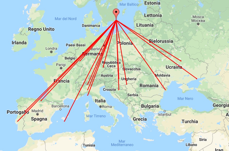 With this tool it is possible to create QSO maps overlay on Google maps there each QSO get a line from the home location to each DX location. An EDI logbook file is used as input. The creation will only use complete locator in the 6 characters format.
 -
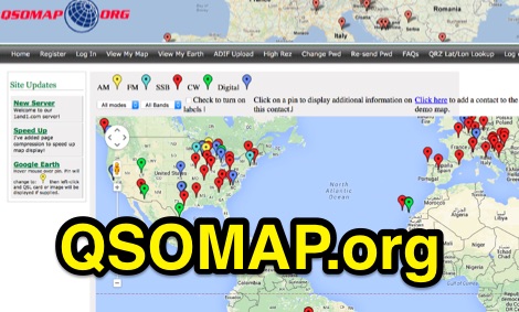 A web site offering a QRZ.com integrated mapping service. Allows creating a google map of your QSOs adding a list of QSOs manually or importing an ADIF log file. Registration and a QRZ.com account is required.
 -
 Collection of world wide radio amateur maps by SP8DA
 -
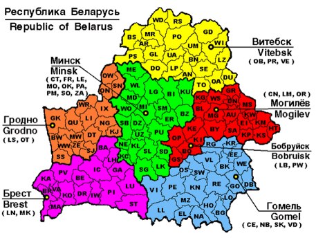
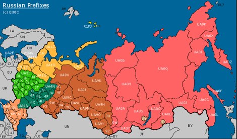 This page contains a map of Amateur Radio Russian Prefixes.
 -
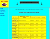 some maps for the UI-View program that SM7DKF is using for APRS
 -
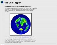 Geographical atlas using radial projection
 -
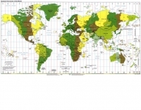 Standard time zone map of the world in a jpeg file
 -
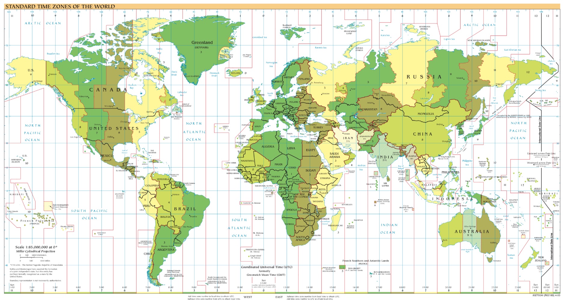 A large printable PDF file representing the world time zones. This map gives an overview of current local times around the world. If you ever asked yourself what time zone am i in, find your answer here.
 -
 Download uiview maps by G3OJZ mostly for APRS UK region
 -
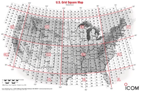 A PDF file containing the US grid square map provided by Icom america.
 -
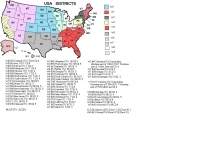 Map of USA Districts
 -
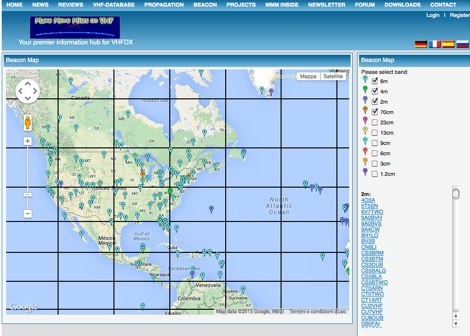 MMMonVHF maintains the data for 6m, 2m, 70cm and 23cm bands in collaboration to LA0BY. This site allow display of a beacon map and latest beacon spots.
 -
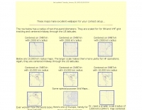 Maidenhead grid maps for VHF/UHF, These maps make excellent wallpaper for your contest setup.
 -
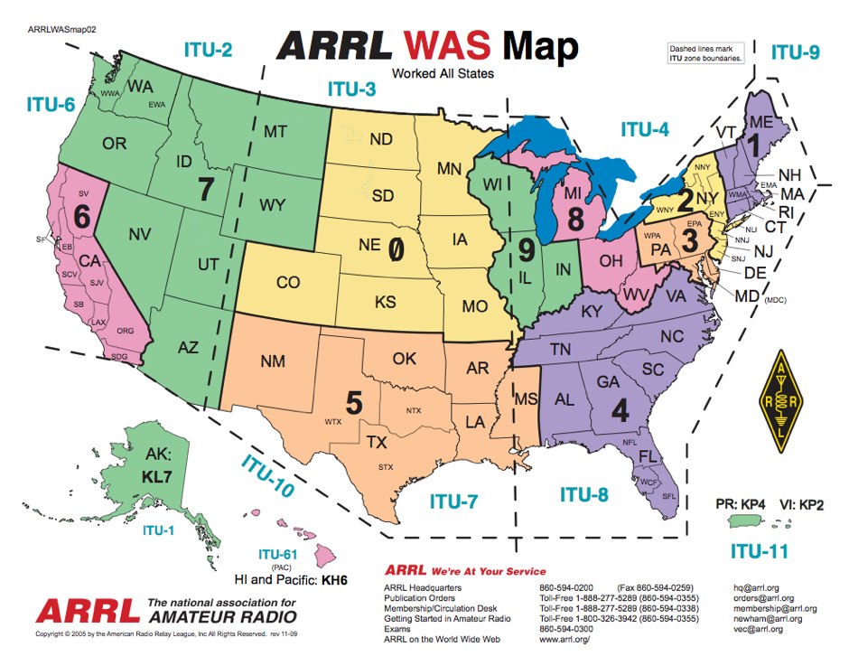 WAS Map, worked all States by ARRL
 -
 Amateur radio world maps by VK2CA including DXCC list.
 -
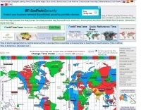 World time zones map with current time
 -
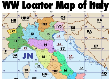 Amateur radio map of Italy with WW locators, provinces abbreviations and Call sign Prefixes, in a A3 size PDF file free to download, made available by IU3KJL Davide
 -
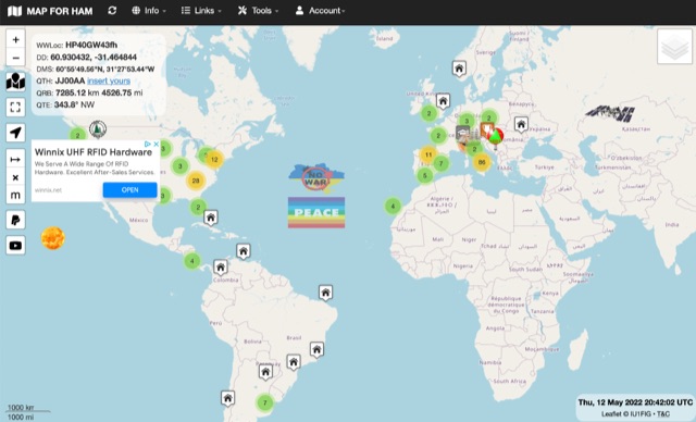
 Developed by IZ3MEZ offer a click and show WW locator information using Google Maps API interface.
 -
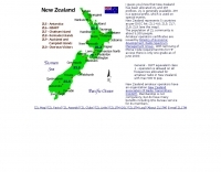 New Zealand ham radio map
 -
 This free amateur radio world map is a scalable vector graphics drawing. Two formats are available a SVG vector graphics and a high resolution PNG bitmap format in 600 DPI resolution. Current map picture has been updated on 2023.
 -
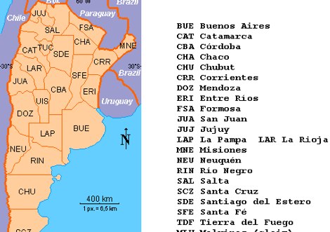
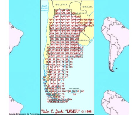 Map of Argentina Locators
 -
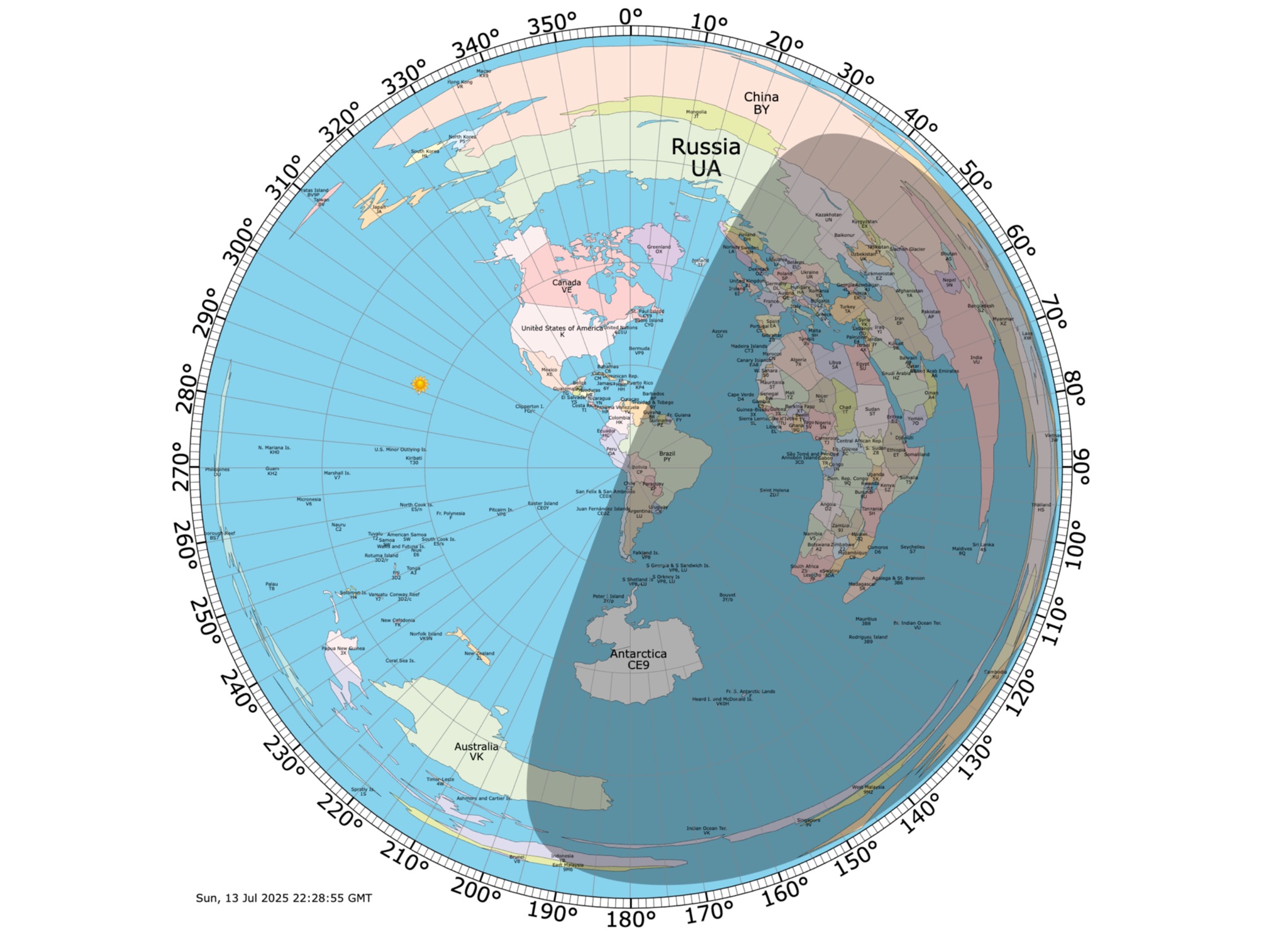 Online coloured Azimuthal Map Generator. By default, this map shows the current gray line. The parts of the Earth that are currently in the sun (i.e., daytime) appear brighter, and the parts of the Earth that are experiencing night appear darker
 -
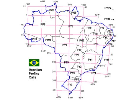 Map of Brazilian prefix call areas
 -
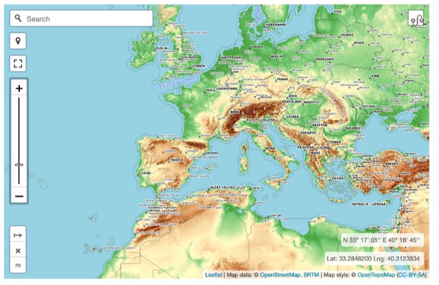 Online interactive elevationmap can help radio amateurs by predicting signal propagation, optimizing antenna placement, planning coverage, ensuring line-of-sight, mitigating interference, and enhancing emergency communication. T
 -
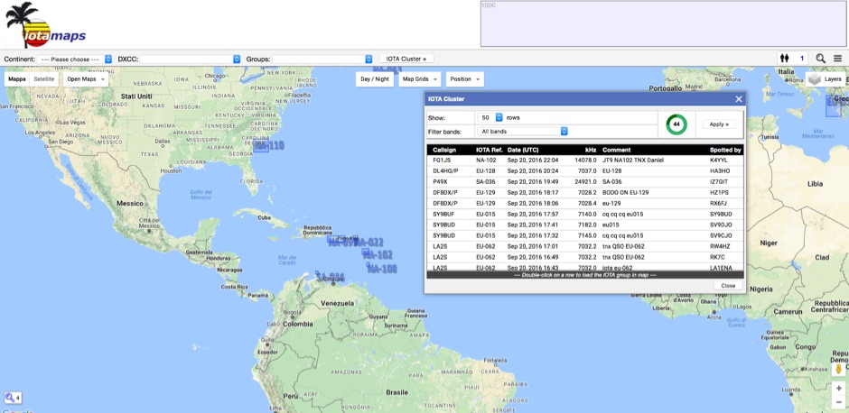
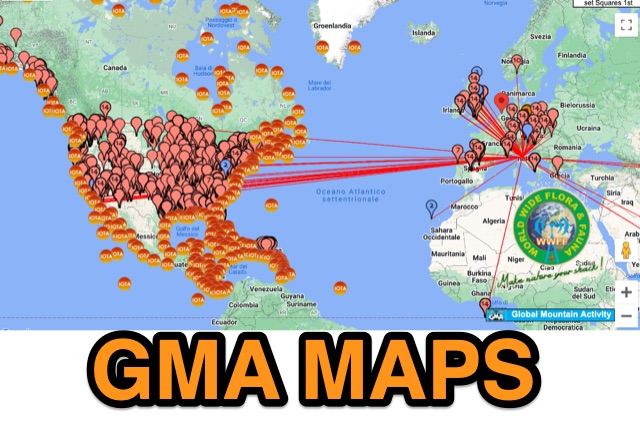 GMA provides an on-line google-map based map with overlays for sota, iota, wwff, lighthouse, mills
 -
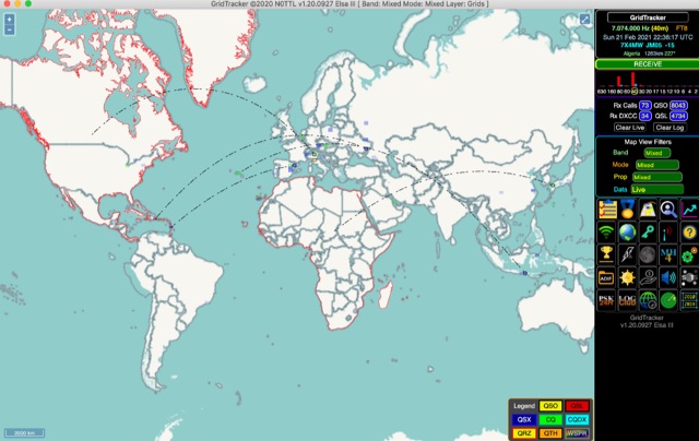 GridTracker listens to live traffic from WSJT-X or JTDX and displays it on a map. It can also load ADIF log files, load clublog, lotw, hrdlog.net and other sources to diplay your logbook statistics and map your QSOs. GridTracker is a free application for windows Linux and MacOS.
 -
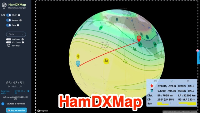 This dynamic DX Map aggregates various resources that will help radio amateurs to operate their stations in search of long distance contacts, DX. HamDXMap displays current MUF values and foF2 critical frequency values around the globe.
 -
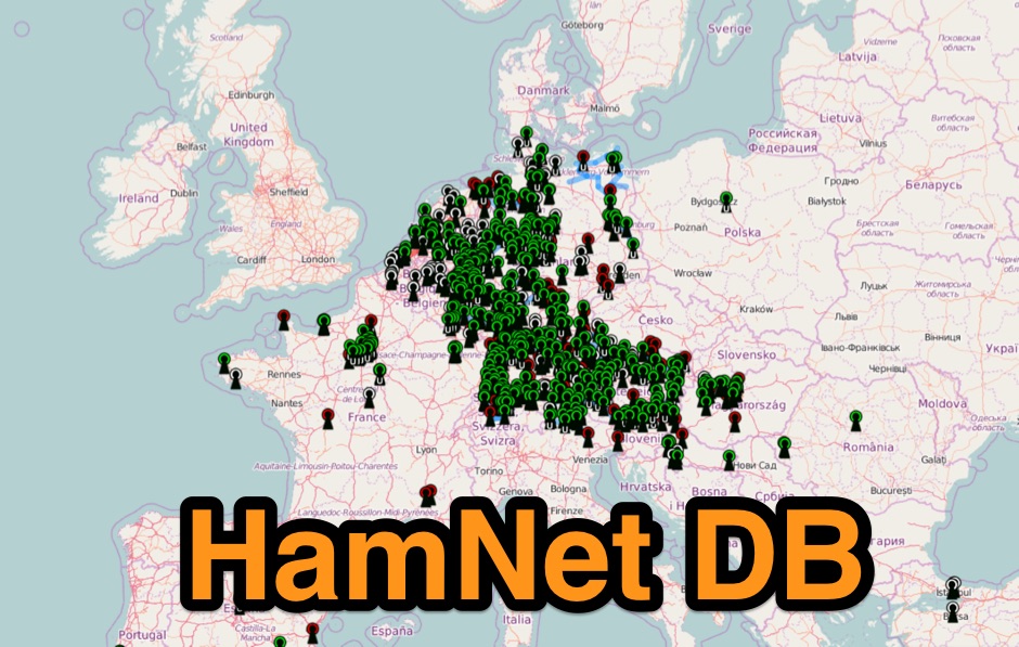 Hamnet IP-Database mapping system mostly european based.
 -
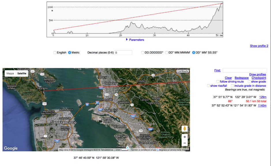 HeyWhatsThat Path Profiler is an online useful tool to do a Line of Sight calculation between yourself and the another station
 -
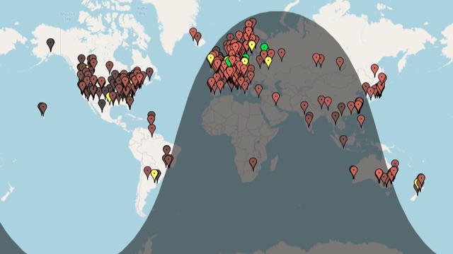 A live map of current KiWiSDR receivers available on the network. It allows users to explore a directory of web-controlled receivers for listening to HF and VHF stations worldwide. The site provides access to remote ham radio stations online, making it a valuable resource for amateur radio operators.
 -
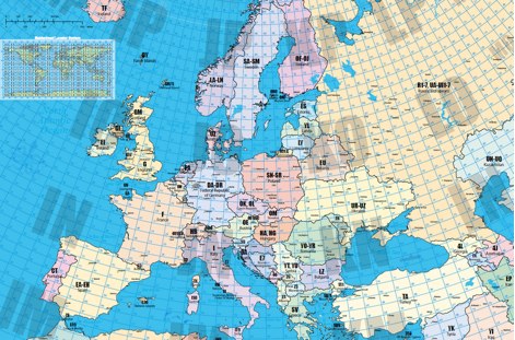 A large locator map of europe available also on printed format by remoteqth.com
 -
 State-by-state maps and log forms you can download to help keep track of your awards
 -
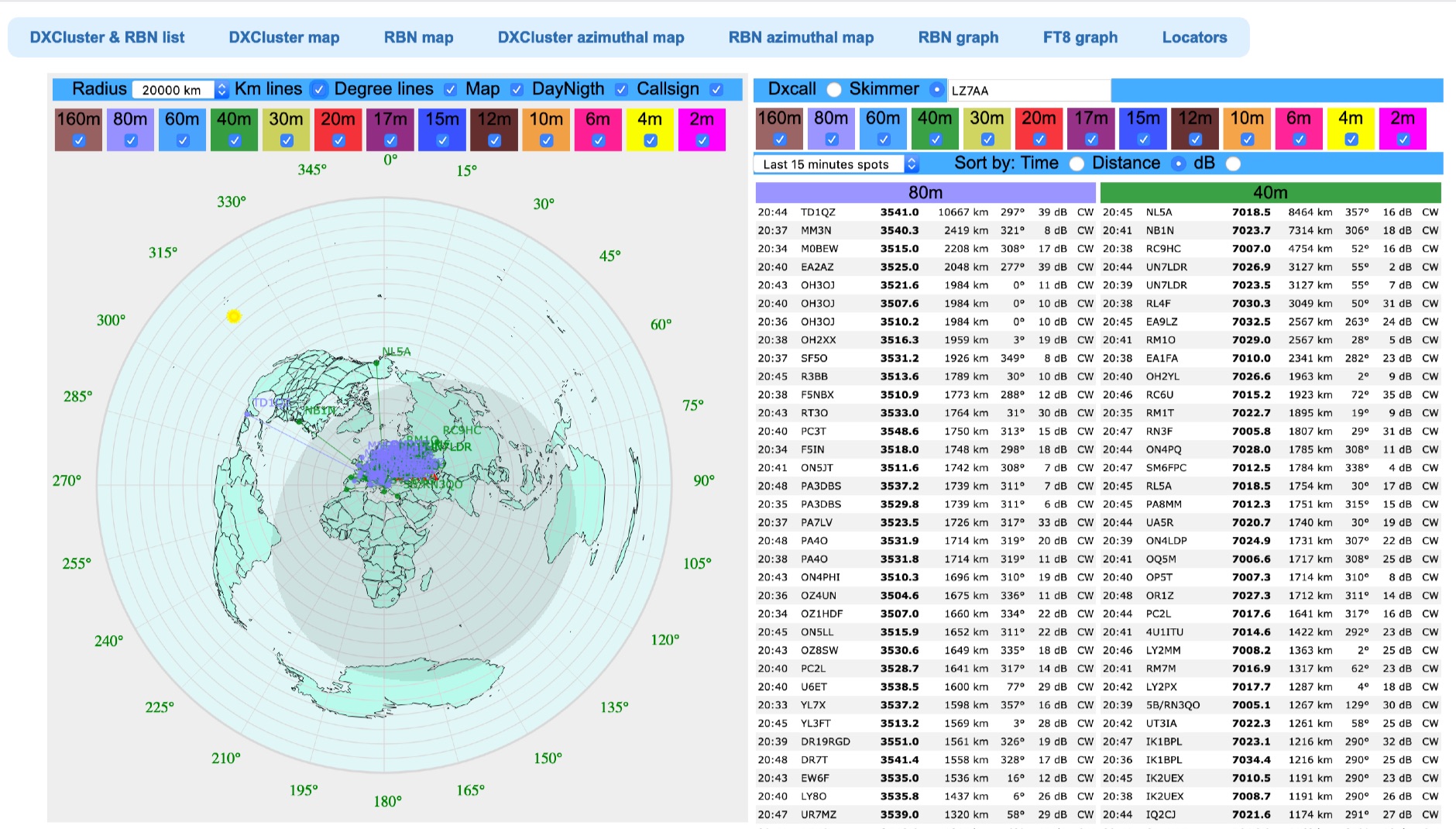 Azimuthal map with DX spot reporting updated online taking source from DX Cluster spot or Skimmer
 -
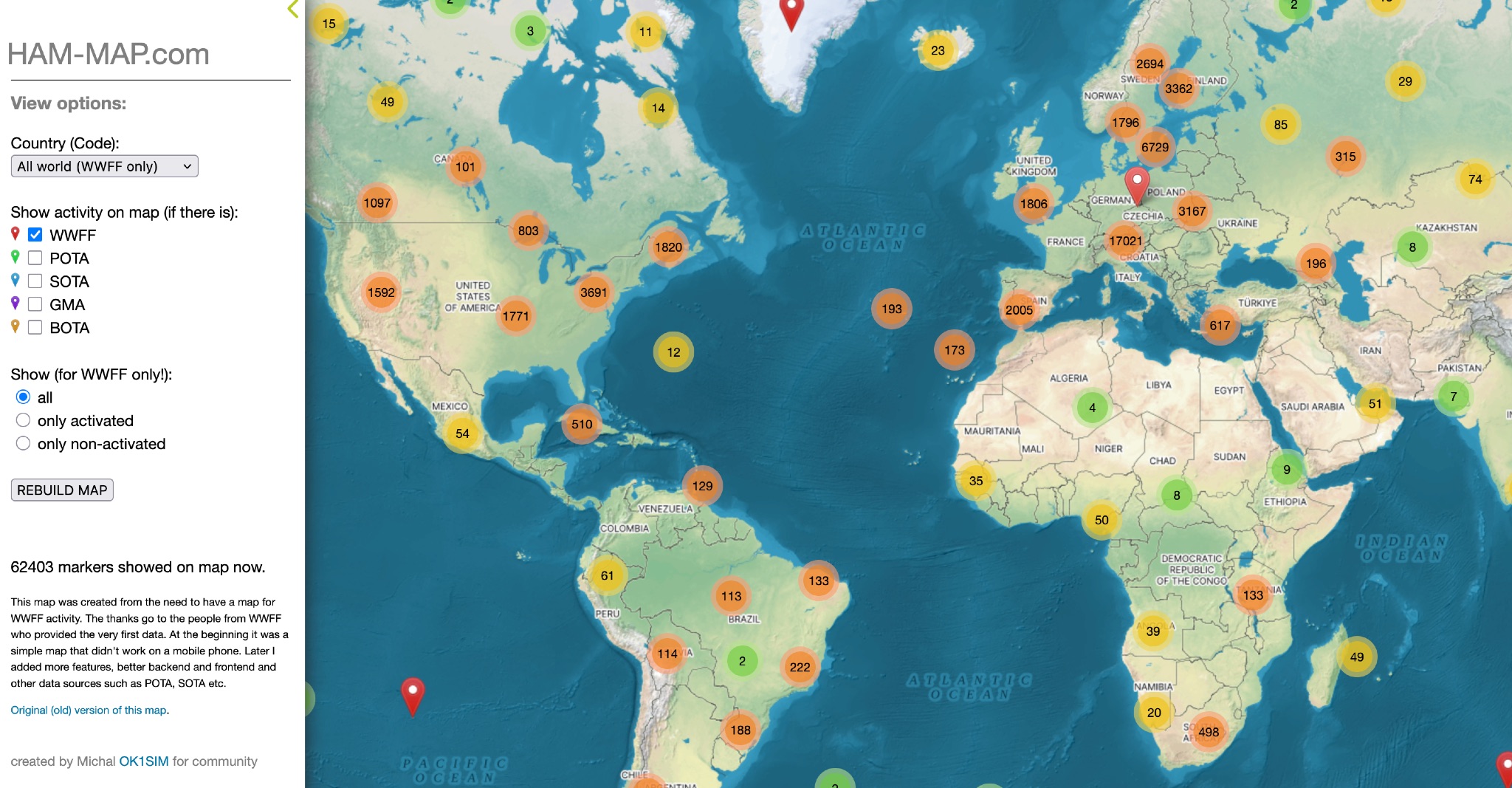 This map was created from the need to have a map for WWFF activity. The thanks go to the people from WWFF who provided the very first data. At the beginning it was a simple map that didn't work on a mobile phone. Later I added more features, better backend and frontend and other data sources such as POTA, SOTA etc.
 -
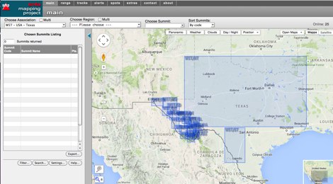 An interactive map for sota operations. SOTA Activators and cheasers will find this summits mapping site very useful resource. Based on Google maps.
 -
 This free PDF file contains two Worldwide grid square maps. The first map displays the fields (first two letters of a maidenhead locator) while the second includes also squares (third and fourth digit) and it can be useful to determine what is your ham radio grid square. PDF file can be enlarged and scaled to A3 and higher dimensions.
 -
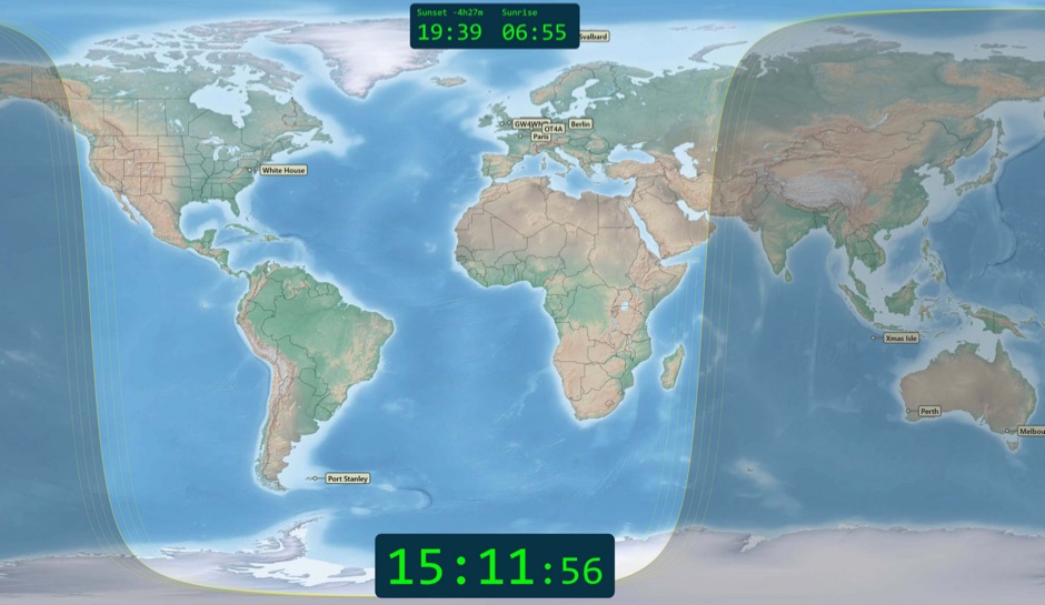 Free windows world map application display current time, sunrise and sunset, greyline map, dx stations, requires windows 7 or higher. The program includes three resized Natural Earth maps which have been resized to 4k or slightly less. By Simon Brown G4ELI better known as the inventor of Ham Radio Deluxe.
 -
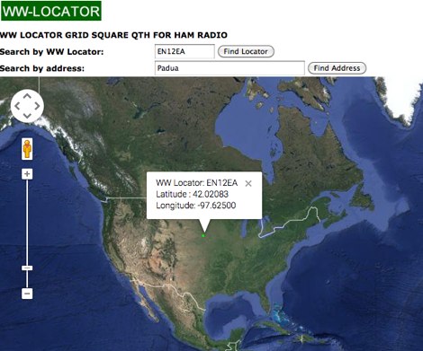
 WW Locator grid square map and QTH locator made with google maps for ham radio
 -
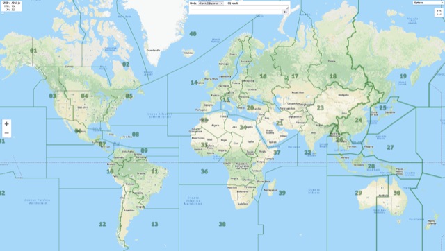 Show CQ and ITU Zone in an interactive clickable map based on google maps. Additional locator tool tip can be displayed by clicking on points, and a search function it is also available to locate addresses, and locators.