Amateur Radio Maps and Azimuthal Projections
Find specialized maps for amateur radio, including azimuthal equidistant projections and world prefix charts.
Amateur radio operators often use specialized maps to visualize propagation paths, plan antenna directions, and understand call sign prefixes around the world. These maps are essential tools for DXing, contest operations, and everyday QSOs, helping hams to quickly identify grid squares and geographical features relevant to radio activity.
Many hams rely on custom azimuthal equidistant projection maps to show true great circle bearings from their station to any point on Earth, optimizing antenna projects for specific DX targets. Large wall maps, like the ARRL Amateur Radio Map of North America, provide detailed geographic information, call sign prefix boundaries, and grid squares. Other resources, such as the RSGB Ham Maps, offer global prefix overviews, helping operators quickly locate countries and their associated call sign blocks for better band planning and DX spotting.
-
 This large, colorful wall map features current geographic detail and labels, grid squares, call sign prefixes, boundaries and more.
 -
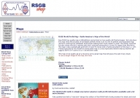 RSGB World Prefix Map - Radio Amateur's Map of the World