Search results
Query: amateur radio map
Links: 126 | Categories: 5
-
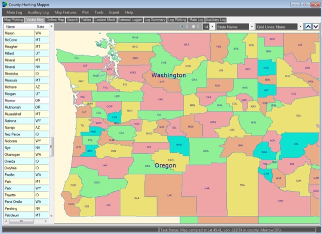 A unique, easy-to-use Amateur Radio program for creating County, State, Section and Grid Locator outline maps of North America that can be filled by Hand, from a Contest Logger UDP Feed, or from Imported ADIF or Cabrillo Logs.
 -
 MLog 0.8d is a freeware logging software designed for Windows operating systems (NT, 98, ME, 2000, XP) that facilitates the logging, management, and analysis of amateur radio QSOs. It features a customizable input mask for rapid contest logging, a robust search function for existing contacts, and immediate data storage in CSV format to prevent data loss. The software also includes a double-check mechanism against reference logs during callsign entry, integrated DXCC information, and a "magic field" for streamlined data input, all within a single-window interface. Key functionalities include graphical QSL card management via _QSL-Collection_, CW output through soundcard or PC speaker, and direct access to _Radio Amateur Callbook_ data. MLog supports transceiver control via _Ham Radio Deluxe_ URLs, offers a detailed world map with locator conversions, and can launch _VOACAP_ through _HamCap_. It provides extensive data analysis options for QSLs, _Locator_ large fields, _DOKs_, _DXCCs_, QSO counts, and user-defined contest evaluations, alongside flexible import/export capabilities for various log formats.
 -
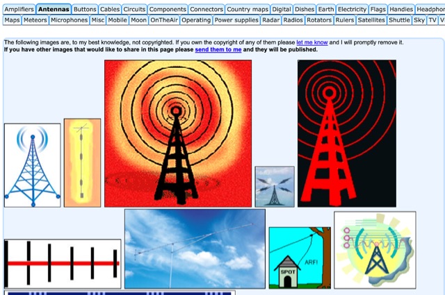 HAM radio related clipart gallery, is a large collection of amateur radio gifs and jpeg images classified in several categories
 -
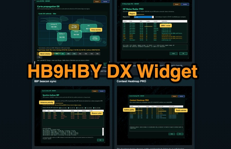 Demonstrates the _Widget DX HB9HBY_ software, a compact desktop application for amateur radio operators, providing essential real-time information. The widget displays UTC time, current HF propagation conditions, local weather, and thunderstorm risk. It also integrates radio-related links and offers advanced PRO functions, such as a DX map, HF noise radar, IBP beacon synchronization, contest heatmap, aurora radar, and a rare DX radar. The software is available for Windows 10/11 and Linux, with a macOS version planned for future release, and supports both French and English interfaces. Author HB9HBY highlights the widget's simple installation process and automatic update capabilities, which can be silent for minor fixes or include notifications for significant changes. The free version provides core functionalities, while a 15-day free trial unlocks the PRO features. A lifetime PRO license is available for a one-time payment of CHF 10, activating advanced tools that help operators make quicker decisions at the station by correlating propagation, UTC, DX activity, and local conditions, though results remain indicative and require confirmation via listening or tools like _RBN_ or _PSKReporter_.
 -
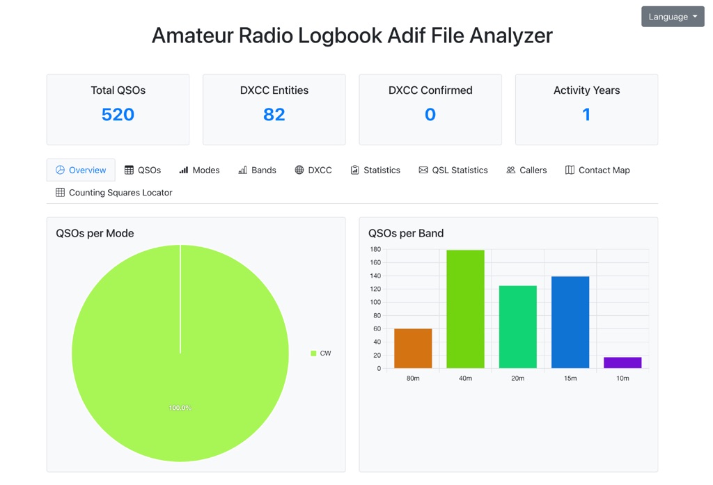 The Amateur Radio Logbook ADIF File Analyzer available at loganalyzer.sv5fri.eu is a convenient web-based tool that allows you to upload your ADIF log and instantly generate a visual map of your QSO contacts along with detailed statistics—by band, mode, time, grid squares, DXCC, and more. It provides an intuitive overview of your operating patterns and performance without requiring any software installation.
 -
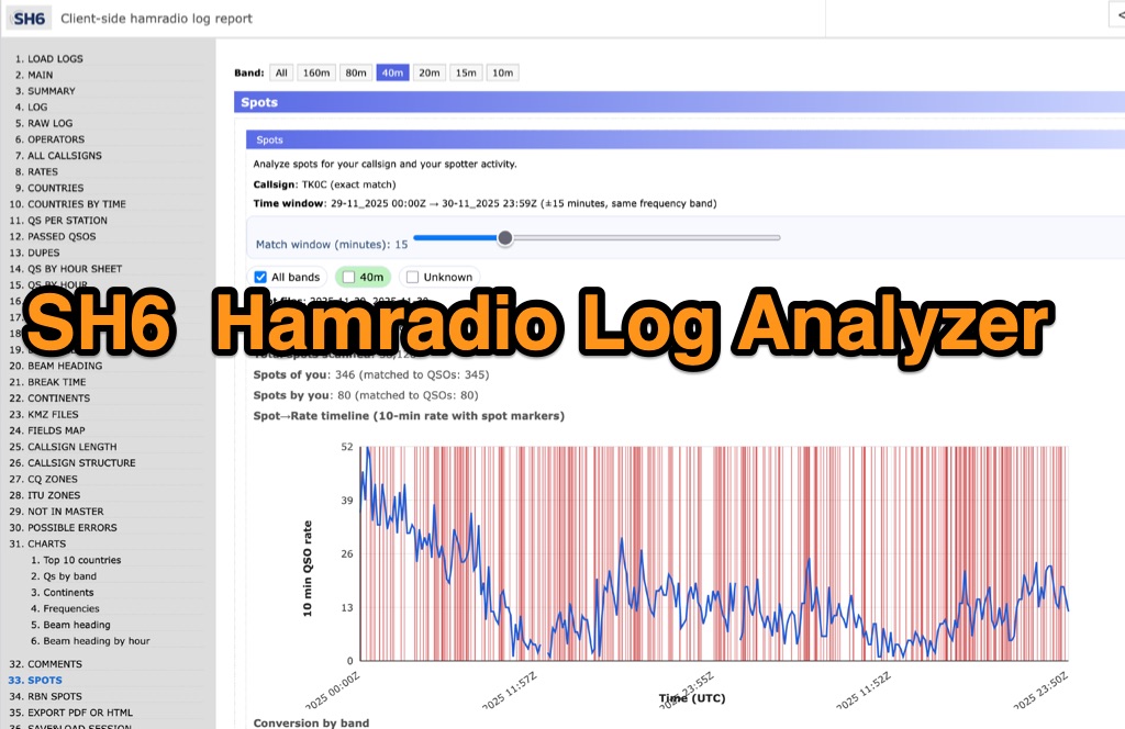 SH6 is a versatile, browser-based utility designed for the detailed analysis and visualization of amateur radio contest logs. Supporting standard formats such as Cabrillo and ADIF, the tool allows operators to upload personal files via drag-and-drop or access a searchable public archive containing over one million logs. Key capabilities include comprehensive performance metrics, offering summaries of band breakdowns, QSO rates, and beam headings. Furthermore, SH6 provides advanced geographic visualization through interactive maps, analyzing contacts by country, zone, and continent. A standout feature is the side-by-side comparison mode, enabling users to contrast two distinct logs for strategic assessment. SH6 transforms raw log data into actionable insights regarding operator performance without requiring software installation.
 -
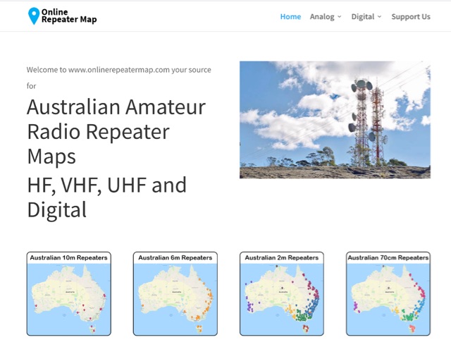 Online Repeater Map aims to help Australian amateur radio operators quickly and easily visualize the location of ham radio repeaters
 -
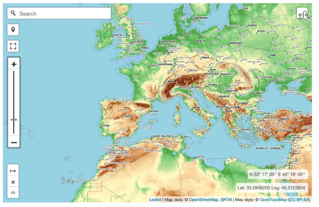 Online interactive elevationmap can help radio amateurs by predicting signal propagation, optimizing antenna placement, planning coverage, ensuring line-of-sight, mitigating interference, and enhancing emergency communication. T
 -
 This article published on QEX details measurements of tree conductivity and permittivity at HF frequencies, addressing a long-debated topic in amateur radio. N6LF conducted experimental impedance measurements on Douglas fir and maple trees using a vector network analyzer with rings of nails inserted into tree trunks. Results showed that tree conductivity increases with frequency while relative permittivity decreases, similar to soil characteristics. Measured conductivity ranged from 0.06 to 0.4 S/m at 10 MHz, aligning with values used in previous research. These findings validate that NEC modeling can reliably estimate trees' substantial impact on HF antenna performance.
 -
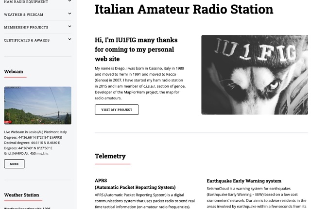 My name is Diego, I was born in Cassino, italy in 1980 and moved to Terni in 1991 and then to Recco (Genoa) in 2007. I have started my ham radio station in 2015 and I am member of c.i.s.a.r. section of Genoa. Developer of the MapForHam project, the map for radio amateurs.
 -
 Operating on the HF and VHF bands, the URE WebCluster serves as a real-time DX spotting network for amateur radio operators. It aggregates DX spots from various sources, presenting them with detailed information such as DX callsign, frequency, mode, and spotter details. The platform integrates essential propagation data, including current solar indices like _K-index_ and _A-index_, alongside visual propagation maps, which are crucial for planning long-distance contacts. Users can submit new DX spots, contributing to the collective intelligence of the amateur radio community, and filter existing spots by band, mode, or callsign, enhancing operational efficiency. This resource enables operators to monitor band openings and identify active DX stations, significantly aiding in _DXCC_ pursuit and contest operations. The integration of solar-terrestrial data directly within the cluster interface allows for immediate correlation between propagation conditions and observed DX activity, a feature not universally present in all web clusters. By providing both raw spot data and contextual propagation information, the URE WebCluster offers a practical tool for real-time decision-making during operating sessions, allowing hams to quickly adapt to changing band conditions and target specific _DX_ entities.
 -
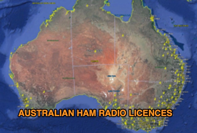 Discover a comprehensive solution for mapping Australian ham radio entities using data from the ACMA Public Register. This tool, developed in Delphi 7, generates KML files for Google Earth, showcasing repeaters, beacons, and operators across different prefixes. While respecting privacy regulations, the files provide valuable insights into the amateur radio landscape.
 -
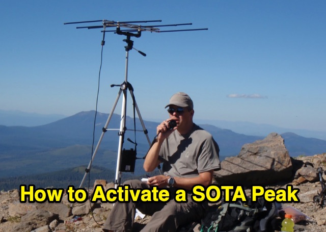 Outlines the essential steps for successfully activating a **Summits on the Air (SOTA)** peak, providing a structured approach for amateur radio operators participating in this popular award program. It details crucial pre-activation planning, including navigating the SOTA website, setting up a SOTA Data account, and consulting the **Association Reference Manual (ARM)** for specific regional rules and peak information. The guide also covers using mapping resources like adventureradio.de and lists ofjohn.com to identify suitable summits and check access conditions. The document emphasizes safety during the activation, advising operators to monitor weather, carry rain gear, and plan ample time for the ascent and descent. It specifies the **4-QSO minimum** requirement within the Activation Zone and recommends calling "CQ SOTA" on traditional QRP or VHF calling frequencies. The guide also suggests using local 2m FM repeaters for safety communications and spotting, while clarifying that repeater QSOs do not count for SOTA points. Post-activation activities include submitting logs to sotadata.org.uk, uploading trip reports to share experiences with future activators, and promoting SOTA participation on various reflectors. The guide highlights the program's appeal through its awards system for both activators and chasers, encouraging new participants in North America.
 -
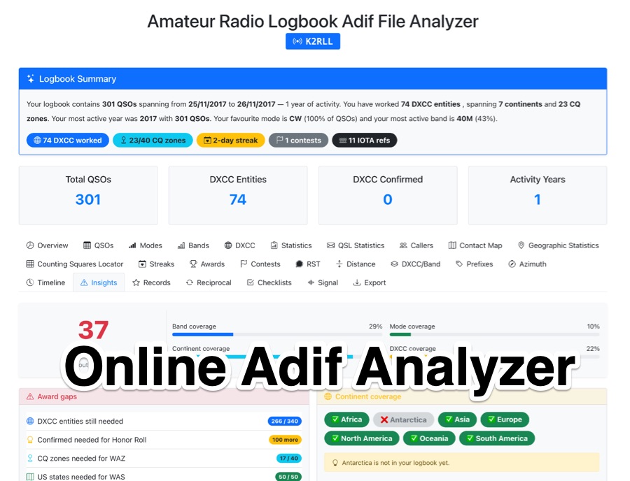 The _Amateur Radio Logbook ADIF File Analyzer_ processes ADIF files locally within the user's browser, ensuring no QSO data is uploaded to a server. It generates a visual map of contacts and detailed statistics across various parameters, including band, mode, time, grid squares, and DXCC entities. The tool offers insights into operating patterns and station performance without requiring any software installation. Users upload their ADIF log files directly, and the analysis is performed client-side, providing immediate results. The output includes charts and graphs that visualize QSO distribution and activity. This approach prioritizes user privacy and data security, as logbook information remains on the user's computer throughout the analysis process. The analyzer supports standard ADIF formats, enabling hams to quickly review their log data for trends and achievements. It is a free, open-source utility designed for general amateur radio log analysis.
 -
 Demonstrates a cloud-based suite of tools for amateur radio operations, eliminating local software installation. The platform integrates a comprehensive logbook with import/export functionality, an _eMap_ application displaying DX spots, user locations, and grayline data, alongside a dynamic band map derived from DX cluster information. It also provides a _vQSL_ system for QSL management and a mailbox with QSO verification. Users can access a Web DX cluster to monitor spots and _DXCC_ status, or connect via Telnet using external programs like _Logger32_ or Ham Radio Deluxe. The cluster supports advanced spot filtering by QRG, spot call, spot from, and origin, with configurable mail alerts based on IARU zone filters. Additional features include a real-time chat for skeds, azimuth/distance calculations from a user's QTH (with QRA locator), a search engine for spot and logbook databases, a band status matrix, and a propagation tool for MUF calculations, leveraging data from N0NBH.
 -
 Operating a web-based DX cluster, this resource presents real-time amateur radio DX spots, facilitating contact logging and propagation analysis. It leverages the Spiderweb platform, offering users the ability to filter DX spots based on various criteria, including inclusion and exclusion rules. The interface integrates directly with QRZ.com for immediate callsign lookups, displaying flag icons for geographical context, and provides charts and statistics derived from spot data. Further enhancing its utility for DXers and contesters, the cluster includes direct links to MUF (Maximum Usable Frequency) maps and HamQSL solar condition reports. These external data sources provide critical propagation insights, assisting operators in making informed decisions about band selection and operating times. The service also offers Telnet access at dxc.sv5fri.eu:7300 for those preferring a command-line interface.
 -
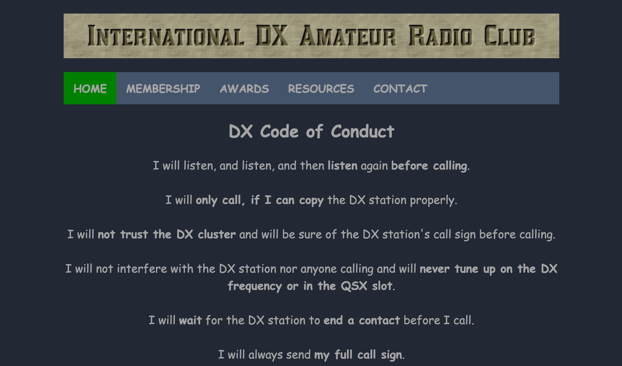 The International DX Amateur Radio Club provides a structured environment for amateur radio operators interested in long-distance communication. The club offers a variety of awards, including the DX Countries Award, DX United States Award, and DX Continents Award, among others. These awards recognize achievements in contacting stations across different geographical areas, such as Europe, Africa, South America, and Asia. The club also supplies resources like DX Spots, Grey Line Map, and Solar Data to assist operators in optimizing their communication strategies. The DX Code of Conduct emphasizes disciplined operating practices. Operators are encouraged to listen carefully before transmitting and ensure they have correctly identified the DX station's call sign. The guidelines advise against interfering with ongoing communications and stress the importance of patience, such as waiting for the DX station to complete a contact before calling. Operators are reminded to send their full call sign and avoid continuous calling, maintaining respect for fellow operators to foster a cooperative amateur radio community. DXZone Technical Profile: DX Awards | DX Code of Conduct | Grey Line Map
 -
 LZ QSL printing serivice have more than 25 years experience with QSL printing. First started as Gold Print Service in 1997 presented by LZ3HI. It provides other printed products for commercial or personal use such as Amateur Radio World Map, Eyeball cards, Business cards, Calendars, Posters, Flyers, Pens etc
 -
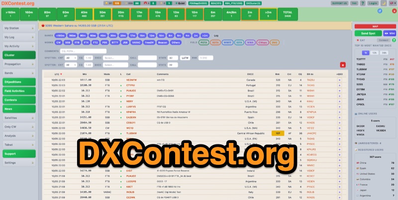 DXContest.org provides a real-time DX cluster, integrating advanced spotting capabilities with features like _propagation maps_, _PSKReporter_, and the _Reverse Beacon Network_. This platform enables radio amateurs to monitor DX activity, apply sophisticated filters to spot data, and even utilize CAT control for their transceivers directly through the web interface. The service is designed for immediate utility, offering free access without requiring user registration. Users can send DX spots, control their radio via CAT, and consult a contest calendar. The platform also provides traditional Telnet access for those preferring client-based cluster interaction. Developed by Pascual R. Salas Vidal, EA5WU, the service aims to be a comprehensive tool for real-time DX operations and contest participation, offering a blend of modern web features and classic cluster functionality.
 -
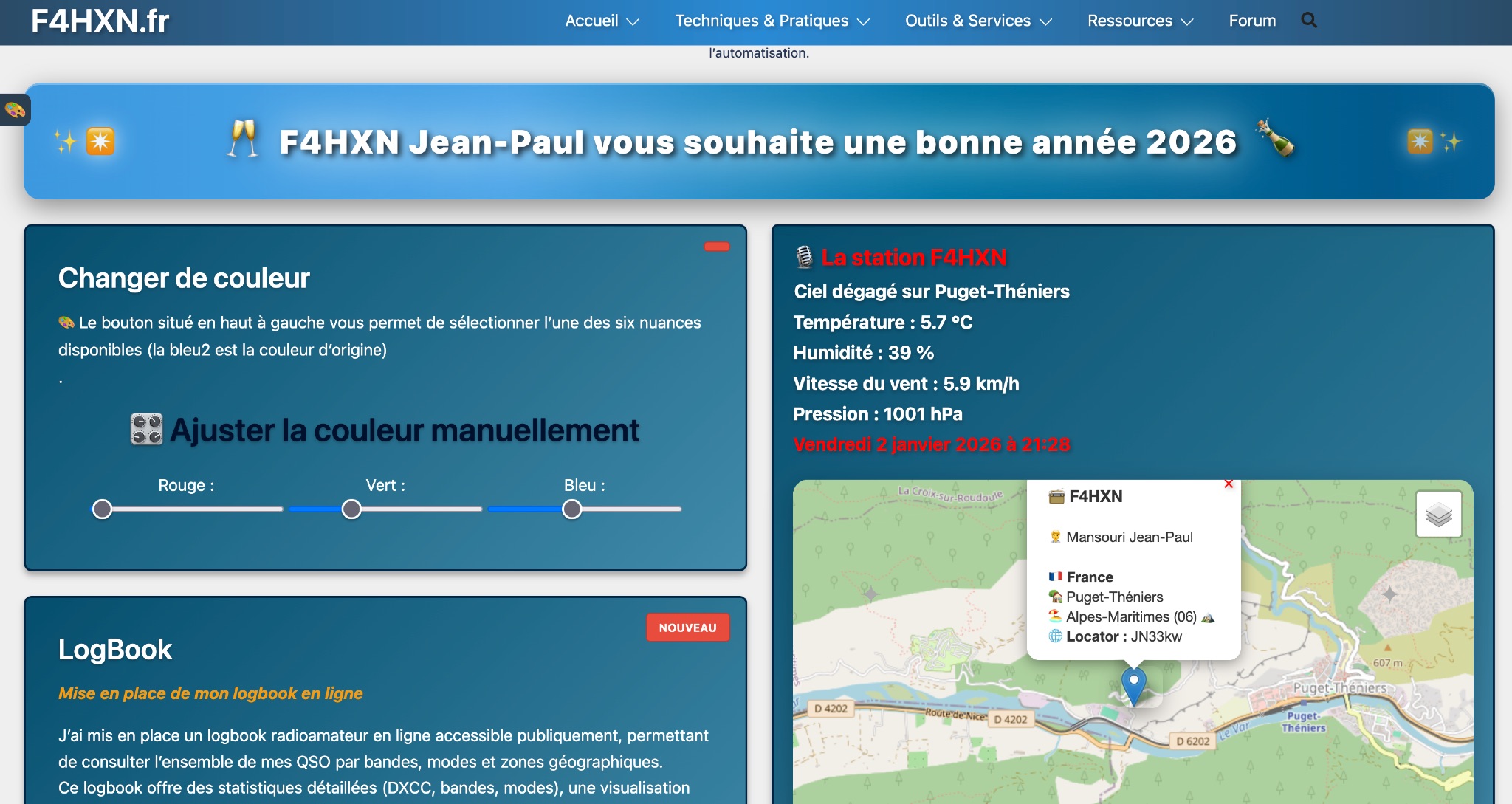 Demonstrates various technical projects and tutorials for amateur radio operators, focusing on digital modes, monitoring, and station setup. It covers topics such as implementing a _WSPR_ station, setting up ADS-B reception, configuring a _DXSpider_ cluster, and utilizing monitoring tools like Prometheus and Grafana. The resource provides practical guides for integrating modern IT solutions with ham radio activities, including Docker and Linux environments for radio applications. This site also features a publicly accessible online logbook, offering detailed statistics on QSOs by band, mode, and geographical zone, with visual mapping of contacts. It includes a comprehensive amateur radio lexicon, explaining hundreds of terms, and provides a real-time display of the F4HXN station's local weather conditions. The resource also aggregates information on upcoming ham radio events and offers a **SWR simulator** for antenna analysis, allowing users to visualize ROS changes based on frequency and antenna parameters.
 -
 Callook provides a **USA amateur radio callsign lookup service** with data current as of March 25, 2026. The platform allows users to search for valid callsigns and retrieve detailed information, including geographic coordinates sourced from the Bing Maps API. A mathematically calculated **grid square** is derived from these coordinates, though accuracy is not guaranteed due to reliance on external services. The service supports multiple access methods, including a browser search plugin, direct API access with a reference, and plain text output for integration into other applications or scripts. This tool facilitates rapid identification of US amateur radio operators, offering an alternative to other callbook services. Its API access enables developers to integrate callsign lookup functionality into custom applications, streamlining data retrieval for logging software or contest management. The direct presentation of FCC data, combined with grid square calculation, assists DXers and contesters in verifying contact information and location details during on-air operations.
 -
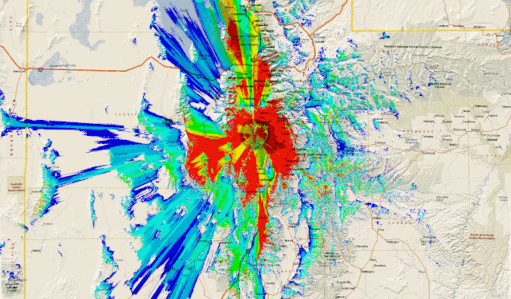 This study analyzes the antenna pattern of the Utah Amateur Radio Club's 146.760 MHz repeater following antenna relocation in 1997. Noting degraded transmission toward the north, a customized signal mapping system using a Yaesu FT-817, GPS, and software was developed to log real-time signal data. Calibration techniques extended the radio's signal range, enabling precise field measurements. The method allowed continuous signal strength monitoring while driving, revealing anomalies in coverage likely due to tower modifications. Findings helped assess and visualize the antenna’s actual radiation pattern and highlighted environmental impact on signal distribution.
 -
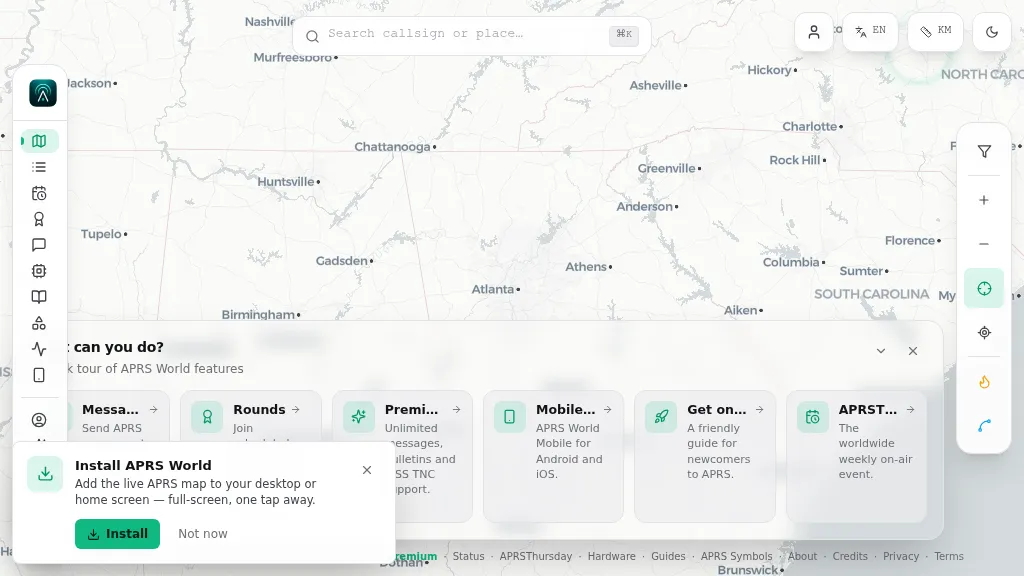 Operating on the Automatic Packet Reporting System (APRS) network, this platform provides a real-time, visual representation of amateur radio stations globally. Users can track callsigns, locate nearby stations, and even send APRS messages directly from a web browser, all without requiring a login. The system integrates live APRS-IS data, presenting it in an intuitive, map-based interface that supports 11 different languages, making it accessible to a broad international audience. Beyond basic station tracking, the platform offers detailed per-station pages, including historical weather data and telemetry logs. This functionality extends to companion Android and iOS applications, which incorporate an RF / KISS-TNC mode, allowing mobile devices to interface directly with APRS via radio. My own field experience with similar APRS visualization tools confirms the utility of such a resource for situational awareness during events or simply monitoring local and regional ham radio activity. The inclusion of weather and telemetry history adds significant value for those interested in environmental data or remote station performance.
 -
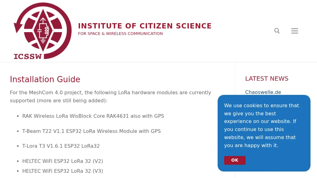 The resource provides a technical installation guide for _MeshCom 4.0_, an amateur radio mesh networking project utilizing LoRa hardware modules. It systematically covers the setup process for several supported devices, including the RAK Wireless LoRa WisBlock Core RAK4631, T-Beam T22 V1.1, T-Lora T3 V1.6.1, HELTEC WiFi ESP32 LoRa 32 (V2 and V3), HELTEC E290, ESP32 / E22 modules, and the T-deck from Lilygo. The guide specifies support for the **EU433** frequency band, ensuring amateur radio compatibility, and details the use of an online flash tool for ESP32 modules and an embedded drive for RAK modules. It further describes accessing the MeshCom 4.0 Dashboard and Map functionalities, crucial for network visualization and management. Firmware configuration for ESP32 modules is meticulously outlined, covering essential parameters such as setting callsigns, country codes, and gateway parameters via a serial console like PuTTY. Commands for activating gateway mode, setting internet IP addresses, and configuring WLAN SSID and password for modules with WLAN capability are provided, enabling modules to function as either clients or gateways within the MeshCom network.
 -
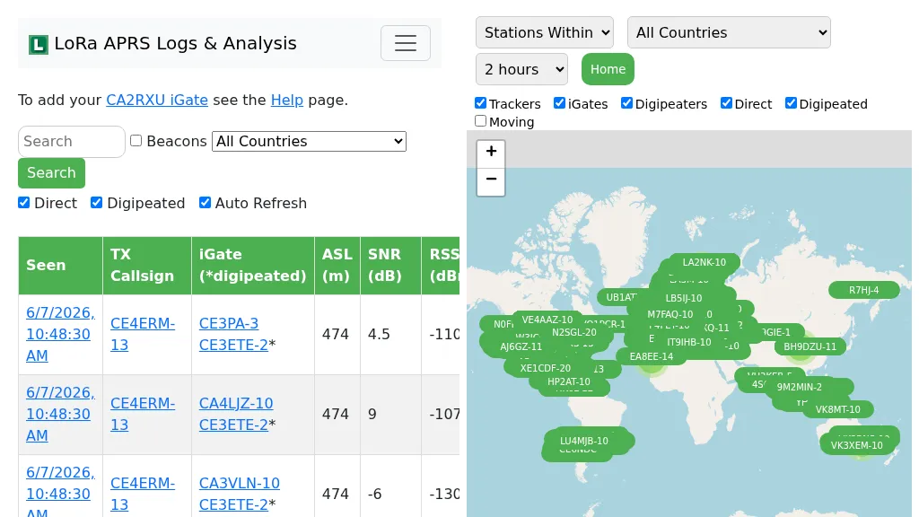 Demonstrates the operational status and reach of the LoRa APRS infrastructure, providing a live mapping and logging service for network participants. Users can verify network coverage, monitor _iGates_, and track mobile stations, observing messages and real-time network activity. The platform offers insights into station locations and data flow within the LoRa APRS system, which is crucial for understanding the performance of LoRa technology in Automatic Packet Reporting System applications. This utility helps amateur radio operators understand where transmissions are being received and processed by iGates, and how mobile units are moving within the network. The site's analysis tools provide RF performance monitoring and metrics, enabling users to assess network efficiency and identify areas for improvement. For example, operators can see how many packets are received by specific iGates, or track the path of a mobile station over a **100 km** range, offering practical insights into signal propagation and network reliability for _packet radio_ enthusiasts.
 -
 Over 44,000 square kilometers of Scotland's natural beauty provide a unique backdrop for the _GMFF_ award program. Designed for amateur radio operators who thrive on portable operations, this program encourages activators to set up stations in designated flora and fauna areas. Participants engage in _SSB_ and _CW_ modes, making contacts from these scenic locations, which are part of the _WorldWide Flora and Fauna_ network. Activators and chasers alike benefit from the program's structure, which awards points for successful contacts. The _GMFF_ program is part of a larger global initiative, allowing operators to contribute to conservation awareness while enjoying their hobby. With a focus on environmental preservation, the program aligns amateur radio activities with ecological interests, promoting responsible and sustainable operating practices. The program's website provides resources for participants, including maps of designated areas and guidelines for operation. By participating, operators not only enjoy the challenge of portable operation but also support the conservation of natural habitats. The _GMFF_ program thus combines the thrill of amateur radio with a commitment to environmental stewardship.