Search results
Query: region map
Links: 18 | Categories: 1
Categories
-
 Several grid square maps on the net, including world maps, regional maps and specific country grid square maps, collected by ve2pij
 -
 The page provides a tool to create a customized Ham Radio Az Map on the fly, with various dimensions available. It is a valuable resource for amateur radio operators to visualize and optimize pointing of directional antennas. The content includes maps for different regions, prefix maps, and world maps.
 -
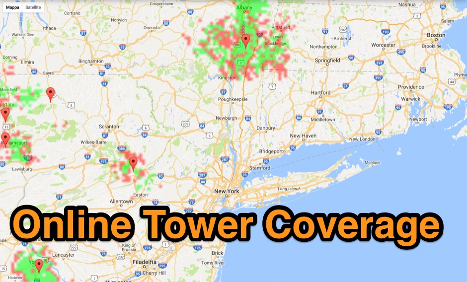 Allow you to create Tower Coverage Maps for any geographical area in the entire world. Maps are based on region and topography, taking into account for hills, mountains and trees. Commercial software allowing a free map trial
 -
 These pages provide general propagation advice for HF communicators. Information available includes inferred global propagation conditions, real time HF fadeout coverage charts, regional ionospheric vertical MUF maps and Hourly Area Prediction charts for Astralia and Asia, Europe and North America
 -
 Illustrates the global distribution of **DX-Cluster** nodes through an interactive map interface, enabling radio amateurs to visualize and access real-time DX spots. The resource provides direct TELNET and HYPER links for each node, facilitating immediate connection to various clusters for up-to-the-minute propagation information and station activity. This visual approach simplifies the process of locating and connecting to a suitable DX-Cluster, whether for local or international DXing. Amateurs can use this tool to quickly identify active clusters in different geographic regions, which is particularly useful for **DXpedition** planning or contest operations. The direct links streamline access, bypassing manual configuration for many cluster types. It serves as a practical aid for operators seeking to monitor band conditions, find rare DX, or participate in competitive operating events by leveraging aggregated spotting data.
 -
 The image is a all in one map of ITU Zones displaying worldwide regions and zones. It provides information on ITU Regions at IARU website, aimed at radio amateurs and technical users. Image size is in hight resolution and jpeg format, free to download.
 -
 Understanding high-frequency (HF) skywave propagation is crucial for amateur radio operators seeking to optimize long-distance communications. This resource details the fundamental principles of HF radio propagation, including the properties of electromagnetic waves, the characteristics of various HF bands, and distinct propagation modes such as skywave, ground wave, and line-of-sight. It places significant emphasis on the ionosphere's pivotal role in refracting HF waves, explaining how solar activity directly influences ionospheric conditions and, consequently, propagation paths. The resource integrates real-time monitoring capabilities, featuring dynamic charts and data from DX clusters, WSPRnet, and the Reverse Beacon Network, which allow users to track current band activity and propagation conditions globally. It also delves into advanced topics like Near Vertical Incidence Skywave (NVIS) and gray line propagation, providing insights into ionosonde data and various propagation prediction models. The site presents a detailed analysis of solar-terrestrial interactions, geomagnetic indices, and space weather phenomena, illustrating their direct impact on HF communication reliability. Practical tools and applications are highlighted, including real-time QSO planners, online Maximum Usable Frequency (MUF) maps, and alerts for solar flares or geomagnetic storms. The guide systematically breaks down complex concepts into accessible chapters, offering a structured approach to learning about ionospheric regions, diurnal and seasonal effects, and the interpretation of propagation indicators like foF2, MUF, and Lowest Usable Frequency (LUF). This makes it a robust reference for hams aiming to deepen their technical understanding and improve operational effectiveness.
 -
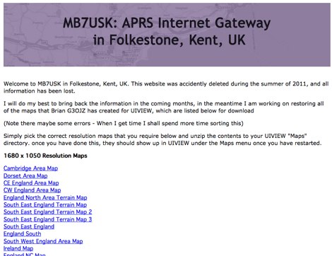
 TAHO.EXE, an open-source software, facilitates the creation of APRS maps for _UI-View_ by converting free data from _OpenStreetMap_ into the required *.JPG and *.INF file formats. This utility, developed by Dimitri Junker with specific UI-View format support added at the request of HB9DTX, streamlines the process of integrating detailed geographical information into the _UI-View_ platform. It operates on Windows, generating map files with border coordinates in just a few clicks, eliminating the tedious manual creation of *.INF files for custom maps. This converter allows UI-View users to leverage the continuously updated and community-contributed data of OpenStreetMap, which often surpasses commercial map quality in specific regions. The process is straightforward, with a detailed step-by-step guide available on the OpenStreetMap wiki, translated into French and German. TAHO.EXE significantly enhances the utility of UI-View by providing a readily accessible and continuously improving source of detailed, current geographical maps for displaying APRS station positions and objects.
 -
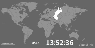 World Map - Time Zones realtime map allow to select and display current time for selected regions
 -
-
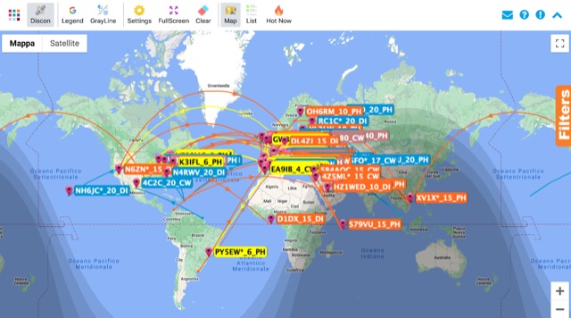 Monitoring real-time amateur radio activity is essential for DXers and contesters seeking rare contacts or tracking propagation. This online service aggregates DX spots from various **DX Cluster** networks, presenting them visually on a world map. Users can observe new spots as they appear, facilitating quick identification of active stations and potential openings. The platform offers filtering capabilities, allowing operators to narrow down displayed spots by specific bands such as 160m, 80m, 40m, 20m, 10m, and even VHF/UHF segments like 70cm and 23cm. Further refinement is possible by selecting the source continent of the spotter or the continent of the DX station, which assists in strategic operating. The service also includes a "Hot Now" list, highlighting currently active stations with recent spots. This dynamic display supports informed decision-making for pursuing **DX contacts** across different bands and geographical regions.
 -
 Accessing this interface provides entry to one of the largest databases for amateur radio voice repeaters, encompassing over 8000 entries from more than 60 countries. The resource supports both desktop and mobile access, with a default display based on browser type, or forced via a "force" parameter (e.g., relais.dl3el.de?force=mobile). Users input a QTH-locator to find local repeater information. The database integrates FM-Funknetz servers and hotspots, potentially creating duplicate entries but ensuring new FM-Funknetz repeaters are immediately displayed. DMR repeater information, including status and talkgroup configurations, is sourced directly from DMR+ / ircDDB and Brandmeister systems, with real-time updates for active and default talkgroups. C4FM/Wires-X installations, particularly MMDVM-based gateways not listed in Yaesu's database, are identified through Brandmeister dashboard descriptions, marked with "W-x" or "W-x#MMDVM" for manual entries. D-Star repeater data from ircddb or QuadNet2 is also incorporated, with entries marked (i), (o), or (d) for manual additions. An APRS interface allows searching by callsign, using Sassan, DL3NCK's database, and offers a mobile-friendly, auto-refreshing display that follows an APRS station. Output data can be generated in GPX format for offline smartphone maps or CSV for spreadsheet applications. The database also attempts to determine valid repeater offsets based on IARU region and frequency, indicated by a "." after the frequency.
 -
 The resource provides an interactive map interface for locating amateur radio license holders across the United States. Users can input a _callsign_, _gridsquare_, zip code, or street address to center the map, which then dynamically populates with station markers. This functionality allows for precise geographical searches, revealing the distribution of hams within specific areas. Upon initial search, the map renders with adjustable zoom and pan capabilities. A key feature is its automatic reload mechanism: after two seconds of inactivity, the map updates to display stations within the newly viewed area. This ensures that the displayed data remains relevant to the user's current focus, whether exploring a densely populated urban center or a more remote region. Further interactive elements include clickable gridsquare labels, which re-center the map, and a "Show gridsquares" checkbox for toggling grid line visibility. Clicking on individual station markers reveals a popup containing the licensee's name and address information, making it a practical tool for geographical station identification.
 -
-
 Approximately 524,475 Brazilian amateur radio operators are cataloged within this resource, offering a comprehensive database for the South American region. Each entry includes geographical coordinates, enabling users to visualize station locations directly within Google Earth. This functionality supports DXers in identifying potential contacts and understanding propagation paths relative to specific Brazilian QTHs. The platform serves as a digital callbook, primarily focused on the Brazilian amateur radio community. It facilitates the lookup of callsigns and associated location data, which is crucial for award tracking, contest planning, and general operational awareness. The integration with mapping services provides a visual dimension to traditional callsign databases, enhancing the utility for operators interested in geographical aspects of radio communication.
 -
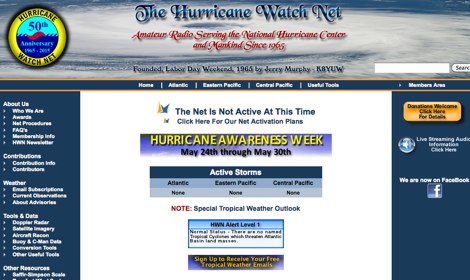 The Hurricane Watch Net (HWN) is an amateur radio organization dedicated to serving the National Hurricane Center and the public since 1965. It plays a crucial role in disseminating real-time tropical weather information for the Atlantic and Eastern Pacific regions. The HWN operates during hurricane events, providing updates and facilitating communication among amateur radio operators and emergency services. This network is essential for ensuring that communities are informed and prepared for severe weather conditions. In addition to its operational role, the HWN offers educational resources and outreach programs aimed at enhancing public awareness about hurricane preparedness. This includes providing access to tracking maps, storm surge information, and safety guidelines. The HWN encourages amateur radio operators to participate in its activities, fostering a spirit of community and collaboration in the face of natural disasters. By subscribing to their email updates, individuals can stay informed about active storms and receive vital safety information.
 -
 Approximately 100 MeshCom nodes are visualized in real-time on a geographical map, providing a dynamic overview of the LoRa mesh network. This resource, hosted by _OE1KFR_, details node positions, telemetry data, and message traffic. Users can measure distances between two selected nodes, view text messages with callsign, destination, and gateway information, and access position data including latitude, longitude, and altitude. The platform supports filtering by regions such as Europe, USA, and Asia, allowing operators to focus on specific geographical areas. The detailed node list table presents comprehensive status information for each node, including gateway callsign, firmware version, hardware type, and environmental telemetry like temperature, pressure, humidity, and CO2 levels. This granular data enables operators to monitor network health and individual node performance, facilitating troubleshooting and optimization of MeshCom deployments. The map interface enhances situational awareness for those engaged in LoRa mesh networking.
 -
 NCPACKET is a club whose mission is to create a social media network in North Carolina and adjoining counties and whose network is Internet free, and based on TARPN technology. The NCPACKET project was started in 2014 and the NCPACKET group was started in 2019. NCPACKET meets at restaurants throughout the networked regions. See the website for maps and callsigns of people who could help you get started in the project.