Search results
Query: distance bearing
Links: 13 | Categories: 2
-
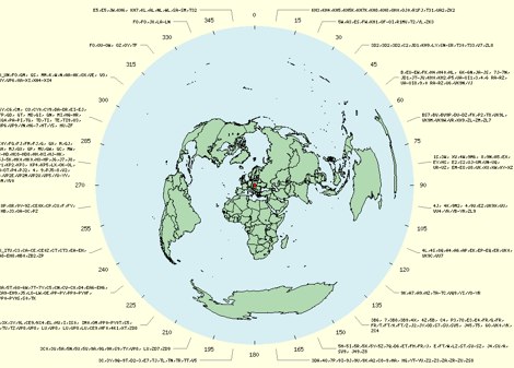 The page provides a tool to create a customized Ham Radio Az Map on the fly, with various dimensions available. It is a valuable resource for amateur radio operators to visualize and optimize pointing of directional antennas. The content includes maps for different regions, prefix maps, and world maps.
-
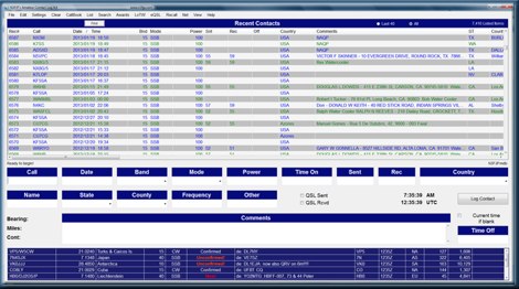 Amateur Contact Log (AC Log) by N3FJP is a commercial Windows-based general logging program designed for amateur radio operators, supporting Windows 7 through 11. It provides comprehensive tracking for various operating awards, including Worked All States (WAS), Worked All Counties, Worked All Countries (WAC), DXCC, VUCC, Grids, Zones, IOTAs, and Lighthouses. The software features a customizable user interface, allowing operators to display specific data fields and adjust font sizes. It includes built-in databases for counties and countries, facilitates queries by band, mode, or power level, and offers a bearing and distance calculator for DX contacts. AC Log also provides DX spotting via Telnet or packet TNC, supports keyboard CW, and can play wave files. The program offers full support for ADIF import and export, enabling seamless integration with external services like eQSL, QRZ, Club Log, and the ARRL's Logbook of the World (LoTW) for QSO uploads and confirmation downloads. It interfaces with popular transceivers from Elecraft, Icom, Kenwood, Ten Tec, and Yaesu, and connects with digital mode software such as WSJT-X, Fldigi, and JTAlert via API. AC Log includes a Net Manager form for group logging, prints basic QSL label strips, and integrates with QRZ and Ham Call lookup services. The software is fully networkable for multi-PC operation, supports Parks on the Air (POTA) logging, and displays worked entities and DX spots on a real-time world map. Full featured Trial version available for 45 days
-
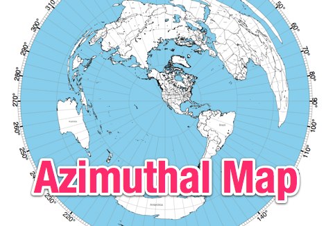 NS6T's Azimuthal Map generator provides a web form for creating custom azimuthal projections centered on a user-specified QTH. Users can input their location using latitude/longitude coordinates, a Maidenhead grid square (e.g., IO91um), or a city name, with support for both US and international locations. The system processes these inputs to render a map displaying true bearings from the specified origin. Output customization includes options for distance, with a recommendation for 17500 kilometers and 8.5" x 11" paper size for integration with PSTRotator software. The generated PDF can be zoomed and clipped for use as a .jpg file in PSTRotator/Maps directories. The tool also offers an experimental color azimuthal map variant. City data for non-US locations is sourced from The World Gazetteer. The resource encourages user feedback and problem reports via comments on the associated blog, aiming for continuous improvement of the mapping utility.
-
 Calculate bearing and distance and Locator online with this Java application, may not work with all browser.
-
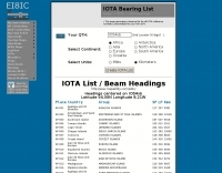 A list of all IOTA reference numbers and IOTA groups for the Islands On The Air award, personalised to your own QTH
-
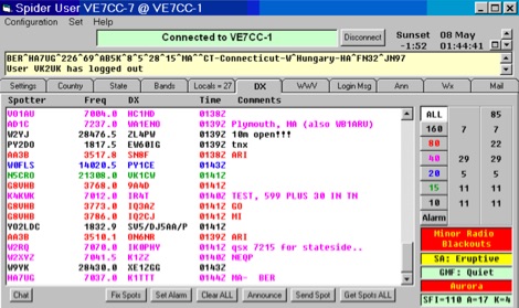 CCUser DX Spot Client is a robust Windows-based Telnet and TNC program for DX cluster systems like CC Cluster, DX Spider, and others. It offers features like multiple Telnet connections, advanced DX spot filtering, bearing/distance display, and integration with LoTW and eQSL. Users benefit from band-specific color coding, missed spot recovery, and detailed DX data, including zones and grid squares. Additional functionalities include chat groups, DX alarms, and WWV data display. It supports logging and contest tools via Telnet, DDE, and RS-232 outputs.
-
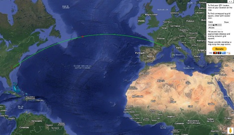 This grid locator map uses Google map apis to find your QTH locator by simply clicking on the map. You can either enter your QTH locator and find the calculated distance and bearing between your QTH and another grid square.
-
 Over 47 full-screen maps are available within _NAOMI_ (North American Overlay Mapper), a free Windows program designed for US and Canadian amateur radio enthusiasts. This mapping suite includes 9 backgrounds such as CQ Zones, ITU Zones, and ARRL Sections, along with 16 foreground layers like Counties, Areacodes, and Grid Locators. Users can calculate distances and bearings, track real-time mouse positions with continuous Grid-Locator data, and integrate with APRS for live station tracking via the FindU database. For a global perspective, the _Global Overlay Mapper_ (GOM) provides a world map, 8 continental maps, and 29 sub-continental maps, all with 12 active layers including Country Outlines, CQ/ITU Zones, and Prefix information. Both NAOMI and GOM offer feature-locate systems to jump to positions based on prefixes, capital cities, or Grid Locators, and provide customized beam headings and distance displays. The site also features _LogView_, a post-contest log visualization tool that analyzes Cabrillo-format logs by plotting QSOs on maps, supporting over 30 major contests like CQWW and ARRL DX, and allowing comparison with published results.
-
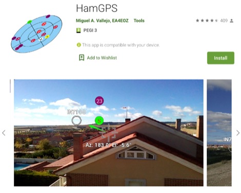 Display your current Maidenhead locator with 10 digit precision. It also computes bearing and distance to a set of target locations using locator or latitude / longitude. Useful to align antennas in VHF / UHF / microwave DX activities. No network or fancy maps usage, so it can be used even in remote locations.
-
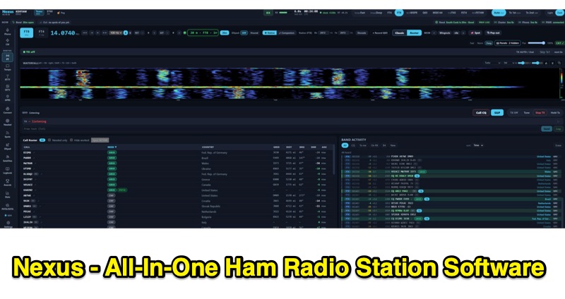 Nexus is a free and open-source ham radio software application, built in Rust by KD9TAW, designed to integrate multiple station functions into a single program. It supports fifteen operating modes, including FT8, FT4, CW, SSB, FM, RTTY, SSTV, and APRS, with both transmit and receive capabilities across Windows, Linux, and Raspberry Pi platforms. The software provides band activity displays with country, distance, and bearing information, a call roster, a 3-D propagation globe with live spots, and alerts for new DXCC, WAS, WAZ, VUCC, and IOTA entities. It also features a native RF panadapter for Icom CI-V and Flex radios, or a live audio scope for other transceivers. Nexus integrates a comprehensive logbook, computes awards offline without requiring an account, and includes repeater search functionality with curated memory packs. It offers CHIRP CSV round-trip compatibility for approximately 1,000 radio models and is compatible with WSJT-X, JTDX, and MSHV via UDP protocol for seamless integration with existing workflows. The application supports ADIF import/export for log data management and provides accessibility features for operators with hearing or visual impairments, including screen reader compatibility and keyboard-navigable interfaces.
-
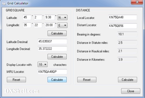 Grid Calculator allows you to calculate either a grid square locator or the latitude and longitude of a location. Grid Calculator can be used to calculate a Great Circle bearing and distance between two stations in statute miles, nautical miles, and kilometers.
-
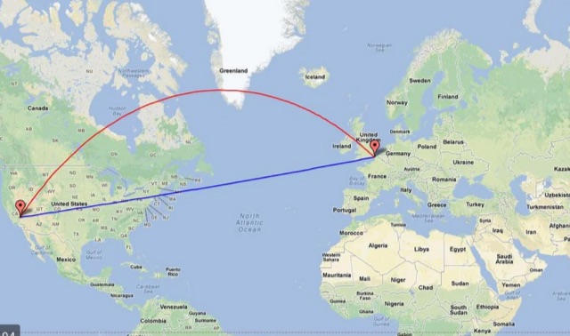 Calculate distance, bearing and more between Latitude/Longitude points. This page presents a variety of calculations for latiÂtude/longiÂtude points, with the formulas and code fragments for implementing them.
-
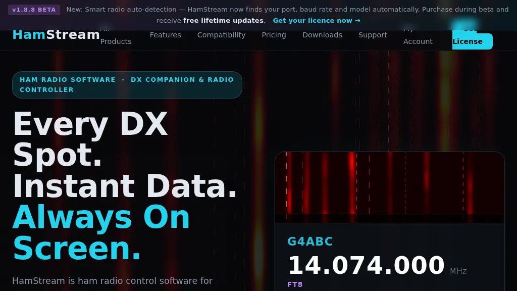 HamStream, a versatile ham radio control software, integrates real-time DX cluster data directly into the operator's workflow, eliminating the need for constant alt-tabbing. As an Extra Class operator, I appreciate how it instantly displays callsign, country, distance, bearing, and QRZ profile data for spotted stations, mirroring the efficiency of a well-organized shack. The software acts as a comprehensive radio controller, reading frequency, mode, and S-meter in real time from connected rigs, supporting CAT via serial, CI-V, _HAMLIB_, and direct connections to _FlexRadio SmartSDR_ and Apache Labs ANAN (via Thetis). Key features include instant QRZ lookups, distance and bearing calculations with a live great-circle minimap, and favorite alerts for specific callsigns. The one-click logging functionality is particularly useful, populating callsign, frequency, and mode into _N1MM+_, Log4OM, DXKeeper, Logger32, StationMaster Pro, and Ham Radio Deluxe via UDP, streamlining contest and casual logging alike. Its smart radio auto-detection for port, baud rate, and model simplifies setup, a welcome relief from manual configuration. Beyond core operating, HamStream also displays 'Also on this frequency' information and can tune the radio to spotted frequencies, enhancing situational awareness. For those who stream their operations, it offers an OBS overlay with live viewer counts and chat integration, making it a compelling tool for modern amateur radio engagement.