Search results
Query: qth location
Links: 13 | Categories: 0
-
 Managing extensive amateur radio contact logs efficiently requires specialized software that integrates various operational aspects. Aether provides a macOS-native logging solution, designed from the ground up using Apple's Cocoa, to streamline QSO entry, organization, and retrieval for Mac users. It supports modern macOS technologies and offers an intuitive interface, aligning with the user experience expected on Apple platforms. The application includes features such as automatic dupe checking, which quickly identifies previous contacts with a station, and awards tracking, indicating if a new contact is needed for specific operating awards. Aether also integrates rig control via RS-232, automatically populating frequency, mode, and power data from supported Elecraft, Icom, Kenwood, Yaesu, and some TEN-TEC transceivers. This automation reduces manual entry errors and speeds up the logging process. Furthermore, Aether offers comprehensive QSL management, including synchronization with eQSL.cc and Logbook of The World, and the ability to print QSO detail and address labels for paper QSLs. It also incorporates automatic callbook lookup from sources like QRZ.com and HamQTH.com, and calculates distance and beam heading, with Google Maps integration for visualizing contact locations. Full ADIF and Cabrillo import/export capabilities ensure compatibility with other logging software and contest submission platforms.
 -
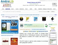 Ham Radio Android Apps to displays your current QTH locator on Google Maps using the GPS or WiFi / network location.
 -
 Beaconmap is a Win95/98/NT program to help listeners to identify the beacon stations of the NCDXF/IARU beacon network. The program displays a flashing dot at the location of the beacon that is currently transmitting. The call sign of the beacon, as well as the QTH is shown in the status bar. By PA1ARE
 -
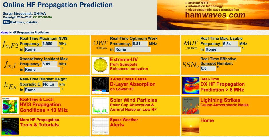 Real-time dashboard with 3000km optimal working & maximum usable frequency as well as maximum NVIS frequency; all for your internet access location.
 -
 The Mobile-Portable Reflector serves as a dedicated discussion platform for amateur radio operators interested in mobile and portable operations. It facilitates the exchange of information and answers questions specifically related to operating amateur radio from vehicles, temporary field locations, or while walking. The platform is not intended for general amateur radio discussions; its scope is strictly limited to mobile-portable topics. Subscribers can access prior postings to review historical conversations and solutions. The list is administered by _dick at k7vc.com_ and operates on Mailman version _2.1.12_. Subscription requires email confirmation and offers optional privacy password protection, with an option to receive daily batched emails.
 -
 A 2x3-foot laminated world map product is detailed, offering customization for amateur radio operators. Each map features two distinct views: one centered on the operator's specific station location and another precisely centered on its _antipode_. Countries are clearly labeled, complemented by a tabular listing of all countries. The map integrates a standard latitude/longitude grid alongside concentric circles that delineate distance increments radiating outward from the operator's QTH. Personalization includes the operator's name, callsign, and location printed directly on the map. This custom mapping service provides a unique visual aid for DXing and propagation analysis, allowing operators to quickly ascertain beam headings and distances from their station. The dual-view presentation, particularly the antipodal centering, offers a practical reference for understanding long-path propagation and identifying potential DX opportunities. The inclusion of distance circles and personalized station data makes it a tailored tool for daily operating and contest planning, distinct from generic world maps.
 -
 Facilitates logging of amateur radio contacts directly within a web browser, enabling seamless operation across various devices including Windows, macOS, Linux, iOS, and Android. This web-based application stores all log data securely in the cloud, providing accessibility from any internet-connected location. It supports importing existing log data via CSV files, with future plans for _ADIF_ file import, and offers a robust QSL card generation feature, producing print-ready PDF files in standard 148mm x 100mm dimensions. The platform integrates with Japanese government databases to automatically populate callsign-related information such as station location and license issue dates, streamlining data entry. It also assists with JCC/JCG searches for accurate QTH logging. The service leverages SSL encryption for all communications and benefits from security oversight by certified information security professionals. Users can register using email/password or existing Facebook/Google accounts, and the beta version is currently available for free. The system has processed over **5,297,881** logs, with **28,369** logs recorded in the past 24 hours.
 -
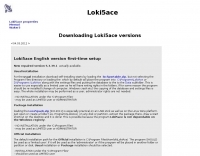 Loki5ace version 5.3.39.1 is a freeware amateur radio logging program designed for Windows operating systems (XP, Vista, 7) and compatible with Linux Wine. The software offers multiple installation methods, including a portable version (loc5portable.zip or Loce5pack.zip) that does not require administrator rights or Windows Registry modifications, making it suitable for USB stick deployment or limited user accounts. An official installation (loc5acest.zip) is also available, typically installing to C:\Program Files\Hamlok\LokiAce\ and requiring administrator privileges for initial setup and updates, with user-specific settings and database files stored in application data folders. The program's database, Loc4ac.mdb, can be renamed to the user's callsign for personalization. Loki5ace supports context-sensitive help, which requires WinHlp32.exe installation on Windows Vista and 7. The software includes features such as special print functions, Telnet Watch with comment display, and an 'Own QTH' field for location management. Updates can be performed via an in-program function or by manually copying the Loki5ace.zip file, which contains the main executable, Loki5ace.exe, to the program folder. The latest version 5.3.39.0 includes repairs for special prints and enhancements to the Telnet Watch feature.
 -
 DX Maps provides a specialized map printing service, focusing on amateur radio applications such as world prefix maps and custom great circle projections. The platform allows radio operators to visualize propagation paths and DX entities relevant to their QTH and operational goals. This service supports the creation of high-quality, large-format maps tailored for shack display or operational planning. The service facilitates the generation of personalized maps, which can include specific callsign locations, beam headings, and other critical amateur radio data points. Users can specify parameters to create maps that aid in understanding global propagation conditions and optimizing antenna aiming for long-distance contacts. The UK-based operation ensures a localized service for European hams, with international shipping options available. DX Maps also offers QSL card printing, complementing its mapping services.
 -
 Approximately 524,475 Brazilian amateur radio operators are cataloged within this resource, offering a comprehensive database for the South American region. Each entry includes geographical coordinates, enabling users to visualize station locations directly within Google Earth. This functionality supports DXers in identifying potential contacts and understanding propagation paths relative to specific Brazilian QTHs. The platform serves as a digital callbook, primarily focused on the Brazilian amateur radio community. It facilitates the lookup of callsigns and associated location data, which is crucial for award tracking, contest planning, and general operational awareness. The integration with mapping services provides a visual dimension to traditional callsign databases, enhancing the utility for operators interested in geographical aspects of radio communication.
 -
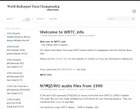 The World Radiosport Team Championship (WRTC) is a unique on-site ham radio competition, typically held every four years, bringing together top operators globally. Unlike traditional contests where participants operate from their home QTH, WRTC competitors travel to a designated location and operate from identical stations under field conditions, ensuring a level playing field. Past events have taken place in diverse locations such as Seattle (1990), Slovenia (2000), Russia (2010), and Italy (2023), showcasing the international scope of this **radiosport** challenge. Because each WRTC event is organized by a dedicated, volunteer-driven committee, historical information and results often become dispersed across various online platforms. This resource serves as a centralized repository, diligently collecting and preserving data from all previous WRTC competitions. It provides a consistent point of reference for participants, enthusiasts, and researchers interested in the history and evolution of this premier **DX contesting** event. The WRTC Sanctioning Committee officially endorses this site, ensuring its accuracy and completeness.
 -
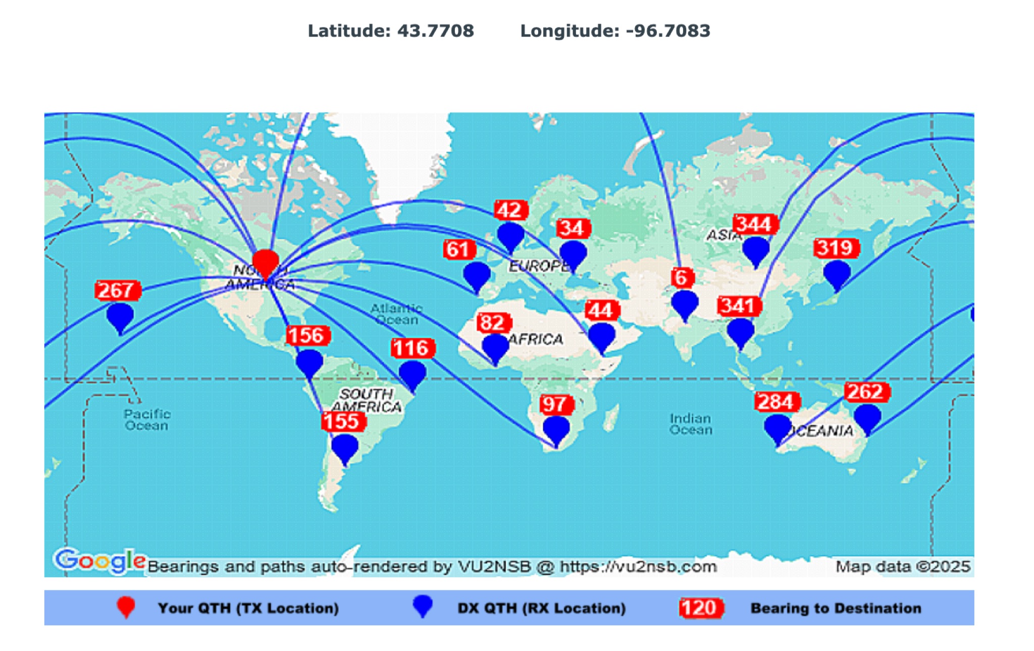 This page by Basu (VU2NSB) presents automatically rendered antenna bearings with geodesic paths projected on a rectangular map. ch geodesic great circle path displayed on the map originates from your location that is derived from your Internet IP address. Therefore the Antenna Bearing Geodesic Map generated below should be accurate and relevant to your physical location (QTH). This map is an alternative to the Great circle Map.
 -
 Demonstrates a cloud-based suite of tools for amateur radio operations, eliminating local software installation. The platform integrates a comprehensive logbook with import/export functionality, an _eMap_ application displaying DX spots, user locations, and grayline data, alongside a dynamic band map derived from DX cluster information. It also provides a _vQSL_ system for QSL management and a mailbox with QSO verification. Users can access a Web DX cluster to monitor spots and _DXCC_ status, or connect via Telnet using external programs like _Logger32_ or Ham Radio Deluxe. The cluster supports advanced spot filtering by QRG, spot call, spot from, and origin, with configurable mail alerts based on IARU zone filters. Additional features include a real-time chat for skeds, azimuth/distance calculations from a user's QTH (with QRA locator), a search engine for spot and logbook databases, a band status matrix, and a propagation tool for MUF calculations, leveraging data from N0NBH.