Search results
Query: weather tracking
Links: 15 | Categories: 1
Categories
-
 Select your favorite satellite and watch its trajectory on Google Maps in real time! Includes ISS tracking, Weather, Geostationary, GPS Military, and of course Amateur radio satellites. N2YO provides comprehensive real-time satellite tracking with particular emphasis on amateur radio satellites. The service offers precise pass predictions calculated for user-specific locations, displaying upcoming passes with azimuth, elevation, and duration data essential for ham operators planning satellite contacts. N2YO features dedicated tracking for amateur radio satellites including FM, linear transponder, and digital satellites, with frequency information and downlink/uplink details. The platform delivers live tracking visualizations on interactive maps, Doppler shift calculations, and automated email notifications for upcoming passes. This free resource integrates weather satellite tracking alongside NOAA imagery, making it invaluable for radio enthusiasts pursuing satellite communications.
 -
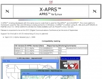 APRS for Linux is a multifaceted system for use with packet radio by Hams, it allows the monitoring of real time geographical information such as the position of vehicles, the status of weather, radio direction finding and much much more. It envolves mapping, GPS tracking, packet radio, etc
 -
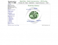 Kantronics produce Modems, Tnc, Kam, Marine, wireless modems. Packet radio communication devices, HF E-mail, paging, GPS tracking, weather data gathering, or wireless data transmission.
 -
 Ground tracks are the trace of the satellite's path over the ground. Amsat, ISS, geosynchronous satellites, navigation satellites, weather satellites, Iridium satellites, visible Satellites. Requires Java
 -
 FindU.com operates as a robust database archiving **APRS** (Automatic Packet Reporting System) data, including weather, position, telemetry, and message reports. It integrates data from both amateur radio APRS systems and the internet-based Citizen Weather Observer Program. This substantial 58 GB database is hosted on dual servers utilizing data replication, processing approximately 20 new reports per second to provide constantly updated information. The system supports various applications, such as displaying weather reports, tracking position data, and facilitating long-term vehicle tracking. A notable function involves forwarding over 100,000 near-realtime weather observations daily to the National Oceanographic and Atmospheric Administration (NOAA) for accuracy checks and use by NOAA and the National Weather Service. Additionally, it archives APRS reports from the International Space Station. Access to the database is primarily via dynamic web pages, with a comprehensive list of available CGIs detailed on a dedicated server page. While direct URL parameter editing is possible for advanced users, alternative web pages with forms simplify query submission. The platform utilizes **PNG** images for dynamic graphics, a choice made due to past GIF patent issues, ensuring broad browser compatibility.
 -
 SWIFT WX Version 2.0 combines a powerful GIS mapping engine with real-time weather maps and storm tracking data making it the most comprehensive storm tracking application available.
 -
 OpenTracker+ and Tracker2 series APRS devices for real-time vehicle tracking, weather monitoring, and remote telemetry, aprs tracker manufacturer.
 -
 The _ISS Detector_ Android application, with over 5 million downloads, offers precise predictions for visible passes of the International Space Station. It notifies users minutes before an overhead pass, integrating local weather conditions to ensure optimal viewing opportunities. The core functionality focuses on the ISS, but in-app purchases extend its capabilities to track other celestial and artificial objects. Optional extensions, available via in-app purchase, allow users to monitor dozens of amateur radio and weather satellites, providing real-time transmitter information and Doppler frequencies. Additional extensions cover _Starlink_ satellites, the _Hubble Space Telescope_, rocket stages, bright satellites, comets, and planets, expanding the scope beyond the ISS to a broader range of observable space phenomena. The app's interface is designed for ease of use, displaying pass times, directions, and elevation. It adapts predictions based on the user's GPS location, ensuring accurate local forecasts. The latest update, dated April 3, 2026, includes corrections for magnitude values and various speed and stability optimizations.
 -
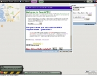 Openaprs is a site dedicated to bringing you aprs tracking data and weather information.
 -
 OpenHamClock is a modern, open-source dashboard for amateur radio operators, designed as a web-based successor to the original HamClock. Deployable locally on a Raspberry Pi or via the cloud, it centralizes essential DX operations into a single, intuitive interface. At its core is an interactive world map that visualizes real-time DX spots, signal paths, satellite tracking, and POTA activators. The software seamlessly integrates critical tools like WSJT-X, DX Cluster, and PSKReporter for monitoring digital traffic. Additionally, it provides vital environmental data, including real-time space weather indices, solar activity, and personalized HF propagation predictions. With customizable themes and a modular architecture, OpenHamClock offers modern operators comprehensive, at-a-glance situational awareness of global radio conditions
 -
 Accurate meteorological data is crucial for optimizing antenna performance, predicting propagation, and ensuring safe tower work. This resource provides a curated inventory of weather stations, including models like the _AcuRite Atlas_ with lightning detection and the _Ambient Weather WS-2902_ WiFi Smart Weather Station, which offer real-time data on environmental factors. The product listings detail specific features such as direct-to-Wi-Fi connectivity, rainfall tracking, and temperature insights, enabling informed decision-making for various amateur radio operations. The platform categorizes products by application, featuring weather stations tailored for home and backyard use, as well as more robust systems for farm and agriculture, which can be critical for field day operations or remote station monitoring. It also highlights _Made in USA_ options, emphasizing local manufacturing and support. Beyond weather instruments, the site also presents related surveillance technology, such as the _Waggle solar CCTV camera_, designed for outdoor reliability with an IP65 weatherproof rating. This integration allows for comprehensive monitoring of remote ham radio shacks or antenna sites, combining environmental data with visual oversight.
 -
 Demonstrates the practical application of APRS (Automatic Packet Reporting System) through the lens of HB9PVI's activities in Switzerland. It covers the system's core function of reporting geographical positions and telemetry data from various objects, including mobile stations, aircraft, and the ISS, distributed via packet radio and internet gateways. The resource highlights the routing paradigm shift introduced in April 2005, specifically the recommendation to use _WIDE1-1_ instead of RELAY and WIDE for digipeating to reduce duplicate packets. The page presents real-time maps displaying the positions of amateur radio stations in Switzerland and around Bern, updated every few minutes. It details specific callsigns like _HB9BA-2_ (HB9PVI's home QTH), _HB9BA-8_ (a weather station), and _HB9BA-4_ (a WIDE digipeater on Weissenstein mountain), providing context for their roles within the local APRS network. Links to track HB9PVI's mobile operations (_HB9PVI-9_) and handheld devices (_HB9PVI-15_, _HB9PVI-7_) are also provided. Furthermore, the resource curates a list of APRS software options for various operating systems, including _JavAPRS_ for Europe, _UI-view_, and _X-Astir_ for Linux, alongside digipeater/IGATE software like _DiXPRS_. It also offers downloadable APRS information, including a PDF article by HB9PVI and HE9ZGN, and a PowerPoint presentation in German, making it a repository of practical and historical APRS data.
 -
 Small company based in Santa Maria, California, designing and manufacturing electronic products for amateur radio, education, and commercial users. Product line includes APRS devices for real-time vehicle tracking, weather monitoring, and remote telemetry, as well as the ADS-SR1 Simplex Repeater, the ADS-WS1 Weather Station, the SSTVCAM slow-scan TV camera, and GTRANS protocol translator for Garmin FMI.
 -
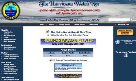 The Hurricane Watch Net (HWN) is an amateur radio organization dedicated to serving the National Hurricane Center and the public since 1965. It plays a crucial role in disseminating real-time tropical weather information for the Atlantic and Eastern Pacific regions. The HWN operates during hurricane events, providing updates and facilitating communication among amateur radio operators and emergency services. This network is essential for ensuring that communities are informed and prepared for severe weather conditions. In addition to its operational role, the HWN offers educational resources and outreach programs aimed at enhancing public awareness about hurricane preparedness. This includes providing access to tracking maps, storm surge information, and safety guidelines. The HWN encourages amateur radio operators to participate in its activities, fostering a spirit of community and collaboration in the face of natural disasters. By subscribing to their email updates, individuals can stay informed about active storms and receive vital safety information.
 -
 The article describes the construction of a Lindenblad antenna, which is well-suited for receiving signals from low-orbiting weather satellites. The key points are: The Lindenblad antenna has an omnidirectional horizontal radiation pattern and is optimized for low to medium elevation angles, making it ideal for tracking passing satellites near the horizon. It is designed to receive circular polarization, which is common for weather satellite signals. The antenna is constructed using 4 folded dipole elements arranged on a cross-shaped frame. The necessary materials include a plastic junction box, PVC tubing, and aluminum rods to form the dipole elements. The article provides detailed instructions for preparing the components, assembling the dipoles, and connecting the feed lines to create the complete antenna. The completed antenna can be mounted on a vertical support, with the dipole elements angled at 30 degrees from horizontal, to optimize reception of the passing satellites. The author notes that the design was originally published in a now-defunct magazine, Meteo Satellite Inf", in 1993