Search results
Query: real time information
Links: 79 | Categories: 3
-
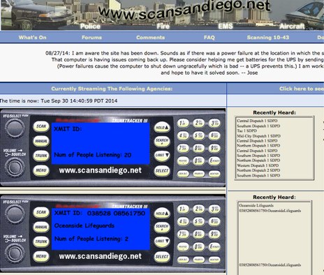 Three live police scanner streams are offered, broadcasting twenty-four hours a day from San Diego County. KE6CBF, the site's operator, provides real-time communications from agencies like the San Diego Police Department (SDPD), San Diego Fire-Rescue Department (SDFD), Sheriff, California Highway Patrol (CHP), and Air Traffic Control (ATC). Beyond the live audio, the platform includes a community forum for scanner enthusiasts. It also provides resources such as FAQs, _10-43_ information pages, and police codes to assist listeners in understanding the transmissions. The site aims for high-quality streaming audio with minimal downtime, supported by user donations. Powered by technologies like PERL, mySQL, ICECAST, APACHE, and LINUX, the site is designed for optimal viewing at **1024 x 768** resolution or higher.
 -
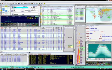 Logger32 is a well-established amateur radio logging program designed primarily for DXers who require a flexible and data-driven logging environment. The software maintains a comprehensive logbook database capable of handling large volumes of QSOs while offering detailed tracking of DXCC entities, awards, and band/mode statistics. One of the core strengths of Logger32 is its DX cluster integration. The program connects to telnet DX clusters and displays spots in real time, with filtering options by band, mode, country, or callsign. The cluster window can automatically highlight needed DXCC entities, band-fills, or new modes based on the operator’s log. Logger32 also provides rig control through CAT interfaces, supporting a wide range of transceivers via serial or USB connections. When properly configured, frequency and mode are automatically captured in the log entry window. The software supports digital mode integration through external applications and can exchange information using standard interfaces. Another important feature is its award tracking system, including DXCC, WAS, IOTA and other common amateur radio awards. The program calculates worked, confirmed, and needed entities with detailed reports. Logger32 supports ADIF import and export, allowing interoperability with other logging systems. It also includes QSL management, with tracking for bureau, direct, and electronic confirmations such as LoTW or eQSL when configured. Overall, Logger32 remains a technically capable logging solution focused on DX tracking, cluster awareness, and detailed statistical analysis of operating activity.
 -
 QRZ.com provides a comprehensive online **callbook** service, enabling amateur radio operators to look up detailed information for over 2 million licensed stations worldwide. Each entry typically includes the licensee's name, address, QSL route, and often a personal biography with station details, antenna configurations, and operating interests. The platform integrates various features such as a **Logbook of the World (LoTW)** interface, allowing users to confirm QSOs directly, and a robust search engine for rapid call sign resolution. The resource also features dynamic content, including real-time solar-terrestrial data from N0NBH, an active online swapmeet for buying and selling amateur radio gear, and a news section with articles covering current events, contest results, and special event station announcements. Recent news items highlight topics like the 'Five Two Simplex Challenge' and the '9th HamSCI Workshop,' indicating a focus on active operating and scientific engagement within the amateur community. Furthermore, QRZ.com supports various amateur radio awards, such as the new 'USA250 Award,' encouraging participation in specific operating programs.
 -
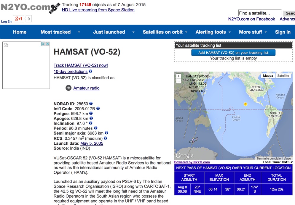 Select your favorite satellite and watch its trajectory on Google Maps in real time! Includes ISS tracking, Weather, Geostationary, GPS Military, and of course Amateur radio satellites. N2YO provides comprehensive real-time satellite tracking with particular emphasis on amateur radio satellites. The service offers precise pass predictions calculated for user-specific locations, displaying upcoming passes with azimuth, elevation, and duration data essential for ham operators planning satellite contacts. N2YO features dedicated tracking for amateur radio satellites including FM, linear transponder, and digital satellites, with frequency information and downlink/uplink details. The platform delivers live tracking visualizations on interactive maps, Doppler shift calculations, and automated email notifications for upcoming passes. This free resource integrates weather satellite tracking alongside NOAA imagery, making it invaluable for radio enthusiasts pursuing satellite communications.
 -
 Over 200 Telnet DX cluster entries are meticulously cataloged, each providing the cluster's callsign, IP address or hostname, and the specific port for connection. The resource details the geographic location for each cluster, often including grid square information or city/country, which is crucial for operators seeking regional or local spotting networks. For instance, **AB5K** offers both worldwide and USA/Canada-only spot feeds, while **K2LS** explicitly limits spots to USA/Canada/Caribbean Zones 1-8, excluding chat messages. The compilation serves as a practical reference for amateur radio operators who utilize traditional Telnet clients for real-time DX spotting. It presents a raw, unadorned list, prioritizing direct access information over elaborate interfaces. This format allows for quick integration into logging software or terminal programs that support Telnet connections. Distinctively, the resource focuses exclusively on Telnet access, differentiating it from web-based or aggregated cluster services. The sheer volume of listed clusters, spanning continents from Europe and North America to Asia and Oceania, makes it a robust tool for DXers and contesters aiming to monitor propagation and identify rare DX stations across various bands.
 -
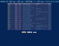 The SK6AW DX-Cluster provided a web-based interface for real-time DX spotting, featuring a flexible and configurable environment for amateur radio operators. It supported various display _skins_, allowed users to send spots, and integrated _e-mail and push notifications_ for alerts. The platform was designed to offer a comprehensive spotting experience, enabling users to track propagation and DX activity across multiple bands, similar to traditional _telnet clusters_ but with a modern web interface. This service, formerly hosted on dedicated servers, transitioned to a shared hosting platform before its scheduled shutdown on December 13, 2025. The decision to discontinue the cluster was attributed to a lack of resources for updating it to contemporary standards. Users seeking similar functionality are directed to alternative DX spotting services such as _dxsummit.fi_ or _dxheat_, which continue to provide real-time DX information and related features for the amateur radio community.
 -
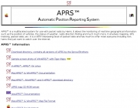 Automatic Position Reporting System windows program, allow monitoring of real time geographical information such as the position of vehicles, the status of weather, radio direction finding and more.
 -
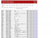 Presents a web-based DX cluster interface, F5LEN Webcluster, which functions as a member node within the broader European DX Cluster network. It displays current DX spots across a wide range of amateur radio bands, from VLF through SHF, including specific bands like 1.8 MHz, 144 MHz, and 10 GHz, as well as satellite operations on QO-100. The service offers filtering options for various modes and activities, such as CW, QRP, IOTA, and specific VHF/UHF bands. Operators can access real-time propagation data, including Solar Flux Index (SFI), Sunspot Number (SSN), Kp index, and Auroral activity (Au), alongside tools for solar forecasts and tropospheric ducting predictions. The platform facilitates DX spotting by providing a centralized point for sharing and viewing contact information, aiding in DX hunting and contest operations. It also includes links to an Atlas, Sun tools, and a mobile version for portable access.
 -
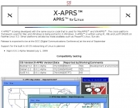 APRS for Linux is a multifaceted system for use with packet radio by Hams, it allows the monitoring of real time geographical information such as the position of vehicles, the status of weather, radio direction finding and much much more. It envolves mapping, GPS tracking, packet radio, etc
 -
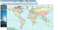 DXMaps.com presents a dynamic, real-time mapping service for amateur radio DX spots, integrating data from traditional DX clusters, _PSK Reporter_, and WSPR networks. The platform visually plots global QSO and SWL activity, enabling users to observe propagation conditions across various bands, from 2200m to >450 MHz. It offers distinct overlays such as the magnetic equator, gray line, moon footprint for EME, and VOACAP propagation predictions, providing a comprehensive view of radio wave behavior. The service allows granular filtering of displayed spots, including options to show only DX-Cluster data, PSK Reporter activity, or WSPR signals. Users can refine the map view by selecting specific bands (e.g., 160m, 20m, 6m, 2m), limiting spots to the last 15 minutes, or displaying only contacts exceeding **2600 km**. Additional features include the ability to toggle grid squares, aurora forecasts, and various amateur radio zones (CQ, ITU). Distinctively, the resource updates automatically every minute, ensuring current propagation intelligence without manual refresh. It also supports specialized views for EME, ionospheric scatter, and aircraft scatter, alongside FM DX and APRS activity. The platform emphasizes the importance of accurate locator information in DX spots to enhance data quality and offers a user manual and FAQ for guidance.
 -
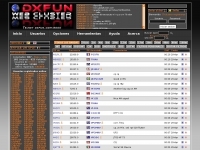 Demonstrates a **DX cluster** web service providing real-time amateur radio spot reports, propagation information, and solar data. The platform integrates features such as a gray line map, **DXCC** tracking, and a personal logbook, allowing users to manage their confirmed entities and contacts. It supports various bands from 160m to 70cm, including specific filters for modes like FT8/FT4, and offers both web and Telnet access for spotting and monitoring. The service provides graphical representations of spot reports, detailing activity across different frequency bands and modes (CW, SSB, digital). Registered users gain access to advanced functionalities, including personalized filters and tools for calculating DXCC status. The platform also includes a classifieds section and options for mobile access, catering to a broad range of amateur radio operators interested in DXing and contesting.
 -
 These pages provide general propagation advice for HF communicators. Information available includes inferred global propagation conditions, real time HF fadeout coverage charts, regional ionospheric vertical MUF maps and Hourly Area Prediction charts for Astralia and Asia, Europe and North America
 -
 Illustrates the global distribution of **DX-Cluster** nodes through an interactive map interface, enabling radio amateurs to visualize and access real-time DX spots. The resource provides direct TELNET and HYPER links for each node, facilitating immediate connection to various clusters for up-to-the-minute propagation information and station activity. This visual approach simplifies the process of locating and connecting to a suitable DX-Cluster, whether for local or international DXing. Amateurs can use this tool to quickly identify active clusters in different geographic regions, which is particularly useful for **DXpedition** planning or contest operations. The direct links streamline access, bypassing manual configuration for many cluster types. It serves as a practical aid for operators seeking to monitor band conditions, find rare DX, or participate in competitive operating events by leveraging aggregated spotting data.
 -
 LogDDM, a freeware logging application, supports the tracking of over **100** different awards, including _DXCC_, WAZ, and WAS, directly within its interface. This software facilitates comprehensive log management for amateur radio operators, integrating functionalities such as a built-in callbook lookup, real-time packet cluster access, and direct rig control for various transceivers. It also offers robust import and export capabilities, primarily utilizing the ADIF format, which is essential for submitting logs to award sponsors or transferring data between different logging platforms. Developed by Giorgio, IV3DDM, the program is designed to streamline the logging process, allowing hams to efficiently record contacts and manage their QSL information. It provides a centralized hub for operational data, from initial QSO entry to final award application. Key features include detailed QSL management, support for multiple operating modes, and a user-friendly interface, making it a practical tool for daily operating and contest logging.
 -
 FindU.com operates as a robust database archiving **APRS** (Automatic Packet Reporting System) data, including weather, position, telemetry, and message reports. It integrates data from both amateur radio APRS systems and the internet-based Citizen Weather Observer Program. This substantial 58 GB database is hosted on dual servers utilizing data replication, processing approximately 20 new reports per second to provide constantly updated information. The system supports various applications, such as displaying weather reports, tracking position data, and facilitating long-term vehicle tracking. A notable function involves forwarding over 100,000 near-realtime weather observations daily to the National Oceanographic and Atmospheric Administration (NOAA) for accuracy checks and use by NOAA and the National Weather Service. Additionally, it archives APRS reports from the International Space Station. Access to the database is primarily via dynamic web pages, with a comprehensive list of available CGIs detailed on a dedicated server page. While direct URL parameter editing is possible for advanced users, alternative web pages with forms simplify query submission. The platform utilizes **PNG** images for dynamic graphics, a choice made due to past GIF patent issues, ensuring broad browser compatibility.
 -
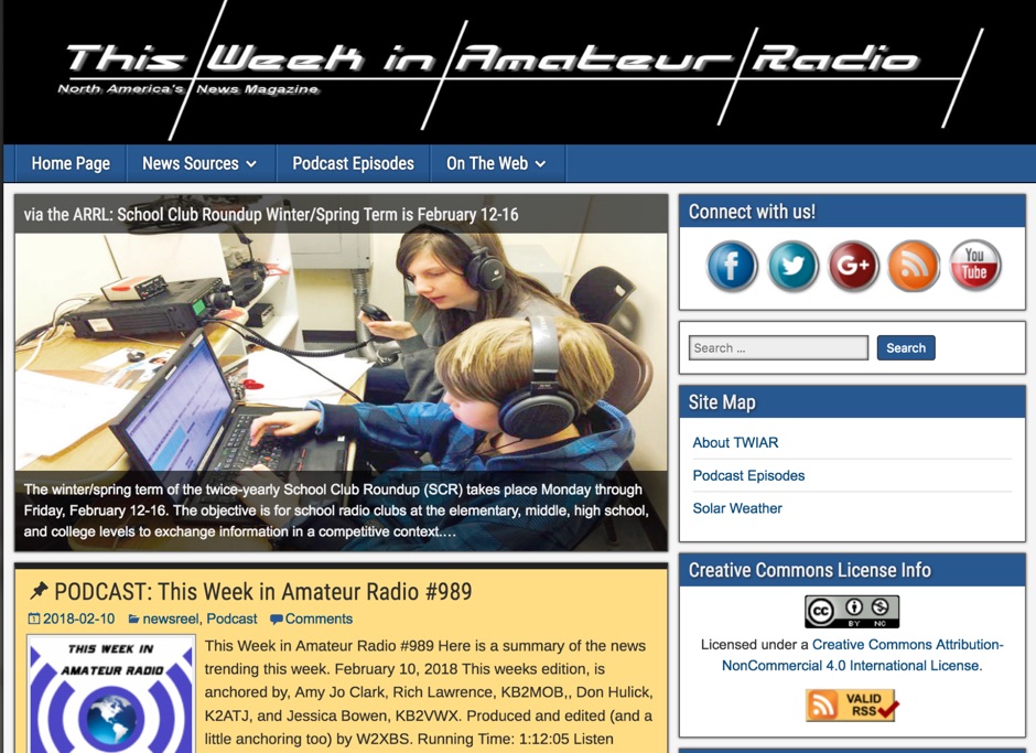 7.5 MHz wideband audio delivered via AMC-7 satellite transponder 5 provides a robust platform for disseminating amateur radio news. This service caters to operators seeking timely updates on regulations, technology, and DX news. The bulletin is accessible in both MP3 and RealAudio formats, ensuring compatibility with a wide range of devices and listening preferences. Regularly updated content keeps amateur radio enthusiasts informed about the latest developments in the hobby. The service covers a broad spectrum of topics, including contesting, digital modes, and antenna technology. By leveraging satellite and internet distribution, it reaches a global audience, making it a vital resource for operators worldwide. Listeners can expect a consistent flow of information, with new episodes released frequently. The service's commitment to providing high-quality content ensures that amateur radio operators remain well-informed and engaged with the community.
 -
 VQLog 3.1 - 782 is a shareware logbook program designed for Windows operating systems (95, 98, NT, 2000, ME, XP, Vista, 7, 10, or later), supporting resolutions of 800x600 or higher. It can also operate on macOS and Linux via virtualization software like Virtual PC for MAC, Oracle VirtualBox, or VMware. The software facilitates QSO access by date, callsign, prefix, square, DXCC, and other parameters, offering robust import capabilities for ADIF, Cabrillo, and ASCII files from various contest and logbook programs. Key features include comprehensive award tracking for DXCC, WAZ, WAC, WPX, WAS, IOTA, TPEA, DIE, VUCC, 100EACW, and up to 30 user-defined awards. It generates customizable summaries and graphical statistics for QSO activity, DX contests, Most Wanted Squares (MWS), propagation openings, and prefixes. VQLog supports DX-Spot reception and processing from DX-Cluster and PSK-Reporter with programmable warnings, integrates with callbook services like QRZ.COM and Buckmaster's CD, and offers online lookup. Electronic QSL and log upload support extends to LoTW, eQSL.cc, Clublog, and DXMAPS, with real-time updates for online logs. The program provides extended QSO information for VHF-DXers, including separate TX/RX frequencies, start/end times, propagation modes, and specific entry fields for MS, EME, and Tropo. CAT support for rig control and interfaces with ARSWIN and PstRotator for azimuth/elevation control are also included.
 -
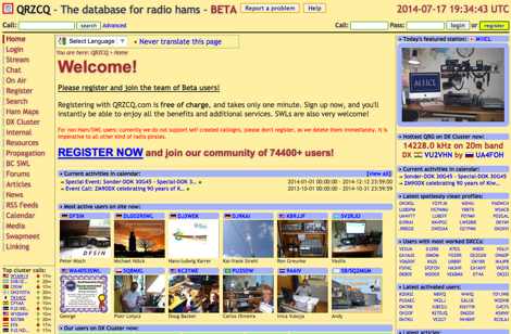 QRZCQ.com provides a centralized online platform for amateur radio operators, integrating a global callsign database with DX Cluster functionality. The service features real-time DX spotting, filtering capabilities for specific bands (e.g., 160m, 80m, 40m, 20m, 15m, 10m), and specialized filters for awards like IOTA, SOTA, WWFF, and QRP activity. It also includes a logbook, QSL manager lookup, contest calendar, and various ham radio articles and news feeds, supporting a wide range of operating activities and information retrieval. The platform aggregates data from multiple sources, offering a dynamic view of on-air activity and callsign information. Users can register for free to access additional services, including a personal logbook, buddy lists, and chat features, fostering community interaction among over 198,600 registered users. The DX Cluster displays recent spots with frequency, DX call, spotter, and remarks, covering bands from VLF to VHF. Beyond DX spotting, the site provides resources such as repeater directories, propagation information, and a swapmeet, making it a multi-faceted tool for both casual browsing and serious DXing or contesting. The service also highlights active users, latest news, articles, and videos, keeping the content fresh and relevant.
 -
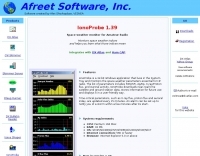 Monitors the space weather parameters essential for HF radio, including SSN/SFI, Ap/Kp, X-ray/Proton flux, and Auroral activity. IonoProbe downloads near-real time satellite and ground station data, stores information for future use and displays it in a user-friendly way.
 -
 CQDX11.com serves as a vital hub for Citizens Band (CB) radio operators, particularly those interested in the 27 MHz band. The site offers a wealth of information on CB radio models, modifications, and antennas, catering to both beginners and seasoned DXers. Users can explore various resources, including a logbook for tracking contacts, forums for community interaction, and guides on equipment and techniques for effective communication. In addition to technical resources, CQDX11.com emphasizes the social aspect of CB radio, providing a platform for users to share experiences, tips, and engage in real-time chat. The site also features a section dedicated to CB radio news and updates, ensuring operators stay informed about the latest trends and developments in the CB community. Whether you're looking to enhance your setup or connect with fellow enthusiasts, CQDX11.com is an essential destination for all things related to CB radio.
 -
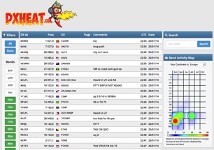 Over 15 years of experience in DXing and contesting informed the development of _DXHeat_, a responsive web DX Cluster and analytics platform. This service delivers real-time DX spots, accessible on both desktop and mobile devices, featuring intuitive filtering capabilities. Users can quickly narrow down spots by band, mode, or specific callsign, streamlining the search for rare DX or contest multipliers. The platform integrates data from various sources, including traditional telnet clusters, the Reverse Beacon Network (_RBN_), and _PSK Reporter_, offering a comprehensive view of propagation and activity. Beyond live spotting, DXHeat provides extensive cluster analytics for individual callsigns, allowing operators to research past activity and propagation trends. This deep dive into historical data can be particularly useful for planning future DXpeditions or optimizing contest strategies. The interface is designed for serious DXers, prioritizing quick access to relevant information and robust data analysis.
 -
 DX Finder presents a real-time DX cluster service tailored for amateur radio operators engaged in DX chasing and contesting. The platform aggregates DX spots, Reverse Beacon Network (RBN) data, and PSK Reporter information, displaying current activity across various amateur bands. It provides a centralized interface for monitoring propagation conditions and identifying rare DX entities, aiding operators in making timely contacts. The service integrates multiple data streams to offer a comprehensive view of global amateur radio activity. Users can access real-time spotting data, which includes callsigns, frequencies, modes, and signal reports, facilitating efficient station operation. The inclusion of RBN and PSK Reporter data enhances situational awareness, allowing operators to assess band openings and signal paths more effectively. DX Finder supports both web and Telnet access, catering to different operational preferences. It also features a dedicated JOTA cluster, specifically designed to support the Jamboree On The Air event.
 -
 Over 47 full-screen maps are available within _NAOMI_ (North American Overlay Mapper), a free Windows program designed for US and Canadian amateur radio enthusiasts. This mapping suite includes 9 backgrounds such as CQ Zones, ITU Zones, and ARRL Sections, along with 16 foreground layers like Counties, Areacodes, and Grid Locators. Users can calculate distances and bearings, track real-time mouse positions with continuous Grid-Locator data, and integrate with APRS for live station tracking via the FindU database. For a global perspective, the _Global Overlay Mapper_ (GOM) provides a world map, 8 continental maps, and 29 sub-continental maps, all with 12 active layers including Country Outlines, CQ/ITU Zones, and Prefix information. Both NAOMI and GOM offer feature-locate systems to jump to positions based on prefixes, capital cities, or Grid Locators, and provide customized beam headings and distance displays. The site also features _LogView_, a post-contest log visualization tool that analyzes Cabrillo-format logs by plotting QSOs on maps, supporting over 30 major contests like CQWW and ARRL DX, and allowing comparison with published results.
 -
 Operating a specialized DX cluster, this service provides real-time DX spots exclusively from stations confirmed to be _Log of The World_ (LoTW) users. This unique filtering mechanism allows DXers to prioritize contacts with stations that are highly likely to upload their logs to LoTW, streamlining the process of achieving confirmed DXCC or other awards. The cluster aggregates data from various sources, presenting a focused view of active LoTW participants across multiple bands. By narrowing the scope to LoTW-active stations, the platform significantly reduces the effort required for QSL management, as users can confidently pursue contacts knowing a digital confirmation is probable. This targeted approach is particularly beneficial for contesters and DXpedition chasers aiming for rapid award qualification, offering a strategic advantage in identifying viable contacts. The service supports both web-based access and traditional telnet connections, ensuring broad compatibility for amateur radio operators. It processes thousands of spots daily, with a focus on delivering accurate and timely information relevant to LoTW users, facilitating more efficient and productive operating sessions.
 -
 DX_Central, a compact desktop application, provides amateur radio operators with critical propagation data by aggregating solar statistics and imagery from various authoritative sources. This includes real-time information from agencies like NOAA and NIST, offering insights into current space weather conditions that directly impact HF propagation. The software is designed for both Linux and Windows operating systems, making it accessible to a broad range of hams. It presents a concise overview of solar activity, which is essential for planning DX operations and understanding band openings and closures across the HF spectrum. Operators can utilize the displayed solar flux index, K-index, and other relevant parameters to make informed decisions regarding their operating times and target bands, optimizing their chances for successful long-distance contacts.
 -
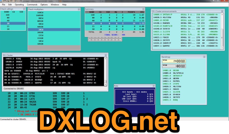 Provides a robust contest logging solution for Windows users, supporting over **500** distinct amateur radio contests. The software integrates _digital modes_ and offers comprehensive logging features essential for competitive operating. It facilitates efficient entry, real-time scoring, and post-contest log submission in standard formats. Developed and maintained by K1LZ and a dedicated team, DXLog.net is provided free of charge to the amateur radio community. Users can access support and report bugs via the dedicated groups.io forum, ensuring ongoing development and user assistance. The platform includes detailed release notes and an archive of support information, aiding operators in maximizing their contest performance.
 -
 Operating on the amateur radio bands, DXers rely on timely information to chase rare contacts. This resource offers a specialized web interface for accessing DX cluster data, specifically designed for mobile phone displays. It presents real-time **DX spots** in a compact, easy-to-read format, stripping away extraneous elements often found on traditional cluster interfaces. The core functionality focuses on delivering essential spotting information—callsign, frequency, mode, and comments—without requiring complex navigation or excessive data loading, which is crucial for mobile data usage. The utility of this mobile-first design becomes apparent when operating portable or away from a shack. Unlike full-featured _telnet clusters_ or web-based aggregators, DXLite prioritizes quick access and readability on small screens. The interface displays a continuous stream of spots, allowing operators to rapidly identify potential DX opportunities across various bands. Its minimalist approach ensures fast loading times and efficient data consumption, making it a practical tool for on-the-go DXing and contesting.
 -
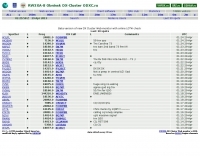 Approximately 1,500 unique DX spots are typically visible on the _ODXC Web Monitor_ at any given time, providing real-time intelligence for amateur radio operators seeking DX contacts. This service aggregates spotting data from the _RW3XA-8 Obninsk DX Cluster_ node, presenting it through a straightforward web interface. Users can monitor current activity across various HF bands, identifying stations calling CQ DX or reporting rare entities. The platform supports both traditional telnet access for those using dedicated cluster clients and a Java-based web interface, catering to different operational preferences. It serves as a practical tool for contesters and DXers to track propagation, identify active stations, and plan their operating strategies. The cluster data includes callsigns, frequencies, modes, and spotter information, crucial for effective DX hunting. Integration with other spotting networks like _RBN_ and _PSK Reporter_ enhances its utility.
 -
 Presents the _K7AR DX NorthWest Web Cluster_, an online service for amateur radio operators to access real-time DX spots. The resource functions as a web-based interface, enabling users to monitor current band activity, identify rare DX stations, and track propagation conditions across various amateur bands. It aggregates spotting data, making it accessible without requiring a dedicated telnet client, thus simplifying access for many hams. The cluster integrates with the broader DX spotting network, offering a continuous stream of reported contacts. While specific performance metrics are not detailed, such web clusters typically update spots within **seconds** of submission, providing timely information crucial for DXing and contesting. Its utility lies in offering a quick, browser-based overview of the airwaves, comparable to traditional telnet clusters but with enhanced accessibility.
 -
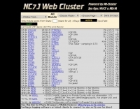 The NG7M Web Cluster, maintained by W7CT and NG7M, offers real-time DX spotting information crucial for amateur radio operators engaged in DXing and contesting activities. This service aggregates DX spots from various sources, presenting them in a user-friendly format accessible via both web interface and traditional telnet protocols. Operators can monitor band conditions, identify rare DX entities, and track propagation paths across multiple amateur radio bands. This cluster supports a wide range of operating modes and bands, facilitating efficient station operation for both casual DX chasers and serious contesters. The system integrates data from the Reverse Beacon Network (RBN) and PSK Reporter, enhancing its utility by providing automated CW and digital mode spots alongside manually entered voice spots. Access methods include a direct web interface for graphical display and a telnet connection for command-line interaction, catering to different operational preferences. The cluster's data stream is continuously updated, ensuring timely information for making critical operating decisions.
 -
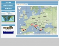 The HA8TKS VHF DXCluster is an essential online resource for amateur radio operators focusing on VHF and higher frequencies. This platform provides real-time information on DX spots, allowing users to track and engage in two-way radio communications effectively. The integrated map mash-up feature enhances the user experience by visually displaying the locations of DX stations, making it easier for operators to plan their contacts and optimize their antenna setups based on geographical data. In addition to the DXCluster functionality, the site offers various HAM tools, including a QRB calculator, which helps operators determine the distance to DX stations based on Maidenhead grid locators. The platform supports multiple modes of operation, including CW, SSB, RTTY, and digital modes like FT8 and JT65. With a user-friendly interface and comprehensive data, the HA8TKS VHF DXCluster is a valuable asset for both novice and experienced operators looking to enhance their DXing and contesting activities.
 -
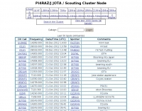 Demonstrates a specialized **DX cluster** designed to support the annual Jamboree On The Air (JOTA) event, facilitating real-time spotting for participating Scout stations. While its web interface has been discontinued due to security concerns, the cluster remains fully operational and accessible through standard cluster software. Operators can connect to the JOTA cluster by pointing their client to www.pi4raz.nl on port 7300. This setup allows for the exchange of **DX spots** and other operational information relevant to JOTA participants, ensuring that Scouts and their amateur radio mentors can continue to make contacts and log stations during the event.
 -
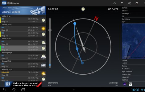 The _ISS Detector_ Android application, with over 5 million downloads, offers precise predictions for visible passes of the International Space Station. It notifies users minutes before an overhead pass, integrating local weather conditions to ensure optimal viewing opportunities. The core functionality focuses on the ISS, but in-app purchases extend its capabilities to track other celestial and artificial objects. Optional extensions, available via in-app purchase, allow users to monitor dozens of amateur radio and weather satellites, providing real-time transmitter information and Doppler frequencies. Additional extensions cover _Starlink_ satellites, the _Hubble Space Telescope_, rocket stages, bright satellites, comets, and planets, expanding the scope beyond the ISS to a broader range of observable space phenomena. The app's interface is designed for ease of use, displaying pass times, directions, and elevation. It adapts predictions based on the user's GPS location, ensuring accurate local forecasts. The latest update, dated April 3, 2026, includes corrections for magnitude values and various speed and stability optimizations.
 -
 Several bash scripts are provided to automate common amateur radio tasks on Linux and FreeBSD systems, addressing the need for quick access to specific data without navigating web interfaces. These utilities include `call` for fetching US callsign details from callook.info, `qth` for obtaining address information for US and Canadian callsigns, and `grid` for determining grid squares based on license addresses. Each script is designed for command-line execution, allowing for single lookups or interactive sessions, and emphasizes a KISS (Keep It Simple, Stupid) programming philosophy. Another script, `au_kp.sh`, is tailored for weak signal VHF operators, fetching and displaying the NOAA 30-minute Aurora forecast and GFZ Space Weather Kp index data. This script generates static images, requiring re-execution for updates, and is intended to be run as a clickable desktop object for real-time space weather monitoring. It helps operators track propagation conditions, especially during solar cycle peaks. Beyond bash scripts, the resource offers a PHP/web page `fortune` implementation, including Henrik Aasted Sorensen's PHP script, sample HTML/CSS, and a HOWTO guide for creating fortune files. W3DHJ provides several amateur radio-themed fortune files, such as "Ham Humor & Wisdom" with 354 entries and "VHF Rover Humor & Wisdom" with 223 entries, along with other general humor and wisdom collections. These fortune files are designed with embedded HTML for web page display and are refreshed monthly, offering a total of 21,400 entries.
 -
 Accessing this interface provides entry to one of the largest databases for amateur radio voice repeaters, encompassing over 8000 entries from more than 60 countries. The resource supports both desktop and mobile access, with a default display based on browser type, or forced via a "force" parameter (e.g., relais.dl3el.de?force=mobile). Users input a QTH-locator to find local repeater information. The database integrates FM-Funknetz servers and hotspots, potentially creating duplicate entries but ensuring new FM-Funknetz repeaters are immediately displayed. DMR repeater information, including status and talkgroup configurations, is sourced directly from DMR+ / ircDDB and Brandmeister systems, with real-time updates for active and default talkgroups. C4FM/Wires-X installations, particularly MMDVM-based gateways not listed in Yaesu's database, are identified through Brandmeister dashboard descriptions, marked with "W-x" or "W-x#MMDVM" for manual entries. D-Star repeater data from ircddb or QuadNet2 is also incorporated, with entries marked (i), (o), or (d) for manual additions. An APRS interface allows searching by callsign, using Sassan, DL3NCK's database, and offers a mobile-friendly, auto-refreshing display that follows an APRS station. Output data can be generated in GPX format for offline smartphone maps or CSV for spreadsheet applications. The database also attempts to determine valid repeater offsets based on IARU region and frequency, indicated by a "." after the frequency.
 -
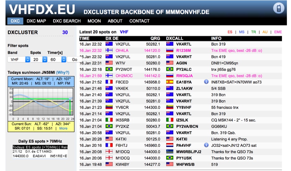 Presents the VHFDX.EU web cluster, a specialized resource for VHF, UHF, and microwave DX spotting. It details the cluster's functionality, including real-time spot aggregation and a DXCluster Map interface for visualizing activity. The resource highlights its integration with the MMMonVHF backbone, ensuring a robust data flow for monitoring band openings and propagation events across higher frequencies. It also references reviews of the ON4KST and N0UK chat systems, which are frequently used in conjunction with VHF DX operations. The platform offers a mobile-optimized view for on-the-go access to DX spots, catering to portable and mobile operators. It further provides daily ES (Sporadic E) spot summaries, a critical feature for VHF operators tracking this specific propagation mode. The cluster serves as a central point for operators to share and receive information on rare grid squares, contest activity, and general band conditions above 50 MHz.
 -
 The GB7MBC resource provides real-time DX spotting information through both web and **telnet cluster** interfaces, catering to amateur radio operators seeking immediate updates on propagation and station activity. It integrates features such as a **JOTA cluster**, RBN (Reverse Beacon Network) data, and PSK Reporter spots, offering a comprehensive view of current band conditions and DX opportunities across various modes and frequencies. The platform also includes a forum for community interaction and detailed DX cluster statistics, allowing users to analyze historical spotting data. Users can access the cluster via a standard web browser or through a telnet client, providing flexibility for different operating environments. The inclusion of RBN and PSK Reporter data enriches the spotting experience by cross-referencing reported signals with automated reception reports, enhancing the reliability and utility of the DX information. This combination of real-time data, community features, and statistical analysis makes it a practical tool for DXers and contesters.
 -
 The Reverse Beacon Network (RBN) graph presents a dynamic visualization of amateur radio spots, specifically tracking CW, BPSK, and RTTY signals over the last 15 minutes. Users can filter these real-time spots by DX continent, spotter continent, and individual frequency bands, including **160m through 70cm**. The interface also offers a bandwidth reduction option, which is particularly useful for operators with limited internet connectivity. This resource provides a unique perspective on propagation conditions and station performance by aggregating data from various _Reverse Beacon Network_ nodes. It automatically refreshes every 10 seconds, ensuring that the displayed information is current and relevant for active DXers and contesters. The graph's Y-axis represents time, with each spot indicating activity within a one-minute interval. Beyond the primary RBN graph, the platform also features dedicated maps for both DXCluster and RBN data, including azimuthal projections. An additional FT8 graph is available, though noted as being under construction, indicating ongoing development to expand its utility for digital mode enthusiasts. The system was developed by HA8TKS, with the initial concept attributed to CT1BOH.
 -
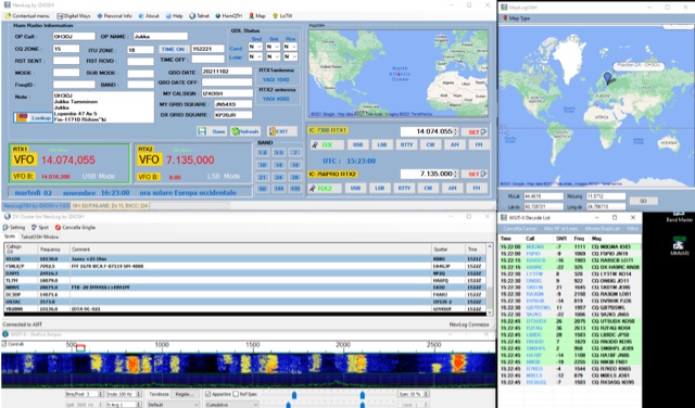 NewLogOSH is a logging application for amateur radio operators, featuring integrated support for various digital modes including FT4, FT8, RTTY, and PSK. The software incorporates DXCluster connectivity and radio interfacing capabilities, allowing for seamless operation with transceivers. Its database is built within the SQLite environment, providing a robust and portable data storage solution for logging QSOs and managing station information. The program's architecture focuses on practical functionality for daily amateur radio operations. Operators can utilize NewLogOSH for contest logging, general DXing, and managing their station's contact history. The inclusion of FT4 and FT8 modes reflects current trends in digital communication, while RTTY and PSK support caters to established digital protocols. The DXCluster integration provides real-time spot information, aiding in DX hunting and propagation analysis. Its SQLite backend ensures data integrity and ease of backup, making it a reliable tool for maintaining comprehensive station logs.
 -
 715 days, 6 hours, 58 minutes, and 29 seconds of uptime are reported for the YSFReflector-Dashboard by DG9VH, which monitors the IT C4FM SUD / ITALY-SUD reflector. This dashboard, compiled on December 1, 2017, provides real-time operational statistics for the reflector, including system information, disk usage, and connected YSFGateways. The dashboard also features a "Last Heard List" and an "All Heard List," displaying callsigns, durations, and timestamps (Europe/Rome) of stations active on the reflector. These lists offer a quick overview of recent activity, which can be useful for tracking **C4FM** traffic. While the resource is titled "IZ7AUH-6 DX Web Cluster," the primary content displayed is a **YSFReflector** dashboard. This suggests the platform might serve a dual purpose, offering both traditional DX cluster services and monitoring for Yaesu System Fusion reflectors.
 -
 The CES Wireless Technologies website details a range of **GPS fleet tracking** solutions designed for mobile information systems. It highlights offerings such as dispatch and mapping software, Automatic Vehicle Location (AVL) systems, and mobile data display terminals. The platform also mentions support for Automatic Number Identification (ANI) and Continuous Tone-Coded Squelch System (CTCSS) functionalities, indicating integration with two-way radio communication protocols. Specific products include GPS tracking devices and associated software for fleet management, emphasizing features like real-time location monitoring and operational efficiency. The site positions itself as a manufacturer in this specialized domain, catering to commercial and public safety sectors requiring robust mobile data solutions. While the page title mentions "Ham Radio Directory" categories, the content primarily focuses on commercial GPS and fleet management technologies, not amateur radio applications. The listed products are geared towards professional mobile radio (PMR) environments rather than typical ham radio operations.
 -
 Reports indicate the PA1RBZ DX Cluster, previously accessible via telnet at pa1rbz.dyndns.org on port 9000, is no longer operational. The QSL.net hosting platform displays a 404 error, indicating the specific page or file for the cluster's web interface or related information is missing. This service was designed to provide amateur radio operators with real-time DX spotting data, facilitating long-distance contacts across various bands. The cluster's primary function was to aggregate and disseminate DX spots, allowing users to monitor current propagation conditions and identify active stations. Such systems are crucial tools for DXers and contesters, enabling rapid response to new openings and rare DX entities. QSL.net, which hosts over 30,000 amateur radio websites, provides these services free of charge to hams, relying on user donations for operational continuity.
 -
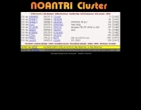 The Noantri WebCLX presents real-time DX spots, including frequency, DX callsign, country, and comments, facilitating active DXing and contesting. It operates as a web-based cluster, offering an alternative to traditional Telnet clusters for accessing spotting data. The interface displays current UTC, allowing operators to track propagation and activity across various amateur bands. This service is maintained by the _Noantri DX Group ARI Roma_, indicating its origin within the Italian amateur radio community. It supports the dynamic exchange of DX information, crucial for operators seeking new entities or participating in competitive events. Key features include the display of spots for modes like FT8, and it functions as a DXSpider-based system, providing a robust platform for **DX spotting** and **propagation analysis**.
 -
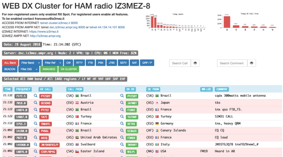 The IZ3MEZ Web DX Cluster presents real-time amateur radio DX spots across 20 distinct frequency bands, spanning from **LF (2190m)** at 135.7 kHz up to **SHF (QO-100)** at 10499 MHz. It displays the DX callsign, frequency, DXCC entity, spotter callsign, and spotter DXCC entity, along with any accompanying comments. The cluster also lists various operating modes such as CW, RTTY, FT8, FT4, FT2, PSK, and SSTV, and supports special operating activities like QRP/P and specific award programs including IOTA, POTA, SOTA, WCA, and JOTA. The cluster's interface provides a dynamic feed of the latest 50 spots, continuously updated with precise timestamps. It offers direct **Telnet protocol** access for users preferring a command-line interface, with configuration instructions provided. The resource also integrates with other spotting networks like RBN and PSK Reporter, enhancing its utility for DXers and contesters seeking propagation information and activity monitoring across a broad spectrum of amateur radio frequencies.
 -
 These pages contain near-realtime and archived information on active regions and solar activity
 -
 This resource provides a discussion group platform for amateur radio operators interested in APRS within Argentina. It facilitates technical discussions, sharing of operational experiences, and coordination among users of the Automatic Packet Reporting System in the region. The group serves as a central point for exchanging information on local digipeater networks, IGate deployments, and mobile tracking applications, covering both hardware and software aspects relevant to APRS implementation. The forum enables members to post questions, offer solutions, and disseminate news related to APRS activities specific to Argentina, fostering a community-driven approach to problem-solving and knowledge transfer. It supports the collaborative development and maintenance of the APRS infrastructure, allowing for real-time interaction on topics such as frequency usage, network topology, and integration with other amateur radio services.
 -
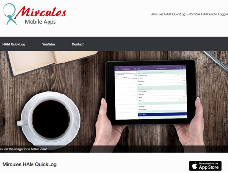 Mircules HAM QuickLog provides a mobile logging solution for amateur radio operators, supporting quick contact entry on iOS and Android platforms. It features multiple log file management, instant callsign information display including Country, ITU zone, CQ Zone, and DXCC number, and robust ADIF and CSV import/export capabilities. The application is designed for efficient logging with optional fields and default values, streamlining the process for both shack and field operations. The software includes dedicated support for POTA, SOTA, and IOTA activations through specific fields like MY_SIG_INFO, SIG_INFO, MY_SOTA_REF, IOTA, and MY_IOTA. A specialized contest mode offers real-time dupe checking and automatic TX exchange updates to enhance contest efficiency. Integration with QRZ.COM and HAMQTH.COM allows for direct operator information lookup and import, while Open Street Maps integration provides geographic context for contacts. The application also features a notes and scratchpad function for each log file.
 -
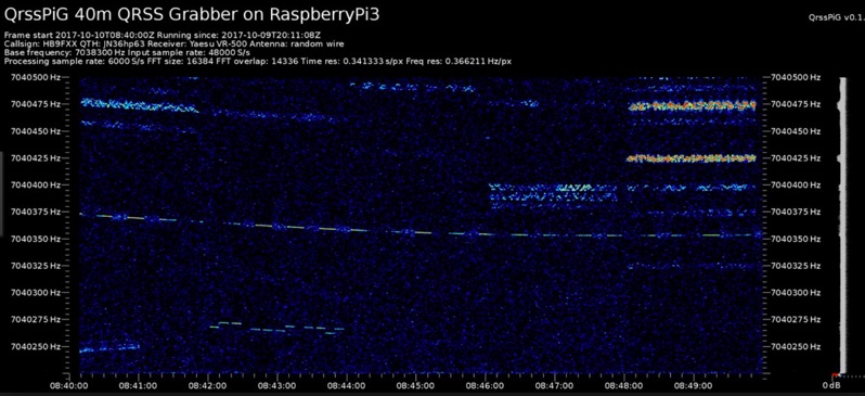 Monitoring extremely weak signals in the QRSS (Very Slow Morse) mode requires specialized receiving and processing capabilities to extract information below the typical noise floor. This project provides a software solution, _QrssPiG_, designed to run on a Raspberry Pi, enabling it to function as a dedicated QRSS grabber. It interfaces with various Software Defined Radio (SDR) devices, including the popular _rtl-sdr_ dongles and _HackRF_ units, to acquire raw I/Q data streams. The software then performs the necessary signal processing to visualize and decode these faint, long-duration CW transmissions, often operating with milliwatts of power. The system leverages the computational power of the Raspberry Pi for real-time signal analysis, allowing hams to participate in QRSS experiments and monitor distant beacons. It supports different SDR hardware, offering flexibility in setup and deployment for home stations or remote monitoring sites. The project includes detailed instructions for installation and configuration, making it accessible for those familiar with Linux environments. This grabber is particularly useful for tracking propagation on the LF and HF bands where QRSS activity is common, providing a visual representation of signal presence over extended periods.
 -
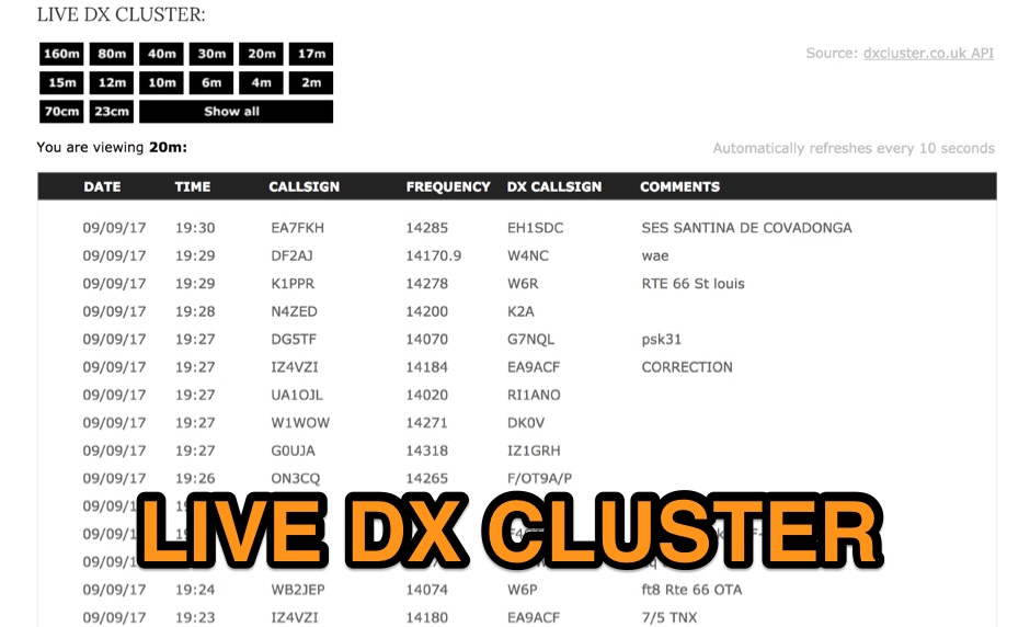 View real-time spot information by band for active amateur radio operators around the world via the DX Cluster network, taking raw data from a JSON API made available by DXCluster.co.uk
 -
 The 3Y0K website is the official platform for the Bouvet Island DXpedition scheduled for February 2026. It serves as a comprehensive resource for amateur radio operators, providing essential information about the expedition, including updates on operations, band availability, and communication modes such as FT8 and CW. The site aims to keep the amateur radio community informed about the expedition's progress and activities, encouraging participation and support. Users can find details on how to donate to the expedition and contact information for inquiries, as well as links to social media for real-time updates and community engagement. In addition to operational details, the 3Y0K site offers various resources for those interested in DXpeditions. It highlights the significance of Bouvet Island as a rare DXCC entity and outlines the logistical challenges faced by the team. The website is designed to be user-friendly, featuring a clear layout that allows visitors to navigate easily through the information. Overall, the 3Y0K website is a valuable resource for amateur radio operators looking to engage with the Bouvet Island DXpedition and enhance their understanding of amateur radio operations.