Search results
Query: Map
Links: 355 | Categories: 12
Categories
- Manufacturers > Amateur Radio Maps
- DX Resources > DX Maps
- Software > Grid Bearing and Maps
- Operating Modes > Repeaters > Repeater maps
- Operating Aids > Maps
- Software > RF Coverage Mapping
- Software > APRS
- Operating Aids > Distance & Bearing
- Operating Aids > Grid Squares
- DX Resources > IOTA
- Ham Radio > Regional > Ukraine
- Operating Modes > Repeaters > USA
-
 A 2x3-foot laminated world map product is detailed, offering customization for amateur radio operators. Each map features two distinct views: one centered on the operator's specific station location and another precisely centered on its _antipode_. Countries are clearly labeled, complemented by a tabular listing of all countries. The map integrates a standard latitude/longitude grid alongside concentric circles that delineate distance increments radiating outward from the operator's QTH. Personalization includes the operator's name, callsign, and location printed directly on the map. This custom mapping service provides a unique visual aid for DXing and propagation analysis, allowing operators to quickly ascertain beam headings and distances from their station. The dual-view presentation, particularly the antipodal centering, offers a practical reference for understanding long-path propagation and identifying potential DX opportunities. The inclusion of distance circles and personalized station data makes it a tailored tool for daily operating and contest planning, distinct from generic world maps.
 -
 VQSpot is a simple utility program developed for sending DX-Spots automatically when QSO are logged into VQLog
 -
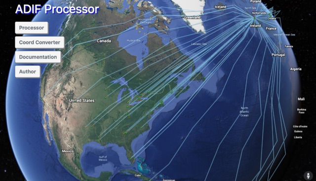 The ADIF Processor is an online application that visualizes amateur radio contacts from an ADIF log file using Google Earth. SOTA CSV log files can also be used. As well as allowing you to view and explore your contacts in Google Earth, you will be able to see a Markdown or text table of contacts, use the output ADIF file which contains QRZ.com data, accurate contact distances and fields populated from comments in the input file. Print QSL labels. One of the benefits of using the ADIF Processor before uploading/storing your ADIF file is detecting errors in callsigns and activity references (e.g. POTA or SOTA references).
 -
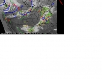
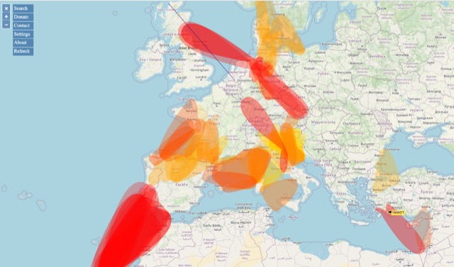 VHF – Based on realtime APRS reports. This map shows real-time radio propagation from stations operated near 144 MHz. It uses data gathered by Automatic Packet Reporting System-Internet Service (APRS-IS) from packet stations in the amateur radio service. The map shows activity from the past hour. Paths are smoothed to create a color-coded footprint indicating the distance VHF signals are likely to be traveling.
 -
 Depiction mapping software can download and integrate maps, elevation plots, weather data, situation reports, damage assessments, volunteer movement, and more. It interface with your APRS ssystem
 -
 First Turkish APRS web site. Many TA APRS Maps for UI-Wiev
 -
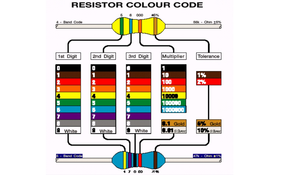 How to understand resistor colour codes
 -
 APRS-Webserver, that presents aprs-data and maps for free using Google Maps api. The position data is imported from aprs.org, winlink.org and echolink.org. The map data are partially commercial and free. This server is for amateur radio purposes only.
 -
-
 Ham radio dealer. Antennas, connectors, books, maps baluns and spare antenna components
 -
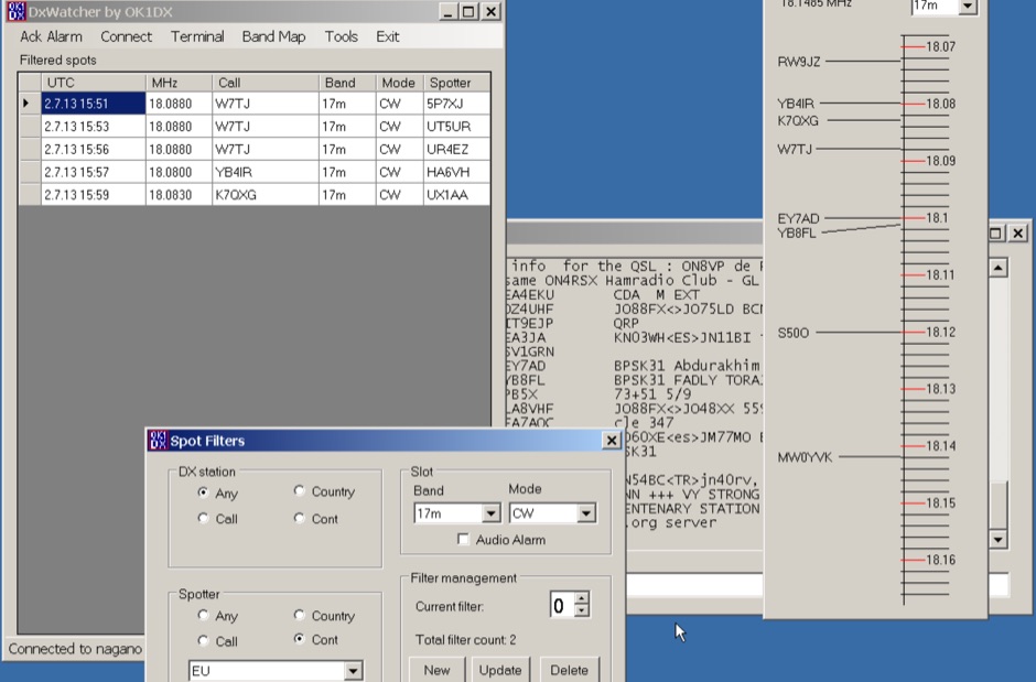 Demonstrates a specialized DX cluster monitoring application, _DxWatcher_, designed for Windows environments. It processes DX spots received via Telnet/Internet, presenting them in a filtered table and a dynamic bandmap. The software integrates with transceivers, specifically the FT-2000, to read VFO frequency and enable one-click tuning to spotted stations. _DxWatcher_ version 1.0.3.0, released on 13 June 2020, includes minor bugfixes and improvements such as enhanced recovery from suspend mode. Key features include configurable bandmap position and size, automatic opening, and bolding of spots received within the last **10 minutes**. The application utilizes the standard _ctry.dat_ file for DXCC country analysis, allowing users to update it for current DXCC status. Source code, developed in C# with MS Visual Studio 2008, is freely available, encouraging modification and sharing while requesting retention of the original author's callsign.
 -
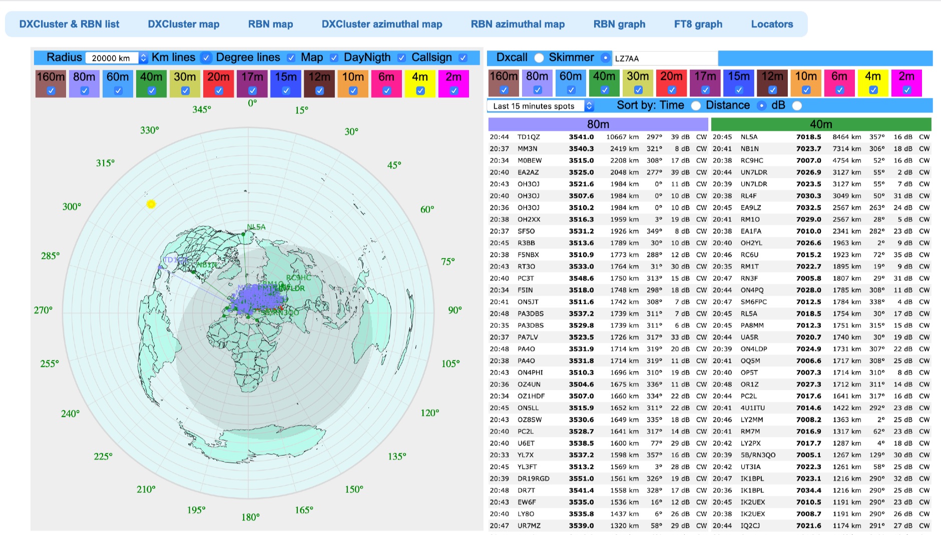
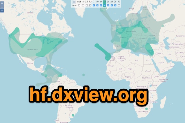 This map shows real-time radio propagation from stations operating on 11 bands between 1.8 and 54 MHz in the amateur radio service. The display shows world-wide activity from the last 15 minutes and is automatically updated about every minute. Data for the map is gathered from several online sources: WSPRnet, Reverse Beacon Network (CW, FT4, FT8), PskReporter, and DX Cluster.
 -
 Repeater Information & Coverage maps
 -
 Information about Venezuela, frequencies, maps, photos, history, and related links
 -
 BeaconSpot.uk provides an accurate, real-time picture of microwave and VHF/UHF beacons operating across Europe, alongside a worldwide listing of 6-meter beacons. The platform allows users to retrieve detailed data for individual beacons, facilitating in-depth analysis of signal characteristics and propagation paths. Interactive maps visualize beacon distribution by frequency band and display spot coverage for each station, offering a clear geographical overview of active beacons. The system integrates real-time DXCluster spots, sourced from contributors like Alain, ON4KST, and Pascal, F5LEN, and enables users to submit outgoing spots directly to the DXCluster. Beacon keepers can manage their beacon data, receive email alerts upon being spotted, and track their station's ODX (Outstanding DX) records. For every received spot, the distance to the beacon is automatically calculated and displayed, aiding propagation studies.
 -
 The CES Wireless Technologies website details a range of **GPS fleet tracking** solutions designed for mobile information systems. It highlights offerings such as dispatch and mapping software, Automatic Vehicle Location (AVL) systems, and mobile data display terminals. The platform also mentions support for Automatic Number Identification (ANI) and Continuous Tone-Coded Squelch System (CTCSS) functionalities, indicating integration with two-way radio communication protocols. Specific products include GPS tracking devices and associated software for fleet management, emphasizing features like real-time location monitoring and operational efficiency. The site positions itself as a manufacturer in this specialized domain, catering to commercial and public safety sectors requiring robust mobile data solutions. While the page title mentions "Ham Radio Directory" categories, the content primarily focuses on commercial GPS and fleet management technologies, not amateur radio applications. The listed products are geared towards professional mobile radio (PMR) environments rather than typical ham radio operations.
 -
 This program combines the formerly know programs PreFind and MU-Locator into one but with many improvements to find the location of any prefix, country or Maidenhead locator! Display and find locators on any map and calculate the distance and direction between two locators.
 -
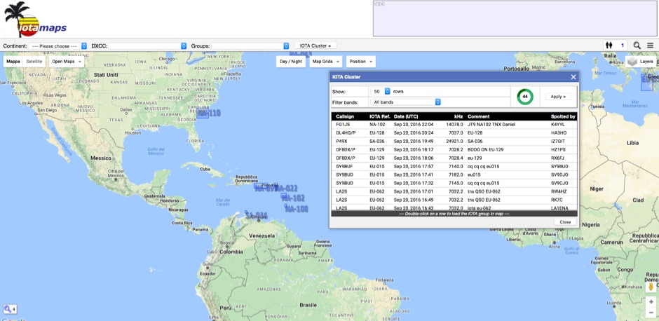 iota mapping project - a mapping resource for the IOTA (Islands On The Air) award program
 -
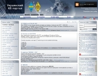 Ukrainian radioamateur on HF: DX News, Contesting, Propagation, Conference, Photo, Radioamateur Map, Online Logs etc.
 -
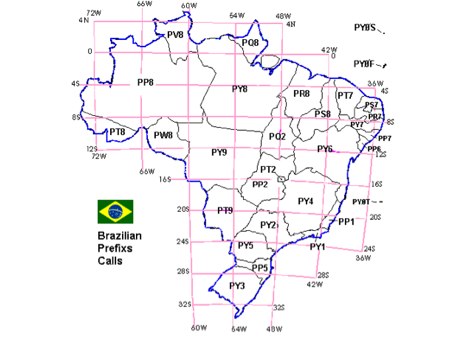
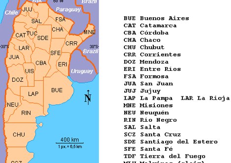 LU Argentina Country CALL division Antarctic and South Atlantic prefixes and sufixes
 -
 Personal page with meeting photos and eleven meter maps too
 -
 Sw tool to design point-to-point multi-hop microwave links and networks, 400MHz to 58 GHz. Site/Hop Configuration; Customized Antenna & Radio Equipment Libraries; Link Budget; Path Profile Analysis ,clearance, reflections; import path profiles from SRTM maps, free download.
 -
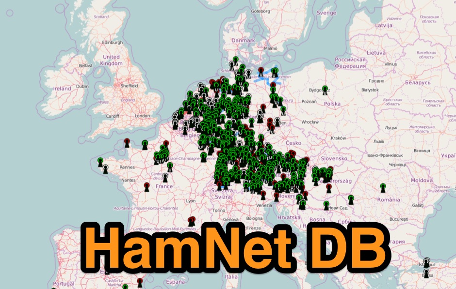 Hamnet IP-Database mapping system mostly european based.
 -
 Azimuthal map with DX spot reporting updated online taking source from DX Cluster spot or Skimmer
 -
 The Maple Valley Amateur Radio Club (MVARC), an ARRL Affiliate club, is a group of amateur radio enthusiasts in the greater Maple Valley area who meet and engage in activities to further the advancement of this hobby for the good of ourselves and the community.
 -
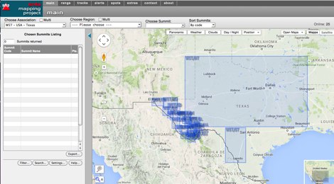 An interactive map for sota operations. SOTA Activators and cheasers will find this summits mapping site very useful resource. Based on Google maps.
 -
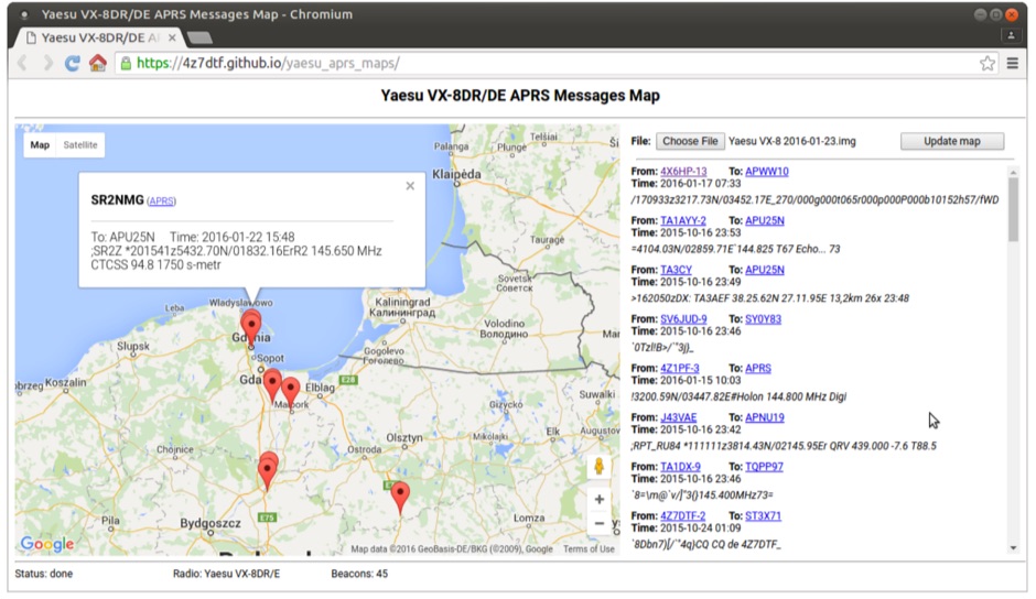 Yaesu VX-8DR/DE received APRS beacons map based on Google Maps. The application parses Chirp's .img files and shows the QTH of the incoming APRS messages.
 -
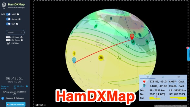 This dynamic DX Map aggregates various resources that will help radio amateurs to operate their stations in search of long distance contacts, DX. HamDXMap displays current MUF values and foF2 critical frequency values around the globe.
 -
-
 Refractive Index maps forecast for Europe
 -
 OpenHamClock is a modern, open-source dashboard for amateur radio operators, designed as a web-based successor to the original HamClock. Deployable locally on a Raspberry Pi or via the cloud, it centralizes essential DX operations into a single, intuitive interface. At its core is an interactive world map that visualizes real-time DX spots, signal paths, satellite tracking, and POTA activators. The software seamlessly integrates critical tools like WSJT-X, DX Cluster, and PSKReporter for monitoring digital traffic. Additionally, it provides vital environmental data, including real-time space weather indices, solar activity, and personalized HF propagation predictions. With customizable themes and a modular architecture, OpenHamClock offers modern operators comprehensive, at-a-glance situational awareness of global radio conditions
 -
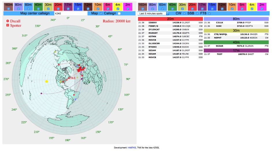 DXCluster spots rendered on a Real-Time Azimuthmal Map centered on a custom callsign
 -
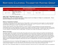 Amateur radio direction finding, transmitter hunting. triangulating a radio signal direction and plotting its bearing on a map. hunters use doppler systems for tracking hidden transmitters
 -
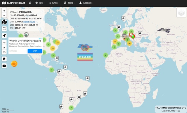
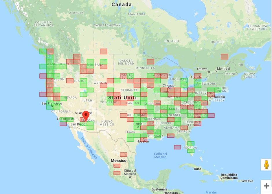
 The resource provides an interactive map interface for locating amateur radio license holders across the United States. Users can input a _callsign_, _gridsquare_, zip code, or street address to center the map, which then dynamically populates with station markers. This functionality allows for precise geographical searches, revealing the distribution of hams within specific areas. Upon initial search, the map renders with adjustable zoom and pan capabilities. A key feature is its automatic reload mechanism: after two seconds of inactivity, the map updates to display stations within the newly viewed area. This ensures that the displayed data remains relevant to the user's current focus, whether exploring a densely populated urban center or a more remote region. Further interactive elements include clickable gridsquare labels, which re-center the map, and a "Show gridsquares" checkbox for toggling grid line visibility. Clicking on individual station markers reveals a popup containing the licensee's name and address information, making it a practical tool for geographical station identification.
 -
 State-by-state maps and log forms you can download to help keep track of your awards
 -
 The first interactive map of amateur radio repeaters and more updated in REAL TIME.
 -
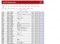
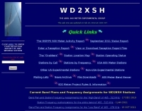 On March 27, 2017, the FCC adopted final rules for the USA 630-meter band, detailed in Report and Order FCC 17-33, which required PLC coordination with the Utilities Telecom Council before amateur operations could commence. This resource documents the WD2XSH experimental group's activities, including authorized stations, band plans, and frequency assignments within the 465-515 KHz range, with many stations operating between 495-499 KHz and 501-510 KHz. The site also highlights the WRC-12 decision on February 14, 2012, which granted a new **7-kilohertz-wide** secondary allocation between _472-479 kHz_ for the Amateur Radio Service worldwide. The group's efforts included operating with a maximum ERP of **20 Watts** across 45 stations in the continental USA, Alaska, and Hawaii, using emission modes such as CW, PSK-31, FSK-31, and MSK-31. The site provides links to download FCC 17-33 in PDF and DOCx formats, and offers a station location map, a list of stations by callsign and frequency, and an archive of news updates. Reception reports for any 600-meter station are encouraged to help the amateur radio community understand propagation and repeatability on this challenging band.
 -
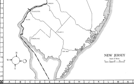
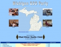 Participating in state QSO parties offers a focused opportunity for amateur radio operators to make contacts within a specific geographic area, often aiming to work all counties or administrative divisions. The Michigan QSO Party (MiQP) serves as an annual event where hams worldwide can connect with stations located in Michigan, contributing to county totals and overall scores. This resource provides the official rules, historical results, and information on planned operations, enabling participants to prepare effectively for the contest. Contesters can access details on scoring, exchange requirements, and various operating categories, ensuring compliance with the _Mad River Radio Club_ (MRRC) sponsored event. The site also offers downloadable Michigan county maps, a crucial tool for those pursuing county hunting awards or planning their operating strategy to maximize **multipliers**. Beyond the contest specifics, the platform facilitates community engagement through a link to the official groups.io mailing list, fostering interaction among participants and organizers. It also directs newcomers to the _ARRL_ for general amateur radio licensing information.
 -
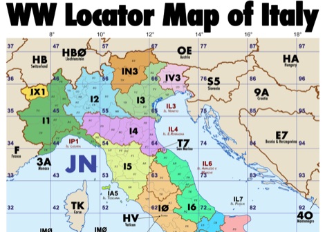 Amateur radio map of Italy with WW locators, provinces abbreviations and Call sign Prefixes, in a A3 size PDF file free to download, made available by IU3KJL Davide
 -
 PSK Reporter provides a real-time visualization of amateur radio digital mode reception reports, aggregating data from a global network of monitoring stations. This platform is particularly useful for operators utilizing modes such as FT8, FT4, and PSK, allowing them to observe signal propagation paths and assess their station's reach. The interactive maps display reception reports, enabling hams to analyze band conditions and optimize antenna performance for various frequencies and times of day, aiding in understanding ionospheric conditions. Operators can filter reports by callsign, band, mode, and time, gaining insights into specific propagation events or evaluating the effectiveness of their transmit setup. The data collected helps in predicting optimal operating windows for DX contacts across various digital modes. Philip Gladstone is the contact person for comments and discussions regarding the system.
 -
-
 Display your current Maidenhead locator with 10 digit precision. It also computes bearing and distance to a set of target locations using locator or latitude / longitude. Useful to align antennas in VHF / UHF / microwave DX activities. No network or fancy maps usage, so it can be used even in remote locations.
 -
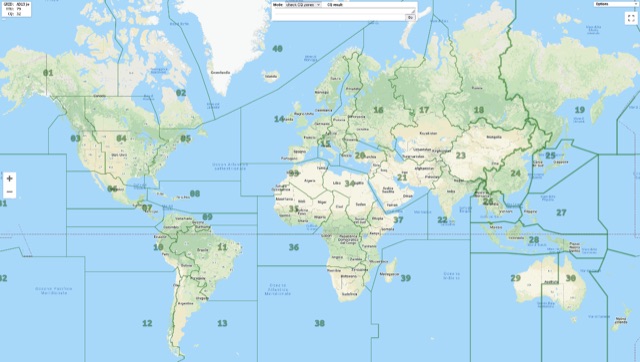 Show CQ and ITU Zone in an interactive clickable map based on google maps. Additional locator tool tip can be displayed by clicking on points, and a search function it is also available to locate addresses, and locators.
 -
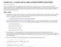 Contest audio recording for N1MM. external "plug-in" which adds a QSO audio recording function.
 -
 The DXCC World Map web application is a modern and interactive mapping tool designed for shortwave radio enthusiasts. It showcases a high-quality world map along with the Sun's position, sunrise and sunset times, the terminator, coordinates, QTH locator, azimuth, azimuth map, current DXCC list, Aurora, and WWV Geophysical Alert Messages. Additionally, it provides the SFI, X-Ray, Kp, and Ap indices.
 -
 Upload an ADIF fiel and plot all worked grids in an online map. Support filtering by band, year and can export the output directly into a google map, or a google earth KML file
 -
 An Google Maps interactive layer showing Australian amateur radio repeaters. You can navigate and zoom as required and click on a repeater-site icon to display frequency, ctcss and other details and notes for that repeater.
 -
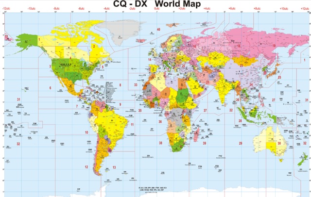
 DX Maps provides a specialized map printing service, focusing on amateur radio applications such as world prefix maps and custom great circle projections. The platform allows radio operators to visualize propagation paths and DX entities relevant to their QTH and operational goals. This service supports the creation of high-quality, large-format maps tailored for shack display or operational planning. The service facilitates the generation of personalized maps, which can include specific callsign locations, beam headings, and other critical amateur radio data points. Users can specify parameters to create maps that aid in understanding global propagation conditions and optimizing antenna aiming for long-distance contacts. The UK-based operation ensures a localized service for European hams, with international shipping options available. DX Maps also offers QSL card printing, complementing its mapping services.
 -
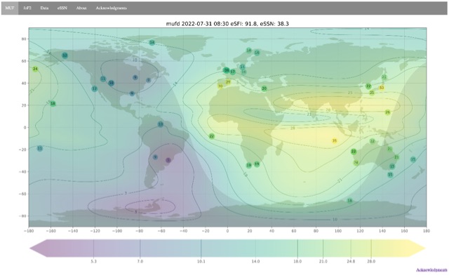 Ionospheric propagation maps MUF and critical frequency