Search results
Query: map
Links: 355 | Categories: 12
Categories
- Manufacturers > Amateur Radio Maps
- DX Resources > DX Maps
- Software > Grid Bearing and Maps
- Operating Modes > Repeaters > Repeater maps
- Operating Aids > Maps
- Software > RF Coverage Mapping
- Software > APRS
- Operating Aids > Distance & Bearing
- Operating Aids > Grid Squares
- DX Resources > IOTA
- Ham Radio > Regional > Ukraine
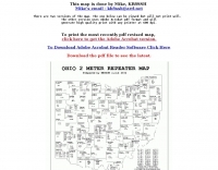
- Operating Modes > Repeaters > USA
-
 SWIFT WX Version 2.0 combines a powerful GIS mapping engine with real-time weather maps and storm tracking data making it the most comprehensive storm tracking application available.
 -
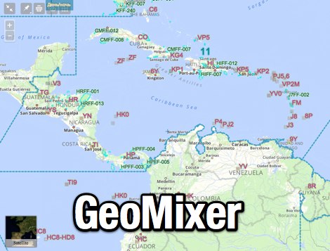 Amateur Radio Maps online mixer of different selectable layers, including DXCC references, IOTA references, ITU and WAZ Zones. Works with most web browsers make heavy javascript usage.
 -
-
 Ham Radio Android Apps to displays your current QTH locator on Google Maps using the GPS or WiFi / network location.
 -
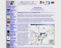
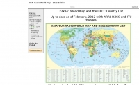 Amateur Prefix Maps by UT0UM updated with ARRL DXCC and ITU changes, available for download in PDF
 -
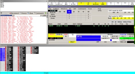
 VQLog 3.1 - 782 is a shareware logbook program designed for Windows operating systems (95, 98, NT, 2000, ME, XP, Vista, 7, 10, or later), supporting resolutions of 800x600 or higher. It can also operate on macOS and Linux via virtualization software like Virtual PC for MAC, Oracle VirtualBox, or VMware. The software facilitates QSO access by date, callsign, prefix, square, DXCC, and other parameters, offering robust import capabilities for ADIF, Cabrillo, and ASCII files from various contest and logbook programs. Key features include comprehensive award tracking for DXCC, WAZ, WAC, WPX, WAS, IOTA, TPEA, DIE, VUCC, 100EACW, and up to 30 user-defined awards. It generates customizable summaries and graphical statistics for QSO activity, DX contests, Most Wanted Squares (MWS), propagation openings, and prefixes. VQLog supports DX-Spot reception and processing from DX-Cluster and PSK-Reporter with programmable warnings, integrates with callbook services like QRZ.COM and Buckmaster's CD, and offers online lookup. Electronic QSL and log upload support extends to LoTW, eQSL.cc, Clublog, and DXMAPS, with real-time updates for online logs. The program provides extended QSO information for VHF-DXers, including separate TX/RX frequencies, start/end times, propagation modes, and specific entry fields for MS, EME, and Tropo. CAT support for rig control and interfaces with ARSWIN and PstRotator for azimuth/elevation control are also included.
 -
-
 The OK DX Club website serves as the home site for the OK DX Club, providing a variety of information such as hot news, propagation details, maps, QSL managers, software recommendations, useful links, and membership information. The site caters to amateur radio operators interested in DXing and offers a platform to share experiences, learn from fellow hams, and explore the world of DXing. The content is regularly updated to provide the latest information and resources for the amateur radio community.
 -
-

-
 Lookup callsigns in locator, or locator of a specified callsign and display in google map
 -
-
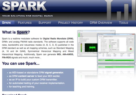 Spark is a realtime modulator software for Digital Radio Mondiale DRM, DRM+ and analog FM/AM radio standards. The software supports all code rates, bandwidths and robustness modes (A, B, C, D, E) published in the DRM standard as well as all mapping schemes, such as Standard Mapping
 -
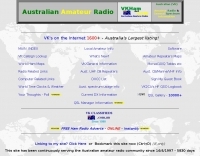 Australia's largest online database of VK email & URL's. Home of the AAR Netring and VK Classifieds. Repeater lists, maps and more...
 -
 Draws a world map centered on your QTH. Type in a DX station's call sign to get the beam aim azimuth and distance to the station.
 -
 Mapping software which links a Garmin GPS receiver to your Macintosh. Includes Maidenhead grid squares and beam-pointing maps.
 -
 TR4W is a contest logging software package supporting over **180** amateur radio contests. The program operates on Windows 7 to windows 11 operating systems. It supports CW keying via serial port, LPT port, or Winkey, with CW speeds ranging from 1 to **99** WPM. Paddle input via LPT port enables the program to function as a keyer, with paddle input aborting computer-generated CW. PTT support includes programmable delay. The software incorporates automatic super check partial and call checking, along with an expanded .DTA database format for names, QTH, grid, and SS check information. A band map displays color-coded aging data. The software features a built-in telnet DXCluster interface, automatically inserting spots into the band map. It supports RTTY operation via the MMTTY engine and includes WAE QTC support for both European and non-European stations. TR4W provides radio interfacing for Elecraft, Icom, Japan Radio, Kenwood, Ten-Tec, and Yaesu transceivers, utilizing serial or USB-to-serial adapters. Networked multiple-rig operation is supported through a client-server model using TCP/IP protocol. Integrated two-radio support (SO2R) is present. The program includes on-the-fly MP3 recording and log backup to USB drives or selected HDD folders. It uses the standard CTY.DAT file for country and beam heading data.
 -
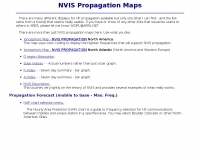
 VOAProp shows you typical propagation for a given hour of the day during a given month. The propagation is shown as expected signal strengths to be received from different parts of the world, plotted on a world map. Windows freeware by G4ILO
 -
-
 This program is a generator of coloured azimuth world maps centered on any terrestrial position. Windows Freeware
 -
 Ballistic simulator "Orbit" allows the physical principles of the motion in the gravitational field of the Earth to be demonstrated and learned. You can calculate with this program the ballistic trajectories of the thrown bodies and orbits of spacecrafts and visualize the astroballistic situation on the flat map of the world and on the rotating globe in the real time
 -
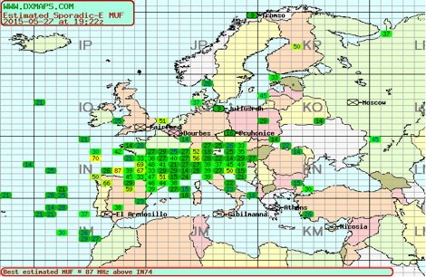 Sporadic-E clouds location and estimated MUF real time map by DXMAPS
 -
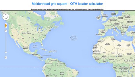
 This grid locator map uses Google map apis to find your QTH locator by simply clicking on the map. You can either enter your QTH locator and find the calculated distance and bearing between your QTH and another grid square.
 -
 This free program displays the location of any locator on a map. It calaculates between two Maidenhead locators the distance (km and miles) azimuth longitude latitude Show the location, direction and distance as you move your mouse on a map! Graphical Locator Program, By ON6MU
 -
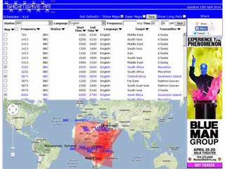 Shortwave Radio Schedules from Eibi/AOKI combined lists. Includes Google maps showing beam directions and long paths.
 -
 World Time and Mapping software including Azimuthal Maps.
 -
 TAHO.EXE, an open-source software, facilitates the creation of APRS maps for _UI-View_ by converting free data from _OpenStreetMap_ into the required *.JPG and *.INF file formats. This utility, developed by Dimitri Junker with specific UI-View format support added at the request of HB9DTX, streamlines the process of integrating detailed geographical information into the _UI-View_ platform. It operates on Windows, generating map files with border coordinates in just a few clicks, eliminating the tedious manual creation of *.INF files for custom maps. This converter allows UI-View users to leverage the continuously updated and community-contributed data of OpenStreetMap, which often surpasses commercial map quality in specific regions. The process is straightforward, with a detailed step-by-step guide available on the OpenStreetMap wiki, translated into French and German. TAHO.EXE significantly enhances the utility of UI-View by providing a readily accessible and continuously improving source of detailed, current geographical maps for displaying APRS station positions and objects.
 -
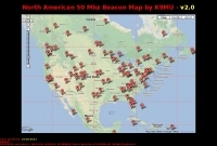 North american 50 Mhz beacon map by K9MU
 -
 Over 47 full-screen maps are available within _NAOMI_ (North American Overlay Mapper), a free Windows program designed for US and Canadian amateur radio enthusiasts. This mapping suite includes 9 backgrounds such as CQ Zones, ITU Zones, and ARRL Sections, along with 16 foreground layers like Counties, Areacodes, and Grid Locators. Users can calculate distances and bearings, track real-time mouse positions with continuous Grid-Locator data, and integrate with APRS for live station tracking via the FindU database. For a global perspective, the _Global Overlay Mapper_ (GOM) provides a world map, 8 continental maps, and 29 sub-continental maps, all with 12 active layers including Country Outlines, CQ/ITU Zones, and Prefix information. Both NAOMI and GOM offer feature-locate systems to jump to positions based on prefixes, capital cities, or Grid Locators, and provide customized beam headings and distance displays. The site also features _LogView_, a post-contest log visualization tool that analyzes Cabrillo-format logs by plotting QSOs on maps, supporting over 30 major contests like CQWW and ARRL DX, and allowing comparison with published results.
 -
 WorkedGrids is a Windows application that displays a map showing the amateur radio grid squares contacted and logged in using a third-party logging program. WorkedGrids uses colors to display information on a per-band basis. Up to four bands can be displayed concurrently by VE2ZAZ Bert
 -
 Ham radio map database with search and logging functions. Currently in german only, run under Windows.
 -
 A comprehensive resource center with DX aids, live propagation, callsign searches, news and bulletins, maps, and more by NW7US
 -
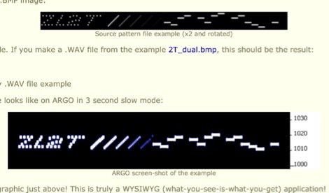 ChirpPix converts a bitmap image to a wave file, which can then be sent by a SSB transmitter and received on spectrogram waterfall displays Image Transmission using ChirpPix and ChirpHell. Click to donwload ChirpPix zip file.
 -
 VHF & Up Software management, Station Log and maps, in English
 -
 APRSmap is a new APRS client software by OE5DXL, which is based on the OSM map source. It allows a lot of features in only one program by a good usability. NO installation is required, just put it on a disk an run it
 -
-
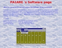 Beaconmap is a Win95/98/NT program to help listeners to identify the beacon stations of the NCDXF/IARU beacon network. The program displays a flashing dot at the location of the beacon that is currently transmitting. The call sign of the beacon, as well as the QTH is shown in the status bar. By PA1ARE
 -

-
 Located in southern Ontario Canada, supplier for HF VHF antenna kits, aluminium tubing, portable j-pole antennas, lightning suppressors, connectors and adapters
 -
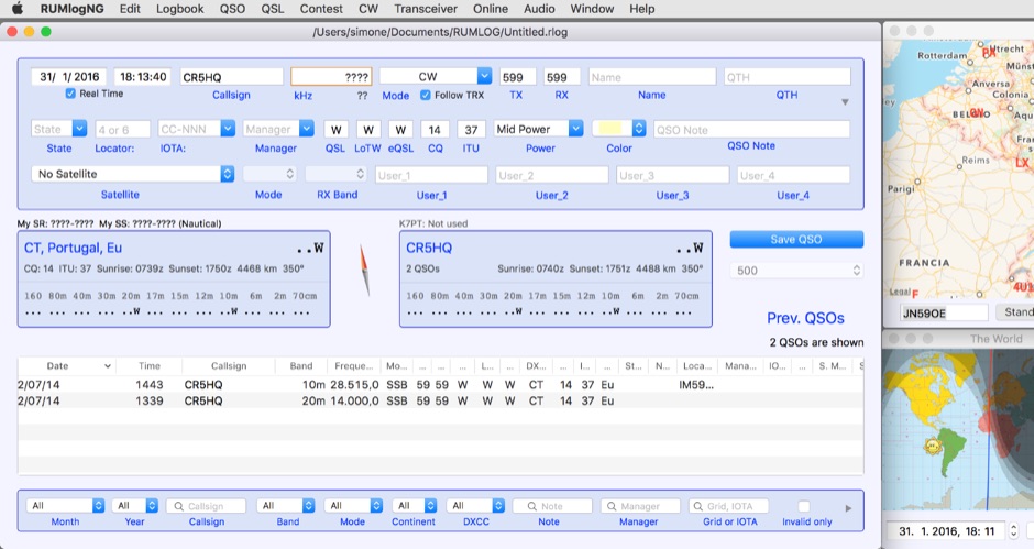 For macOS users engaged in amateur radio operations, a robust logging solution is essential for tracking QSOs, managing contest entries, and handling QSLs. RUMLog addresses these needs by providing a fully featured logbook program designed specifically for the Apple ecosystem. It integrates capabilities such as transceiver control for popular Icom, Elecraft, Yaesu, and Kenwood rigs, CW keyer interfacing, and real-time DX cluster monitoring. The software also includes mapping functions, callsign checking, and extensive import/export options for various log data formats. RUMLog's design supports both general logging and specialized contest operations, offering tools for efficient entry and submission. Its QSL handling and printing utilities streamline the confirmation process, a critical aspect for award pursuits like _DXCC_. The program's ability to interface with a wide array of transceivers via _Hamlib_ or proprietary protocols ensures broad compatibility, allowing operators to leverage its features across different station configurations. The free availability of RUMLog makes it an accessible option for macOS-based hams seeking a powerful logging utility.
 -
 VectorFox is a software born to incorporate a PC into the fox hunting environment. VectorFox is able to take inputs from up to 5 sources, such as a 2m beam, a 2m signal meter, a TDOA, etc, and display the results on the screen. VectorFox also accepts Agrelo inputs. From these results the operator can choose which indication is best and have a line drawn on the map in the direction of the signal.
 -
 DX Propagation by DR2W! High resolution SNR maps in pseudo color. Propagation based on the actual sunspot number.
 -
 This program allows both great-circle (polar) and rectangular projections of the world. The great-circle map is centered on any specified latitude and longitude (the "home" location). The rectangular projection is shown with the home longitude in the middle of the screen.
 -
 Displays amateur radio grid squares worked from third-party logging programs, providing a visual representation of contacts on a world map. This Windows application uses colors to differentiate up to four bands concurrently, calculating the total number of grid squares worked per band. It reads plain-text log files, including fixed-width, character-delimited, ADIF, and Cabrillo formats, dynamically updating the map as log files are saved during contests or general operation. Primarily targeting **VHF** and above operators, WorkedGrids aids in grid square collection for contesting and awards. The software offers a fixed-resolution continental viewpoint, zoom-in capabilities, and supports printing or copying the map to the clipboard. It operates on Windows 95 through Windows 11, requiring minimal CPU and RAM, and features a non-invasive installation. The program has undergone several updates, with version 7 released on March 3, 2024, addressing minor fixes and improving stability.
 -
 Web based VHF-UHF RF planning powered by SPLAT! and Google Maps. Access via website, Android App or dynamic Google Earth interface.
 -
-
-
 GPS information and thorough product reviews
 -
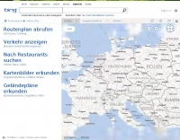
 Detailed online and searchable maps, driving directions and city guides
 -
 Live DX spots are presented through a _web cluster_ interface, utilizing both a world map and a Google Maps display for visualizing amateur radio propagation. The system provides real-time spotting data, enabling operators to track active stations globally. Users can observe current band conditions and station activity, which is crucial for optimizing contact strategies across various amateur bands. The platform's utility extends to contest operations and general DXing, offering a visual representation of where stations are being heard. While the primary function is DX spotting, the site also includes technical articles, such as instructions for interlocking two Flex Radios for single-transmitter compliance in contests, and a guide for constructing a simple **5KW** 1:1 balun for **160m/80m** dipoles using RG400 cable. This combination of live data and practical technical content supports both operational awareness and station improvement.