Search results
Query: geo
Links: 227 | Categories: 9
-
 AN-SOF is a professional comprehensive software tool for the modeling and simulation of antenna systems. AS-SOF allows to describe antenna geometry, Choose construction materials, Describe the environment and ground conditions, Describe the antenna height above ground, Analize radiation pattern and front-to-back ratio, Plot directivity and gain, Analize input impedance and VSWR,Predict antenna bandwidth
 -
 Community focused organization made up of Amateur Radio Operations from the Gordon County and the North Georgia area.
 -
 Low-frequency (LF) radio time signals, operating primarily in the 40–80 kHz range, are broadcast by national physics laboratories for precise clock synchronization. Transmitters like **JJY** (40 kHz, 50 kW; 60 kHz, 50 kW), RTZ (50 kHz, 10 kW ERP), MSF (60 kHz, 15 kW ERP), WWVB (60 kHz, 50 kW ERP), RBU (66.66 kHz, 10 kW), and DCF77 (77.5 kHz, 50 kW) cover vast geographic areas, often several hundred to thousands of kilometers. LF signals offer distinct propagation advantages over higher-band transmissions such as GPS. Their long wavelengths (3–6 km) enable effective diffraction around obstacles like mountains and buildings. The ionosphere and ground act as a waveguide, eliminating the need for line-of-sight and allowing a single powerful station to cover extensive regions. Ground wave propagation minimizes ionospheric variability effects on transmission delay, and signals penetrate most building walls effectively. Robust and low-cost receivers, often priced at 20–30 USD/EUR, are widely used in radio clocks. These receivers typically comprise a tuned ferrite core antenna, a receiver IC (e.g., Atmel T4227, U4223B, MAS1016) for amplification and AM detection, and a microcontroller for decoding the time signal and phase-locking a local clock. Specific components for DCF77, MSF, and WWVB are readily available from vendors like HKW Elektronik and Ultralink.
 -
 Club in Cleveland, White County, Georgia, promoting friendship, mutual assistance, and learning.
 -
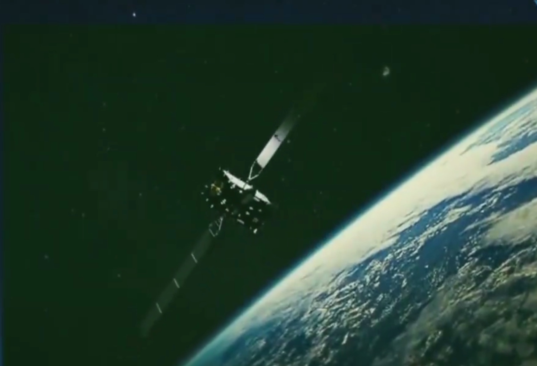 An exaustive article on how to receive the QO-100 geostationary satellite, that carries transponders usable by amateur radio operators
 -
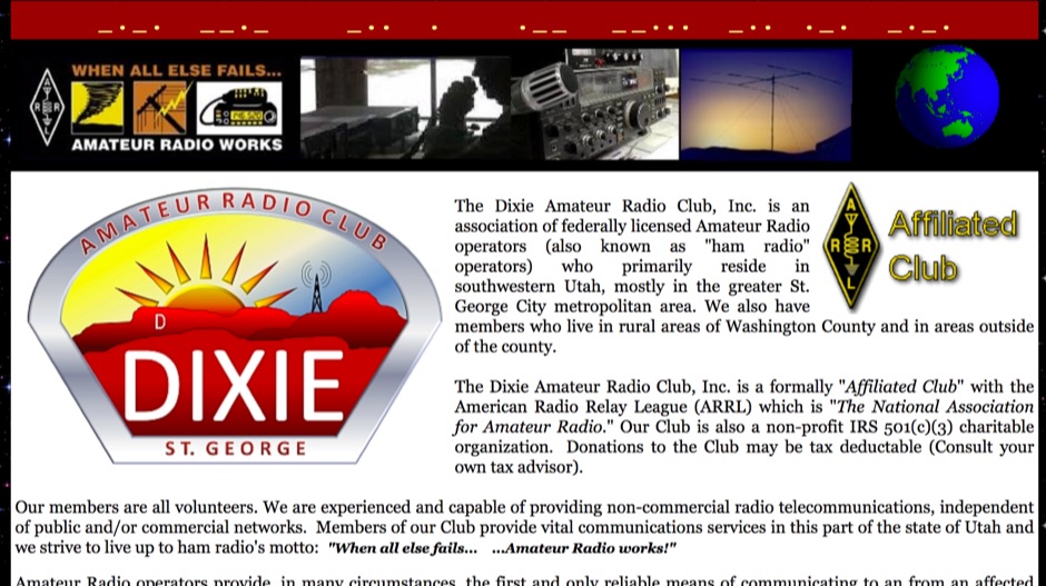 The Dixie Amateur Radio Club, Inc. is an association of federally licensed Amateur Radio operators (also known as "ham radio" operators) who primarily reside in southwestern Utah, mostly in the greater St. George City metropolitan area.
 -
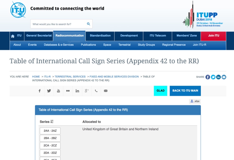 Appendix 42 to the Radio Regulations, published by the International Telecommunication Union (ITU), serves as the authoritative global reference for assigning call sign series to countries. This essential resource allows radio operators, including those in the amateur service, to accurately identify the national origin of a station based on its callsign prefix. It is fundamental for DXers, contesters, and anyone involved in international two-way radio communication, ensuring correct country identification for awards like _DXCC_. The table details the specific blocks of call signs allocated to each administration, facilitating the unambiguous determination of a station's geographical location. For instance, prefixes like K, W, N, and AA-AL are assigned to the United States, while G and M series denote the United Kingdom. Understanding these allocations is crucial for logging contacts and verifying QSLs. This ITU publication is regularly updated to reflect changes in national assignments and new allocations, maintaining its accuracy as the definitive source for call sign series worldwide. It underpins the global framework of radio communication.
 -
 Offers a range of high-performance RF interconnect solutions, addressing the critical need for reliable signal integrity across diverse radio frequency applications. Their product line includes custom cable assemblies, various **RF connectors** (such as SMA), adapters, and terminators, designed to meet stringent specifications from DC up to 40 GHz. These components are essential for maintaining low insertion loss and excellent VSWR in demanding environments, from test benches to operational communication systems. The company specializes in providing tailored solutions for both commercial and government sectors, emphasizing precision manufacturing in Warner Robins, Georgia. Their offerings are crucial for engineers and operators requiring specific lengths, connector types, and performance characteristics for their radio equipment and test setups. Ensuring robust connections and protection against transient voltage events, their **surge protectors** are integrated into systems to safeguard sensitive electronics from damage, a common concern in outdoor or high-power installations.
 -
 Demonstrates the practical application of APRS (Automatic Packet Reporting System) through the lens of HB9PVI's activities in Switzerland. It covers the system's core function of reporting geographical positions and telemetry data from various objects, including mobile stations, aircraft, and the ISS, distributed via packet radio and internet gateways. The resource highlights the routing paradigm shift introduced in April 2005, specifically the recommendation to use _WIDE1-1_ instead of RELAY and WIDE for digipeating to reduce duplicate packets. The page presents real-time maps displaying the positions of amateur radio stations in Switzerland and around Bern, updated every few minutes. It details specific callsigns like _HB9BA-2_ (HB9PVI's home QTH), _HB9BA-8_ (a weather station), and _HB9BA-4_ (a WIDE digipeater on Weissenstein mountain), providing context for their roles within the local APRS network. Links to track HB9PVI's mobile operations (_HB9PVI-9_) and handheld devices (_HB9PVI-15_, _HB9PVI-7_) are also provided. Furthermore, the resource curates a list of APRS software options for various operating systems, including _JavAPRS_ for Europe, _UI-view_, and _X-Astir_ for Linux, alongside digipeater/IGATE software like _DiXPRS_. It also offers downloadable APRS information, including a PDF article by HB9PVI and HE9ZGN, and a PowerPoint presentation in German, making it a repository of practical and historical APRS data.
 -
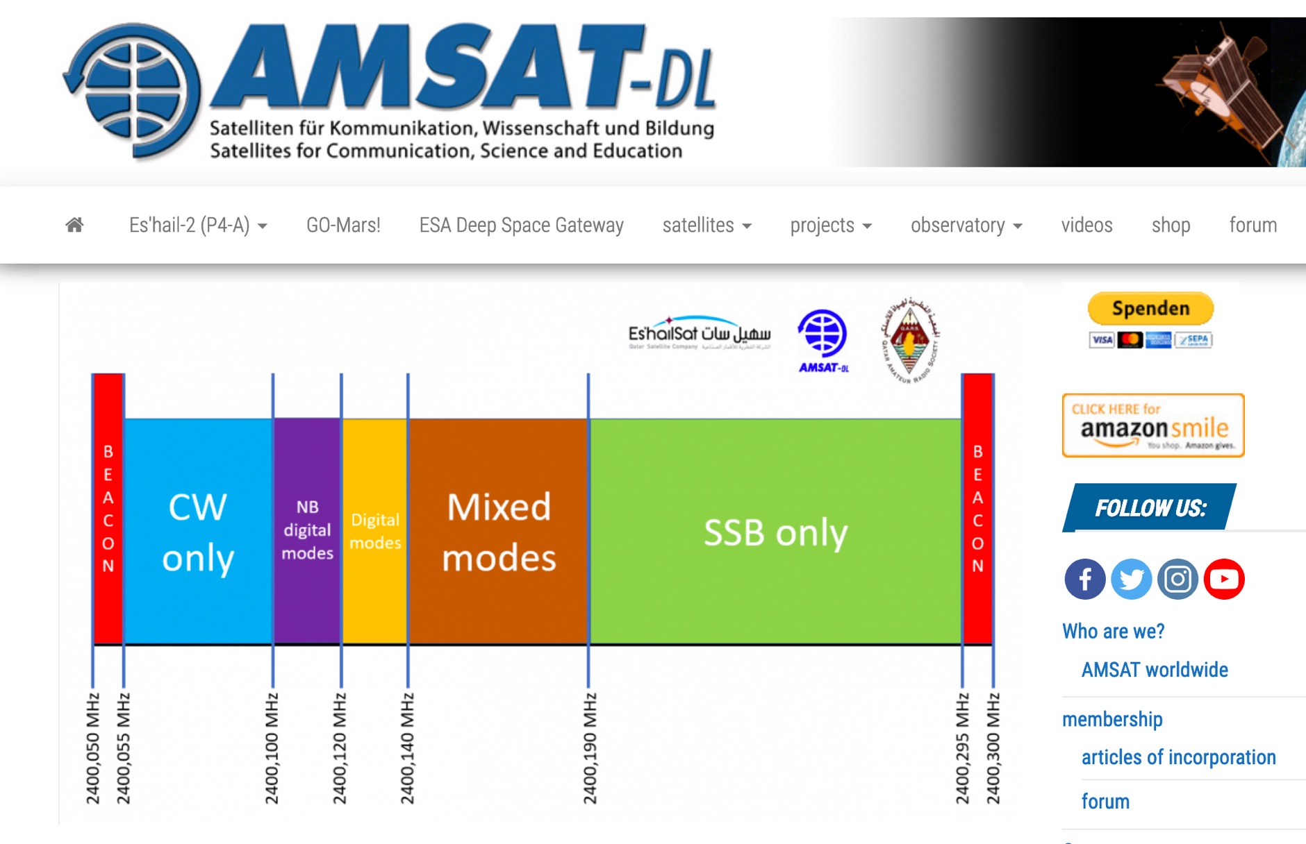 P4-A narrowband transponder Operating Guidelines and Band Plan, coverage map of the QO100 geostationary amateur radio satellite
 -
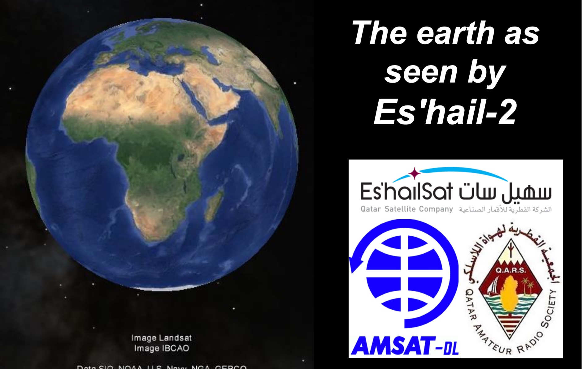 Presentation of the QO-100 the first geostationary OSCAR from Qatar by AMSAT-DL
 -
 Amateur Radio Amateur Radio Manuals & Books Computer Books & Programs Computer Hardware Rare & Hard to Find Books amateur radio,electronics ,electronis parts,tubes, amplifiers,towners, beam antennas and more
 -
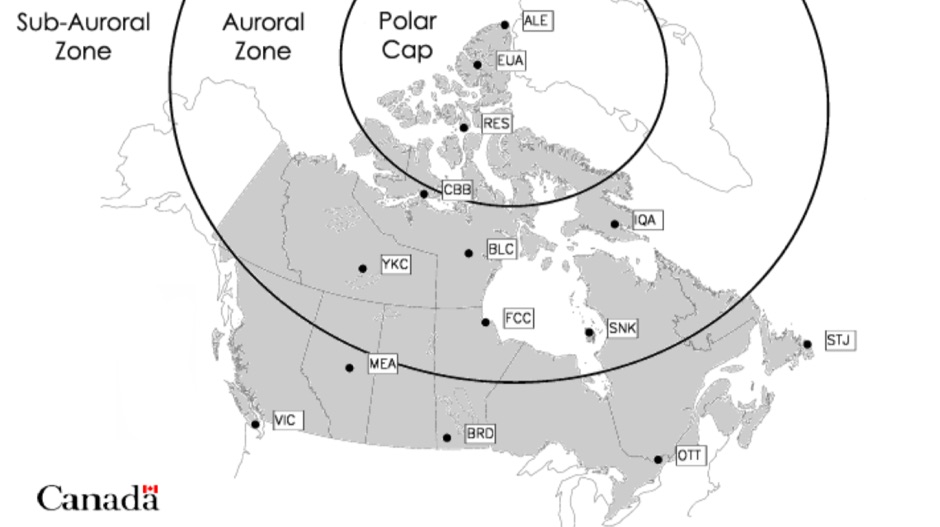 A dynamic collection of high latitude geomagnetic data from 12 Canadian observatories
 -
 The Bazooka antenna, a coaxial dipole, functions as an omnidirectional antenna with vertical or horizontal polarization. Patented in 1939 and refined in 2006, it features a quarter-wavelength coaxial cable with separated conductors. The outer conductor connects to a sleeve, while the inner conductor extends vertically. Initially complex, it has been simplified for versatile use, including military applications. Adding elements can modify its behavior for NVIS or Yagi-Uda configurations. Experiments in 2007 at the Campus de Pesquisas GeofÃsicas in Paula Freitas-PR demonstrated consistent VHF and UHF performance, showing reliable return loss measurements despite variable weather.
 -
 Fast Scan Amateur Television in Alabama, Arizona, Northern California Southern California, Georga, Illinois, Indiana, Kentucky, New Mexico, Nevada, Texas, Washington, Delaware, Maryland, New Jersey, and Pennsylvania
 -
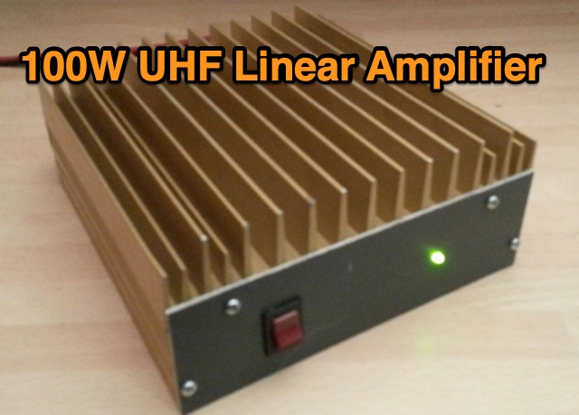 This page details my building of a 100 Watt Power Amplifier for the 432 MHz Band based on two Motorola MRF646 transistors taking inspiration by Carlo Gnaccarini VK3PY, formerly VK3BRZ
 -
 Documents the _5W0M_ DXpedition to Samoa (IOTA OC-097) conducted by a German team from April 4th to 18th, 2013. The resource provides operational details and insights into activating this Pacific entity. It covers the planning, execution, and on-air activities of the multi-operator team, focusing on maximizing contacts across various HF bands. The expedition successfully logged over **30,000 QSOs**, providing DXCC credit for many operators worldwide. The site serves as a historical record, allowing hams to review the expedition's progress and understand the logistical challenges of operating from a remote island. It highlights the strategic band choices and operating techniques employed to achieve a high QSO rate and reach diverse geographical areas.
 -
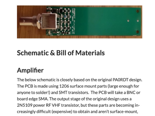 When experimenting with the WellGood Loop antenna, I came across the PA0RDT MiniWhip design referenced in several places. The construction of the PA0RDT MiniWhip is simpler than the WellGood Loop since there are no inductors to wind, but during my testing, I have found the loop to have slightly better performance.
 -
 The page automatically generate a Great Circle Map (GCM) for ham radio operators based on the IP address or by a given QTH locator. The GCM generated, unlike traditional maps of this type, has been rendered in an elliptical shape instead of a circle. This provides an expanded view horizontally thus making it easier to interpret. The map base is colored with each continent colored differently for easier recognition. The color code of the continents is given below the map for easy reference
 -

-
 VP8STI and VP8SGI South Sandwich & South Georgia DX Pedition 2016 - VP8 Log Online, VP8 DX spots and VP8 related links
 -
 The 2D0YLX Amateur Radio Blog, maintained by David Cain (137AT108), serves as a personal station blog from Peel in the Isle of Man, offering insights into various radio-related activities and local connections. It features content relevant to amateur radio operations, including personal experiences and observations from the island, providing a localized perspective on the hobby. The blog's primary focus is on general amateur radio topics, reflecting the author's engagement with the hobby. David Cain's blog provides a platform for sharing operational details and general interest items, often including links to other relevant sites on and around the Isle of Man. The content reflects real-world amateur radio engagement, offering practical glimpses into the daily activities of a station located in a unique geographical area. It is a resource for those interested in the personal side of amateur radio from a specific European island QTH.
 -
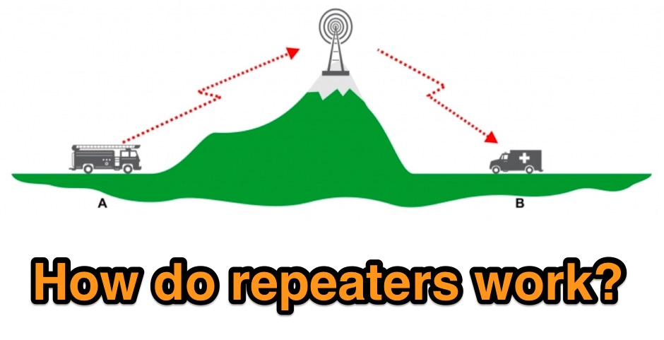 Illustrates the fundamental principles of radio repeaters, detailing their role in extending communication range beyond line-of-sight limitations. It begins by defining _simplex communication_ as a direct radio-to-radio link, effective only when no obstructions impede the signal path. The resource then introduces the concept of a repeater (or base station) strategically positioned on elevated terrain, such as a mountain, to overcome geographical barriers. The article clarifies the repeater's operational mechanism: it receives a signal on one frequency and simultaneously re-transmits it on a different frequency, enabling users on opposite sides of an obstruction to communicate. This _duplex operation_ is likened to satellite communication for VHF propagation, but with a fixed terrestrial station. Specific examples of signal paths are provided, showing how a handheld radio transmits up to the repeater, which then relays the message down to another user, effectively bypassing obstacles like hills or large buildings.
 -
 The Necessary Bandwidth for CW Signals By George Grammer W1DF
 -
 The TVDXA is a general interest and DX Amateur Radio Club serving the Chattanooga, TN and North Georgia area of the Tennessee Valley
 -

-
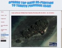 Pigeon Island,Reef Islands,Temotu Province,Solomon Islands 7-22 October 2010
 -
 Details the custom manufacturing of high-performance RF coaxial cable assemblies, emphasizing the use of _Times Microwave_ and other premium U.S.-made components. The company operates as a Small Business within the Albany, GA, HUB ZONE, with all warehousing and production facilities located in Southern Georgia, approximately 150 miles south of Atlanta. MPD Digital specializes in bespoke cable solutions for diverse applications, including amateur radio, WiFi, satellite, and cellular systems. Highlights the availability of thousands of connector configurations, supported by expert engineers on staff. The facility's total plant area and commitment to rapid shipping on custom cable assembly orders are noted. A specific product, the _MPD-400PVC Super Flex Coaxial Cable_, is mentioned as a recent update.
 -
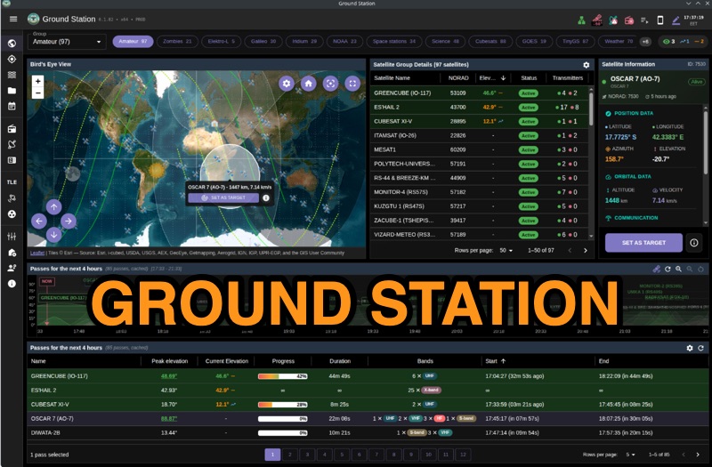 Ground Station offers real-time satellite tracking and radio communication capabilities, primarily for amateur radio operators engaged in satellite operations. It utilizes **TLE data** from sources like CelesTrak and SatNOGS for precise orbital prediction and integrates with various SDR devices, including RTL-SDR, SoapySDR, and UHD/USRP radios, to receive live signals. The software provides automated antenna rotator control and **Hamlib-compatible** rig control with Doppler correction, crucial for maintaining signal lock on fast-moving LEO satellites. It supports IQ recording in SigMF format and decodes several digital modes such as SSTV, FSK, GFSK, GMSK, and BPSK with AX25 USP Geoscan framing. Dedicated interfaces are available for satellite tracking, SDR waterfall displays with live transcription and packet decoding, and telemetry packet viewing. Users can manage TLE data synchronization and SDR hardware, along with browsing decoded outputs through an integrated file browser. An observations dashboard and DSP topology view further enhance the operational experience, providing comprehensive tools for monitoring and analyzing satellite passes.
 -
-
 The document discusses the classifications of sunspots and their potential for solar flare activity, categorizing them into Alpha, Beta, and Delta groups based on their magnetic field characteristics. It explains how these classifications relate to the likelihood of solar flares, ranging from minor to extreme events. The report also outlines the geomagnetic indices and conditions that affect high-frequency (HF) radio propagation, emphasizing the effects of solar flares on radio communication and geomagnetic storms. The information is geared towards amateur radio operators, providing insights into how solar activity influences HF radio operations.
 -
 The NOAA/GML Solar Calculator provides critical data for **solar position** and timing, including sunrise, sunset, and solar noon, for any geographic location on Earth. Users can input specific dates and times, or select from predefined locations such as World Cities, U.S. Cities, GML Observatories, and GML Data Sites. The interface allows for precise geographical input by dragging a red pin on an interactive map, complemented by extensive time zone selections and UTC offset adjustments. Key outputs include the Equation of Time, Solar Declination, and the sun's azimuth in degrees at local time. The tool also generates comprehensive sunrise/sunset tables for an entire year, opening these data sets in a new browser tab for easy access and analysis. While the calculator remains operational, NOAA explicitly states it is no longer actively supported or maintained, advising users that accuracy and functionality cannot be guaranteed, and no further updates or technical support will be provided. Despite the lack of ongoing support, the resource details the underlying calculations and offers spreadsheets for users interested in performing their own solar data computations. It also includes links to older versions of the solar calculator and a glossary of relevant terms, serving as a reference for understanding solar mechanics and their impact on radio propagation.
 -
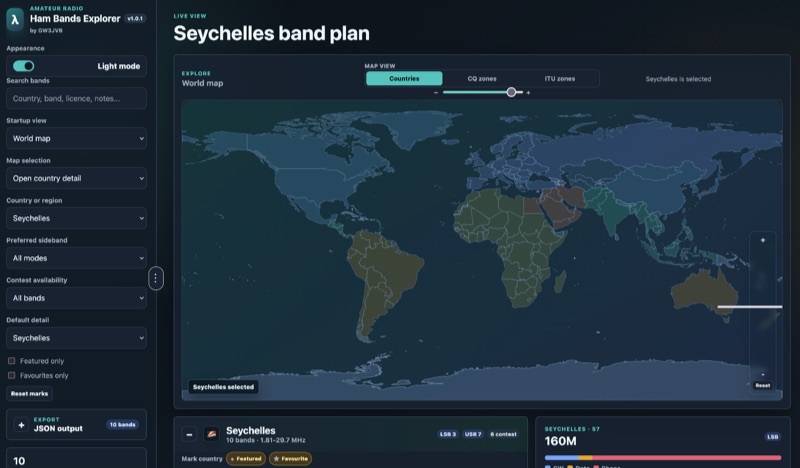 Presents an interactive **Ham Bands Explorer** web application, offering a live view of all amateur radio bands overlaid on a world map. This resource displays **CQ zones** and **ITU zones**, with geographical data sourced from HB9HIL/hamradio-zones-geojson under an MIT license. The interface provides a dynamic visualization of global band conditions, enabling operators to observe activity patterns across different regions. Users can select individual countries to retrieve and display their specific band plans, with frequency coverage details loaded from CountryData.json. The tool indicates 100% frequency coverage, ensuring comprehensive data presentation for selected regions. This functionality supports detailed analysis of national regulatory variations within the amateur spectrum. The application integrates both a map view and a live view, facilitating real-time monitoring and geographical context for band usage. It serves as a practical reference for understanding international amateur radio regulations and visualizing propagation characteristics across various frequency allocations.
 -
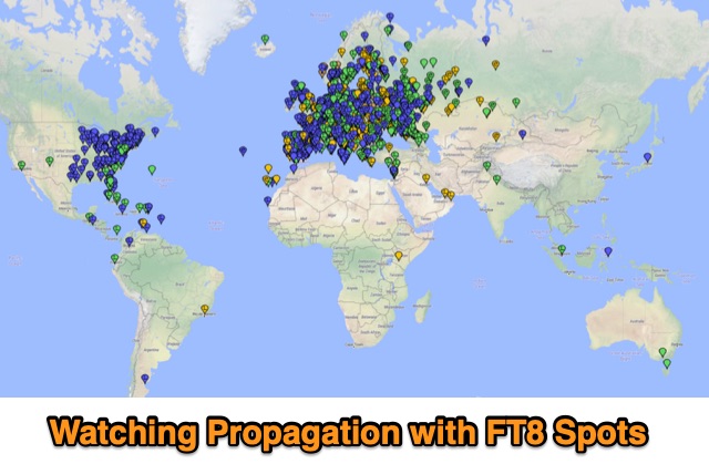 Monitoring propagarion during the day using FT8 reception reprts to determine openings and quality of propagation
 -
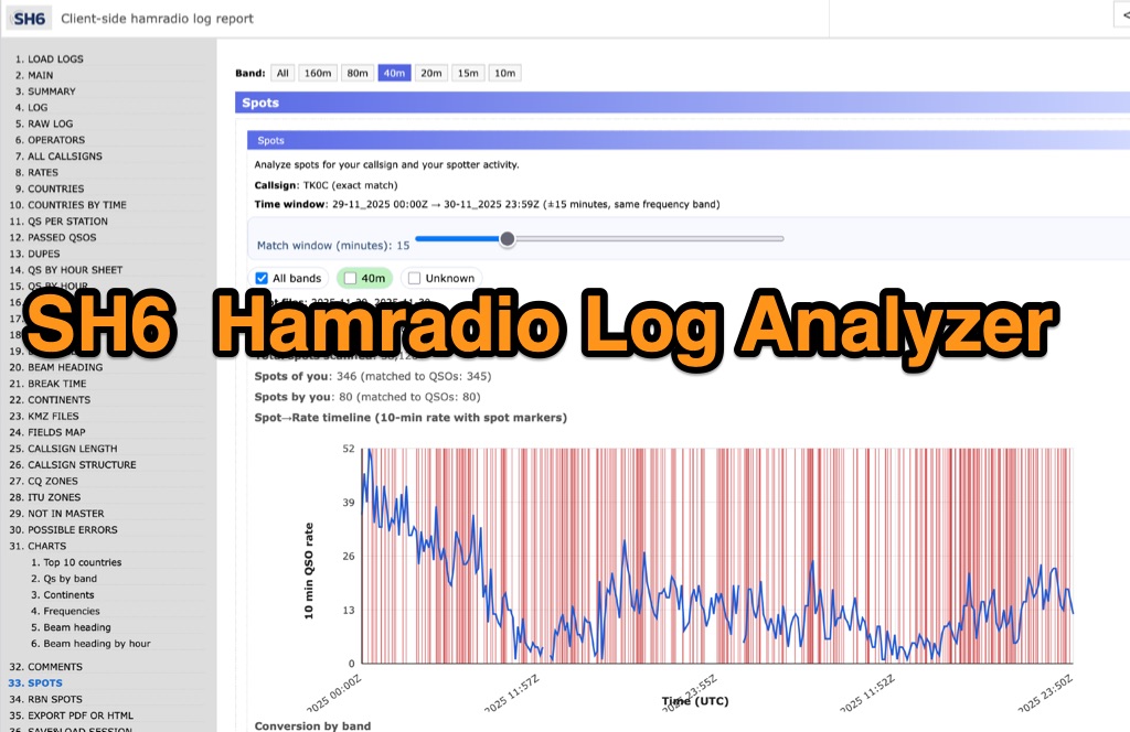 SH6 is a versatile, browser-based utility designed for the detailed analysis and visualization of amateur radio contest logs. Supporting standard formats such as Cabrillo and ADIF, the tool allows operators to upload personal files via drag-and-drop or access a searchable public archive containing over one million logs. Key capabilities include comprehensive performance metrics, offering summaries of band breakdowns, QSO rates, and beam headings. Furthermore, SH6 provides advanced geographic visualization through interactive maps, analyzing contacts by country, zone, and continent. A standout feature is the side-by-side comparison mode, enabling users to contrast two distinct logs for strategic assessment. SH6 transforms raw log data into actionable insights regarding operator performance without requiring software installation.
 -
 AZIWORLD is a user-friendly tool for generating azimuthal maps of the Earth centered on any location. Compatible with Windows XP and later, it supports English and French. Maps can be saved in .bmp format for easy customization. AZIWORLD computes azimuths, distances, and geographical positions, integrating seamlessly with AZIPOINT for automatic antenna pointing. Linux/Ubuntu/Android users can run AZIWORLD via WINE or CROSSOVER. For optimal functionality, installing AZIPOINT alongside AZIWORLD is recommended.
 -
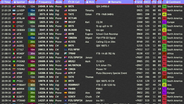 Over 15 amateur radio bands, from 160m to 70cm, are supported by the _DXTRON_ web cluster, providing real-time DX spotting information. This service integrates directly with the _QRZCQ_ API, allowing users to monitor activity across various modes including CW, Phone, Digi, RTTY, SSTV, and SAT. DXTRON displays critical spot data such as timestamp, spotter callsign, frequency, mode, DX call, and remarks, along with geographical details like Grid, DXCC, ITU, CQ zone, continent, and country. Developed by _DO5SSB_, DXTRON v1.42 offers a user-friendly interface for filtering spots by band and mode, catering to both casual DXers and serious contesters. The platform is designed for accessibility, providing a clear overview of current propagation conditions and active stations worldwide. This web cluster is a practical tool for hams seeking to identify rare DX, track contest activity, or simply observe band conditions. Its reliance on the QRZCQ API ensures a consistent flow of up-to-date spotting data, making it a reliable resource for real-time operational awareness.
 -
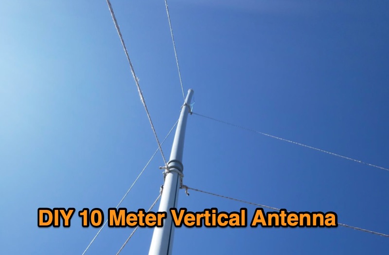 A 10-meter half-wave vertical antenna, designed by Thomas 4L/G8BAG, offers a practical solution for hams with limited space and materials. This "flower pot" design utilizes common hardware store items such as 60mm plastic drain pipes and 75 Ohm coax cable, demonstrating that effective HF operation doesn't require specialized components. The author details the coax preparation, including stripping the outer sleeve and braid at specific measurements like **2510 mm** and 2450 mm, and integrating it into the pipe structure. The construction emphasizes simplicity and low cost, providing an accessible path to getting on the air on the 10m band, especially when a horizontal beam is not feasible. The article notes an SWR of _1.5:1_ with 75 Ohm coax, managed by an MFJ 258 for impedance matching. This temporary solution proved robust, withstanding various weather conditions and achieving contacts across continents, including W, VK, BG, G, JA, and VR2, using 100W SSB from Georgia.
 -
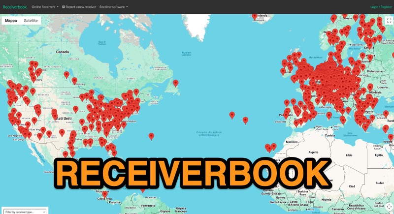 Monitoring radio communications through web-accessible Software Defined Radios (SDRs) has become a popular facet of the hobby, and Receiverbook serves as a centralized directory for locating these remote assets. The platform aggregates listings for both **OpenWebRX+** and **KiwiSDR** installations, providing a gateway to a diverse array of frequencies and operating modes. My own experience with similar directories highlights their utility for casual listening, DXing, and even troubleshooting local RFI by comparing signals across different geographic locations. The directory details specific receiver locations, from Bedford, England, to Marahau, New Zealand, and Berlin, Germany. Each entry often specifies the supported frequency ranges, which can span LF, MF, HF, VHF, and UHF bands, including dedicated segments like 80m, 40m, 2m, and 70cm. Many listings explicitly note support for HAM radio, broadcast services, and public two-way radio, making it a versatile tool for various listening interests. Beyond general frequency coverage, some entries provide granular details about the underlying hardware, such as the **SDRPlay RSP1A** or RTL-SDR Blog V3, and even the antenna types employed, like the Sirio Gain-Master. This level of detail is invaluable for serious SWLs and hams looking to understand the capabilities and limitations of a particular remote receiver before tuning in.
 -
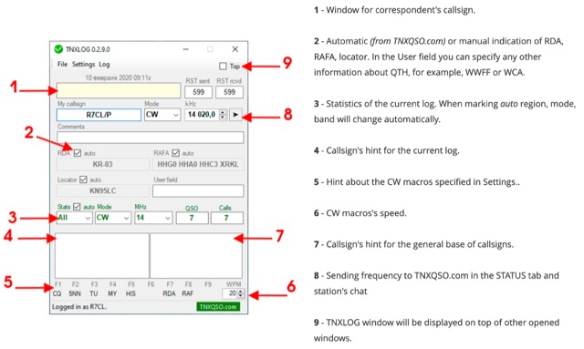 TNXLOG is a specialized logging application designed to complement the TNXQSO.com online service, focusing on real-time data exchange rather than serving as a standalone general-purpose logbook. The software facilitates the transmission of current **QSOs** to the TNXQSO.com server and simultaneously retrieves relevant geographical data such as RDA, Locator, and RAFA from the same server. It maintains real-time QSO statistics, providing operators with immediate feedback on their activity. Additionally, the application supports working with **CW macros** via a COM port, streamlining Morse code operations during contacts. This utility is specifically tailored for users of the TNXQSO.com service, enhancing their operational experience by automating data synchronization and providing instant access to location-specific information. Its design prioritizes integration with the online platform, making it a companion tool for those engaged in specific award programs or regional operating activities that benefit from real-time data exchange and statistics. The software's functionality is distinct from traditional logbook programs, emphasizing its role in a connected operating environment.
 -
 A real-time, responsive map view of APRS (Automatic Packet Reporting System) information, CWOP (Citizens Weather Observer Program), and other APRS-IS sources across the world. The N2RWE Real-time APRS Map leverages cutting-edge technologies and custom software to present a dynamic and user-friendly platform for visualizing Automatic Packet Reporting System (APRS) data. This web application aggregates real-time station locations from various public sources, offering a comprehensive view of APRS activity. It caters to both novice and experienced users by providing features like Maidenhead Grid maps, station lists, license plate searches, and advanced tools for geolocation, address lookup, and data analysis. Additionally, the platform integrates with Summits on the Air (SOTA) information, enhancing the experience for SOTA enthusiasts. By actively supporting the #APRSThursday net, the N2RWE Real-time APRS Map fosters a collaborative environment for the APRS community.
 -
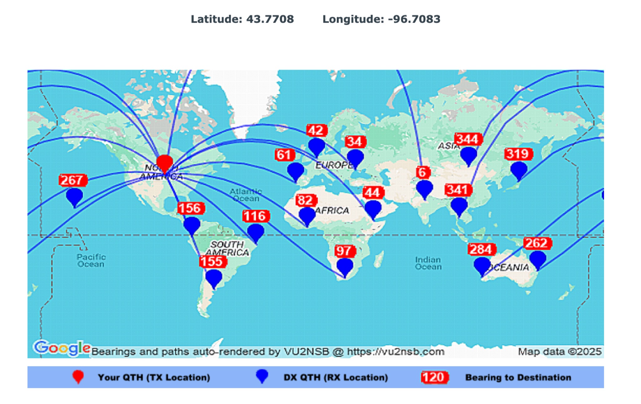 This page by Basu (VU2NSB) presents automatically rendered antenna bearings with geodesic paths projected on a rectangular map. ch geodesic great circle path displayed on the map originates from your location that is derived from your Internet IP address. Therefore the Antenna Bearing Geodesic Map generated below should be accurate and relevant to your physical location (QTH). This map is an alternative to the Great circle Map.
 -
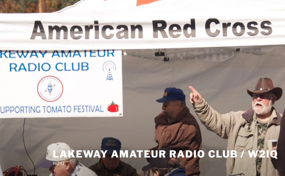 The Lakeway Amateur Radio Club, identified by its callsign _W2IQ_, serves as a significant hub for amateur radio operations within the Lakeway Area. This organization demonstrates a strong commitment to regulatory compliance and amateur radio accessibility through its robust Volunteer Examination (VE) Team. As an ARRL-accredited entity, W2IQ facilitates online FCC amateur radio licensing examinations, providing a critical service for new licensees to enter the hobby. This infrastructure supports the growth of the amateur radio community by streamlining the licensing process, making it highly accessible to prospective operators. The club's technical contributions extend to fostering diverse operational interests, though specific repeater or APRS infrastructure details are not explicitly detailed. Their emphasis on licensing and education, particularly through remote testing protocols, highlights a modern approach to amateur radio entry. This focus on **VEC protocol coordination** ensures a consistent pathway for individuals seeking to obtain or upgrade their amateur radio licenses. The club also promotes engagement with various aspects of the hobby, indicating a broad interest in amateur radio activities and technical development within its geographic sphere of influence. Their dedication to supporting new radio amateurs underscores a foundational role in regional frequency management and community building.
 -
 Andrew Georgakopoulos, SV1DKD, modeled the End-Fed Half Wave (EFHW) antenna using MMANA-GAL software. He evaluated the EFHW-8010-2K from Myantennas.com for field operations, comparing it to random wires, OCFD, and dipole antennas. His results showed similar performance to OCFD, confirming EFHW's practical feeding advantage but with potential high-voltage risks at the feed point
 -
 This page provides updated data and statistics about United States amateur radio operators, including historical totals, demographics, and geographic distributions. It also explains the Amateur Radio Service, highlighting its role in promoting wireless communication and technological advancements. The page is a valuable resource for hams interested in understanding the current landscape of amateur radio in the United States.
 -
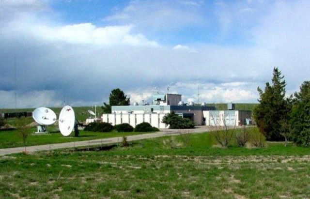 NIST radio station WWV broadcasts time and frequency information 24 hours per day, 7 days per week to millions of listeners worldwide. WWV is located near Fort Collins, Colorado, about 100 kilometers north of Denver. The broadcast information includes time announcements, standard time intervals, standard frequencies, UT1 time corrections, a BCD time code, and geophysical alerts
 -
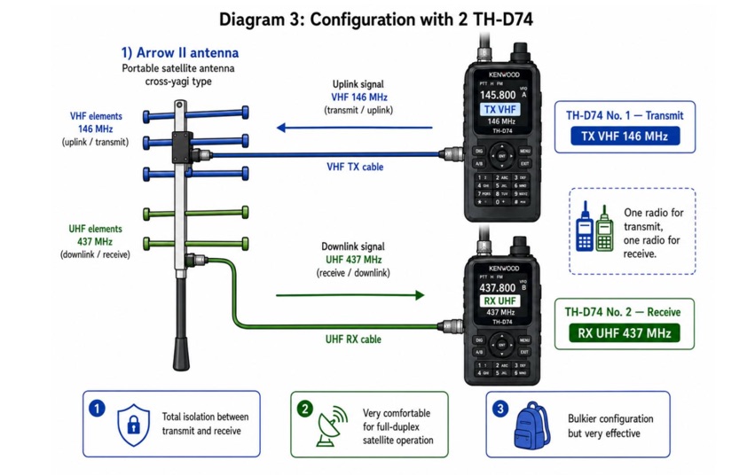 Examines current amateur radio satellite operations as of May 2026, providing a practical overview for hams interested in making their first satellite QSOs. The resource differentiates between Low Earth Orbit (LEO) satellites, such as the _ISS_, SO-50, RS-44, FO-29, AO-7, and GreenCube, and the geostationary QO-100. It highlights the distinct operational requirements for each, noting that LEO birds necessitate real-time tracking, antenna rotation, and Doppler compensation. The article emphasizes the critical practice of listening before transmitting and outlines methods for monitoring QO-100 in real time via the Goonhilly Earth Station WebSDR. It also covers tracking LEO satellites using tools like N2YO.com, Heavens-Above, and amsat.org/status. The author's experience with these platforms informs the guidance on equipment considerations and operating practices, ensuring hams understand the nuances of satellite communication in 2026, including the significant impact of QO-100 since its 2019 launch.
 -
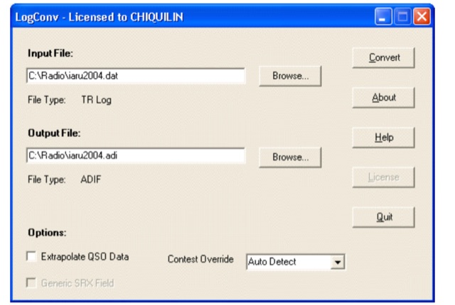 LogConv is a versatile utility designed to convert Amateur Radio log files between various formats such as ADIF, Cabrillo, CT9, CT10, EQF, and TR Log. It offers both GUI and Command line versions for user convenience. LogConv normalizes QSO data, breaking it into separate fields for better visibility. Additionally, it can extrapolate geographic information from contest exchanges, aiding in awards tracking
 -
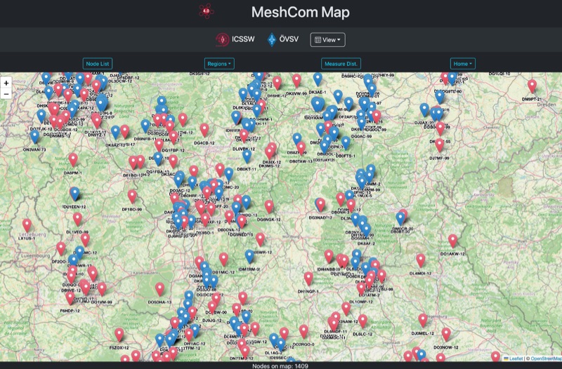 Approximately 100 MeshCom nodes are visualized in real-time on a geographical map, providing a dynamic overview of the LoRa mesh network. This resource, hosted by _OE1KFR_, details node positions, telemetry data, and message traffic. Users can measure distances between two selected nodes, view text messages with callsign, destination, and gateway information, and access position data including latitude, longitude, and altitude. The platform supports filtering by regions such as Europe, USA, and Asia, allowing operators to focus on specific geographical areas. The detailed node list table presents comprehensive status information for each node, including gateway callsign, firmware version, hardware type, and environmental telemetry like temperature, pressure, humidity, and CO2 levels. This granular data enables operators to monitor network health and individual node performance, facilitating troubleshooting and optimization of MeshCom deployments. The map interface enhances situational awareness for those engaged in LoRa mesh networking.
 -
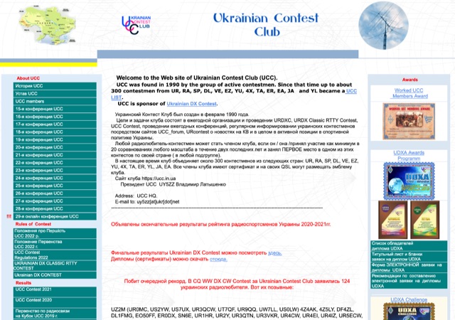 The Ukrainian Contest Club (UCC) website details contest activities, including a March 2026 contest calendar compiled by _UW3WF_ that excludes specific "exotic" tests, mini-tests, sprints, VHF competitions, and events organized by Russian entities. It lists major contests such as the ARRL International DX Contest, Stew Perry Topband Contest, and CQ WPX SSB Contest, providing dates, times, modes, bands (e.g., **10-160m**), organizers, log submission methods, and deadlines. The resource also highlights Ukrainian participation in various international contests, noting specific callsigns that represented the UCC, and acknowledges new Ukrainian records, such as UW5Y's new record in the ARRL DX CW Contest. The site presents contest results and rankings, including the top 20 Ukrainian contesters in the World Amateur Radio Contesting Association (WARCA) rating for 2019-2024, with _UW1M_ ranked #18 globally and #1 in Ukraine with **26,490.32** points. It also details the club's 12th place finish among 155 clubs worldwide in the CQ WPX Contest 2024 (CW + SSB). The resource includes information on WRTC 2026 participants from the club and lists members excluded due to collaboration with adversarial entities, reflecting the current geopolitical context.