Search results
Query: real
Links: 476 | Categories: 18
Categories
- Operating Modes > Satellites > Real Time Tracking
- Operating Modes > APRS > APRS in USA
- DX Resources > Clusters
- Software > iPhone > DX Cluster
- Software > Android > DX Cluster
- Software > Linux > DX Cluster Clients
- DX Resources > DX Maps
- DX Resources > DX Stories
- Internet and Radio > Live streaming
- DX Resources > Logs
- Operating Modes > Meteors
- DX Resources > Clusters > Mobile DX Cluster
- Propagation > MUF Indicators
- Propagation > Observatories
- Internet and Radio > Police Scanners
- Propagation > Propagation Forecast
- Software > Satellite tracking
- Internet and Radio > Web Cams
-
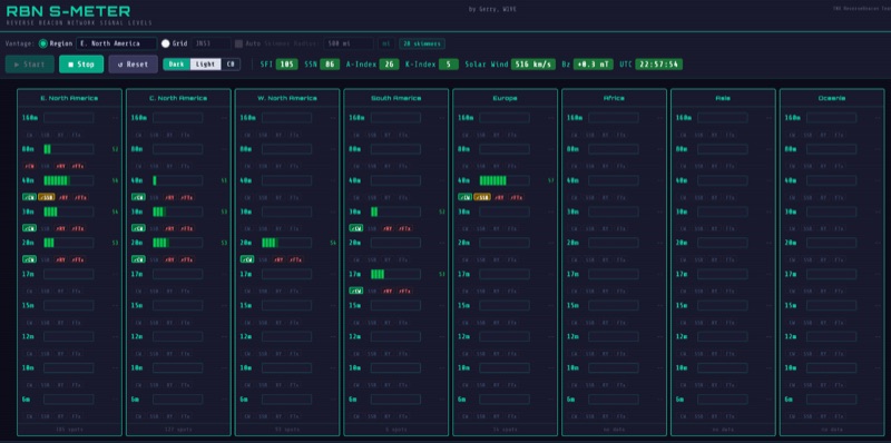 The RBN S-Meter visualizes real-time HF propagation data from the Reverse Beacon Network (RBN). It processes thousands of automated spots per hour, providing a real-time picture of active RF paths on HF bands. Users can set their vantage point using _Region Mode_ or _Grid Square Mode_. Region Mode allows selection from broad geographic areas like E. North America or Europe, while Grid Square Mode uses a Maidenhead grid square and radius for more precise data. The app displays eight region panels, each with horizontal bars for bands 160m through 6m, indicating signal strength with a color ramp from green to red. A dimmer trail shows peak hold values, and an S-unit readout provides additional detail. The app is a free web application accessible on any device, offering a practical tool for ham radio operators interested in CW, RTTY, and FT8 signals. It features a Progressive Web App installation option for enhanced usability on mobile and desktop platforms. Users can install it on Android, iOS, and Windows devices, providing a native app-like experience. The app replaces the previous Windows standalone executable, incorporating user feedback to improve features like grid square mode and automatic location detection.
 -
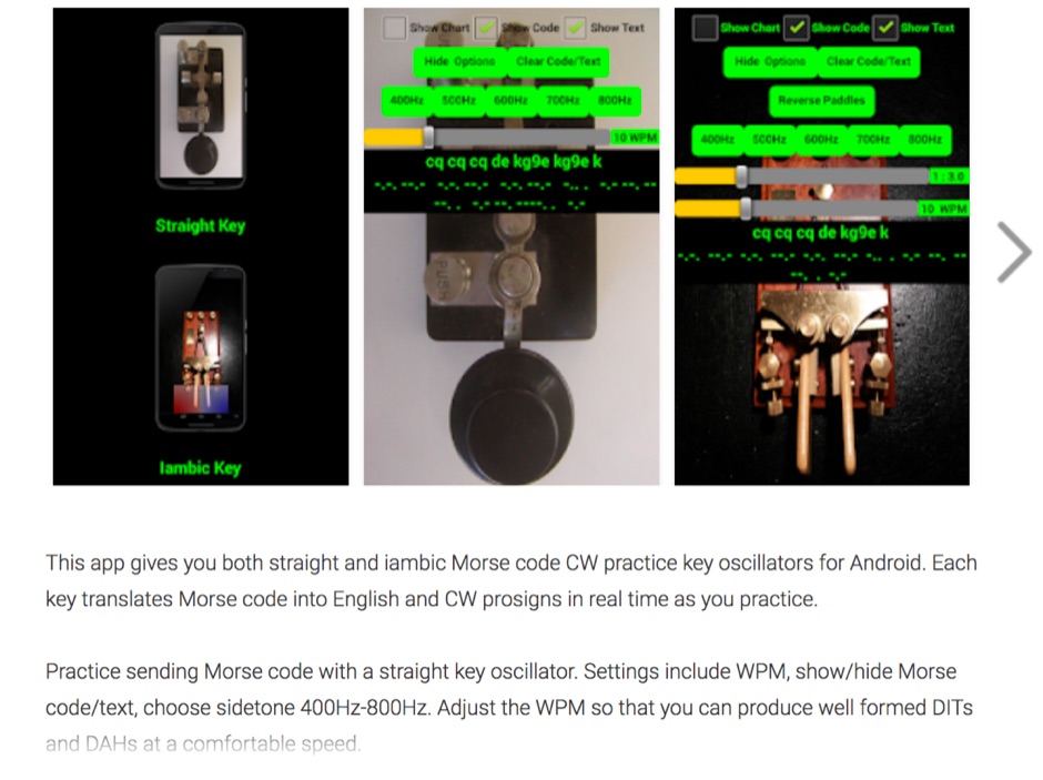 Iambic and Straight key amateur ham radio CW Morse code practice oscillators for Android. This Android app gives you both straight and iambic CW Morse code practice key oscillators. Each key translates Morse code into English and CW prosigns in real time as you practice. Practice sending Morse code with a straight key oscillator. Settings include WPM, show/hide Morse code/text, choose sidetone 400Hz-800Hz. Adjust the WPM so that you can produce well formed DITs and DAHs at a comfortable speed.
 -
 GoGreenSolar provides comprehensive solutions for **DIY solar panel systems**, catering to both homeowners and professionals seeking energy independence or reduced utility costs. Their offerings include a variety of solar kits such as Grid-Tie, Off-Grid, and Battery Backup configurations, designed to integrate seamlessly with existing utility infrastructure or provide complete autonomy in remote locations. Customers can select from Microinverter or String Inverter kits, along with essential components like **solar panels**, inverters, batteries, and racking systems, all curated from reputable brands known for efficiency and durability. The company emphasizes end-to-end support, from initial consultation and custom system design to providing easy-to-follow installation manuals. They offer financing options, including quick-approval loans with zero down payment, and a money-back guarantee if a solar permit is not approved. The platform also features a solar calculator and a questionnaire to help users determine the most suitable system for their specific energy requirements and property characteristics. GoGreenSolar aims to simplify the solar adoption process, enabling significant savings on energy bills and labor costs. Their approach focuses on empowering users to install their own systems with expert guidance, ensuring optimal performance and a secure energy future for homes and businesses.
 -
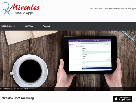 Mircules HAM QuickLog provides a mobile logging solution for amateur radio operators, supporting quick contact entry on iOS and Android platforms. It features multiple log file management, instant callsign information display including Country, ITU zone, CQ Zone, and DXCC number, and robust ADIF and CSV import/export capabilities. The application is designed for efficient logging with optional fields and default values, streamlining the process for both shack and field operations. The software includes dedicated support for POTA, SOTA, and IOTA activations through specific fields like MY_SIG_INFO, SIG_INFO, MY_SOTA_REF, IOTA, and MY_IOTA. A specialized contest mode offers real-time dupe checking and automatic TX exchange updates to enhance contest efficiency. Integration with QRZ.COM and HAMQTH.COM allows for direct operator information lookup and import, while Open Street Maps integration provides geographic context for contacts. The application also features a notes and scratchpad function for each log file.
 -
 The Barrow Amateur Radio Emergency Service Club (BARES) serves as a local hub for amateur radio operators in Barrow County, Georgia, focusing on community engagement and emergency preparedness. Established in 2007, the club provides a platform for hams to connect, share knowledge, and participate in various radio activities. Members often engage in public service events, offering communications support, and conduct regular meetings to discuss technical topics and operational procedures. BARES emphasizes the importance of emergency communications, with members frequently training for and participating in simulated emergency tests (SETs) and real-world disaster response scenarios. The club maintains a focus on local area coverage, ensuring reliable communication infrastructure is available when traditional systems fail. Their activities often involve operating on _VHF_ and _UHF_ bands for local nets and _HF_ for longer-distance emergency coordination. Key activities include field day operations, technical workshops, and supporting local events with radio communications.
 -
 **Low SWR Podcast** was a dedicated platform for amateur radio enthusiasts, produced by Rich, **K0EB**, and his son Brady, **AC0XR**. The podcast covered a range of topics relevant to the ham radio community, including technical discussions, DXing, and radio news. Episodes were crafted to engage both seasoned operators and those new to the hobby, providing insights into the evolving landscape of amateur radio. Despite its cessation in 2014, the podcast remains a testament to the dynamic nature of ham radio, reflecting the changing interests and priorities of its creators. The podcast's archive offers a valuable snapshot of amateur radio discourse during its active years. While no new episodes have been produced since 2014, the existing content continues to serve as a resource for understanding past trends and discussions within the community. The podcast's focus on technical content and real-world applications made it a useful tool for operators seeking to enhance their knowledge and skills. Although inactive, the Low SWR Podcast's legacy persists, highlighting the enduring appeal and educational value of amateur radio media.
 -
 Accurate meteorological data is crucial for optimizing antenna performance, predicting propagation, and ensuring safe tower work. This resource provides a curated inventory of weather stations, including models like the _AcuRite Atlas_ with lightning detection and the _Ambient Weather WS-2902_ WiFi Smart Weather Station, which offer real-time data on environmental factors. The product listings detail specific features such as direct-to-Wi-Fi connectivity, rainfall tracking, and temperature insights, enabling informed decision-making for various amateur radio operations. The platform categorizes products by application, featuring weather stations tailored for home and backyard use, as well as more robust systems for farm and agriculture, which can be critical for field day operations or remote station monitoring. It also highlights _Made in USA_ options, emphasizing local manufacturing and support. Beyond weather instruments, the site also presents related surveillance technology, such as the _Waggle solar CCTV camera_, designed for outdoor reliability with an IP65 weatherproof rating. This integration allows for comprehensive monitoring of remote ham radio shacks or antenna sites, combining environmental data with visual oversight.
 -
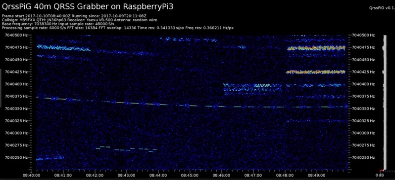 Monitoring extremely weak signals in the QRSS (Very Slow Morse) mode requires specialized receiving and processing capabilities to extract information below the typical noise floor. This project provides a software solution, _QrssPiG_, designed to run on a Raspberry Pi, enabling it to function as a dedicated QRSS grabber. It interfaces with various Software Defined Radio (SDR) devices, including the popular _rtl-sdr_ dongles and _HackRF_ units, to acquire raw I/Q data streams. The software then performs the necessary signal processing to visualize and decode these faint, long-duration CW transmissions, often operating with milliwatts of power. The system leverages the computational power of the Raspberry Pi for real-time signal analysis, allowing hams to participate in QRSS experiments and monitor distant beacons. It supports different SDR hardware, offering flexibility in setup and deployment for home stations or remote monitoring sites. The project includes detailed instructions for installation and configuration, making it accessible for those familiar with Linux environments. This grabber is particularly useful for tracking propagation on the LF and HF bands where QRSS activity is common, providing a visual representation of signal presence over extended periods.
 -
 Amateur radio, Technology, Towers, Land, Wilderness, real estate, Visalia DX Convention Report #1 Flexradio Antennas Dxpedition, Elecraft introduces K3, here are pictures of the radio from the outside and inside from the Visalia DX Convention
 -
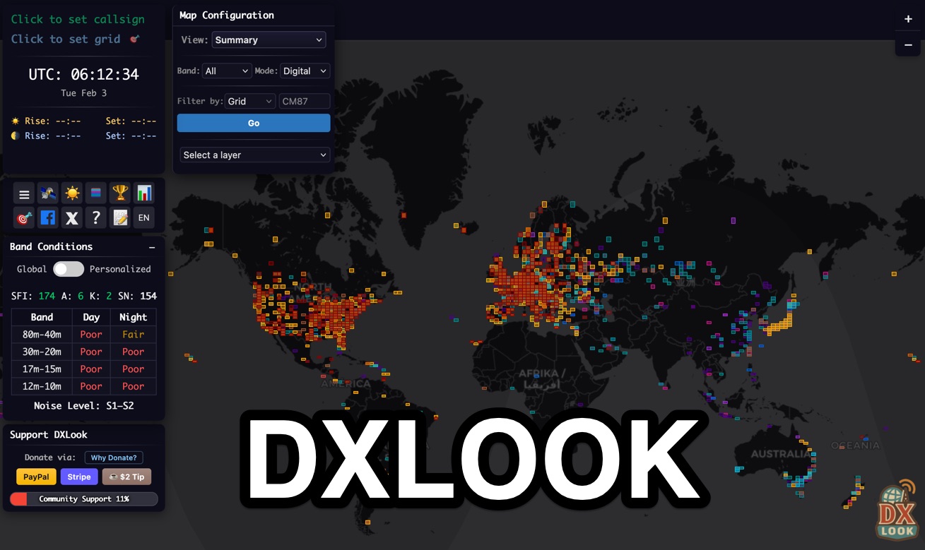 DXLook is a free, web-based propagation platform that delivers comprehensive, real-time insight into HF and VHF conditions directly from any modern browser. It aggregates live spots from PSK Reporter, WSPRnet, RBN, and DX Cluster, complemented by NOAA space-weather metrics such as SFI, K/A indices, and geomagnetic alerts. Integrated VOACAP predictions allow practical "theory versus reality" comparisons, while the interactive world map with filters, gray line, and grid overlays enhances situational awareness. With no installation or maintenance required, DXLook provides a convenient, accurate, and accessible solution for everyday operating and propagation analysis.
 -
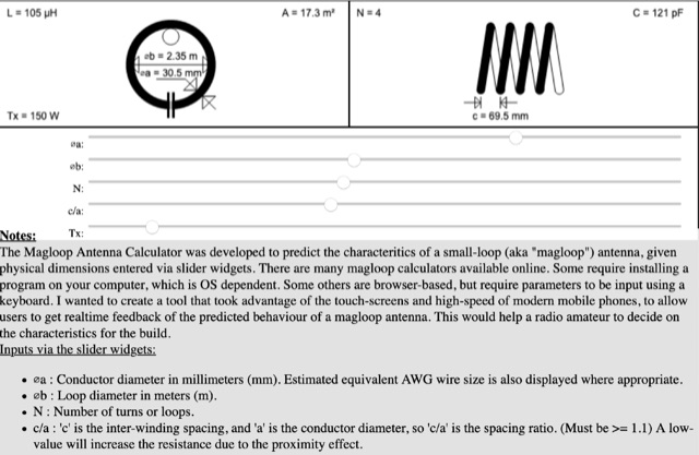 The Magloop Antenna Calculator was developed to predict the characteritics of a small-loop (aka magloop) antenna, given physical dimensions entered via slider widgets. This magnetic loop antenna calculator works also on most mobile devices, adjusting sliders and calculating dimensions in real time.
 -
-
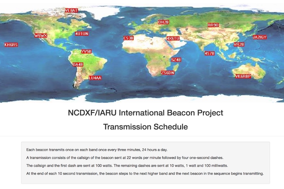 Whatch at beacons transmitting in real time. This page contains a self refreshing table that displays every 10 seconds the current transmission schedule of the international beacon project. Tune your radio and check the beacon you are hearing.
 -
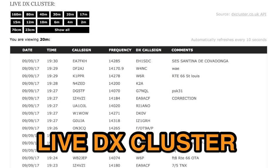 View real-time spot information by band for active amateur radio operators around the world via the DX Cluster network, taking raw data from a JSON API made available by DXCluster.co.uk
 -
-
 Presents RigOne, a radio controller application designed for Windows 10 (later releases) and Windows 11, with a macOS version under active development. The software provides core operational controls such as tuning, VFO following, signal metering, and audio management, emphasizing a clean interface for everyday use. It supports native Icom direct control, with the **IC-7300** serving as the primary tested profile, and integrates **Hamlib** for broader compatibility across various transceivers. The resource details specific features, including frequency and mode read/write, VFO A/B switching, quick mode/band selectors, and switchable analog-style or horizontal-bar signal meters. For the IC-7300, RigOne offers an integrated panadapter, waterfall display, native VOX control, and Twin PBT controls, leveraging live scope data for an enhanced visual operating experience. The application focuses on essential functions, avoiding unnecessary clutter. It outlines the latest version, v1.2.5.1, highlighting updates like a compact layout selector for Tall mode, direct frequency entry, and refined fixed 16:9 panel layouts. The page also clarifies hardware compatibility, noting extensive testing with the IC-7300 via USB/COM CI-V, and invites user feedback for expanding Hamlib support to other radio models, ensuring the software evolves based on real-world amateur radio station use.
 -
 Fox Controller, designed by VE2JX and VE2EMM includes schematic diagram to build the transmitter.
 -
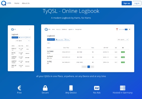 TyQSL provides a web-based online logbook platform, enabling users to manage all QSOs from any device with features like fast ADIF import, supporting up to **100,000 QSOs** per file. The platform facilitates real-time uploads to services such as _Clublog_ and _eQSL_, either automatically or with a single click, ensuring logs are current across multiple platforms. Operators can manage multiple callsigns and create various logbooks within a single account, allowing for flexible QSO organization. The integrated logger features a streamlined layout with live DXCC checking, duplicate QSO alerts, and autofill for satellite operations. It also supports one-click logging from _WSJT-X_. Users can share public profiles, displaying QSO statistics and searchable logbooks, enhancing community interaction. A PRO account offers additional features like an interactive QSO map, showing worked grids and future activities of other users.
 -
 Realtime online log search for 5X3C DXpedition to Uganda 2019
 -
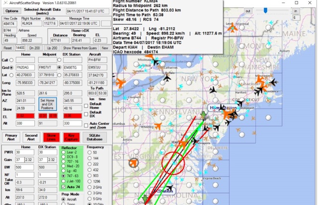 Aircraft Scatter Sharp is a windows application to calculate and assist airscatter operations. Real-time capture and display of plane position data derived from internet plane servers, highlighting of aircraft near the ideal position for scatter, Real-time estimation of Doppler shift and its rate of change.
 -
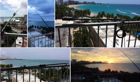 The Buddistick antenna, as demonstrated by KP4MD, effectively handles up to **250 watts** and provides coverage from 40 through 10 meters, with an optional coil extending operation to 80 and 60 meters. KP4MD's video presentation meticulously describes the antenna setup, emphasizing the critical role of the _shunting coil_ for achieving resonance on lower bands like 40 and 80 meters. This practical approach highlights how a compact antenna can deliver solid performance from a constrained location. SWR curve diagrams are included, clearly illustrating the impact of the shunting coil on the antenna's resonating frequency. These visual aids provide concrete evidence of the adjustments needed for optimal operation across different bands, particularly when space is at a premium. KP4MD's insights are particularly valuable for hams operating from apartments or other limited spaces, showcasing real-world results from a balcony installation.
 -
 A Fox transmitter by VE2EMM with construction details part list and schematic diagram
 -
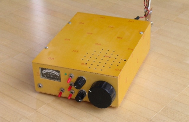 Homemade receiver for 80 meters band. The receiver works very well (in fact better than some of its successors), especially the AGC makes listening to 80m QSOs a real pleasure. Sensitivity is not cutting-edge, but on a full-size short-wave antenna it is by fare sensitive enough.
 -
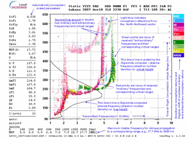 This page displays the current ionogram and tries to determine the nearest digisonde report to your location. Data coming from this sondes are used to determine the MUF for oblique propagation on HF spectrum
 -
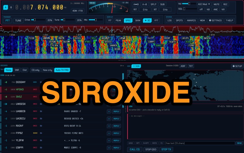 Operates as a universal client for Software Defined Radios, SDRoxide provides a robust platform for amateur radio operators to engage in diverse modes and activities. It integrates a **GPU panadapter** for real-time spectrum visualization, dual VFOs for flexible tuning, and advanced neural noise reduction to enhance weak-signal reception. The software supports a comprehensive suite of digital modes, including FT8, JS8, RTTY, and PSK, alongside built-in skimmers for automated signal detection. Its capabilities extend to Winlink radio email, 868 MHz ISM sensor decoding, and hands-free satellite operation with continuous Doppler correction and Hamlib rotator tracking. The client offers native drivers for popular SDR hardware like RTL-SDR, RX-888, and HackRF One, covering a wide frequency range from 1 MHz to 6 GHz. It also interfaces with CAT-controlled transceivers via Hamlib and Flrig, allowing a second SDR to function as a panadapter. Network dongles, SpyServer, KiwiSDR, and OpenHPSDR Ethernet SDRs are also supported, providing flexibility for remote and local operations. Beyond core radio functions, SDRoxide incorporates a live 3D space-weather globe with aurora and lightning displays, real-time satellite tracking with TLE updates, and a measured propagation heat map. It includes a full-featured logbook with DX cluster spots, award tracking for **DXCC** and WAS, and direct QSL upload integration with services like eQSL and Club Log, streamlining post-QSO management.
 -
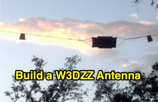 The purpose of this construction is to enable the realization of an HF antenna called W3DZZ with minimal equipment and low cost. It allows traffic on the bands 3.5 / 7/14/21 and 28MHz.
 -
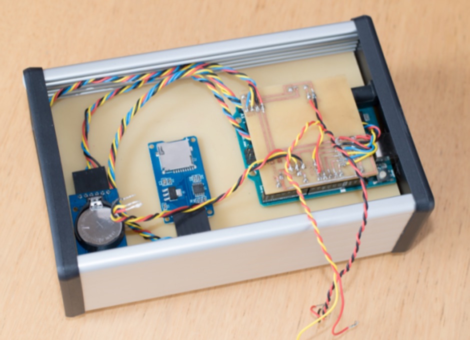 Multi-sensor real-time temperature monitoring and logging system using Arduino
 -
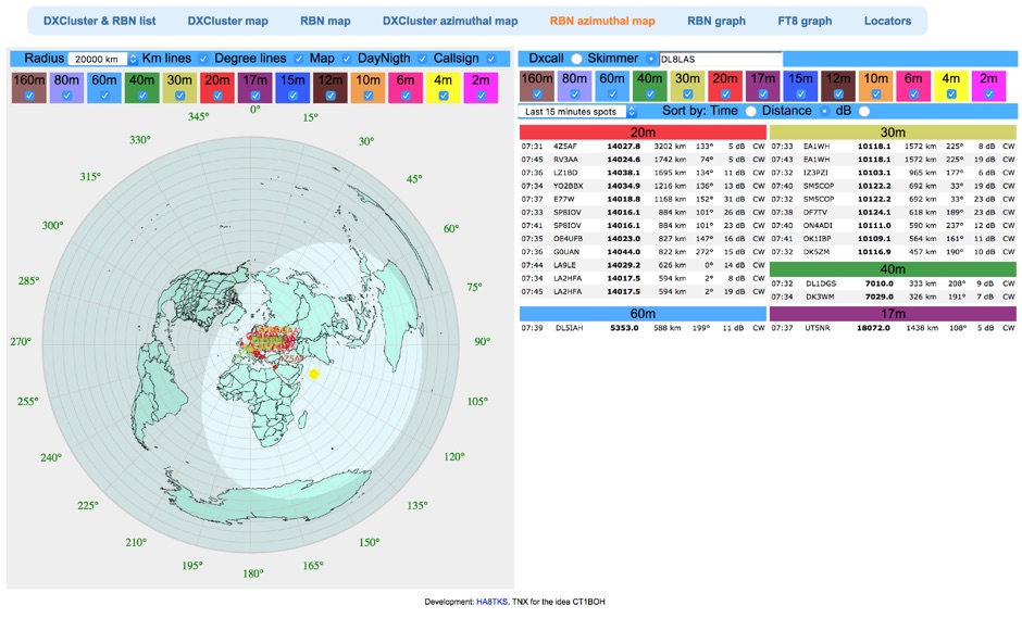 Reverse Beacon Network (RBN) remdered in a Real-Time Azimuthmal Map centered on a custom call sign
 -
 The 3Y0K website is the official platform for the Bouvet Island DXpedition scheduled for February 2026. It serves as a comprehensive resource for amateur radio operators, providing essential information about the expedition, including updates on operations, band availability, and communication modes such as FT8 and CW. The site aims to keep the amateur radio community informed about the expedition's progress and activities, encouraging participation and support. Users can find details on how to donate to the expedition and contact information for inquiries, as well as links to social media for real-time updates and community engagement. In addition to operational details, the 3Y0K site offers various resources for those interested in DXpeditions. It highlights the significance of Bouvet Island as a rare DXCC entity and outlines the logistical challenges faced by the team. The website is designed to be user-friendly, featuring a clear layout that allows visitors to navigate easily through the information. Overall, the 3Y0K website is a valuable resource for amateur radio operators looking to engage with the Bouvet Island DXpedition and enhance their understanding of amateur radio operations.
 -
 Demonstrates the practical application of APRS (Automatic Packet Reporting System) through the lens of HB9PVI's activities in Switzerland. It covers the system's core function of reporting geographical positions and telemetry data from various objects, including mobile stations, aircraft, and the ISS, distributed via packet radio and internet gateways. The resource highlights the routing paradigm shift introduced in April 2005, specifically the recommendation to use _WIDE1-1_ instead of RELAY and WIDE for digipeating to reduce duplicate packets. The page presents real-time maps displaying the positions of amateur radio stations in Switzerland and around Bern, updated every few minutes. It details specific callsigns like _HB9BA-2_ (HB9PVI's home QTH), _HB9BA-8_ (a weather station), and _HB9BA-4_ (a WIDE digipeater on Weissenstein mountain), providing context for their roles within the local APRS network. Links to track HB9PVI's mobile operations (_HB9PVI-9_) and handheld devices (_HB9PVI-15_, _HB9PVI-7_) are also provided. Furthermore, the resource curates a list of APRS software options for various operating systems, including _JavAPRS_ for Europe, _UI-view_, and _X-Astir_ for Linux, alongside digipeater/IGATE software like _DiXPRS_. It also offers downloadable APRS information, including a PDF article by HB9PVI and HE9ZGN, and a PowerPoint presentation in German, making it a repository of practical and historical APRS data.
 -
 High Speed Multimedia (HSMM) radio, as introduced by John Champa, K8OCL, represents a significant advancement in amateur radio's digital capabilities, moving beyond traditional keyboard modes like packet radio. This initiative, driven by ARRL's Technology Task Force, focuses on developing high-speed digital radio networks capable of up to 20 megabits per second. HSMM primarily facilitates digital voice (DV) and digital video (ADV), enabling real-time video transmission from emergency scenes to an EOC without expensive ATV gear, often requiring only a laptop, a PCMCIA card, a digital camera, and a small antenna. The working group's initial efforts concentrate on cultivating microwave skills within the amateur community to build and support portable and fixed high-speed radio-based local networking, or **RLANs**. These networks prove invaluable for RACES and ARES organizations, as well as homeland security and other emergency communications. Field Day exercises and simulated emergency tests (SETs) are encouraged to hone skills in rapid site surveys and deploying broadband HSMM microwave radio networks, with examples like linking Field Day logging stations or antenna test results at the Midwest VHF-UHF Society Picnic 2003. Getting started with HSMM often involves adapting off-the-shelf **IEEE 802.11** (WiFi) equipment to comply with amateur radio regulations, typically operating in the 2.4 GHz ISM bands. While consumer WiFi gear has range limitations under Part 15 rules, proper setup under amateur regulations can extend coverage significantly, with test networks like the Hinternet achieving 5-15 mile ranges at 54 M bit/s using small mast-mounted dish antennas. Careful selection of equipment with external antenna ports, high transmit power, and low receive sensitivity is crucial, along with using low-loss coaxial cable like LMR-400 for optimal performance at these frequencies.
 -
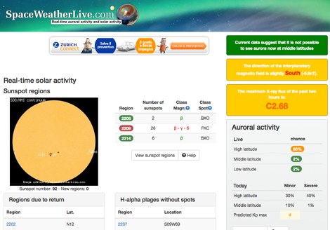 Real-time solar activity page at SpaceWeatherLive.com display sunspot regions, indicating sunspot numbers of with manitude class, Solar Flares and a list of daily events on the sun.
 -
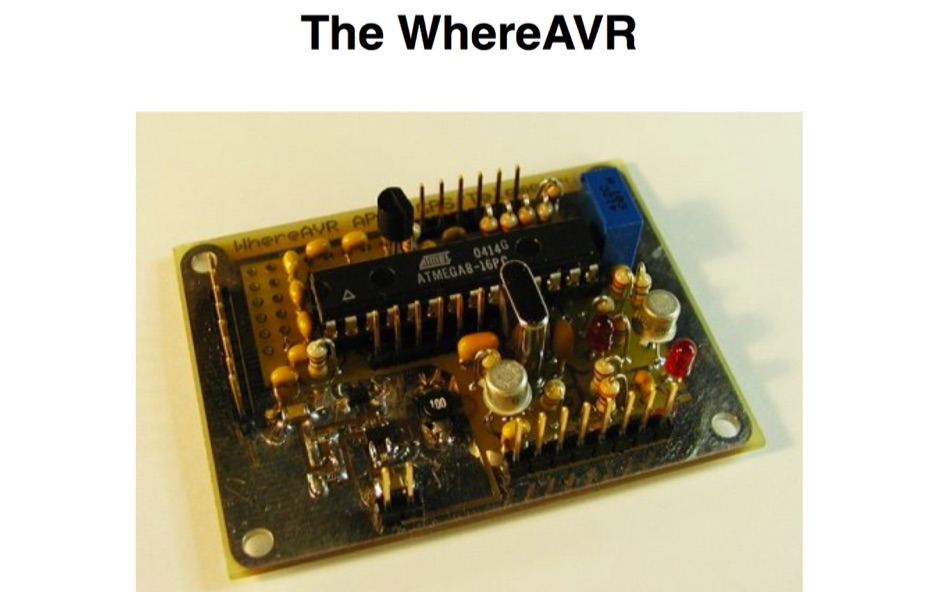 The WhereAVR is a small, lightweight, low-power, and low-cost APRS tracker with a full compliment of analog and digital I/O, as well as the ability to decode ax.25 packets. This allows for the reception of remote commands without the need for a real TNC.
 -
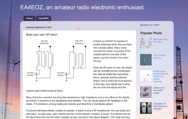 A balun is a MUST for dipoles or similar antennas when they are feed with coaxial cable. From the RF point of view, the shield can be modeled as two conductors, the internal shield (the real shield, this is, ground) and the external shield, who is really far to be ground. In this way, your dipole has 3 arms, the two from the dipole and the coaxial cable shield (external face)
 -
 Encrypted messages, fancy technology, spies use them all to communicate, but sometimes the best way to hide is in plain sight. Right now, broadcasting across the airwaves around the world, are automated, anonymous shortwave AM radio stations that most governments won't acknowledge even exist, much less explain
 -
-
 Of interest to solar keen hams is the YPOP section. Near real time movies of active solar regions in JAVA,GIF or MPEG.
 -
 A 3 band dipole antenna for 40-80-160 meter bands, It's made with easily available materials and is designed for inverted V mounting. The antenna is shortened for these bands, but still manages to make contacts in 80m and 160m with stations in Canada and the USA. The construction details are provided, including the dimensions of the antenna elements and the traps. The antenna is easy to build and provides good performance in all three bands. In Italian.
 -
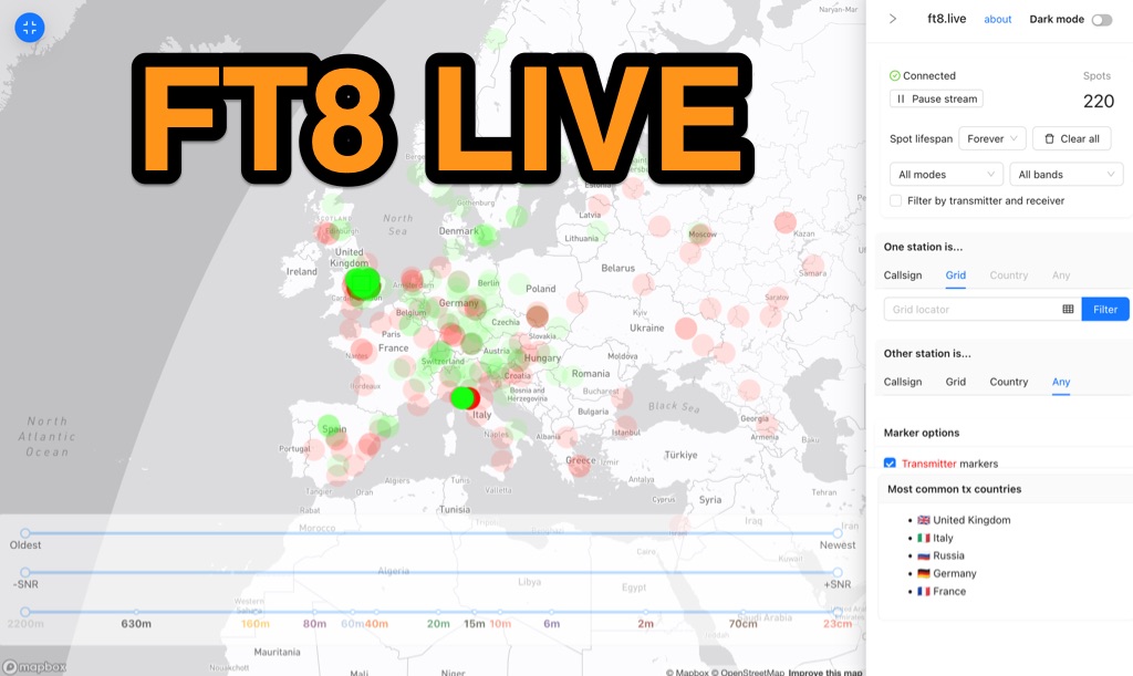 Visualizes real-time amateur radio propagation spots using data from the PSK Reporter MQTT stream, providing immediate situational awareness for radio operators. The platform displays spots from various modes, including CW, WSPR, and JT65, in addition to the dominant FT8 digital protocol. FT8 Live focuses exclusively on live data streams, prioritizing current signal activity over historical archiving, which differentiates it from the official PSK Reporter map. A key feature is its integration with the Summits on the Air (SOTA) API, facilitating SOTA chasing by cross-referencing transmitting callsigns with SOTA alerts; a station is identified as an activator if the spot correlates with a scheduled alert within an eight-hour window. The user interface was developed by Arron (ZL1AN), with core data from Philip Gladstone (N1DQ), and stream delivery managed by Tom Stanton (M0LTE).
 -
 The Salvation Army Team Emergency Radio Network (SATERN) is a vital resource for amateur radio operators involved in emergency communications. This network facilitates the coordination of communication during disasters, ensuring that vital information can be relayed effectively. SATERN operates through a series of nets that connect operators across various regions, allowing for real-time updates and support during emergencies. Participation in SATERN not only enhances your skills as an amateur radio operator but also contributes to community resilience. Operators are trained to handle emergency traffic and provide assistance to those in need. By joining SATERN, you become part of a dedicated team that prioritizes safety and communication in times of crisis. The network encourages regular participation in drills and training sessions to ensure readiness when real emergencies arise.
 -
-
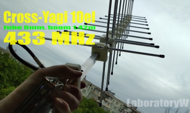 10 Elements Cross-Yagi Antenna for 433 MHz. The base of the 10el antenna is the recalculated RA6FOO antenna.Circular polarization is realized - by a phasing quarter-wave line, matching of horizontal and vertical polarization antennas
 -
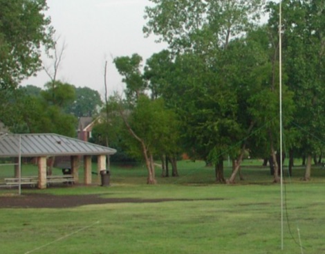 This Field Day Vertical Antenna project is the result of many years of attending various field day sites and realizing that what was needed is a simple, easy to assemble vertical antenna. The design of this Field Day Antenna is not very novel and leverages ideas from Butternut verticals and ARRL publications. The one essential requirement was that the antenna can be raised by just one person. The design of this Field Day Antenna is an above ground mounted ground plane vertical.
 -
 The Black River Amateur Radio Club (K8BRC) operates as a central hub for amateur radio enthusiasts within Van Buren County, Michigan, and its adjacent regions. This organization facilitates various activities, including local nets, educational initiatives, and community service events, all aimed at promoting the hobby and enhancing operational skills among its members. The club's focus on local engagement ensures a strong sense of camaraderie and mutual support among hams, from those just earning their _Technician_ license to seasoned DXers. Members frequently participate in field operations and emergency communications drills, applying practical skills in real-world scenarios. The club also maintains resources for new operators, offering guidance on station setup, antenna theory, and operating procedures. Their commitment to public service is evident through participation in events requiring reliable communication. K8BRC provides a platform for hams to share knowledge, collaborate on projects, and engage in on-air activities, strengthening the local amateur radio community. Many members have achieved **100** DXCC entities.
 -
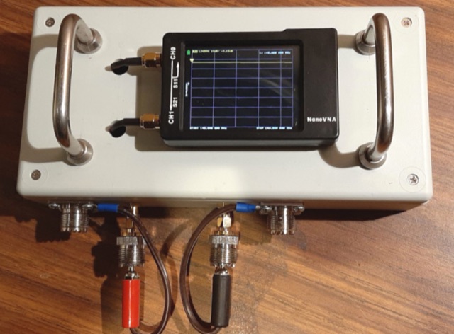 How many times have you heard the advice to coil a few turns of coax at the antenna end to form a choke. How to find out if your common mode current choke really works
 -
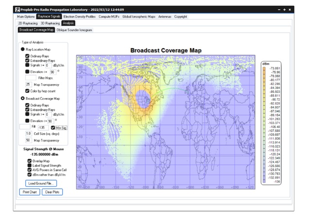 Ray-trace radio signals through a realistic three-dimensional ionosphere using Proplab-Pro. This software has been used by the military, researchers, universities and amateur radio operators around the world to assist in determining radio propagation conditions and radio signal behavior. It is one of the most respected and well established software packages for radio engineers and enthusiasts, being actively updated for over 28 years.
 -
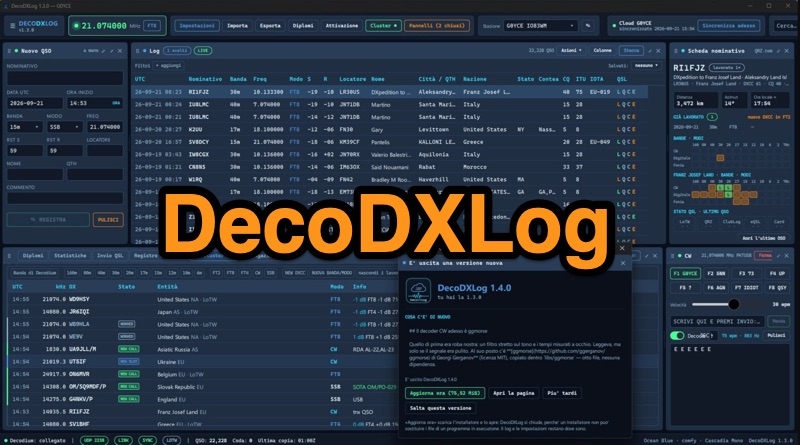 DecoDXLog is a station logbook application for Windows, designed to integrate seamlessly with the _Decodium_ family of software, as well as _WSJT-X_ and JTDX, by receiving QSOs via UDP. It operates around a local SQLite file, providing automatic callbook lookups from QRZ.com XML or HamQTH to complete log entries with name, QTH, and locator data. The software tracks 15 different awards, including DXCC, WAZ, WAS, WPX, IOTA, POTA, and SOTA, calculating progress in real-time and allowing confirmation via LoTW, paper cards, or eQSL. It also features comprehensive statistics, a world map displaying worked locators and cluster spots, and a built-in DX Cluster client that aggregates data from DX Spider/CC Cluster, Reverse Beacon Network, HamAlert, and POTA activations, providing alerts for new DXCC, band, or mode. The application includes a CW keyer/decoder, a contest mode with real-time scoring and Cabrillo export, and robust QSL management for LoTW, QRZ Logbook, eQSL, and Club Log. An optional DecoDXLog Cloud feature enables synchronization of QSOs, station profiles, and settings across multiple devices, ensuring a consistent operating environment. The software is open-source under the GPL-3.0 license, developed by IU8LMC and contributors, and supports lossless ADIF import/export, making it compatible with existing logs. It also integrates with _DecoRotor_ for antenna control, allowing operators to point their antenna directly from the logbook interface.
 -
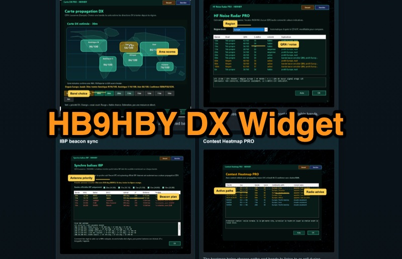 Demonstrates the _Widget DX HB9HBY_ software, a compact desktop application for amateur radio operators, providing essential real-time information. The widget displays UTC time, current HF propagation conditions, local weather, and thunderstorm risk. It also integrates radio-related links and offers advanced PRO functions, such as a DX map, HF noise radar, IBP beacon synchronization, contest heatmap, aurora radar, and a rare DX radar. The software is available for Windows 10/11 and Linux, with a macOS version planned for future release, and supports both French and English interfaces. Author HB9HBY highlights the widget's simple installation process and automatic update capabilities, which can be silent for minor fixes or include notifications for significant changes. The free version provides core functionalities, while a 15-day free trial unlocks the PRO features. A lifetime PRO license is available for a one-time payment of CHF 10, activating advanced tools that help operators make quicker decisions at the station by correlating propagation, UTC, DX activity, and local conditions, though results remain indicative and require confirmation via listening or tools like _RBN_ or _PSKReporter_.
 -
 Small company based in Santa Maria, California, designing and manufacturing electronic products for amateur radio, education, and commercial users. Product line includes APRS devices for real-time vehicle tracking, weather monitoring, and remote telemetry, as well as the ADS-SR1 Simplex Repeater, the ADS-WS1 Weather Station, the SSTVCAM slow-scan TV camera, and GTRANS protocol translator for Garmin FMI.
 -
 The 2D0YLX Amateur Radio Blog, maintained by David Cain (137AT108), serves as a personal station blog from Peel in the Isle of Man, offering insights into various radio-related activities and local connections. It features content relevant to amateur radio operations, including personal experiences and observations from the island, providing a localized perspective on the hobby. The blog's primary focus is on general amateur radio topics, reflecting the author's engagement with the hobby. David Cain's blog provides a platform for sharing operational details and general interest items, often including links to other relevant sites on and around the Isle of Man. The content reflects real-world amateur radio engagement, offering practical glimpses into the daily activities of a station located in a unique geographical area. It is a resource for those interested in the personal side of amateur radio from a specific European island QTH.