Search results
Query: displays
Links: 95 | Categories: 0
-
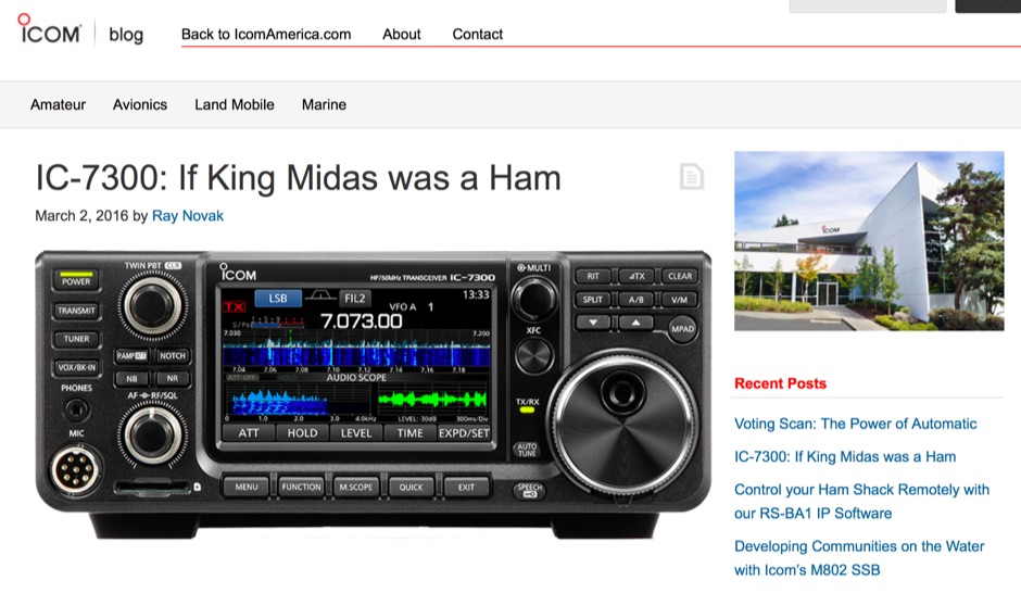 The Icom IC-7300 is a groundbreaking Software Defined Radio (SDR) transceiver that revolutionizes the way amateur radio operators interact with the spectrum. With its large 4.3-inch color TFT LCD touch screen, users can easily navigate through various functions, including real-time spectrum scope and high-resolution waterfall displays. This allows for quick adjustments and enhanced signal awareness, making it easier to find and engage in QSOs. The touch screen interface provides a modern approach to radio operation, replacing traditional buttons with virtual controls that can be accessed with a simple touch. In addition to its user-friendly interface, the IC-7300 boasts advanced features such as IF-DSP filtering, audio scope functions, and a multi-dial knob that combines tactile control with touch screen flexibility. These capabilities enable operators to visualize signals and make precise adjustments to their settings, ensuring optimal performance during contests or casual operating. The IC-7300 is designed for both beginners and experienced hams, making it a versatile addition to any shack. Its innovative design and functionality truly embody the spirit of modern amateur radio.
 -
 Kits for AM FM radio, UHF control, big LED displays, games, controls, timers, chasers and flashers
 -
 LA6EIA Ole's DX-blog details shortwave listening (SWL) and amateur radio DX operations from Norway, providing insights into propagation conditions and station reception. The blog frequently features specific reception reports, often including details such as frequency, mode, and signal strength, alongside observations of various broadcast and utility stations. It documents the author's personal experiences in chasing DX, offering a practical perspective on radio propagation and equipment performance. The content includes logs of received stations, sometimes accompanied by audio clips or screenshots of waterfall displays, illustrating successful decodes or strong signal captures. This resource presents a chronological record of DX achievements and challenges, reflecting the dynamic nature of radio propagation across different bands and times. The blog distinguishes itself by its focus on real-world SWL and amateur radio DXing from a Nordic QTH, offering a unique regional perspective on global radio phenomena. It serves as a personal journal of radio exploration, highlighting specific callsigns, frequencies, and operational details encountered during DX sessions.
 -
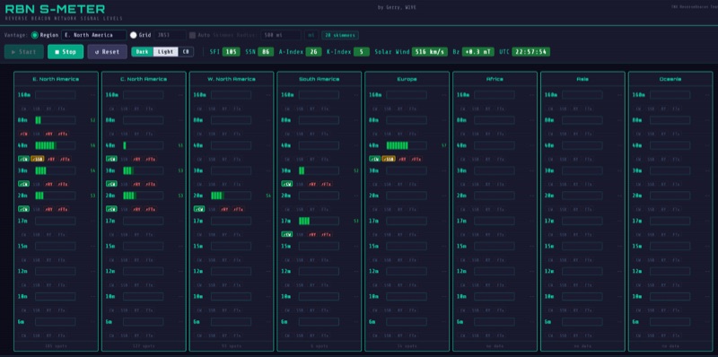 The RBN S-Meter visualizes real-time HF propagation data from the Reverse Beacon Network (RBN). It processes thousands of automated spots per hour, providing a real-time picture of active RF paths on HF bands. Users can set their vantage point using _Region Mode_ or _Grid Square Mode_. Region Mode allows selection from broad geographic areas like E. North America or Europe, while Grid Square Mode uses a Maidenhead grid square and radius for more precise data. The app displays eight region panels, each with horizontal bars for bands 160m through 6m, indicating signal strength with a color ramp from green to red. A dimmer trail shows peak hold values, and an S-unit readout provides additional detail. The app is a free web application accessible on any device, offering a practical tool for ham radio operators interested in CW, RTTY, and FT8 signals. It features a Progressive Web App installation option for enhanced usability on mobile and desktop platforms. Users can install it on Android, iOS, and Windows devices, providing a native app-like experience. The app replaces the previous Windows standalone executable, incorporating user feedback to improve features like grid square mode and automatic location detection.
 -
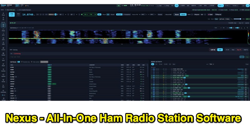 Nexus is a free and open-source ham radio software application, built in Rust by KD9TAW, designed to integrate multiple station functions into a single program. It supports fifteen operating modes, including FT8, FT4, CW, SSB, FM, RTTY, SSTV, and APRS, with both transmit and receive capabilities across Windows, Linux, and Raspberry Pi platforms. The software provides band activity displays with country, distance, and bearing information, a call roster, a 3-D propagation globe with live spots, and alerts for new DXCC, WAS, WAZ, VUCC, and IOTA entities. It also features a native RF panadapter for Icom CI-V and Flex radios, or a live audio scope for other transceivers. Nexus integrates a comprehensive logbook, computes awards offline without requiring an account, and includes repeater search functionality with curated memory packs. It offers CHIRP CSV round-trip compatibility for approximately 1,000 radio models and is compatible with WSJT-X, JTDX, and MSHV via UDP protocol for seamless integration with existing workflows. The application supports ADIF import/export for log data management and provides accessibility features for operators with hearing or visual impairments, including screen reader compatibility and keyboard-navigable interfaces.
 -
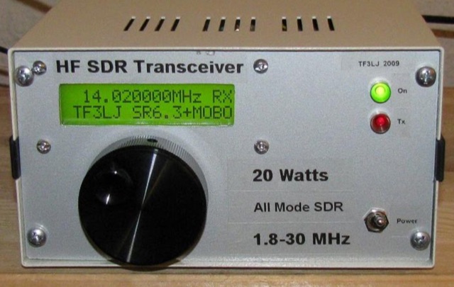 This project describes a DIY all band HF SDR transceiver. Built around a Softrock 6.3 kit, it boasts a 20W homebrew amplifier and ATmega168 microcontroller for USB control. An LCD displays frequency, power, and SWR. Automatic LPF selection and SWR protection enhance functionality. Compatible with Rocky and PowerSDR software, this project provides a cost-effective and powerful HF SDR transceiver for hobbyists.
 -
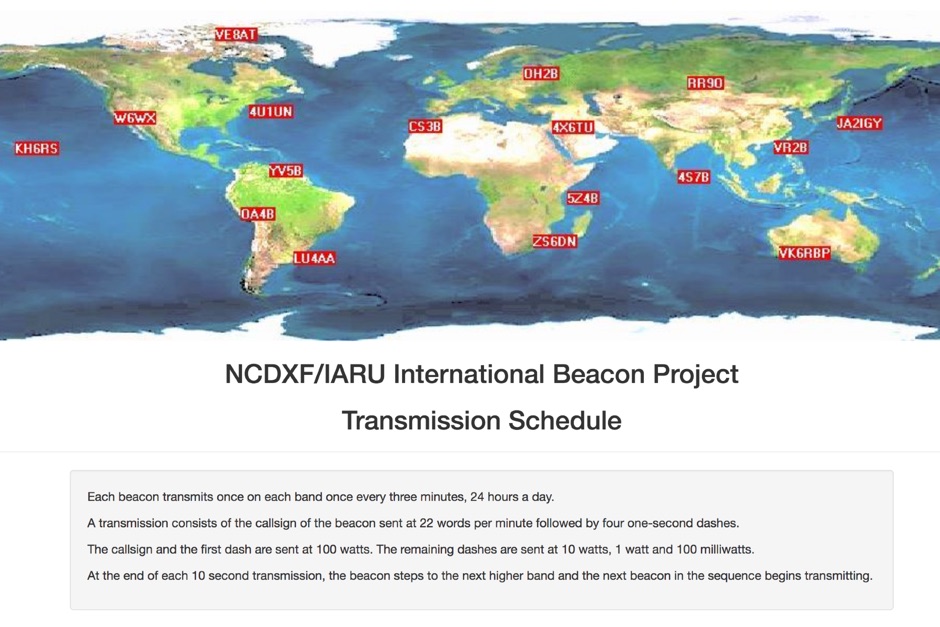 Whatch at beacons transmitting in real time. This page contains a self refreshing table that displays every 10 seconds the current transmission schedule of the international beacon project. Tune your radio and check the beacon you are hearing.
 -
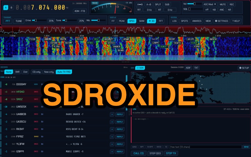 Operates as a universal client for Software Defined Radios, SDRoxide provides a robust platform for amateur radio operators to engage in diverse modes and activities. It integrates a **GPU panadapter** for real-time spectrum visualization, dual VFOs for flexible tuning, and advanced neural noise reduction to enhance weak-signal reception. The software supports a comprehensive suite of digital modes, including FT8, JS8, RTTY, and PSK, alongside built-in skimmers for automated signal detection. Its capabilities extend to Winlink radio email, 868 MHz ISM sensor decoding, and hands-free satellite operation with continuous Doppler correction and Hamlib rotator tracking. The client offers native drivers for popular SDR hardware like RTL-SDR, RX-888, and HackRF One, covering a wide frequency range from 1 MHz to 6 GHz. It also interfaces with CAT-controlled transceivers via Hamlib and Flrig, allowing a second SDR to function as a panadapter. Network dongles, SpyServer, KiwiSDR, and OpenHPSDR Ethernet SDRs are also supported, providing flexibility for remote and local operations. Beyond core radio functions, SDRoxide incorporates a live 3D space-weather globe with aurora and lightning displays, real-time satellite tracking with TLE updates, and a measured propagation heat map. It includes a full-featured logbook with DX cluster spots, award tracking for **DXCC** and WAS, and direct QSL upload integration with services like eQSL and Club Log, streamlining post-QSO management.
 -
 This resource presents a placeholder page for the _Tobacco Valley Amateur Radio Club_ (TVARC), signaling the future establishment of an online presence for this amateur radio organization. The page currently displays a "Coming Soon" message, indicating that the club's official website is in development. It serves as a preliminary marker for the club's digital footprint, suggesting an upcoming platform for members and prospective hams. The current state of the page offers no technical details, operational information, or specific club activities. It functions solely as a temporary landing page, prompting site owners to log in for launch and visitors to check back later. The resource does not provide any data on club repeaters, meeting schedules, or special events, nor does it detail any past achievements like **DX contacts** or **contest scores**.
 -
 This resource, despite its title, does not provide information relevant to amateur radio operations or the W1BD Central Vermont Amateur Radio Club. Instead, the content focuses on commercial topics such as vinyl lettering, business signage, and brand recognition strategies. It details the application of _transfer tape_ for graphics, the importance of pre-masking in vinyl cutting, and the use of squeegees for smooth decal application. The site also discusses various types of business signs, including monument signs and awning signs, highlighting their role in attracting customers and establishing brand presence. Further sections delve into home maintenance tasks like gutter cleaning, offering advice on using power washers and the importance of safety measures when working on ladders. The content also explores strategies for building brand recognition and customer loyalty, emphasizing consistent marketing efforts and excellent customer service. It touches upon the use of custom-printed bags and digital displays, such as LED signs, for enhanced visibility and engagement. The site's articles include practical tips for kitchen renovations, such as upgrading cabinet hardware, adding pendant lighting, and repainting cabinets to achieve a fresh look without significant expense. The content is entirely unrelated to amateur radio activities, club information, or technical aspects of radio communication.
 -
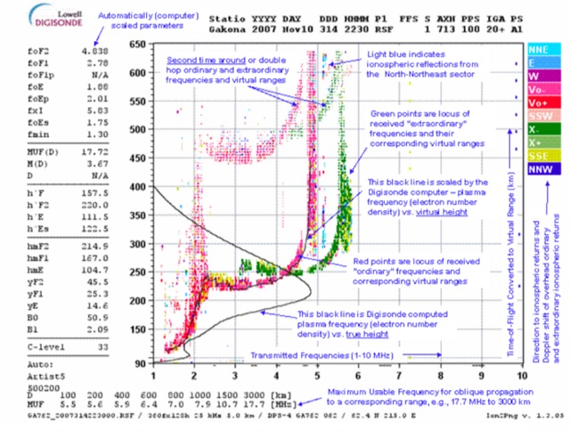 This page displays the current ionogram and tries to determine the nearest digisonde report to your location. Data coming from this sondes are used to determine the MUF for oblique propagation on HF spectrum
 -
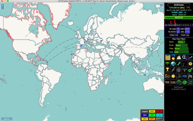 GridTracker listens to live traffic from WSJT-X or JTDX and displays it on a map. It can also load ADIF log files, load clublog, lotw, hrdlog.net and other sources to diplay your logbook statistics and map your QSOs. GridTracker is a free application for windows Linux and MacOS.
 -
 The resource, formerly JH6QIL's blog, now displays a service termination notice from teacup. byGMO, the hosting provider. It explicitly states that the teacup. byGMO service ceased operations on August 1, 2022. The page conveys a message of gratitude to users for their past patronage of the platform. This content serves as an archival record of the service's discontinuation rather than an active amateur radio blog. The original blog content from **JH6QIL** is no longer accessible through this URL, indicating a complete cessation of the hosted service.
 -
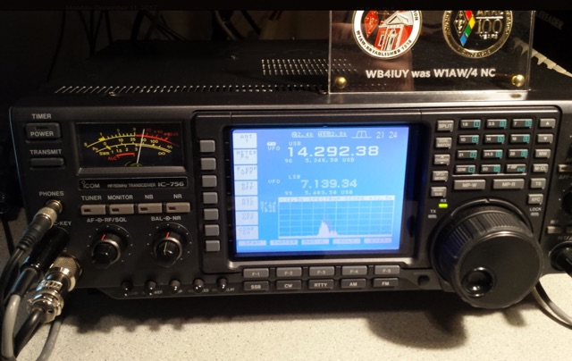 This article is about replacing the LCD display in a Icom IC-756 classic. The displays in these radios have not been supported by Icom in several years.
 -
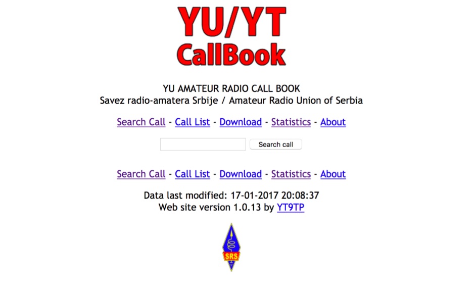 Presents an online callbook specifically for amateur radio operators within Serbia, offering a searchable database of YU callsigns. The resource allows users to query individual callsigns to retrieve associated station information, including operator details and licensing status. It also features a complete list of callsigns registered with the Amateur Radio Union of Serbia, providing a comprehensive directory for the region. The platform includes statistical summaries related to Serbian amateur radio, such as the total number of active licenses and distribution patterns. It displays the last modification date for the underlying data, indicating the currency of the information provided. The web interface is version 1.1.7, developed by YT9TP, ensuring a consistent user experience for accessing Serbian amateur radio data.
 -
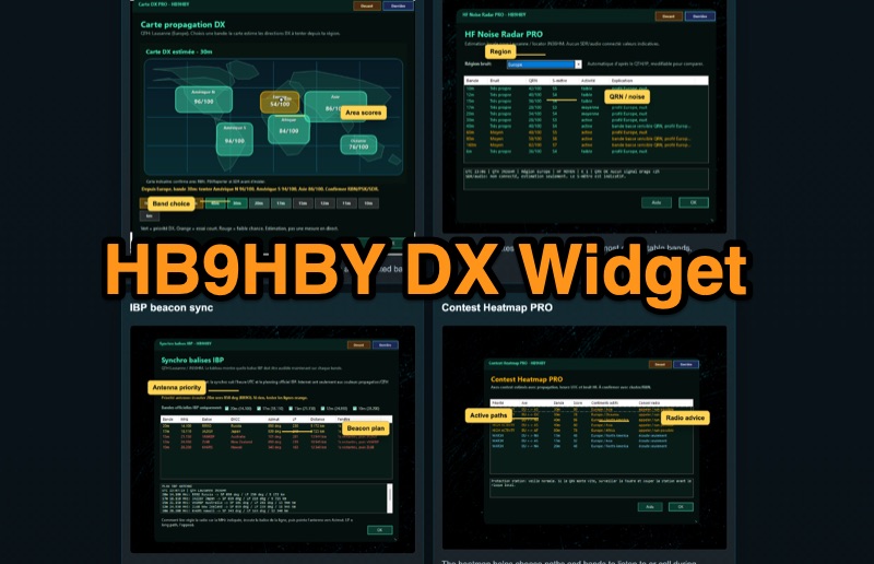 Demonstrates the _Widget DX HB9HBY_ software, a compact desktop application for amateur radio operators, providing essential real-time information. The widget displays UTC time, current HF propagation conditions, local weather, and thunderstorm risk. It also integrates radio-related links and offers advanced PRO functions, such as a DX map, HF noise radar, IBP beacon synchronization, contest heatmap, aurora radar, and a rare DX radar. The software is available for Windows 10/11 and Linux, with a macOS version planned for future release, and supports both French and English interfaces. Author HB9HBY highlights the widget's simple installation process and automatic update capabilities, which can be silent for minor fixes or include notifications for significant changes. The free version provides core functionalities, while a 15-day free trial unlocks the PRO features. A lifetime PRO license is available for a one-time payment of CHF 10, activating advanced tools that help operators make quicker decisions at the station by correlating propagation, UTC, DX activity, and local conditions, though results remain indicative and require confirmation via listening or tools like _RBN_ or _PSKReporter_.
 -
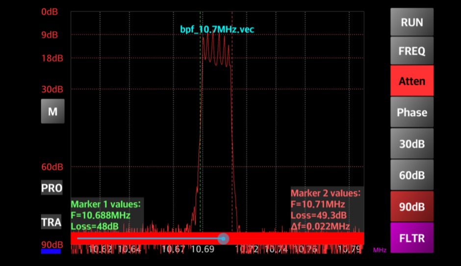 Enables Android users to operate various _miniVNA_ antenna analyzers via Bluetooth, USB, or Wi-Fi, providing a portable solution for RF measurements. The application supports full control over data acquisition, offering features like custom frequency range selection from 1 KHz to the VNA's full range, and automatic screen adaptation for diverse Android device resolutions. It facilitates intuitive, wizard-based calibration for both reflection and transmission modes, saving calibration data for different VNA types (Standard, Pro, Pro with Extender) to avoid repeated procedures. The software displays critical parameters such as SWR, |Z|, Return Loss, Phase, Rs, and |Xs| on 2-axis graphs or Smith charts, with multi-touch gestures for zoom and frequency shift. It includes a frequency generator mode with independent channels and attenuator control for the miniVNA Pro, along with a sweeper function. The cable data mode automatically calculates phase and loss, measures cable length from less than 1 meter to hundreds of meters, and includes a table of common coax cable velocity factors. An experimental X-tal mode measures resonance frequency, Rs, and Q. Data export options include CSV, ZPLOT, and S1P formats, with CSV import capability. The application also features an SM6ENG Audio mode for SWR tuning without visual reference and provides a miniVNA battery voltage indicator. It supports a wide frequency range, with the miniVNA Extender extending coverage up to **1500 MHz**. The application is compatible with Android version 2.2 and later, tested on devices like the _Galaxy TAB 7.7 P6800_.
 -
 Time Mapper UHD is a versatile mapping and time visualization program offering multi-satellite viewing with frequency display and unique country-pairs for PskReporter data. It features live feeds from logging programs and can plot ADIF files. Ideal for schools, offices, or amateur radio stations, it provides customizable 4K or HD world clock displays with over 60 map layers, including ham radio zones and natural features. The program supports various time functions and can import logs for detailed analysis. It runs on Windows 10 or 11 and offers a 30-day free trial.
 -
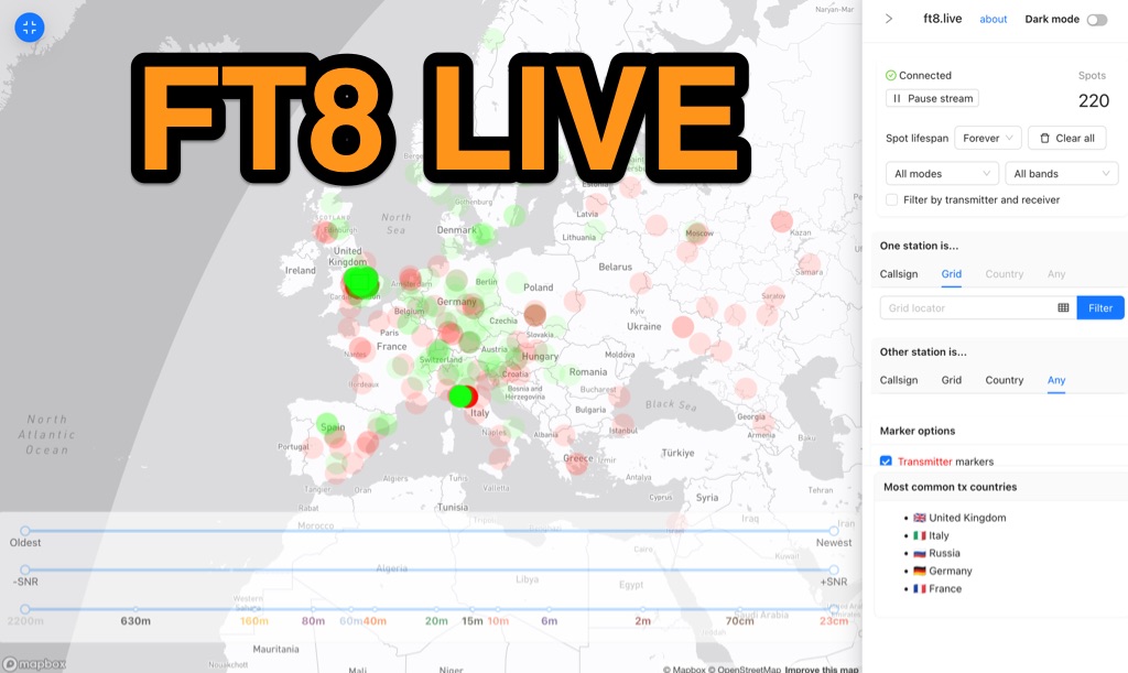 Visualizes real-time amateur radio propagation spots using data from the PSK Reporter MQTT stream, providing immediate situational awareness for radio operators. The platform displays spots from various modes, including CW, WSPR, and JT65, in addition to the dominant FT8 digital protocol. FT8 Live focuses exclusively on live data streams, prioritizing current signal activity over historical archiving, which differentiates it from the official PSK Reporter map. A key feature is its integration with the Summits on the Air (SOTA) API, facilitating SOTA chasing by cross-referencing transmitting callsigns with SOTA alerts; a station is identified as an activator if the spot correlates with a scheduled alert within an eight-hour window. The user interface was developed by Arron (ZL1AN), with core data from Philip Gladstone (N1DQ), and stream delivery managed by Tom Stanton (M0LTE).
 -
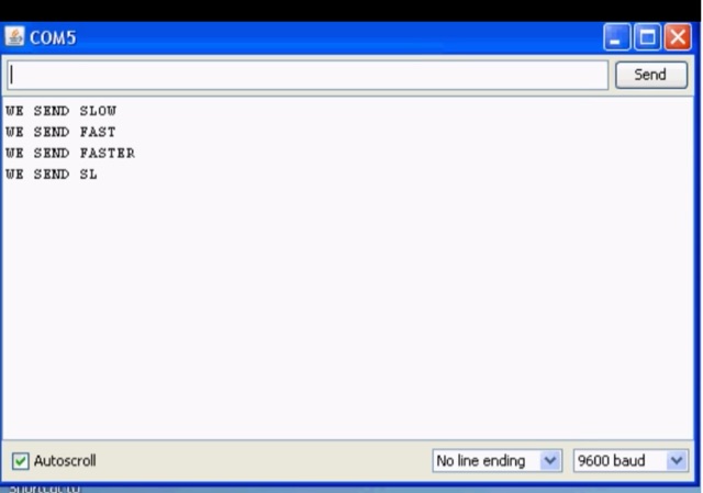 CW decoder using a PIC microcontroller. This is a morse code decoder made using a PIC(16F88) microcontroller, this project supports displays with multiple controller chips
 -
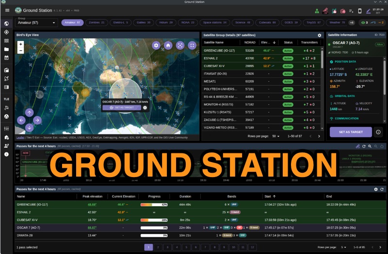 Ground Station offers real-time satellite tracking and radio communication capabilities, primarily for amateur radio operators engaged in satellite operations. It utilizes **TLE data** from sources like CelesTrak and SatNOGS for precise orbital prediction and integrates with various SDR devices, including RTL-SDR, SoapySDR, and UHD/USRP radios, to receive live signals. The software provides automated antenna rotator control and **Hamlib-compatible** rig control with Doppler correction, crucial for maintaining signal lock on fast-moving LEO satellites. It supports IQ recording in SigMF format and decodes several digital modes such as SSTV, FSK, GFSK, GMSK, and BPSK with AX25 USP Geoscan framing. Dedicated interfaces are available for satellite tracking, SDR waterfall displays with live transcription and packet decoding, and telemetry packet viewing. Users can manage TLE data synchronization and SDR hardware, along with browsing decoded outputs through an integrated file browser. An observations dashboard and DSP topology view further enhance the operational experience, providing comprehensive tools for monitoring and analyzing satellite passes.
 -
 Quansheng Dock v0.32.22q is a specialized software application designed for remote operation of Quansheng UV-K5 (and equivalent) handheld radios using a programming cable. The software enables various advanced functionalities and features for these radios, enhancing their usability and flexibility. Quansheng Dock is a Windows application designed for remote control of Quansheng UV-K5 handheld radios using a programming cable. It offers enhanced features such as advanced preset and channel scanning, customizable LCD displays, spectrum analysis, and audio passthrough. The software requires firmware version 0.32.21q and the .NET 6 runtime. An AIOC cable is recommended for full audio functionality. Installation is straightforward and portable.
 -
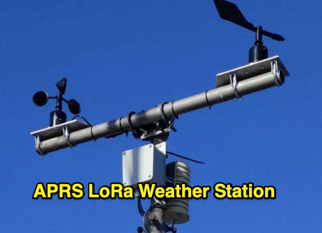 The weather station described here uses a TTGO v3 1.6.2 module and various sensors. It displays the data on an OLED screen and transmits them among a choice of protocols to the APRS, APRS-IS, Wunderground servers or via an MQTT broker. APRS data is transmitted on 433.775 MHz (can be changed) using the LoRa protocol. APRS beacons picked up by iGate gateways are then transmitted to APRS servers.
 -
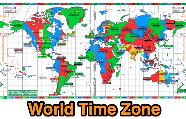 World Time Zone is an online quick reference chart that displays the world time zones in detail. DST is also indicated by yellow markers on the map. UTC difference is marked with different colors, and if you point and click will show up area details
 -
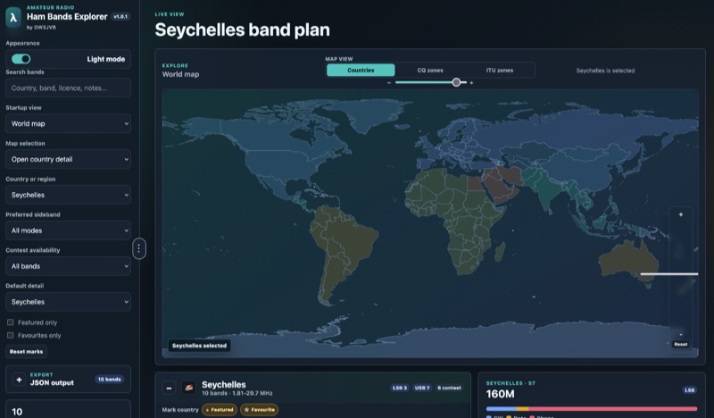 Presents an interactive **Ham Bands Explorer** web application, offering a live view of all amateur radio bands overlaid on a world map. This resource displays **CQ zones** and **ITU zones**, with geographical data sourced from HB9HIL/hamradio-zones-geojson under an MIT license. The interface provides a dynamic visualization of global band conditions, enabling operators to observe activity patterns across different regions. Users can select individual countries to retrieve and display their specific band plans, with frequency coverage details loaded from CountryData.json. The tool indicates 100% frequency coverage, ensuring comprehensive data presentation for selected regions. This functionality supports detailed analysis of national regulatory variations within the amateur spectrum. The application integrates both a map view and a live view, facilitating real-time monitoring and geographical context for band usage. It serves as a practical reference for understanding international amateur radio regulations and visualizing propagation characteristics across various frequency allocations.
 -
 SkyRoof is an open-source, 64-bit Windows application designed for amateur radio operators and satellite enthusiasts, combining satellite tracking and Software Defined Radio (SDR) functionality in a unified platform. The software provides real-time satellite tracking, pass predictions, and visual representations through Sky View, Earth View, and Timeline displays. It features an SDR-based waterfall display covering VHF/UHF satellite segments with Doppler-corrected frequency scales, automatic satellite labeling, and visual tuning capabilities. SkyRoof supports various SDR devices (Airspy Mini, SDRplay, RTL-SDR), external transceiver CAT control, and antenna rotator integration. The application automatically downloads satellite data from SatNOGS and other sources, offers voice announcements for satellite passes, and includes comprehensive frequency control with Doppler tracking, manual corrections, and RIT functionality for enhanced satellite communication operations.
 -
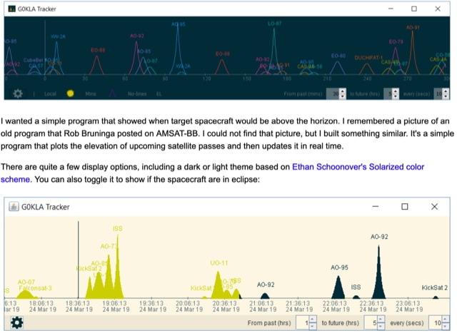 KlaTrack is a Windows-based software application designed to assist amateur radio operators with satellite communication by predicting spacecraft visibility. It provides a simple interface to determine when specific satellites will be above the local horizon, a critical factor for successful two-way contacts via amateur radio satellites. The program processes _Two-Line Element_ (TLE) data to calculate orbital mechanics, offering a practical tool for satellite operators to plan their operating windows. It supports real-time tracking and displays essential pass information. This utility simplifies the complex task of satellite tracking, allowing operators to focus on making contacts rather than manual orbital calculations. While specific gain figures or distances are not quantified, the software's core function directly supports achieving successful satellite QSOs by providing precise pass predictions. It is particularly useful for operators engaging in activities like working the International Space Station (ISS) or other low-Earth orbit (LEO) satellites, where short pass times and precise timing are crucial for maximizing contact opportunities.
 -
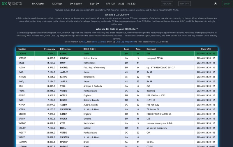 DX Data provides a unified view of real-time DX spots, aggregating data from **DXSpider**, the **Reverse Beacon Network (RBN)**, and PSK Reporter. This online service offers advanced filtering capabilities, allowing amateur radio operators to refine spot displays by DXCC entity, band, mode, CQ zone, and continent. It addresses the challenge of sifting through numerous DX spots by presenting a consolidated stream, enabling DXers to efficiently identify active stations across various bands and modes. The platform integrates with Club Log, which assists in fine-tuning band-entity combinations based on a user's logging history, thereby reducing irrelevant spot noise. Key features include DX email alerts, PSK Reporter tracking, and a custom watchlist for monitoring specific stations or regions. The service also incorporates a live news feed from DX World, providing current information relevant to the DXing community. This design aims to streamline the DX spotting process, offering a responsive interface for identifying operating opportunities.
 -
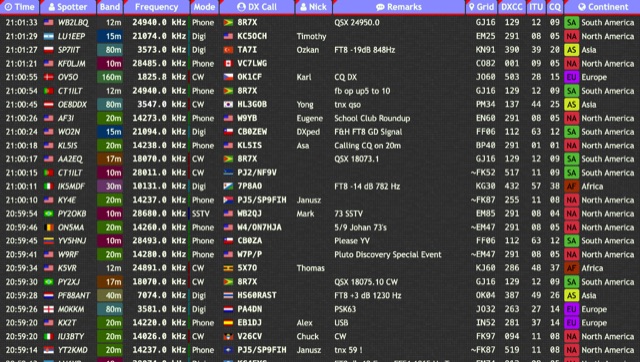 Over 15 amateur radio bands, from 160m to 70cm, are supported by the _DXTRON_ web cluster, providing real-time DX spotting information. This service integrates directly with the _QRZCQ_ API, allowing users to monitor activity across various modes including CW, Phone, Digi, RTTY, SSTV, and SAT. DXTRON displays critical spot data such as timestamp, spotter callsign, frequency, mode, DX call, and remarks, along with geographical details like Grid, DXCC, ITU, CQ zone, continent, and country. Developed by _DO5SSB_, DXTRON v1.42 offers a user-friendly interface for filtering spots by band and mode, catering to both casual DXers and serious contesters. The platform is designed for accessibility, providing a clear overview of current propagation conditions and active stations worldwide. This web cluster is a practical tool for hams seeking to identify rare DX, track contest activity, or simply observe band conditions. Its reliance on the QRZCQ API ensures a consistent flow of up-to-date spotting data, making it a reliable resource for real-time operational awareness.
 -
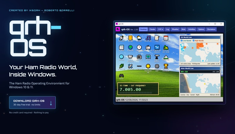 The **qrh-OS** application functions as a dedicated ham radio operating environment within Windows 10 and 11 systems, providing a consolidated platform for various amateur radio activities. It does not alter core system settings but instead presents a virtual desktop populated with specialized utilities and an integrated CAT radio system. This design aims to streamline the operator's workflow by centralizing tools often used for DXing, contesting, and general operating. Key features include a Telnet terminal for DX Cluster connections, real-time APRS tracking, and **CAT control** for transceivers, enabling one-click tuning from various integrated modules like Cluster, POTA, SOTA, WWFF, and Visual DX. The software also incorporates a worldwide Amateur Radio contest calendar, tools for Flora & Fauna activations, and displays for HF Low Bands Beacons and HF propagation conditions. Further utilities encompass a MeshCom Map, POTA Tunable, Reverse Beacons for WSPR network monitoring, SOTA Tunable, and a Timezone display. Visual DX offers an interactive globe showing DX stations and frequencies, while WebSDR/KiwiSDR access extends listening capabilities. An integrated IPTV player and real-time weather maps round out the comprehensive suite, all accessible within a single-window interface.
 -
 HAMRS v2.52.0 provides a portable logging solution for amateur radio operators, supporting macOS, Windows, Ubuntu, Raspbian, iOS, and Android platforms. The software includes offline databases for POTA parks and US callsigns, facilitating logging without internet connectivity. It features ADIF import/export capabilities, enabling one-click uploads to QRZ.com. Rig control is supported through native _Hamlib_ and _FLRIG_ integration, alongside compatibility with _WSJT-X_ for digital modes. Recent updates in v2.50 introduced a QSO Map for visualizing contacts with band colors and filtering, real-time solar and HF/VHF propagation conditions, and a dedicated logging template for ARRL Field Day exchanges. An interactive US Band Plan displays privileges and sub-bands, while a live POTA Spots Map highlights the active park and offers license-aware spot filtering.
 -
 flcluster is a free multiplatform dx cluster client that connects to and displays data from DX cluster servers. The three most common server types are AR-Cluster, CC-Cluster, and DX Spider. The program is designed to work stand alone or as a helper application to fldigi. It can transfer call, mode, and frequency data from a spotted QSO to the appropriate fldigi controls. It can query fldigi for the same items when generating a spot report.
 -
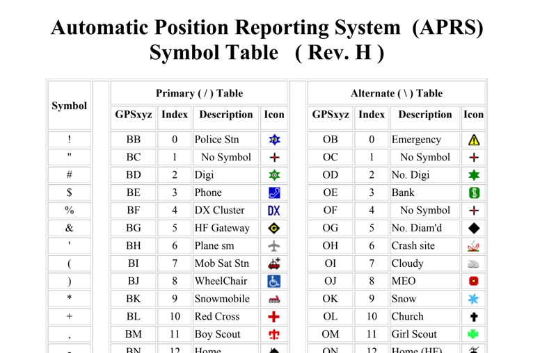 The four-page _APRS Symbol Table_ (Revision H) systematically lists 96 primary and 96 alternate Automatic Packet Reporting System symbols, each with its corresponding GPSxyz Index, a concise description, and a visual icon. For instance, the primary symbol '!' (GPSxyz BB) represents a "Police Stn," while its alternate counterpart '!' (GPSxyz OB) signifies "Emergency." The resource clearly delineates how specific ASCII characters map to distinct graphical representations on APRS displays, crucial for accurate situational awareness. It presents a direct, tabular format, making it an efficient reference for operators needing to quickly identify or interpret the myriad of icons used in APRS mapping applications. The table covers a broad spectrum of common APRS entities, from fixed stations like "Digi" (#) and "Home" (-) to mobile units such as "Car" (>) and "Plane sm" ('), alongside various weather phenomena and emergency services. Compiled by VK4KTP and featuring images by WA8LMF, the document serves as a definitive guide for understanding the visual language of APRS. It is particularly useful for those involved in tactical communications, public service events, or general APRS tracking, ensuring consistent symbol interpretation across different platforms and user interfaces.
 -
 This Arduino project explores long-range RF communication using EBYTE E32 1W LoRa modules (either E32-915T30D or E32-900T30D) paired with ESP32 microcontrollers featuring OLED displays. The setup leverages the modules' Semtech SX1276 chip with amplifier to achieve up to 1W transmission power—significantly more than the chip alone provides. Unlike other LoRa implementations, these modules include a microcontroller that simplifies interface through UART rather than SPI. The documented implementation includes proper wiring between components and Arduino code that configures the module, displays received messages on the OLED screen, and transmits messages every two seconds while keeping power consumption manageable.
 -
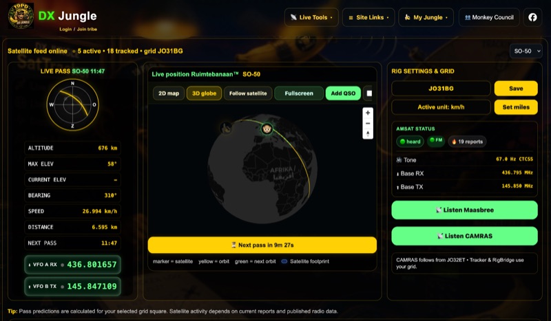 The DX Jungle SatTracker is an interactive online tool designed for real-time amateur radio satellite tracking. It incorporates live Doppler correction, AMSAT satellite status, and pass predictions for various active amateur radio satellites such as ISS, SO-50, FO-29, and RS-44. The platform calculates real-time uplink and downlink frequencies, adjusting for Doppler shift, and displays satellite footprints and orbital paths on a map interface. Users can select specific satellites and input their grid square for localized pass predictions. This service integrates WebSDR support, allowing users to listen to satellite passes live without requiring a physical radio, and offers Companion radio control capabilities. Orbital data is sourced from CelesTrak, while radio frequencies are derived from AMSAT and SatNOGS. The interface provides options to filter for FM repeater-only satellites and displays active passes, ordered by the next available pass, facilitating timely operational planning for satellite enthusiasts.
 -
 open890 is a web-based UI for the Kenwood TS-890S amateur radio, and features good usability, clean design, and high-speed bandscope/audio scope displays, among other features not available either on the radio itself, or in the ARCP remote control software. It is currently only designed to interface with the TS-890 via a LAN (or wifi) connection, and not a USB/serial connection. It may work with the TS-990, as the command set is very similar, but is currently untested.
 -
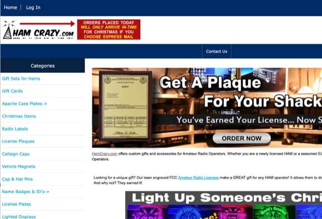 HamCrazy provides various personalized hats, name badges, those light up call sign displays, decals for cars, even case plates for Apache cases
 -
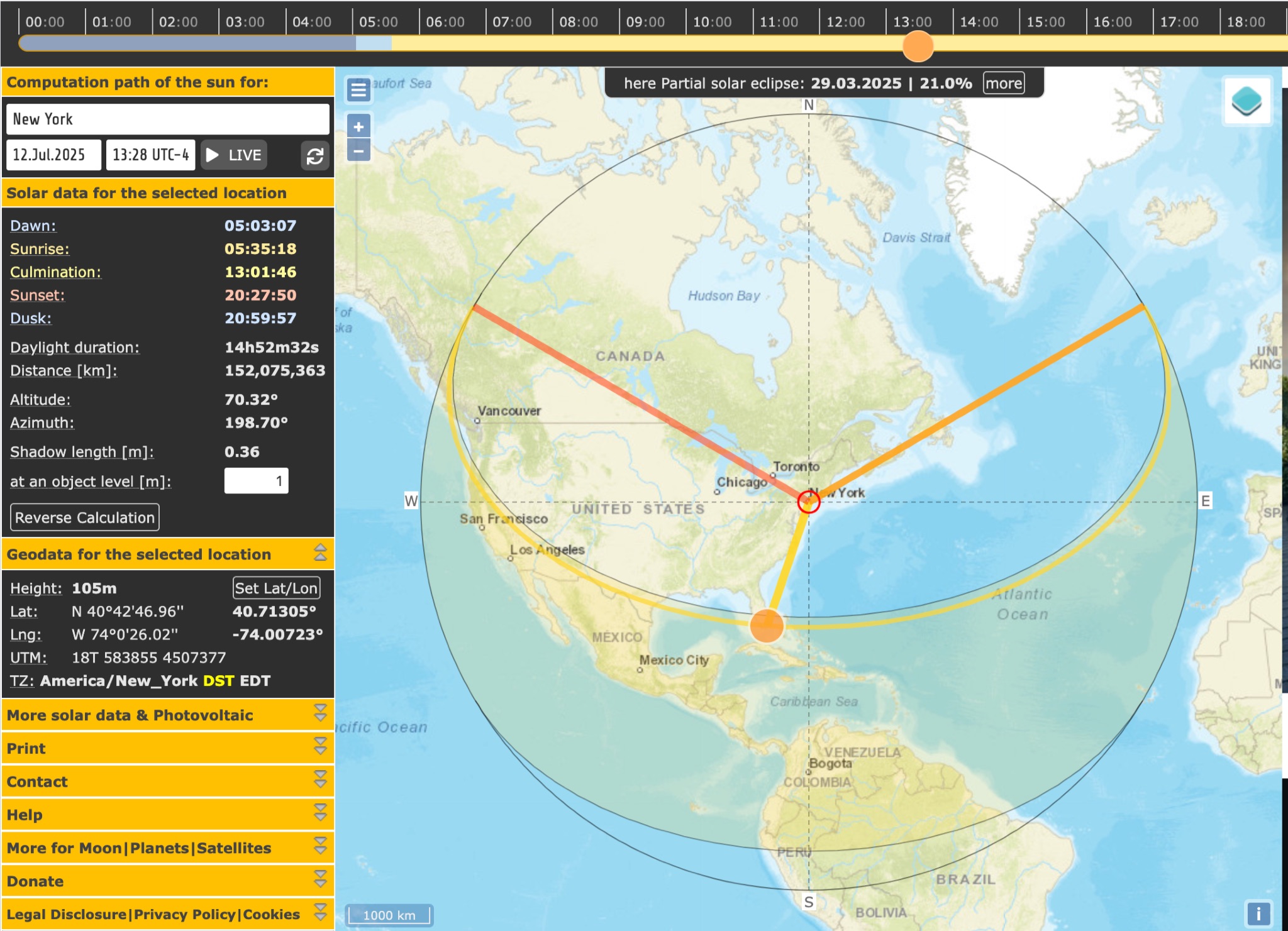 SunCalc is a tool that displays the movement of the sun and sunlight phases for a specific day and location. Users can adjust the sun's positions for sunrise, selected time, and sunset. The visual representation includes a curve showing the sun's trajectory and variations throughout the year. The tool also provides information on sunlight distribution during the day. SunCalc is useful for hams wanting to plan outdoor activities based on sunlight availability and position. Users can support the website's maintenance with a donation via PayPal.
 -
 The Beam project offers various features for controlling antenna rotators, including support for 2 or 4 line LCD displays, software or hardware clocks, open collector drives for azimuth and elevation control, and internal calculations for tracking the sun and moon. It can also track satellites and supports "Flip Mode" for inverted antennas. The 4-line version provides detailed readouts while the 2-line version offers a more compact display. New versions now support PWM and I2C H-bridge modes for adjustable speed control at the end of a move.
 -
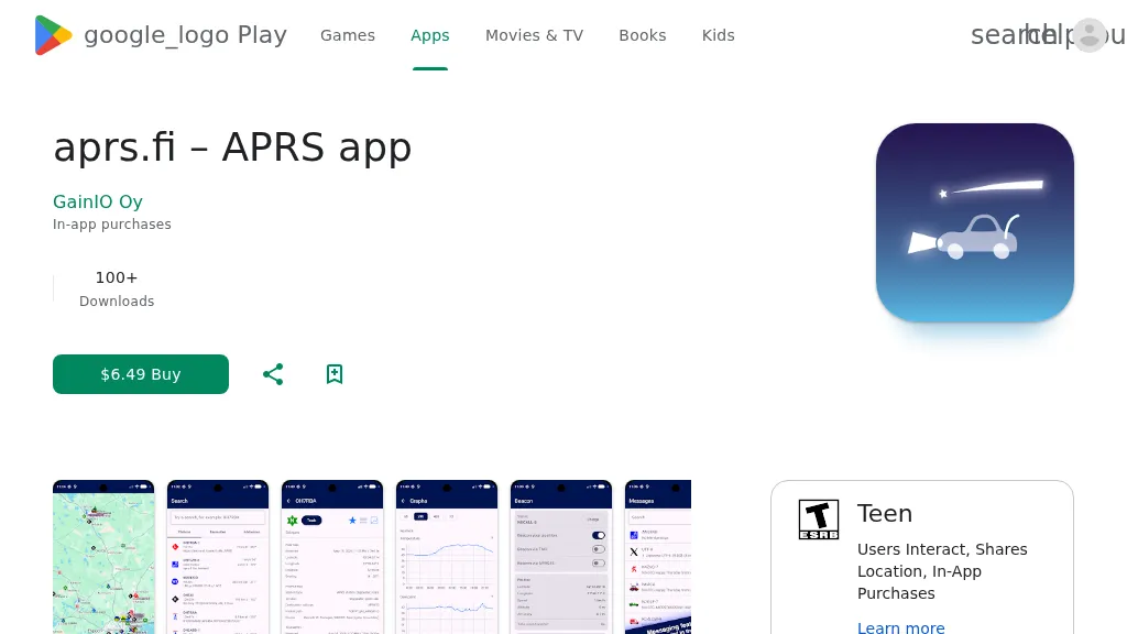 The aprs.fi Android application offers immediate, real-time access to APRS position information, weather reports, and telemetry graphs, allowing users to zoom and browse stations globally without delay. It includes features like callsign and address search with history, multi-station tracking, and map filtering for elements such as weather stations and AIS targets. The app also supports KML and GeoJSON overlay files for enhanced map visualization. Users can beacon their position directly to aprs.fi or connect wirelessly to a Bluetooth, BLE, WiFi, or USB-attached TNC for receiving and transmitting position beacons without an internet connection. The application runs on the robust and fast aprs.fi database, providing _Dark Mode_ support for improved ergonomics in low-light conditions and high-resolution graphics for modern displays, including the full APRS symbol set. While the core application is a one-time purchase, some advanced functionalities, such as APRS text messaging, a high-performance software DSP modem, and _APRS-IS_ beaconing with up to **10 callsign profiles**, require an additional "Extra Features" subscription. This subscription also unlocks RX iGate functionality and extended time ranges for map and graph views, expanding its utility for serious APRS operators.
 -
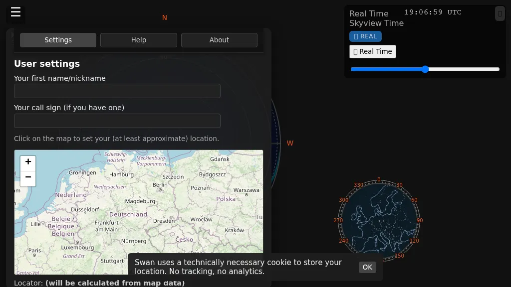 Swan provides a real-time, browser-based visualization of **meteor radiants** and forward scatter corridors, serving as a modern re-imagining of the classic Virgo meteor sky visualization tool. It displays meteor radiant and radio scatter geometry, offering both visual and numerical skyview data. The tool updates in real-time, showing current sky conditions and allowing users to pause and review specific timeframes for analysis of meteor shower activity and potential radio propagation paths. This enables operators to identify optimal windows for **meteor scatter** contacts. Operators can utilize Swan to predict and optimize their meteor scatter DX attempts by understanding the geometry between their station, meteor radiants, and potential receive stations. The interface presents critical data points for assessing forward scatter opportunities, which is crucial for maximizing short-duration meteor burst communications. By observing the real-time skyview, users can correlate meteor activity with observed signal enhancements, refining their operating strategies for specific meteor showers or random meteor pings.
 -
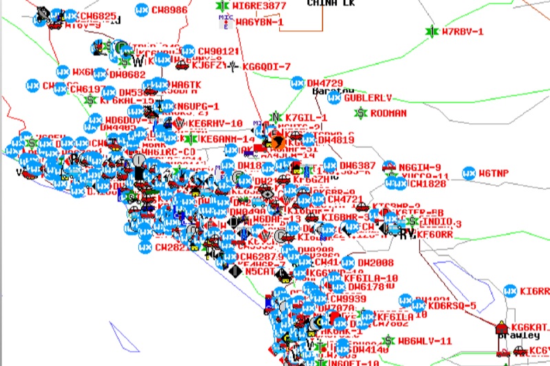 Demonstrates the Automatic Packet Reporting System (APRS) as a radio-based system for real-time tactical data exchange, leveraging the internet for messages, alerts, and bulletins to enhance situational awareness. It explains how APRS displays data on a map, integrating objects with GPS coordinates, weather stations, and alerts, clarifying its primary function as vehicle tracking despite broader capabilities. The document traces APRS development from the late 1980s by Bob Bruninga, WB6APR, through its evolution from Connectionless Emergency Traffic System (CETS) to Automatic Position Reporting System, and finally to Automatic Packet Reporting System with widespread GPS availability. Specific functionalities covered include real-time position and status reporting, message and bulletin exchange, weather data, DF bearings, RF connectivity plots, and local object display. Newer features like Global Email, CQSRVR, APRStt (APRS touchtone) for DTMF-based position reporting on frequencies like 146.58 MHz, and AVRS (Automatic Voice Relay System) for callsign-to-callsign linking via Echolink or IRLP, particularly with transceivers like the D710, are detailed. The resource also mentions AI-FI (APRS WIFI) for laptop integration and the use of the AX.25 protocol on 144.390 MHz in North America. It further describes the role of digipeaters and Internet Gateway stations (IGates) in transporting packets and connecting the on-air APRS network to the APRS Internet System (APRS-IS). The document explains APRS as a random ALOHA network, emphasizing channel loading considerations.
 -
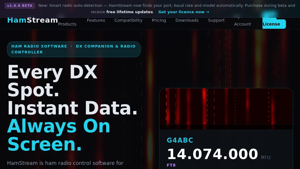 HamStream, a versatile ham radio control software, integrates real-time DX cluster data directly into the operator's workflow, eliminating the need for constant alt-tabbing. As an Extra Class operator, I appreciate how it instantly displays callsign, country, distance, bearing, and QRZ profile data for spotted stations, mirroring the efficiency of a well-organized shack. The software acts as a comprehensive radio controller, reading frequency, mode, and S-meter in real time from connected rigs, supporting CAT via serial, CI-V, _HAMLIB_, and direct connections to _FlexRadio SmartSDR_ and Apache Labs ANAN (via Thetis). Key features include instant QRZ lookups, distance and bearing calculations with a live great-circle minimap, and favorite alerts for specific callsigns. The one-click logging functionality is particularly useful, populating callsign, frequency, and mode into _N1MM+_, Log4OM, DXKeeper, Logger32, StationMaster Pro, and Ham Radio Deluxe via UDP, streamlining contest and casual logging alike. Its smart radio auto-detection for port, baud rate, and model simplifies setup, a welcome relief from manual configuration. Beyond core operating, HamStream also displays 'Also on this frequency' information and can tune the radio to spotted frequencies, enhancing situational awareness. For those who stream their operations, it offers an OBS overlay with live viewer counts and chat integration, making it a compelling tool for modern amateur radio engagement.
 -
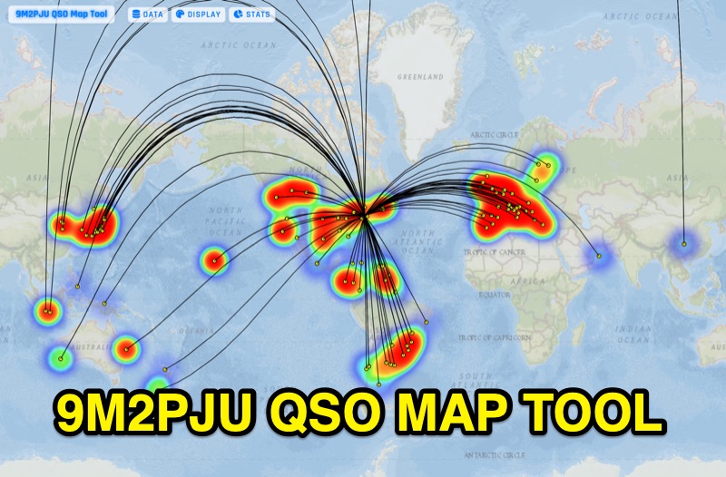 Presents the 9M2PJU QSO Map Tool, a web-based utility designed by Ian Renton for visualizing amateur radio contacts. This tool processes ADIF, Cabrillo, and SOTA CSV log files, allowing operators to plot their QSOs on a selection of base maps, including ESRI NatGeo World Map and OpenStreetMap Mapnik. Users can configure display options such as simple dot markers or xOTA hunter markers, QTH location, outlines, shadows, and geodesic lines, with coloring by band or a fixed hue. The application supports drawing per-band heatmaps and offers overlays for Maidenhead grid squares, CQ zones, ITU zones, and Worked All Britain/Ireland grids. It also provides QSO filtering capabilities and displays comprehensive log statistics, including unique calls, grid squares, CQ zones, ITU zones, and worked DXCCs. Customizable band and mode colors, alongside specific xOTA icons for programs like POTA, SOTA, WWFF, IOTA, and WCA, enhance the visual analysis of operating activity.
 -
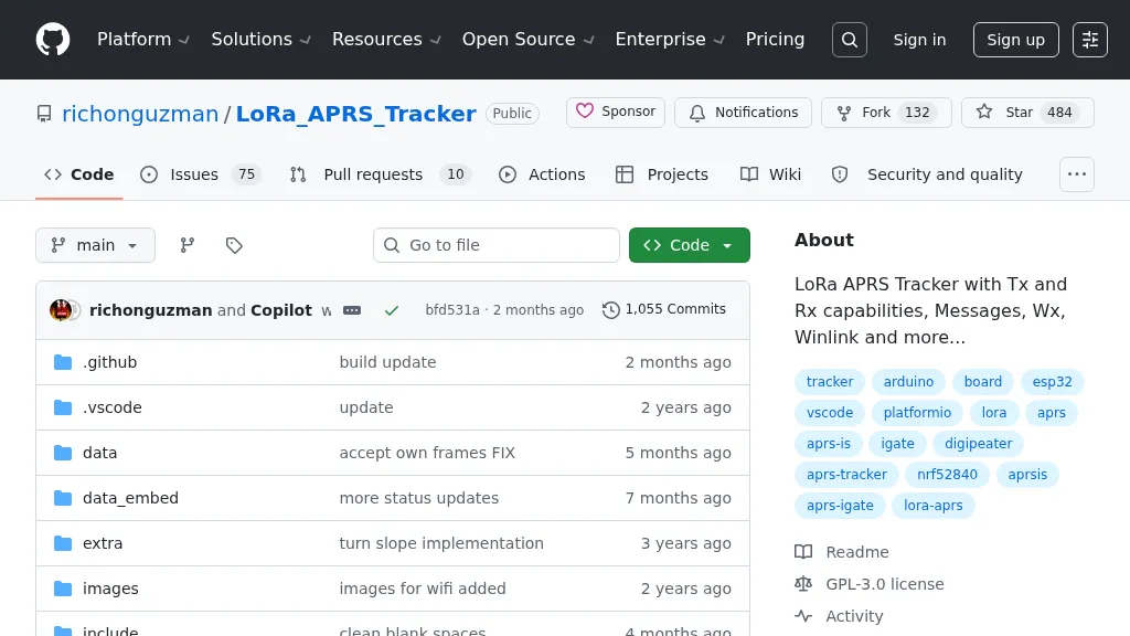 Demonstrates a LoRa APRS Tracker project featuring a comprehensive menu system for message management, weather requests, and monitoring nearby trackers. The device supports adjustable display eco mode and screen brightness, optimizing power consumption by dynamically changing processor speed from 240MHz to 80MHz. GPS beacons are encoded for efficient RF transmission, and an OLED screen displays altitude, speed, course, _BME280_ weather data, or new message counts, along with recently heard stations. Bluetooth connectivity enables operation as a TNC with Android (APRSdroid) or iPhone (APRS.fi app), providing LED and sound notifications for transmissions and received messages. The integrated BME280 module facilitates weather data display and transmission, with Winlink mail support via _APRSLink_. The tracker can switch between **three major LoRa APRS frequencies** worldwide, offering versatile global operation.