Search results
Query: interactive
Links: 52 | Categories: 2
-
 Select your favorite satellite and watch its trajectory on Google Maps in real time! Includes ISS tracking, Weather, Geostationary, GPS Military, and of course Amateur radio satellites. N2YO provides comprehensive real-time satellite tracking with particular emphasis on amateur radio satellites. The service offers precise pass predictions calculated for user-specific locations, displaying upcoming passes with azimuth, elevation, and duration data essential for ham operators planning satellite contacts. N2YO features dedicated tracking for amateur radio satellites including FM, linear transponder, and digital satellites, with frequency information and downlink/uplink details. The platform delivers live tracking visualizations on interactive maps, Doppler shift calculations, and automated email notifications for upcoming passes. This free resource integrates weather satellite tracking alongside NOAA imagery, making it invaluable for radio enthusiasts pursuing satellite communications.
 -
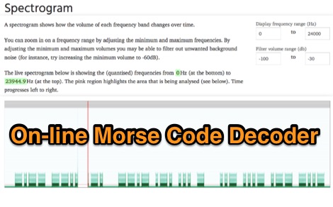 Demonstrates an online **CW** audio decoder tool, currently under active development, designed for analyzing and decoding Morse code. Users can upload audio files containing Morse code or record live audio input via a microphone, with processing handled entirely in JavaScript using the Web Audio API. The software analyzes the audio, attempting to determine the pitch and speed, and then decodes the message, providing options to compare the decoded output against a predefined message or a perfectly timed version. The interface allows for setting optional comparison messages, character speed in WPM, and Farnsworth speed. It also features interactive charts for visualizing the audio analysis, where users can zoom with the mouse wheel and pan by dragging. Specific buttons highlight different element types such as intra-character space, inter-character space, extra elements, missing elements, and replaced elements, aiding in detailed signal analysis. Built-in test files are available for immediate analysis, allowing users to quickly evaluate the decoder's performance. The tool is noted to work with specific browsers and is presented as a testing platform for user feedback, indicating ongoing refinement of its decoding algorithms and user interface.
 -
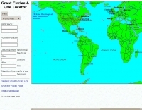 Interactive great circles and QRA Locator map
 -
 Illustrates the global distribution of **DX-Cluster** nodes through an interactive map interface, enabling radio amateurs to visualize and access real-time DX spots. The resource provides direct TELNET and HYPER links for each node, facilitating immediate connection to various clusters for up-to-the-minute propagation information and station activity. This visual approach simplifies the process of locating and connecting to a suitable DX-Cluster, whether for local or international DXing. Amateurs can use this tool to quickly identify active clusters in different geographic regions, which is particularly useful for **DXpedition** planning or contest operations. The direct links streamline access, bypassing manual configuration for many cluster types. It serves as a practical aid for operators seeking to monitor band conditions, find rare DX, or participate in competitive operating events by leveraging aggregated spotting data.
 -
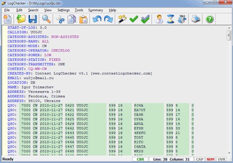 Contest LogChecker is a set of contest tools for Microsoft Windows, combining advanced text editing with keyword highlighted, and the ease and flexibility of import, export, statistics and charting utilities. With LogChecker you can edit, fill in the log, check Cabrillo Format and Header, convert files from the most popular logging software to Cabrillo, print customizable files, calculate statistics and export logs to RTF, PDF or HTML for publishing. You can examine a log in many different ways by highly interactive methods. LogChecker includes a Master Callsign Database tool for managing databases, which have been generated from actual contest logs. Commercial
 -
 Commercial interactive radio control software tun under Windows Controls up to 16 Devices simultaneously with audio, in a client server mode, support for WAVECOM decoders and ROHDE & SCHWARZ receivers
 -
 Amateur Radio Ham Radio Maidenhead Grid Square Locator Map online. This map allow just a point and click to determine dynamically the correct six characters locator. Other functions allow to calculate the distances among two given locators, or coordinates. Hover over map, specify grid, or enter latitude and longitude to show grid and/or calculate distance. Map is powered by Bing Maps.
 -
-
 This grid locator map uses Google map apis to find your QTH locator by simply clicking on the map. You can either enter your QTH locator and find the calculated distance and bearing between your QTH and another grid square.
 -
 SimSmith is a highly interactive, real time Smith chart graphing program. Circuits are constructed using drag-n-drop. Load files can be imported from the EZNEC and CocoaNEC antenna simulation software and from the AIM4170 and miniVNApro antenna analyzers. Circuits and load files can be of any size. Key Features: SimSmith is one of the few Smith chart packages which models transmission line losses. SimSmith also allows the description of circuit elements using algebraic equations. SimSmith has only one screen and allows the screen to be resized to increase workspace or readability.
 -
 This is an interactive design package for designing analogue (i.e. hardware) filters made of inductors and capacitors (Ls and Cs).
 -
 FreqTweak is a tool for FFT-based realtime audio spectral manipulation and display for Linux, offering various algorithms for audio processing in the frequency domain and an interactive GUI. It provides high-resolution spectral displays like scrolling-raster spectrograms and energy vs frequency plots.
 -
 The 3Y0K Log Online provides a detailed logsearch interface for the **3Y0K** DXpedition to Bouvet Island, scheduled for February 2026. This web-based tool, hosted on _Club Log_, allows users to access real-time QSO statistics and leaderboards. The interface includes interactive features such as a map for checking real-time propagation and colored boxes that reveal mode and time breakdowns when hovered over. The service supports HF bands and provides a structured overview of QSOs, including band/mode breakdowns and continent-specific data. Users can report logging inquiries and QSL requests exclusively through the M0OXO Online QSL Request System (**OQRS**). The site also offers additional resources like band plans, operating practices, and FT8 advice. The leaderboard feature, which includes clubs and Contest Club, ranks stations based on the number of band slots worked, with duplicate QSOs being discouraged. The expedition's impact on users' totals is also tracked, providing insights into new bands, modes, and DXCC entities worked. DXZone Focus: 3Y0K DXpedition | Club Log | Bouvet Island
 -
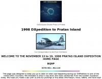 BQ9P Interactive Logbook 1998 DXpedition to Pratas Island
 -
 An interactive repeater map that uses google maps to display location of repaeter types available in Italy by Andrea IW0HOG
 -
 This is an interactive filter design package, for designing digital filters
 -
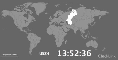 World Map - Time Zones realtime map allow to select and display current time for selected regions
 -
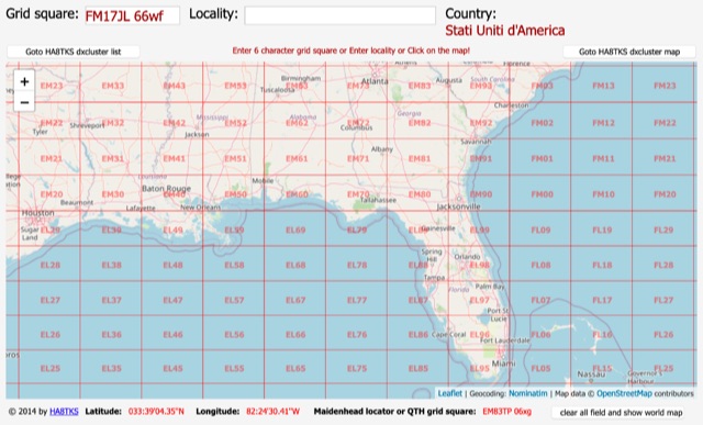 An online interactive grid square map made with openstreet map. Just point and click and zoom in to determine an accurate grid square locator till 10 digit resolution
 -
 Learn quadrature modulation through interactive flash programs. These programs will allow you to learn about quadrature modulation and quadrature demodulation without getting overwhelmed by math.
 -
 Several bash scripts are provided to automate common amateur radio tasks on Linux and FreeBSD systems, addressing the need for quick access to specific data without navigating web interfaces. These utilities include `call` for fetching US callsign details from callook.info, `qth` for obtaining address information for US and Canadian callsigns, and `grid` for determining grid squares based on license addresses. Each script is designed for command-line execution, allowing for single lookups or interactive sessions, and emphasizes a KISS (Keep It Simple, Stupid) programming philosophy. Another script, `au_kp.sh`, is tailored for weak signal VHF operators, fetching and displaying the NOAA 30-minute Aurora forecast and GFZ Space Weather Kp index data. This script generates static images, requiring re-execution for updates, and is intended to be run as a clickable desktop object for real-time space weather monitoring. It helps operators track propagation conditions, especially during solar cycle peaks. Beyond bash scripts, the resource offers a PHP/web page `fortune` implementation, including Henrik Aasted Sorensen's PHP script, sample HTML/CSS, and a HOWTO guide for creating fortune files. W3DHJ provides several amateur radio-themed fortune files, such as "Ham Humor & Wisdom" with 354 entries and "VHF Rover Humor & Wisdom" with 223 entries, along with other general humor and wisdom collections. These fortune files are designed with embedded HTML for web page display and are refreshed monthly, offering a total of 21,400 entries.
 -
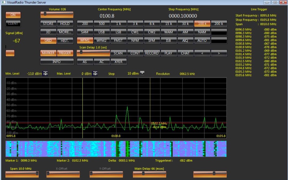
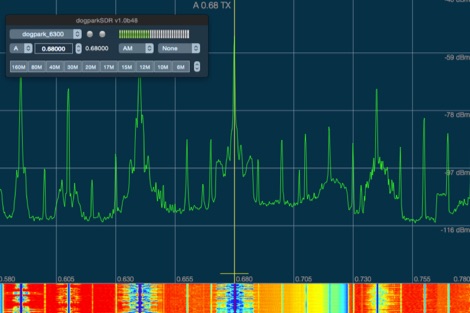 dogparkSDR is a native Macintosh visual radio display and interactive control software for any Flex Radio Systems
 -
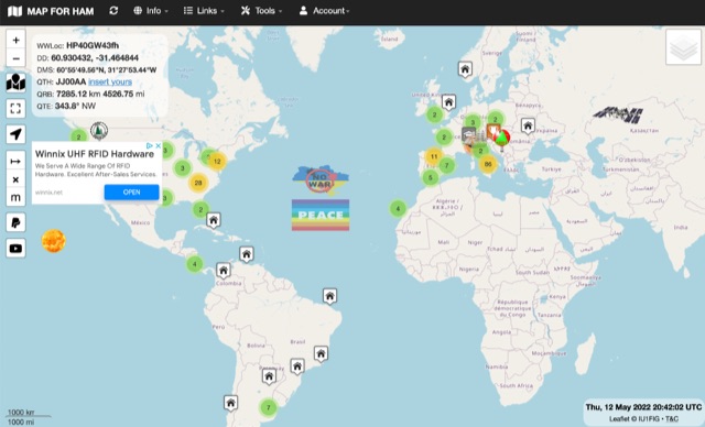
 VK3BFC HamWeb with links, interactive information and much more
 -
 BeaconSpot.uk provides an accurate, real-time picture of microwave and VHF/UHF beacons operating across Europe, alongside a worldwide listing of 6-meter beacons. The platform allows users to retrieve detailed data for individual beacons, facilitating in-depth analysis of signal characteristics and propagation paths. Interactive maps visualize beacon distribution by frequency band and display spot coverage for each station, offering a clear geographical overview of active beacons. The system integrates real-time DXCluster spots, sourced from contributors like Alain, ON4KST, and Pascal, F5LEN, and enables users to submit outgoing spots directly to the DXCluster. Beacon keepers can manage their beacon data, receive email alerts upon being spotted, and track their station's ODX (Outstanding DX) records. For every received spot, the distance to the beacon is automatically calculated and displayed, aiding propagation studies.
 -
 Storm Products Company provides high-value, interconnect products, subsystems, and services to electronics, communications, and instrumentation markets worldwide. Products include Electronic and Microwave cable assemblies, components, and test products.
 -
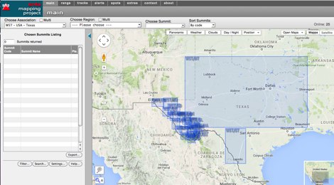 An interactive map for sota operations. SOTA Activators and cheasers will find this summits mapping site very useful resource. Based on Google maps.
 -
 OpenHamClock is a modern, open-source dashboard for amateur radio operators, designed as a web-based successor to the original HamClock. Deployable locally on a Raspberry Pi or via the cloud, it centralizes essential DX operations into a single, intuitive interface. At its core is an interactive world map that visualizes real-time DX spots, signal paths, satellite tracking, and POTA activators. The software seamlessly integrates critical tools like WSJT-X, DX Cluster, and PSKReporter for monitoring digital traffic. Additionally, it provides vital environmental data, including real-time space weather indices, solar activity, and personalized HF propagation predictions. With customizable themes and a modular architecture, OpenHamClock offers modern operators comprehensive, at-a-glance situational awareness of global radio conditions
 -
 PSK Reporter provides a real-time visualization of amateur radio digital mode reception reports, aggregating data from a global network of monitoring stations. This platform is particularly useful for operators utilizing modes such as FT8, FT4, and PSK, allowing them to observe signal propagation paths and assess their station's reach. The interactive maps display reception reports, enabling hams to analyze band conditions and optimize antenna performance for various frequencies and times of day, aiding in understanding ionospheric conditions. Operators can filter reports by callsign, band, mode, and time, gaining insights into specific propagation events or evaluating the effectiveness of their transmit setup. The data collected helps in predicting optimal operating windows for DX contacts across various digital modes. Philip Gladstone is the contact person for comments and discussions regarding the system.
 -
 The resource provides an interactive map interface for locating amateur radio license holders across the United States. Users can input a _callsign_, _gridsquare_, zip code, or street address to center the map, which then dynamically populates with station markers. This functionality allows for precise geographical searches, revealing the distribution of hams within specific areas. Upon initial search, the map renders with adjustable zoom and pan capabilities. A key feature is its automatic reload mechanism: after two seconds of inactivity, the map updates to display stations within the newly viewed area. This ensures that the displayed data remains relevant to the user's current focus, whether exploring a densely populated urban center or a more remote region. Further interactive elements include clickable gridsquare labels, which re-center the map, and a "Show gridsquares" checkbox for toggling grid line visibility. Clicking on individual station markers reveals a popup containing the licensee's name and address information, making it a practical tool for geographical station identification.
 -
 The first interactive map of amateur radio repeaters and more updated in REAL TIME.
 -
 The DXCC World Map web application is a modern and interactive mapping tool designed for shortwave radio enthusiasts. It showcases a high-quality world map along with the Sun's position, sunrise and sunset times, the terminator, coordinates, QTH locator, azimuth, azimuth map, current DXCC list, Aurora, and WWV Geophysical Alert Messages. Additionally, it provides the SFI, X-Ray, Kp, and Ap indices.
 -
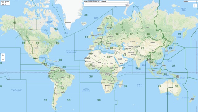 Show CQ and ITU Zone in an interactive clickable map based on google maps. Additional locator tool tip can be displayed by clicking on points, and a search function it is also available to locate addresses, and locators.
 -
 An Google Maps interactive layer showing Australian amateur radio repeaters. You can navigate and zoom as required and click on a repeater-site icon to display frequency, ctcss and other details and notes for that repeater.
 -
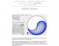
 The interactive Smith chart enables users to navigate their way around a Smith chart, using simple discrete element impedance matching. This page allows users to try using the Smith chart, for education and interest purposes, without installing any software. Try changing the value in the load box to see the location of the impedance on the chart.
 -
 DXLook is a free, web-based propagation platform that delivers comprehensive, real-time insight into HF and VHF conditions directly from any modern browser. It aggregates live spots from PSK Reporter, WSPRnet, RBN, and DX Cluster, complemented by NOAA space-weather metrics such as SFI, K/A indices, and geomagnetic alerts. Integrated VOACAP predictions allow practical "theory versus reality" comparisons, while the interactive world map with filters, gray line, and grid overlays enhances situational awareness. With no installation or maintenance required, DXLook provides a convenient, accurate, and accessible solution for everyday operating and propagation analysis.
 -
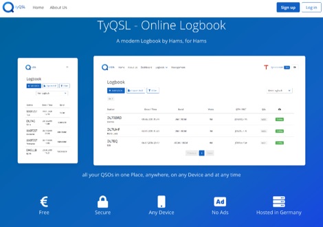 TyQSL provides a web-based online logbook platform, enabling users to manage all QSOs from any device with features like fast ADIF import, supporting up to **100,000 QSOs** per file. The platform facilitates real-time uploads to services such as _Clublog_ and _eQSL_, either automatically or with a single click, ensuring logs are current across multiple platforms. Operators can manage multiple callsigns and create various logbooks within a single account, allowing for flexible QSO organization. The integrated logger features a streamlined layout with live DXCC checking, duplicate QSO alerts, and autofill for satellite operations. It also supports one-click logging from _WSJT-X_. Users can share public profiles, displaying QSO statistics and searchable logbooks, enhancing community interaction. A PRO account offers additional features like an interactive QSO map, showing worked grids and future activities of other users.
 -
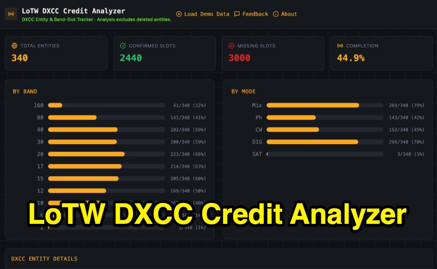 Visualizing DXCC award progress often requires manual parsing of Logbook of the World (LoTW) reports, which can be time-consuming and prone to error. This web-based utility streamlines the process by allowing hams to upload their LoTW DXCC Credit Report spreadsheet, providing an interactive dashboard for tracking confirmed entities, bands, and modes. It processes .xlsx, .xls, and .csv files, performing all calculations client-side within the browser for privacy and speed. The tool presents a comprehensive stats overview, detailing total entities, confirmed slots, and overall completion percentage. It includes progress bars for bands from _160m_ through _2m_, and modes such as CW, Phone, and DIG. A sortable DXCC Entity Details Table lists each entity, its confirmed count, and specific missing band/mode slots, with a CSV export option. Further features include a Band/Mode Matrix grid for granular confirmed status per entity, toggles for specific bands like _6m_ and _2m_, and tracking for DXCC Challenge progress across 10 eligible HF/VHF bands. It also highlights nearly complete entities and identifies most-wanted DXCC entities based on the uploaded data.
 -
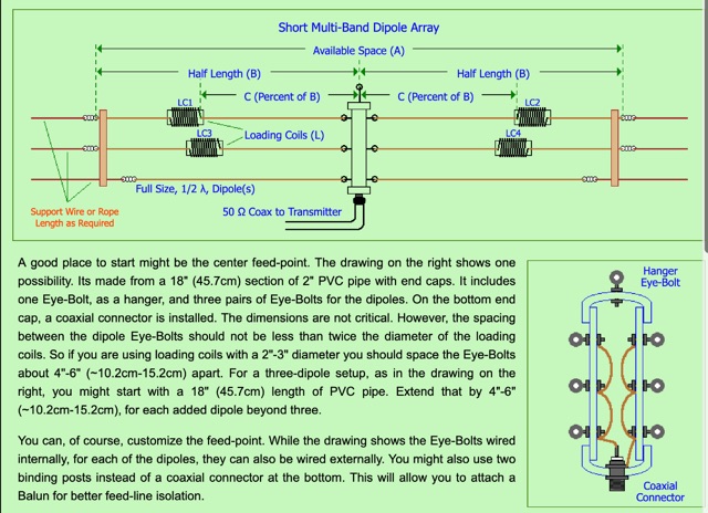 A 60-foot available space, for example, might necessitate a shortened multiband dipole array to cover 80, 40, and 15 meters effectively. This resource details the construction of such an antenna, combining full-size and coil-loaded dipoles on a single feedline. It addresses the common challenge of fitting multiple HF bands into restricted physical footprints, providing practical guidance for hams with smaller backyards or portable operations. The core of the offering is an interactive calculator that determines required loading coil inductance and dipole lengths for various amateur bands from 160m to 10m. Users input their available space, and the tool provides dimensions, coil turns, and an efficiency rating (Good or Fair) based on the antenna's electrical length relative to a quarter-wavelength. It also suggests suitable _PVC_ pipe diameters for coil forms. The article further illustrates a center feed-point assembly using an 18-inch section of 2-inch _PVC_ pipe, detailing eye-bolt spacing and coaxial connector installation. It emphasizes the importance of adequate spacing between parallel dipoles and offers customization options for the feed-point, including the addition of a _Balun_ for improved feedline isolation.
 -
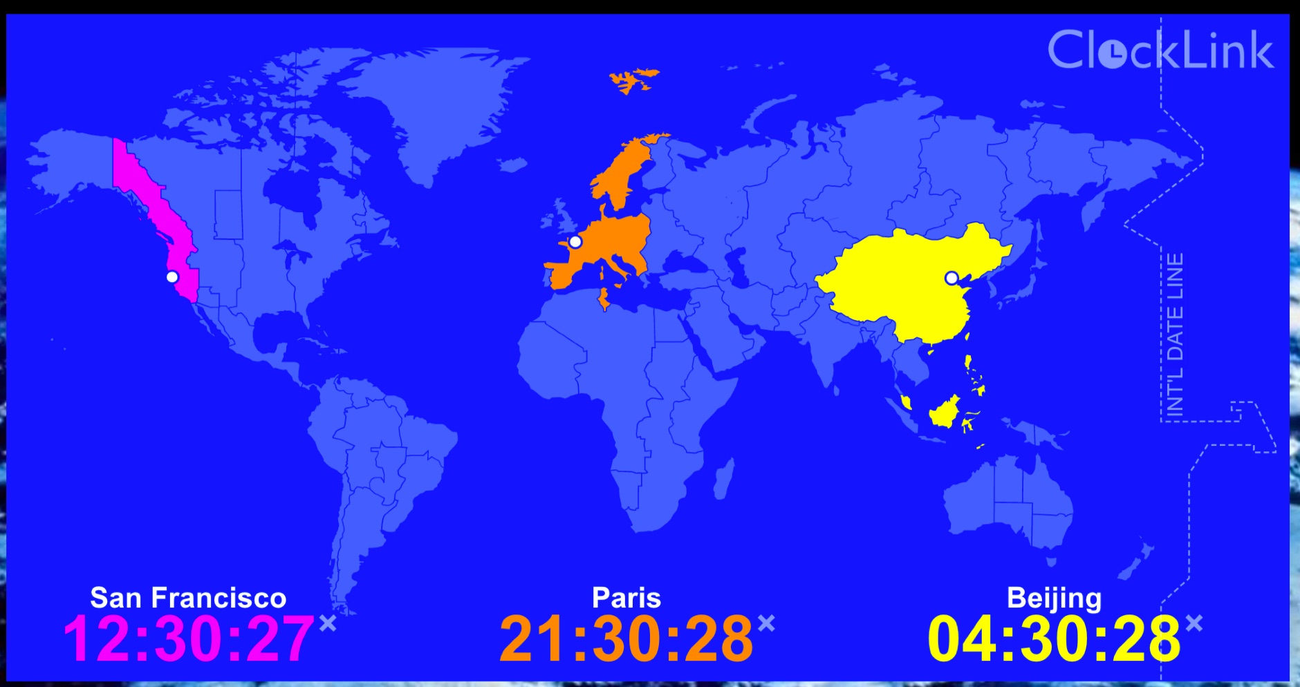 Three local city times around the world displayed simultaneously.
 -
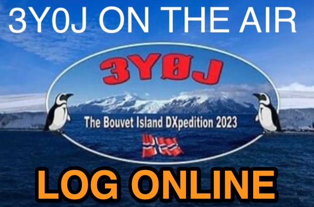 Accessing current operational statistics for a DXpedition is crucial for DXers planning their next contact. This Club Log page provides a detailed, real-time overview of the 3Y0J Bouvet Island operation, a highly sought-after DXCC entity. It presents a dynamic dashboard showing total QSOs, unique calls worked, and duplicate contacts, all updated as logs are uploaded from the remote location. Users can observe the expedition's progress and strategize their operating times. The interface features interactive charts and graphs, allowing operators to analyze the _3Y0J_ log data by band and mode, including CW, FT8, and SSB. A breakdown of QSOs by continent provides insight into propagation patterns and where the expedition has focused its efforts. The page also includes a map for checking real-time propagation conditions to Bouvet Island, which is invaluable for optimizing contact attempts. Further details include the first and last QSO times, total operating days, and the impact on users' DXCC totals, such as new bands, modes, or DXCC entities worked. This resource is a vital tool for the DX community, offering transparency and actionable intelligence for chasing one of the rarest entities on the air.
 -
 The HF Beacon Tracker is an advanced interactive tool designed for DXers and ham radio opoerators in general to monitor active beacons operating below 14 MHz. Built upon a high-fidelity 3D Earth globe, the application provides a spatial perspective on signal paths by integrating real-time environmental data with a comprehensive beacon database curated by Mirek OK1DUB. Beacons are plotted using precise Maidenhead locators and feature a real-time day/night terminator overlay to help operators identify Gray Line propagation opportunities. With a single click, users can calculate the exact distance from their own QTH to any beacon, visualized via an animated Great-Circle Path arc on the globe surface. To enhance its diagnostic capabilities, the tool seamlessly integrates with PSK Reporter, allowing users to right-click CW beacons to instantly fetch current reception reports and signal strength data. The interface is fully optimized with a mobile-responsive design, smooth globe rotation, and togglable Dark/Light themes suitable for any shack environment. Whether you are performing antenna gain tests, conducting ionospheric research, or simply hunting for band openings, the HF Beacon Tracker transforms raw database information into an intuitive, visual diagnostic suite. It serves as an essential asset for any operator looking to master HF band conditions.
 -
 Zenith Tracker offers real-time satellite tracking, pass predictions, and radio hardware integration for ham radio operators. The platform includes an interactive world map showing satellite positions, footprints, and ground tracks, as well as a polar radar visualization for detailed pass analysis. Users can view upcoming passes, set filters, and receive notifications. Integration with CSN Technologies S.A.T Hardware and QTRigDoppler allows for automatic radio control, antenna tracking, and transponder management. The platform also offers APRS message interface, grid square-based location input, and API integration for rover activations. Zenith Tracker is recommended for both general users and those needing advanced hardware integration.
 -
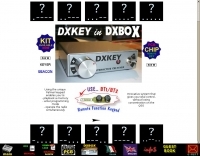
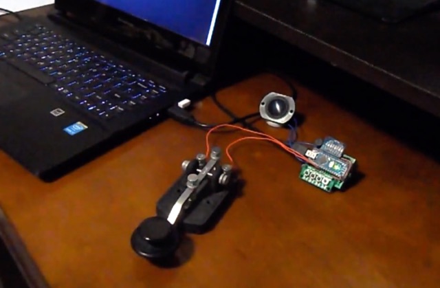
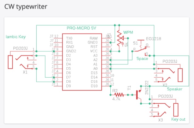 The CW typewriter is a compact adapter board that transforms Morse code into ASCII characters using an Iambic key. It connects to a computer via USB, emulating the keyboard. The device features inputs for Iambic keying and a WPM speed potentiometer, and outputs for a key and a speaker for side tone. The device can be used with various software and online typing games for practice, offering a unique and interactive way to learn and use Morse code.
 -
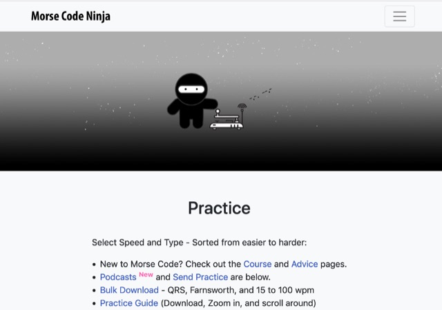 A comprehensive morse code auduio guide with several youtube movies classified by skill level, characters and numbers, sentences, speed level and more. All movies are linked by an interactive interface that let you select the speed and the excercise type. The page contains an downloadable set of morse code exercises and several other resources
 -
 The Trainer is based on a simple modular built STEM/game platform, plus newly developed interactive software,it contains six training routines, easy to advance, and consists of various learning aids. You select them from a menu. Feedback for menu selection is given audibly and through an LED display and serial monitor.
 -
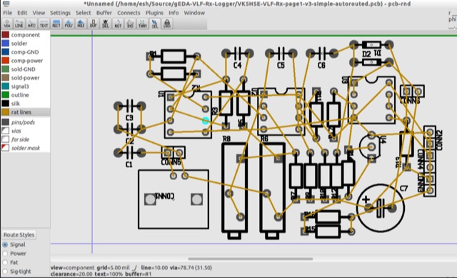 PCB is an interactive printed circuit board editor for Unix, Linux, Windows, and Mac systems. This Software runs across multiple platforms such as Unix, Linux, Windows as well as Mac systems. This Tool is widely used for electronics as well as electrical circuit designing that comes with schematic capture. PCB offers high end features such as an autorouter and trace optimizer which can tremendously reduce layout time.
 -
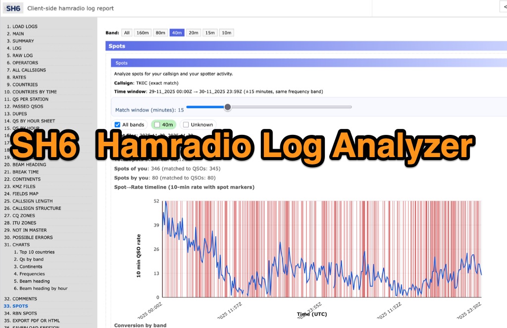 SH6 is a versatile, browser-based utility designed for the detailed analysis and visualization of amateur radio contest logs. Supporting standard formats such as Cabrillo and ADIF, the tool allows operators to upload personal files via drag-and-drop or access a searchable public archive containing over one million logs. Key capabilities include comprehensive performance metrics, offering summaries of band breakdowns, QSO rates, and beam headings. Furthermore, SH6 provides advanced geographic visualization through interactive maps, analyzing contacts by country, zone, and continent. A standout feature is the side-by-side comparison mode, enabling users to contrast two distinct logs for strategic assessment. SH6 transforms raw log data into actionable insights regarding operator performance without requiring software installation.
 -
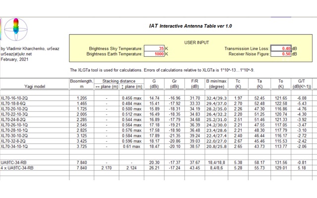 IAT is an excel sheet table evaluate parameters of VHF UHF antennas edited by Vladimir UR5EAZ. The difference between this tool and the existing VE7BQH Antenna Table is the use of G / T and C / N instead of the G / Ta parameter. In this table, Vladimir applies the ITU recommendations to assess the noise properties of a radio receiving system and shows the advantage of the G / T concept over the G / Ta concept when choosing an antenna.
 -
 GridViewer is an interactive and lightweight open source web-based tool designed for ham radio operators to visualize and analyze their worked grid squares from ADIF-log files. GridViewer was developed to address a real-world challenge faced by many ham radio operators using lightweight or single-board computers like the Rock 4 SE (in my case) or Raspberry Pi.
 -
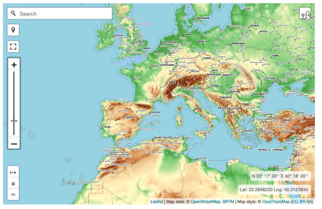 Online interactive elevationmap can help radio amateurs by predicting signal propagation, optimizing antenna placement, planning coverage, ensuring line-of-sight, mitigating interference, and enhancing emergency communication. T
 -
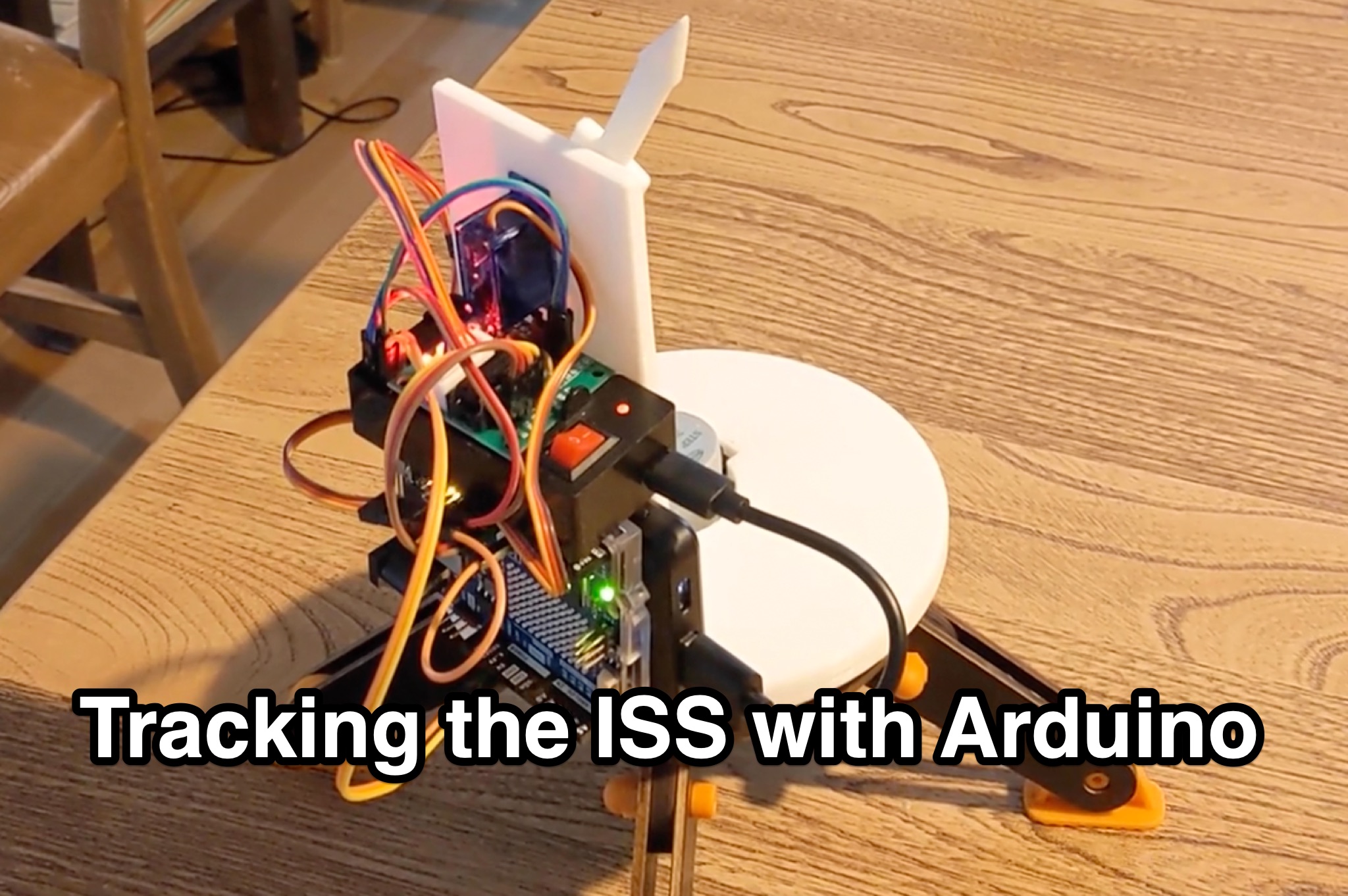 Learn how to hack an IR turret to track the International Space Station (ISS) as it passes overhead. Discover the basics of the ISS and how to use simple tools to point an arrow at the ISS without looking at a phone. Find out how to calculate the azimuth and elevation angles to locate the ISS in the sky and enjoy watching this habitable space craft orbit the earth at a speed of 28,000 km/h. Take your hobby to the next level by bouncing radio signals off the ISS or even talking to the astronauts on board. Turn stargazing into an interactive and educational experience with this fun and practical project.