Grid Bearing and Maps for Amateur Radio Operators
Find software tools for calculating grid squares, bearings, distances, and visualizing ham radio contacts on maps.
Ham radio operators often use grid locators and maps to visualize their QSOs and plan antenna headings. These tools help hams track their DX progress, especially in VHF/UHF contests and satellite operation where grid squares are key to scoring. Understanding propagation paths and beam headings is crucial for making long-distance contacts on all bands, from HF to microwave.
This category offers various software tools for calculating Maidenhead grid squares, distances, and azimuths. Operators can find applications like TinyLocator and HamGrids for precise grid calculations, or use mapping software such as Azimuth and GcmWin to plot great-circle maps centered on their QTH. Many programs also integrate with logging software, allowing hams to visualize their worked grids and fields, like with GridViewer or WorkedGrids, directly from their ADIF files.
-
 GridViewer is an interactive and lightweight open source web-based tool designed for ham radio operators to visualize and analyze their worked grid squares from ADIF-log files. GridViewer was developed to address a real-world challenge faced by many ham radio operators using lightweight or single-board computers like the Rock 4 SE (in my case) or Raspberry Pi.
 -
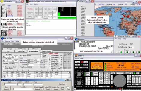 Windows contest logging software with multiple functions like antenna rotor control, dx cluster, cat control, voice and cw keying, supports many data modes, qrz lookup, pirint qsl and labels, mapping and more. Donationware software.
 -
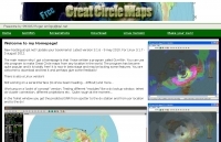
 Amateur Radio Maps DOS and Windows program which contains maps of continents and countries. Not updated since 2000.
 -
 The AZIMUTH program plots a world map in either azimuth (beam heading) or Mercator projections. If you specify your home location in latitude and longitude, the azimuth projection is centred on your location. The Azimuth map program can display Maidenhead grids - this is useful for 6m, 2m, and UHF DX communication display. Various features of the map are: Azimuth or Mercator projections , Maidenhead grid display, Simple map zooming, Print maps with adequate resolution up to one meter sized map
 -
 This program is a generator of coloured azimuth world maps centered on any terrestrial position. Windows Freeware
 -
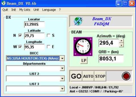 BEAM_DX is a free windows software for radioamateurs or radio listeners usage. It allows to point a directionnal antenna towards an azimuth, a locator, an international prefix or any other geographical position on earth predefined by its latitude and its longitude
 -
 A free application that displays location information determined from a callsign, displays translations of common "QSO words and phrases" in the languages used in the callsign's DXCC entity, displays beam headings and SpotCollector DX Spots on a world map, displays country maps, and provides point-and-click control of antenna rotators from AlfaSpid, ARSWIN, Heath, Hygain, M2, Prosistel, SARTek, TIC, Trackbox, and Yaesu
 -
 The EZ QRA Locator softawre is a simple software for the calculation of QRA locators
 -
 GCM is a freeware great circle map plotting software for windows, you can choose colours, scale, meridians, fields and or squares from the maidenhead locator system.
 -
 A javascript online calculator of bearing and distances by G4VWL
 -
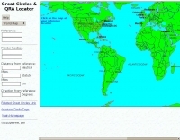 Interactive great circles and QRA Locator map
 -
 calculate maidenhead grid square and coordinates
 -
 GRIDX, a BASIC program that calculates grid squares and Great Circle headings and grid.exe, a grid locator calculator
 -
 Ham radio map database with search and logging functions. Currently in german only, run under Windows.
 -
 Ham Radio Mapping and QSL managent software
 -
 Add-in module to Microsoft Excel, contains a set of radio amateur relevant special functions: DistSphericLocator(Loc1; Loc2) Calculates the spheric earth model distance between two locators [km] DirSphericLocator(Loc1; Loc2) Calculates the spheric earth model direction from Loc1 to Loc2
 -
 HamCalc is a free collection of calculators for radio amateurs include Antenna ERP calculations, Attenuators, Audio Filter design, Coil Winding, Decibels, Great Circles map and calculator, HF Filters, HF Traps, Metric conversions OP Amps QRA Locator to Latitude/Longitude, Radio Horizon calculator, Resonance Satellite orbit calculator Timer calculations (555 timer)Zener Diode calculations Download zip By G4VWL
 -
 Windows application that will allow you to perform calculations with the popular Maidenhead Grid Square system. This grid system is used worldwide by amateur radio operators for many aspects of ham radio.
 -
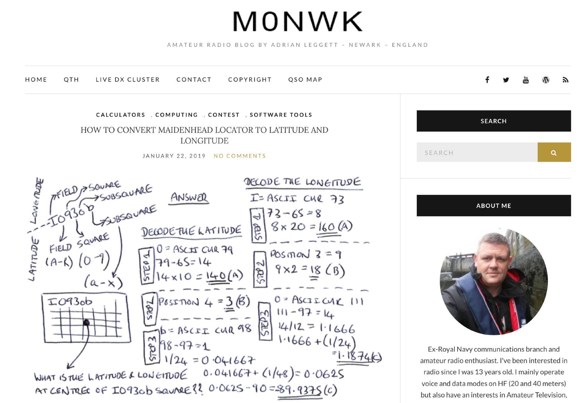 Blog post by Adrian M0NWK showing how to calculate the latitude and longitude at the centre of a Maidenhead locator using basic maths.
 -
 Distance and directions calculation program using both Spheric, the perfect round earth model, and Vincenty's inverse ellipsoid algorithm, the WGS 84 earth model.
 -
 This free program displays the location of any locator on a map. It calaculates between two Maidenhead locators the distance (km and miles) azimuth longitude latitude Show the location, direction and distance as you move your mouse on a map! Graphical Locator Program, By ON6MU
 -
 This program allows both great-circle (polar) and rectangular projections of the world. The great-circle map is centered on any specified latitude and longitude (the "home" location). The rectangular projection is shown with the home longitude in the middle of the screen.
 -
 This program combines the formerly know programs PreFind and MU-Locator into one but with many improvements to find the location of any prefix, country or Maidenhead locator! Display and find locators on any map and calculate the distance and direction between two locators.
 -
 Amateur radio programs to download, locator , log, etc... for Psion Aprs maps for PC (ui-view)
 -
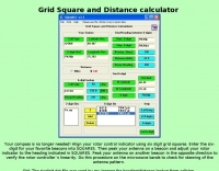 Grid Square and Distance calculator by w3km
 -
 This free program calculates the location of any locator. It calaculates the distance, azimuth, longitude and latitude between two Maidenhead locators. Converts longitude/latitude coordinates to Maidenhead locator Converts Maidenhead locator to longitude/latitude coordinates
 -
 Calculates grid squares from latitudes and longitudes, the reverse, and calculates distances and headings from two sets of lat/long or grid square. Convert Grid Square to Lat Log and vice versa. Freeware for Windows
 -
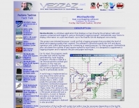
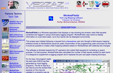 WorkedFields is a windows free software to displays a map showing the amateur radio field squares contacted and logged in using a third-party logging program.
 -
 WorkedGrids is a freeware Windows application that maps amateur radio grid squares from third-party log files, displaying contacts by band.
 -
 Direction and distance calculator for windows
 -
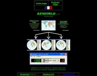
 AZIWORLD is a user-friendly tool for generating azimuthal maps of the Earth centered on any location. Compatible with Windows XP and later, it supports English and French. Maps can be saved in .bmp format for easy customization. AZIWORLD computes azimuths, distances, and geographical positions, integrating seamlessly with AZIPOINT for automatic antenna pointing. Linux/Ubuntu/Android users can run AZIWORLD via WINE or CROSSOVER. For optimal functionality, installing AZIPOINT alongside AZIWORLD is recommended.
 -
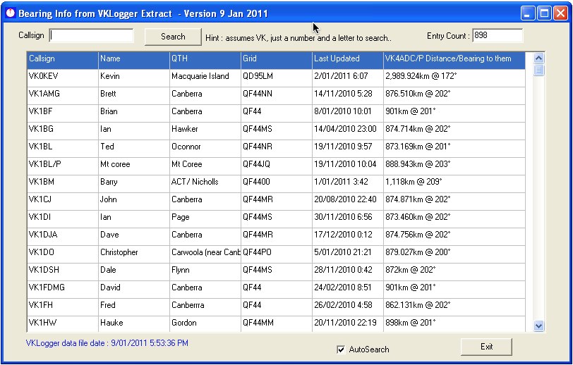 Bearing Info uses an extract from the VKLogger.com web site Op-Info to make it easy to find a callsign and hence bearing and distance information. It is written specifically for VK operators for use in Field Days although it could be considered a general purpose amateur radio utility, mainly for Aussies by VK4ADC
 -
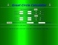
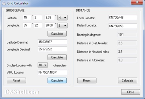 Grid Calculator allows you to calculate either a grid square locator or the latitude and longitude of a location. Grid Calculator can be used to calculate a Great Circle bearing and distance between two stations in statute miles, nautical miles, and kilometers.
 -
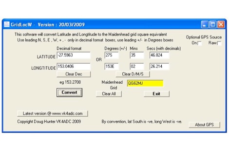 GridLocW is a free Lat/Long to Maidenhead converter for Windows - with optional GPS support, includes the formula to calculate geodesic distance (in m) between two points specified by latitude/longitude.
 -
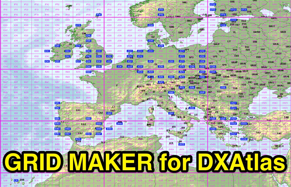 Gridmaker takes your ADIF-file and searches for all the grids on the specified band. It then makes files for use in DXAtlas
 -
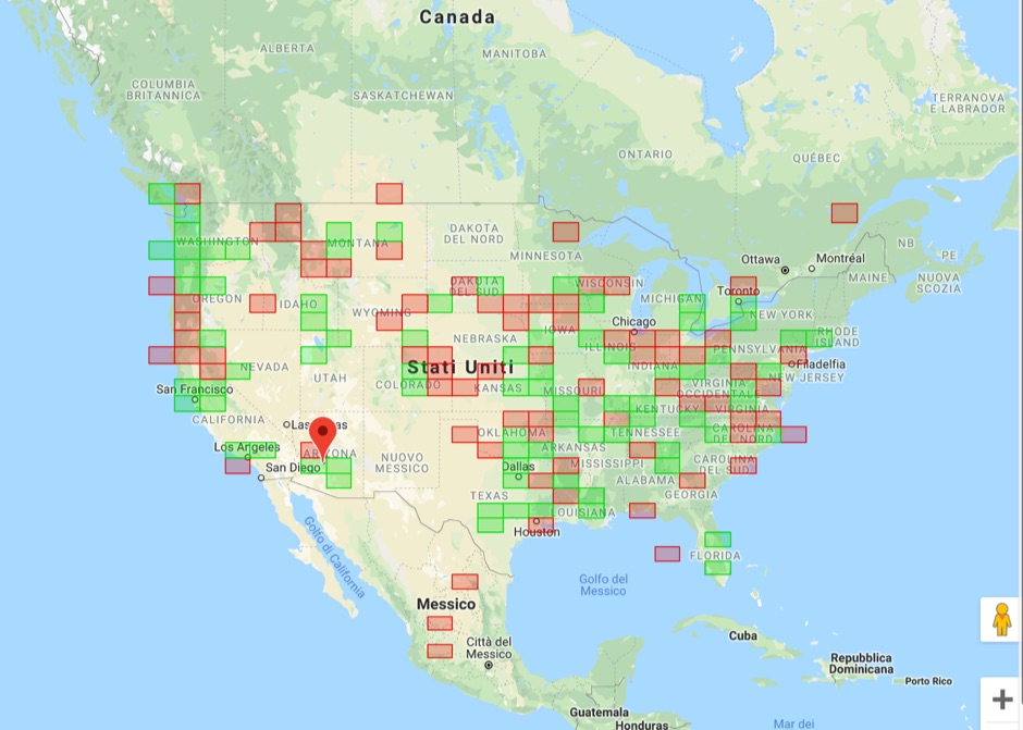 Upload an ADIF fiel and plot all worked grids in an online map. Support filtering by band, year and can export the output directly into a google map, or a google earth KML file